VFRMap.com
As reported by Flying Singer.
Another thing I bought was a $15 generic Xbox game controller to use with the drone camera in MSFS. Someone wrote that the default button setup wasn’t intuitive compared to Xbox games, but since I never used an Xbox controller (or Xbox), it’s all new to me. Feels pretty solid.

So I set up a C172S on G1000 autopilot flying east toward Boston at low altitude and got out to take pictures (hit the Insert key). The controller has a lot of buttons so coordinating zooms, pans, rotations, sweeps, etc. will take some practice. But it is clearly way ahead of the keyboard for drone ops and cinematic views.
I grabbed a couple of brief video clips flying east over the Mass Pike (Interstate 90) over Framingham, MA. Very close to Lake Cochituate and “Shoppers World,” one of the oldest large shopping centers in the US. I used the Xbox controller to try to fly around the 172. I’m also planning to use clips like this to later compare the graphics quality (pretty dreadful here) with the same locations on the new PC, maybe next weekend depending on how long it takes to set up.
I’ve also been preparing for that by backing up key files from my C: drive to an external drive I can access on the new PC, moving some software licenses (a few music VST’s and sample libs) to my iLOK USB device, and doing an installed program inventory.
It appears that VFRMap.com is the work of a single person who has a Patreon link on his site. It’s super cool and I decided to go to Patreon and send him $5 a month (I support a couple of musical acts on Patreon).
I will probably continue that for a while as encouragement and possibly use the charts with MSFS as I proposed the other day. But I found and even better free flight planning site (ad supported), SkyVector.com, which has ALL sorts of charts world-wide, airport info, and real-life flight planning.
It’s very cool.
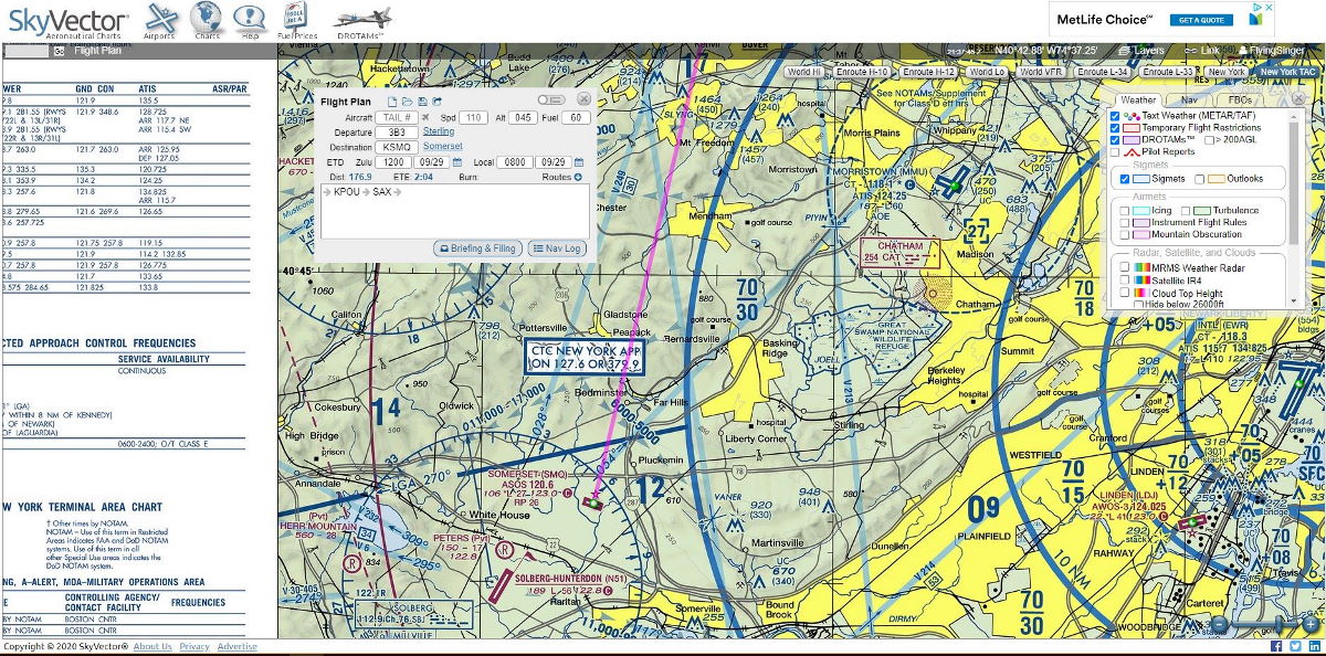
You just have to be sure not to click the “File flight plan” button or you may be in trouble with the FAA. This thing is for real!
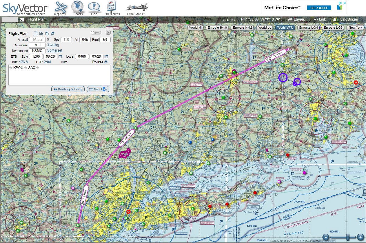
So I threw in a quick test flight plan from 3B3 (Sterling) to SMQ (Somerset, NJ), using the mouse to drag my path away from some congested areas like NYC (though I am flying right over Bradley, a large airport in Connecticut (we drove there – New England Air Museum is there). No matter! I put in a departure time for 0800 local on 9/29/20 so it would have weather info for wind and fuel planning as shown in the navlog.
So I registered as a private pilot based at Sterling, which I have been, though I’m not planning to fly IRL anytime soon.
They don’t really need that anyway. It seems to just be free based on ads. That’s one slight plus for VFRmap.com, no ads (but fewer charts).
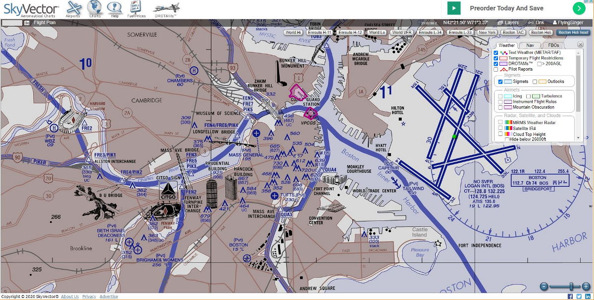
I love the layer features, though in a sim, who cares about TFR’s? I love the word DROTAMS (NOTAMS for drone operations). I also love the details in the Boston heli chart.
NYC heli is pretty nice too. Purple UAS (no-drone) zones are new for me since I last looked closely at sectional charts. Like this example for Vandenberg AFB which has a cool rocket symbol. Oxnard (Piper’s airport) and Santa Ynez are on there too
So many wonders in the world when you’re an aviation geek and/or flight sim nerd!
https://skyvector.com