Dominican Republic
Natural Wonders
Fly out of Santa Cruz de Barahona 60 nautical miles east of the Dominican Republic's capital Santo Domingo and marvel at the natural wonders in the Sierra de Bahoruco National Park.
NOTAM: The Haiti / Dominican Republic border runs through the mid point of Playita de Punta dam. The border ascends into the mountains after WP 2 and there are no visible clues as to where it is. WP 3-4 take you straight along the boderfollow the border from 5 miles after WP 3.
Return flights:
- 44 nm: NW to Lake Enriquillo
- 101 nm: Coastal flight, straight to WP 4 - Pedernales Beach, return along the coast via WP 5-8
- 155 nm: Entire route
- Country: Dominican Republic
- Locale: Santa Cruz de Barahona
- Route: Maria Montez MDBH to Maria Montez MDBH
- Distance: 44, 101, 155 nm
- File name: dominican-republic-MDBH-to-MDBH-VFR-santa-cruz-de-barahona-220629
Waypoints
- WP 1 - Town of El Ganadero
- WP 2 - Dam: Playita de Punta, Tierra Nueva
- WP 3 - Lago en Medio
- WP 4 - Pedernales Beach
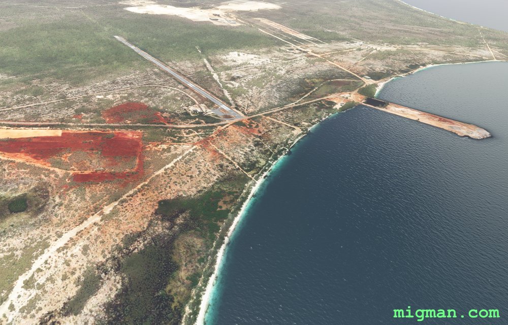
- WP 5 - Cabo Rojo Airport MDCR 4,782 ft
- WP 6 - Laguna de Oviedo
- WP 7 - Town of Paraiso
- WP 8 - Small peninsula: Punta Prieta
 WP 1 - Town of El Ganadero
 WP 2 - Dam: Playita de Punta, Tierra Nueva
 WP 3 - Lago en Medio
 WP 4 - Pedernales BeachWP 5 - Cabo Rojo Airport MDCR 4,782 ft
 WP 6 - Laguna de Oviedo
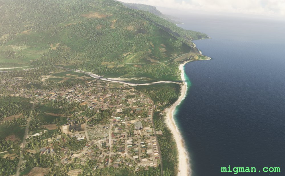 WP 7 - Town of Paraiso
 WP 8 - Small peninsula: Punta Prieta
 WP 8 - Small peninsula: Punta Prieta
 Maria Montez MDBH
 Santa Cruz de Barahona