Caribbean 4 | Missions in the MiGMan’s World Tour DLC
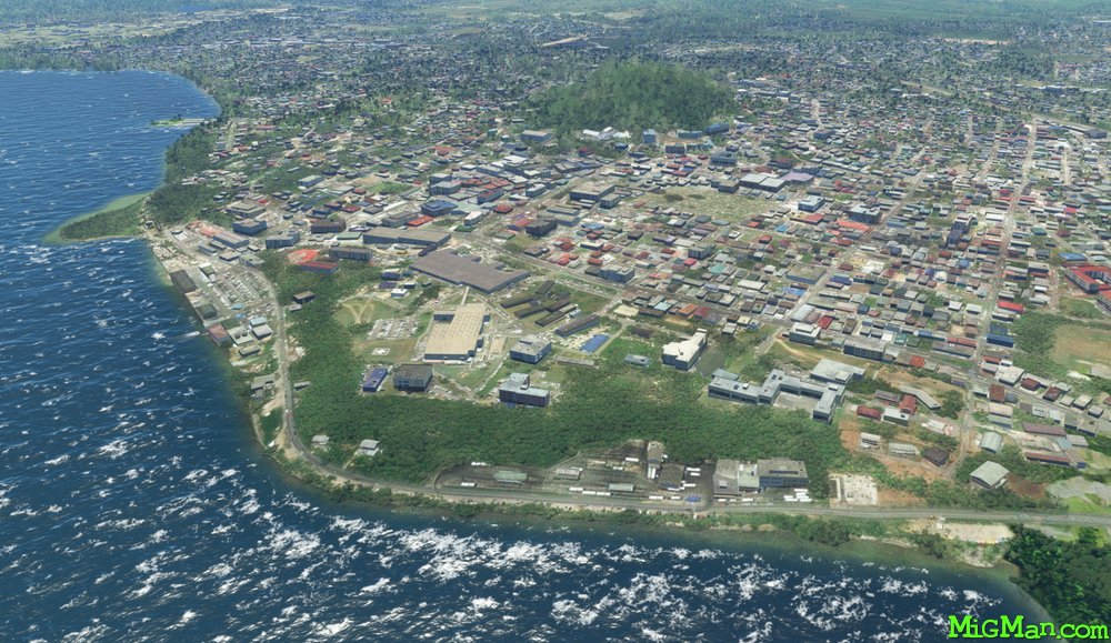
San Fernando and the South-West Coast
AboutExplore the many coastal towns and beaches in Trinidad's south west. The Point-A-Pierre POL (Petroleum, Oil, Liquid storage facility) is at the north end of the large coastal city of San Fernando. Follow the coastline all the way to Icacos Point which is the southernmost point on Trinidad.
Round trips:
24 nm: WP 1 Camden Airfield TTCO 3742 feet
38 nm: WP 1 and 2 to San Fernando
112 nm: Entire route
150 nm: South East Region. Trinidad's south eastern area is sparsely populated and covered by forest. If you want to experience that region then fly to WP 5 at San Francique, turn east and follow the coast. After about 40 nm the coast turns north at Galeota Port and continues for another 43 nm to Galera Point.
 Trinidad and Tobago
location_citySan Fernando
flight_takeoffTTPP Piarco
airline_seat_recline_extraCaribbean 4
tagCoastal flight
tagDam spotting
Trinidad and Tobago
location_citySan Fernando
flight_takeoffTTPP Piarco
airline_seat_recline_extraCaribbean 4
tagCoastal flight
tagDam spotting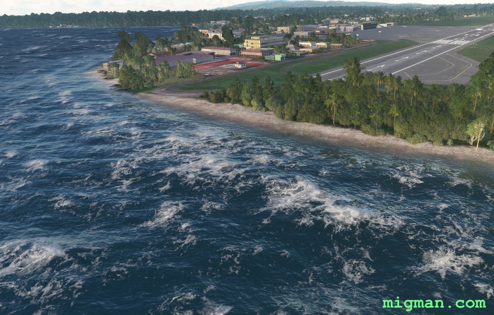
Crown Point, Tobago
AboutOf the two islands in the Republic of Trinidad and Tobago, Tobago is the northernmost at about 14 nautical miles north of Trinidad. Take off from Crown Point TTCP 8992 feet and circumnavigate the island.
Round trips:
12 nautical miles: Scarborough at Waypoint 1
18 nautical miles: Plymouth at Waypoint 6
46 nautical miles: Entire route
Round trips:
12 nautical miles: Scarborough at Waypoint 1
18 nautical miles: Plymouth at Waypoint 6
46 nautical miles: Entire route
Trinidad and Tobago
location_cityTobago
flight_takeoffTTCP Crown Point
airline_seat_recline_extraCaribbean 4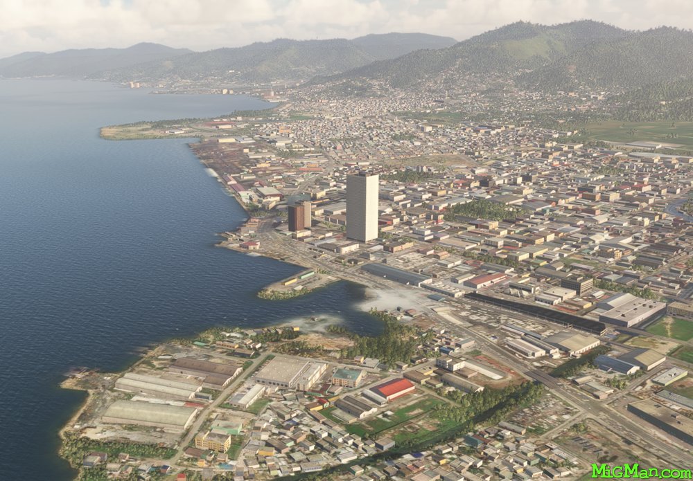
Trinidad North West
AboutJust off the north coast of Venezuela lay the islands of Trinidad and Tobago, one of the larger island chains in the West Indies. Fly out out of Piarco International Airport TTPP 10,457, across the the capital Port of Spain, explore the north east coast of Trinidad and return across the east to west mountain range.
NOTAM: At Chacachacare. Venezuela is visible 5 nautical miles to the west across Bocas del Dragon.
Round trips: 58 nm: At WP 5 Diego Martin, turn south and follow the valley south for 5nm to WP 2 - Intersection at Fort George then return to Piarco airport. 70 nm plus: Explore the north east coast: Fly directly to WP 6, follow the coast to the east. At the most easterly point turn south and follow the coast. When ready, return via WP 7 or directly to Piarco airport. 72 nm: Entire route
Trinidad and Tobago
location_cityTrinidad
flight_takeoffTTPP Piarco
airline_seat_recline_extraCaribbean 4
tagCoastal flight
tagCanyon runs & Mach Loops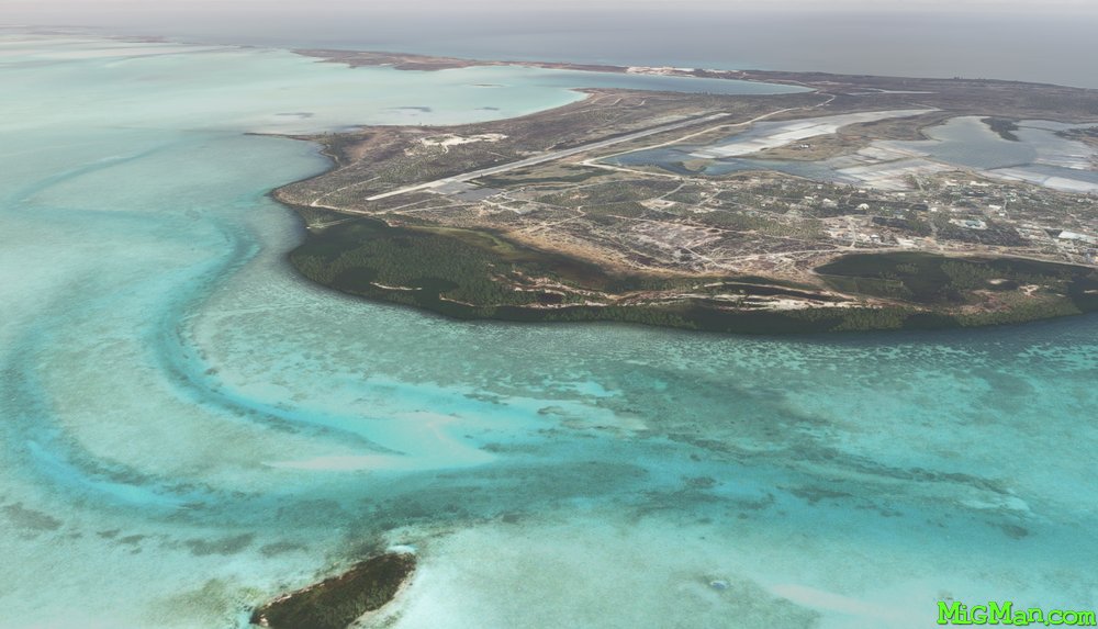
Grand Turk Island and the Southern Cays
AboutExplore the southern cays in the Turks and Caicos Islands. Take off from JAGS McCartney International Airport MBGT in the capital, Cockburn Town. At Salt Cay there is an abandoned aerodrome with a 2804ft runway. Do a low level pass and check the runway condition before attemping a landing!
Return flights:
14 nm: Cotton Cay
44nm: South Caicos
77nm: Entire route
Return flights:
14 nm: Cotton Cay
44nm: South Caicos
77nm: Entire route
 Turks and Caicos Islands
location_cityGrand Turk Island
flight_takeoffMGGT La Aurora
airline_seat_recline_extraCaribbean 4
tagAiports
Turks and Caicos Islands
location_cityGrand Turk Island
flight_takeoffMGGT La Aurora
airline_seat_recline_extraCaribbean 4
tagAiports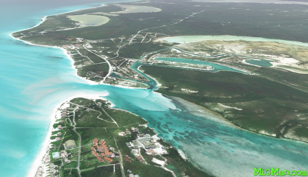
Providenciales, North and West Caicos
AboutFly past some of the most gorgeous resorts and beaches in teh Caribbean by taking off from Providenciales International Airport MBPV 9199 ft and following the northern shoreline to Little Water Cay (Iguana Island). Continue along the northern shores to the northern end of North Caicos. Fly down the east coast of North Caicos and back over Providenciales to West Caicos.
Round Trips:
24 nm: Lake Catherine, West Caicos
24 nm: Pine Cay Airport MBPI at Leeward Settlement
28 nm: Northwest Point National Park
85 nm: Entire route
Round Trips:
24 nm: Lake Catherine, West Caicos
24 nm: Pine Cay Airport MBPI at Leeward Settlement
28 nm: Northwest Point National Park
85 nm: Entire route
Turks and Caicos Islands
location_cityProvidenciales
flight_takeoffMBPV Providenciales
airline_seat_recline_extraCaribbean 4
tagBridges
tagCoastal flight
tagAiports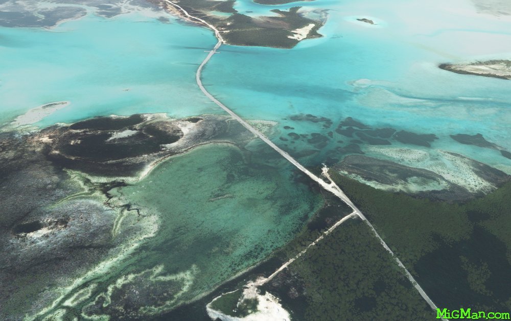
South, East and Middle Caicos Islands
AboutEnjoy the stunning crystalline water and complex lagoons in the South, East and Middle Caicos Islands. Consider stopping at Conch Bar airstrip to soak up some Caribbean sun! Fly out of South Caicos International Airport MBSC with a 6013 ft runway but be aware that Conch Bar is a modest 2433 ft, and is surrounded by a dense wood.
Return flights:
34 nm: Big Pond lagoon. Middle Caicos
39 nm: Cedar Point via WP 1 and WP 2
67 nm: Entire route
Return flights:
34 nm: Big Pond lagoon. Middle Caicos
39 nm: Cedar Point via WP 1 and WP 2
67 nm: Entire route
Turks and Caicos Islands
location_citySouth Caicos
flight_takeoffMBSC South Caicos
airline_seat_recline_extraCaribbean 4
tagBridges
tagAiports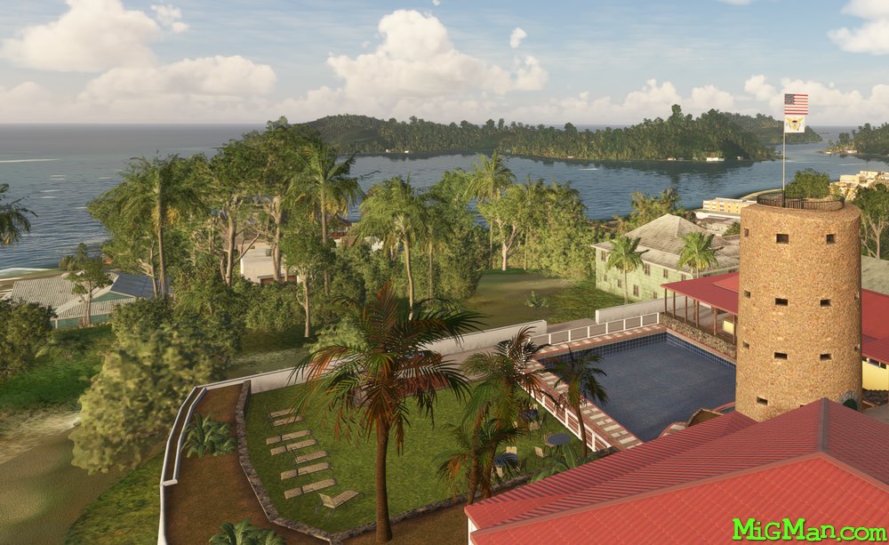
Blackbeard, a Pirate of the Caribbean
AboutThe U.S. Virgin Islands was purchased from Denmark by the U.S.A. for $25 million in 1917. Traditionally home to hundreds of sugar plantations, the main islands are Saint Croix, Saint John, Saint Thomas. Blackbeard, a notorious pirate, left a watch at capital, Charlotte Amalie, today known as "Blackbeard’s Castle". It is very difficult to spot from an aircraft. If you want to look for it, it’s located 2nm east of the threshold of RWY 28, and 0.2 nm from the shore.
Round trips:
14 nm: Turquoise Bay, near WP 5
45 nm: Entire route
Round trips:
14 nm: Turquoise Bay, near WP 5
45 nm: Entire route
 U.S. Virgin Islands
location_cityCharlotte Amalie
flight_takeoffTIST Cyril E. King
airline_seat_recline_extraCaribbean 4
U.S. Virgin Islands
location_cityCharlotte Amalie
flight_takeoffTIST Cyril E. King
airline_seat_recline_extraCaribbean 4