Caribbean 2 | Missions in the MiGMan’s World Tour DLC
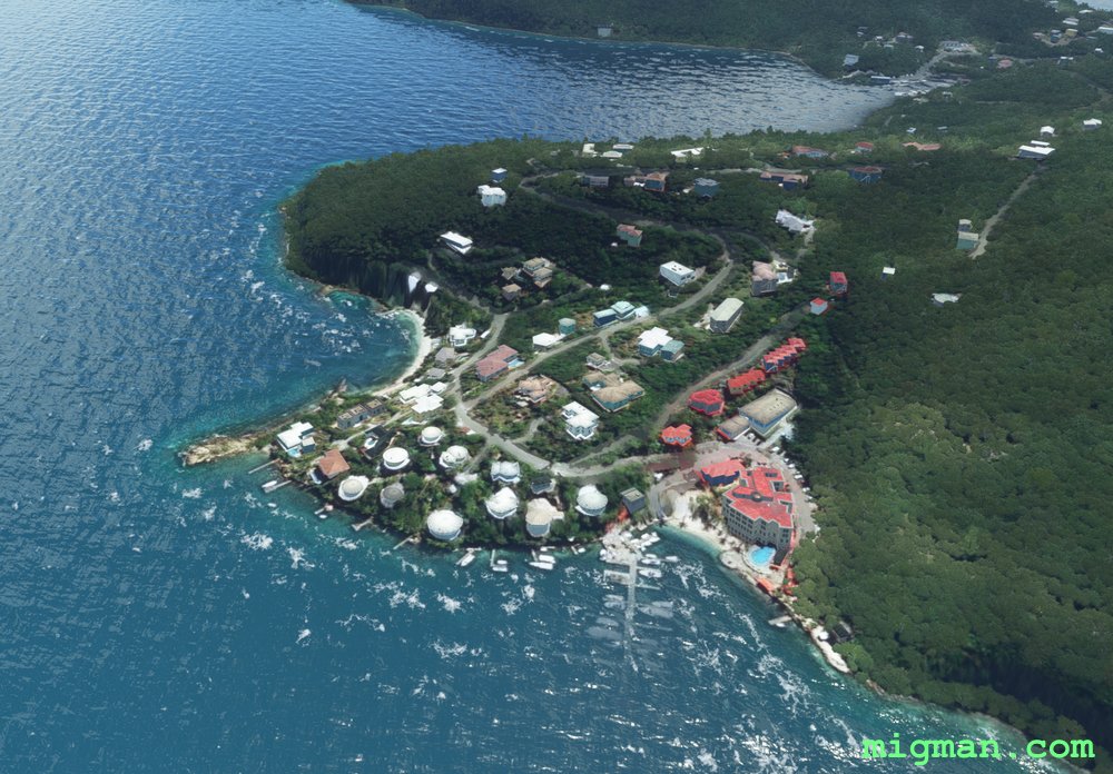
British Virgin Islands
AboutTake off from Terrance B. Lettsome ap, 4 m NE of the capital
Road Town. There are lots of bays, beaches and resorts to explore on this trip. I have set the waypoints to the most obvious points in the landscape but have fun and explore! The British Virgin Islands has some of the highest terrain in the Carribean, with Sage Mountain National Park exceeding 2,000 ft.
 British Virgin Islands
location_cityRoad Town
flight_takeoffTUPJ Terrance B. Lettsome
airline_seat_recline_extraCaribbean 2
tagAiports
British Virgin Islands
location_cityRoad Town
flight_takeoffTUPJ Terrance B. Lettsome
airline_seat_recline_extraCaribbean 2
tagAiports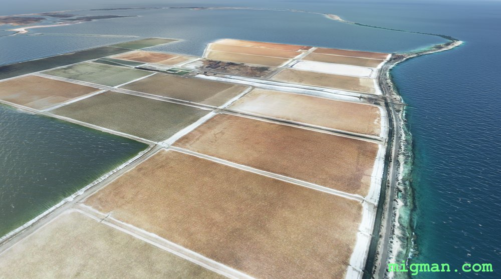
Bonaire, Salt of the Earth
AboutCaribbean Netherlands consists of the islands of Bonaire, Sint Eustatius and Saba. Bonaire is about 40 nm N of Venezuela. Follow the coast of Bonaire, visiting the enormous saltworks and their colourful drying pans south of the airport.
 Caribbean Netherlands
location_cityBonaire
flight_takeoffTNCB Bonaire
airline_seat_recline_extraCaribbean 2
tagCoastal flight
Caribbean Netherlands
location_cityBonaire
flight_takeoffTNCB Bonaire
airline_seat_recline_extraCaribbean 2
tagCoastal flight
Sint Eustatius and Saba
AboutCaribbean Netherlands consists of three islands: Bonaire about 40 nm N of Venezuela and 400 nm to the NE, Sint Eustatius and Saba. Both of the latter have volcanos.
Caribbean Netherlands
location_citySint Eustatius
flight_takeoffTNCE F. D. Roosevelt
airline_seat_recline_extraCaribbean 2
tagVolcano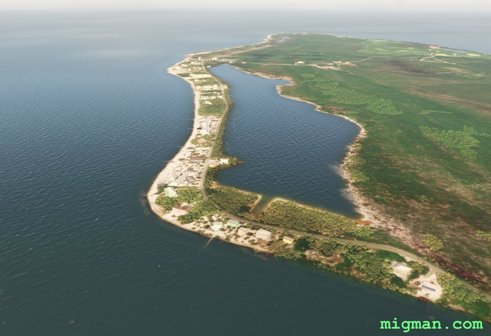
Cayman Brac and Little Cayman
AboutTake off from Gerrard-Smith International MWCB and explore the two smaller islands of the Cayman trilogy. Follow South Side Road along the southern shoreline to Pollard Bay and fly around the coast, back to the airport and then cross 5 miles of shark infested ocean to Little Cayman.
 Cayman Islands
location_cityCayman Brac
flight_takeoffMWCB Gerrard-Smith
airline_seat_recline_extraCaribbean 2
tagCoastal flight
tagAiports
Cayman Islands
location_cityCayman Brac
flight_takeoffMWCB Gerrard-Smith
airline_seat_recline_extraCaribbean 2
tagCoastal flight
tagAiports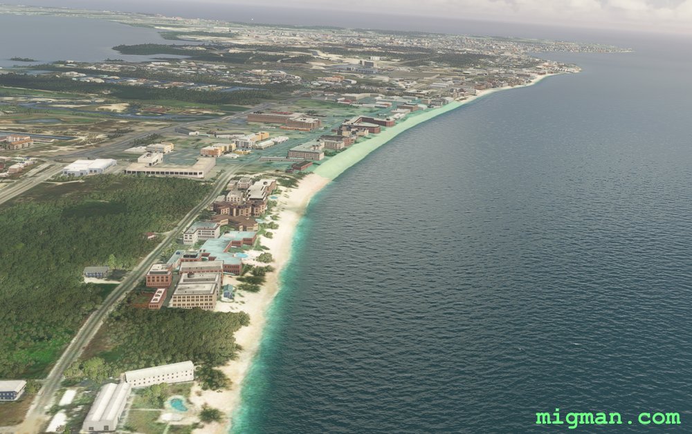
Grand Cayman
AboutGrand Cayman is a major cruise ship destination and the largest in the Cayman's chain, the other two being Little Cayman and Cayman Brac. Fly out of the capital George Town and circumnavigate Grand Cayman Island.
Cayman Islands
location_cityGeorge Town
flight_takeoffMWCR Roberts
airline_seat_recline_extraCaribbean 2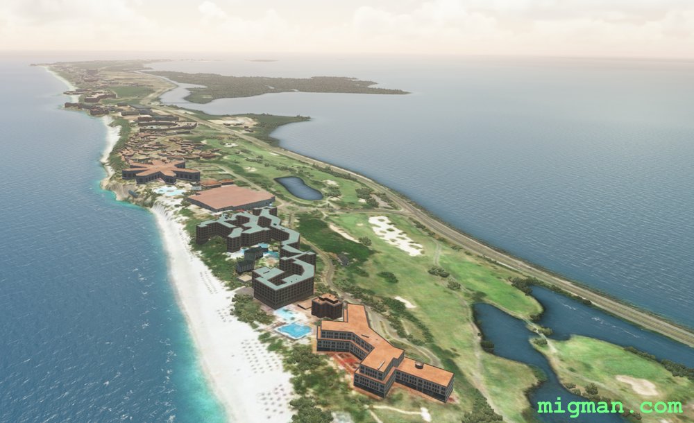
Bay of Cardenas
AboutExplore the Bay of Cardenas, 60 miles east of Havana. At about 3 miles past WP1 you will fly past Kawama Aerodrome / Santa Marta Airport MUKW on your right, at the base of the Hicacos Peninsula.
Return flights:
12 nm - WP 1: Bay of Camarioca
40 nm: WP 1 & 2: Hicacos Peninsula
67 nm: Entire route
Return flights:
12 nm - WP 1: Bay of Camarioca
40 nm: WP 1 & 2: Hicacos Peninsula
67 nm: Entire route
 Cuba
location_cityMatanzas
flight_takeoffMUVR Juan G. Gomez
airline_seat_recline_extraCaribbean 2
Cuba
location_cityMatanzas
flight_takeoffMUVR Juan G. Gomez
airline_seat_recline_extraCaribbean 2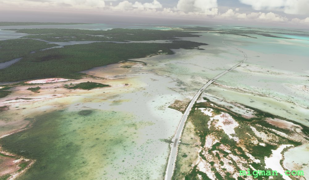
Cayo Santa Maria Causeway
AboutThe Cayo Santa Maria Causeway extends about 8 miles off the north coast of Cuba and connects to an extensive island chain.
This flight plan provides a beautiful setting to practice basic flight skills at a generous runway.
Cuba
location_cityVilla Clara
flight_takeoffMUBR Las Brujas
airline_seat_recline_extraCaribbean 2
tagCoastal flight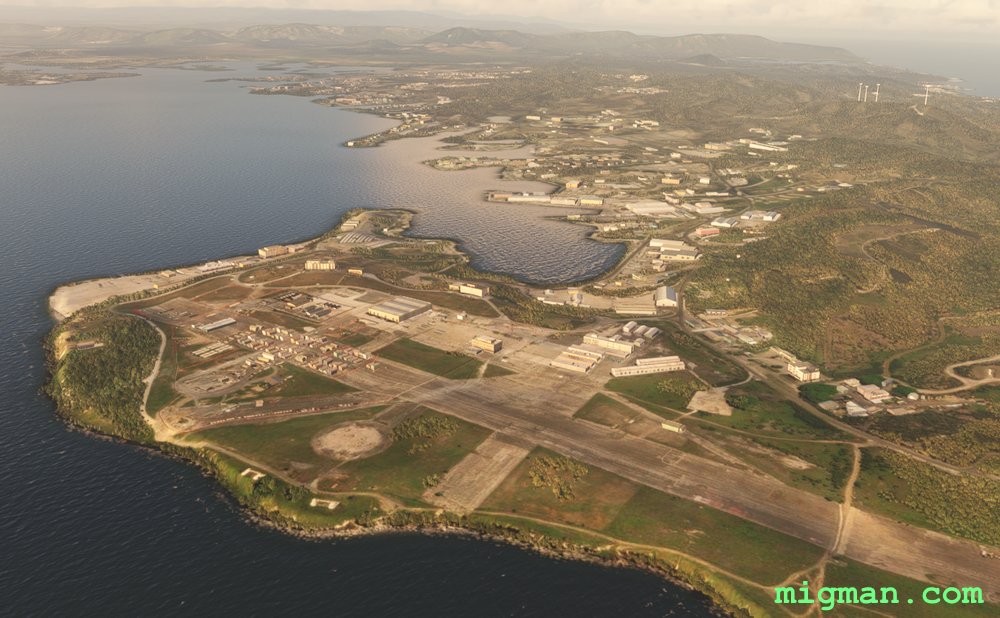
Guantanomo
AboutHaving been granted special permission, you can fly out of Guantanomo Bay Naval Air Station and inspect the famous camp.
Return flights:
32 nm: WP 1,2,3, Guantanomo
72 nm: Entire route
Return flights:
32 nm: WP 1,2,3, Guantanomo
72 nm: Entire route
Cuba
location_cityGuantanamo
flight_takeoffMUGM Guantanomo Bay Naval Air Station
airline_seat_recline_extraCaribbean 2
tagDam spotting
tagAiports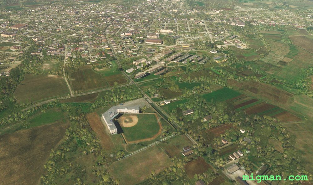
Havana to the South Coast
AboutTake off from Jose Marti International Airport in Cuba's capital city Havana and explore the countryside down to the south coast. Along the way familiarise yourself with the location of three other airports.
The lake at WP 1 is a good reference for approaching RWY 24, being 3 miles from the threshold.
Return trip options:
20 nm: San Antonio de los Banos Airport MUSA at WP 6
34 nm: Batabano Airport MUBO (Agricultural) at WP 5
40 nm: Lake at WP 1 and the dam at WP 2
56 nm: Juan de la Cruz Airport MUGU at WP 5
75 nm: Entire route
Cuba
location_cityHavana
flight_takeoffMUHA Jose Marti
airline_seat_recline_extraCaribbean 2
tagCoastal flight
tagDam spotting
tagAiports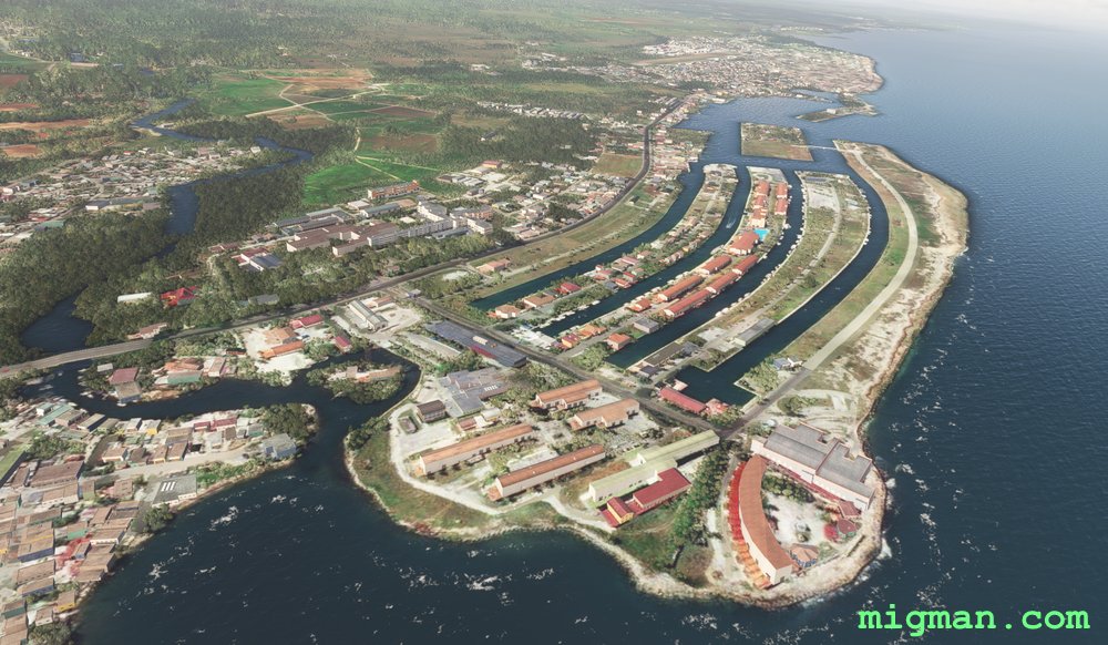
Havana's Northern Shores
AboutFly out of Jose Marti International Airport in Cuba's capital city Havana and explore the local coastline. The lake at WP 1 is a good reference for approaching RWY 24, being 3 miles from the threshold.
Return trip options:
17 nm: Centre of Havana, WP 4
37 nm: NE shore and Havana: WP 1,2,3,4
48 nm: NW shore and Havana: WP 4,5,6
69 nm: Entire route
Return trip options:
17 nm: Centre of Havana, WP 4
37 nm: NE shore and Havana: WP 1,2,3,4
48 nm: NW shore and Havana: WP 4,5,6
69 nm: Entire route
Cuba
location_cityHavana
flight_takeoffMUHA Jose Marti
airline_seat_recline_extraCaribbean 2
tagCoastal flight
tagAiports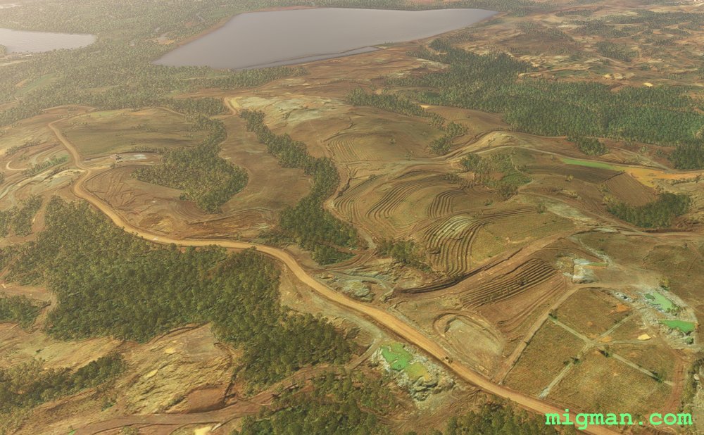
Nickel and Dams, Cuba Northwest
AboutFly out of Orestes Acosta MUMO at the town of Moa on Cuba's north east coast. Moa is dominated by the nickel mining operation at the Pedro Soto Alba Nickel Plant. Fly west through the Pico Cristal National Park and return along the north coast.
Return flights:
34 nm: Guajaco Uno
50 nm: Dam at WP 1, WP2 Guajaco Uno
101 nm: Entire route
Return flights:
34 nm: Guajaco Uno
50 nm: Dam at WP 1, WP2 Guajaco Uno
101 nm: Entire route
Cuba
location_cityHolguin
flight_takeoffMUMO Orestes Acosta
airline_seat_recline_extraCaribbean 2
tagBridges
tagAiports
tagDam spotting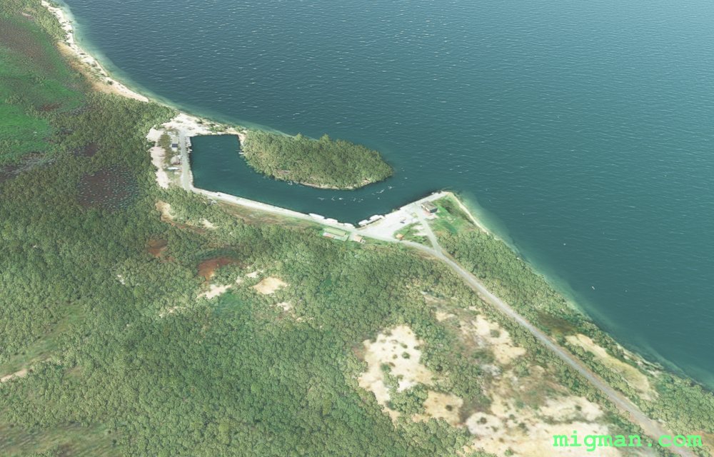
Fountain of Youth
AboutTake off from Rafael Cabrera (MUNG) and find the fountain of youth on the Isla de la Juventud in the Gulf of Batanabo.
Return journeys:
9 nm - Across Nueva Gerona, north of the airport
16 nm - to Las Nuevas Lake at WP 2
71 nm - Entire Route
Return journeys:
9 nm - Across Nueva Gerona, north of the airport
16 nm - to Las Nuevas Lake at WP 2
71 nm - Entire Route
Cuba
location_cityIsla de la Juventud
flight_takeoffMUNG Rafael Cabrera
airline_seat_recline_extraCaribbean 2
tagAiports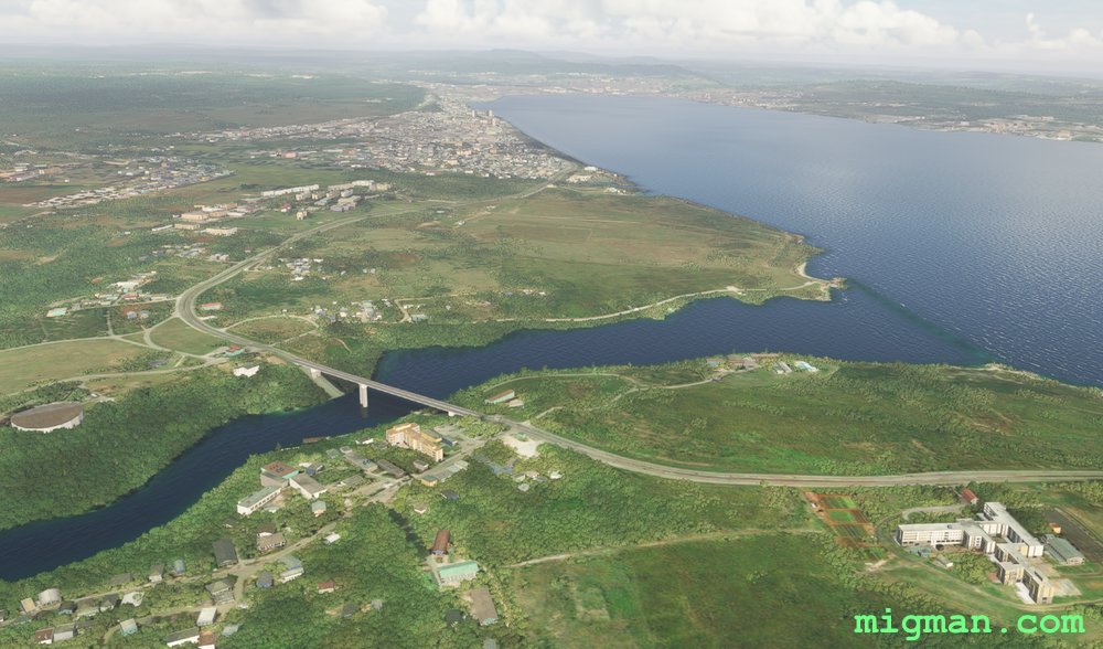
Matanzas North West Coast
AboutLocated 45 nm east of Havana, Matanzas is capital of the Province of Matanzas. Take off from Juan G. Gomez International Airport. Fly to Matanzas, over several large lakes and return along the coast from Santa Cruz del Norte, about 20 miles east of Havana.
Return flights:
15 nm: WP 1, Matanzas
36 nm: WP 1,2 - Caunavaco Dam
60 nm: Entire route
Return flights:
15 nm: WP 1, Matanzas
36 nm: WP 1,2 - Caunavaco Dam
60 nm: Entire route
Cuba
location_cityMatanzas
flight_takeoffMUVR Juan G. Gomez
airline_seat_recline_extraCaribbean 2
tagBridges
tagCoastal flight
tagDam spotting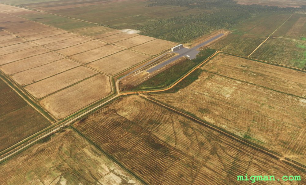
Pinar del Rio Bush Strip Tour
AboutLa Coloma MULM is the longest airfield in this area. This fertile region hosts a bevy of agricultural airstrips. Take a light aircraft, check out the farms and do touch and go's at the strips.
NOTAM: The large lake Embalse el Punto (2 miles EW, 3 miles NS) is about 2 miles from the threshold of RWY 25 at La Coloma.
Return trips:
11 nm - Pinar del Rio at WP 9
14 nm - La Coloma Port at WP 1
27 nm - WP 1,2
75 nm - Entire route
NOTAM: The large lake Embalse el Punto (2 miles EW, 3 miles NS) is about 2 miles from the threshold of RWY 25 at La Coloma.
Return trips:
11 nm - Pinar del Rio at WP 9
14 nm - La Coloma Port at WP 1
27 nm - WP 1,2
75 nm - Entire route
Cuba
location_cityPinar del Rio
flight_takeoffMULM La Coloma
airline_seat_recline_extraCaribbean 2
tagAiports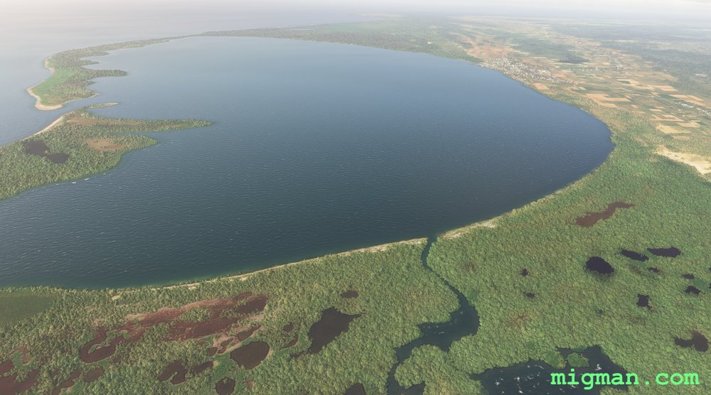
San Julian and the Bay of Cortes
AboutExplore the Bay of Cortes in the SW region of Cuba.
Cuba
location_cityPinar del Rio
flight_takeoffMUSJ San Julian
airline_seat_recline_extraCaribbean 2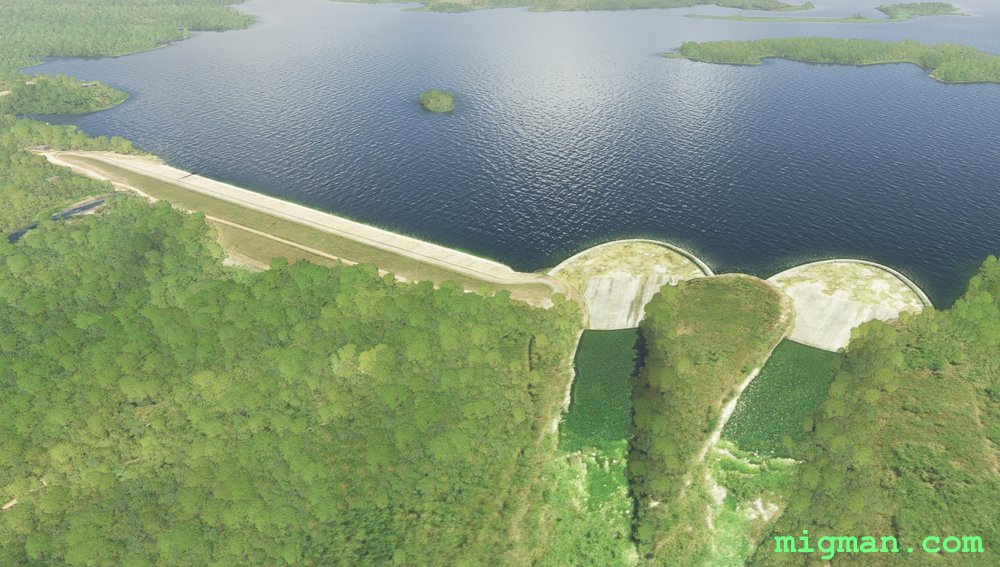
Dams of the South West, Santiago de Cuba
AboutSantiago de Cuba is the second-largest city in Cuba and the capital city of Santiago de Cuba Province. Take off from Antonio Maceo International Airport MUCU and visit 7 of the local water cachements. See how many others you can spot on your trip!
Return flights:
11 nm: Fly north for 5 miles across the city of Santiago de Cuba
23 nm: WP 7, Blanka Lake Dam
85 nm: Entire route
Return flights:
11 nm: Fly north for 5 miles across the city of Santiago de Cuba
23 nm: WP 7, Blanka Lake Dam
85 nm: Entire route
Cuba
location_citySantiago de Cuba
flight_takeoffMUCU Antonio Maceo
airline_seat_recline_extraCaribbean 2
tagBridges
tagDam spotting
Villa Clara: Bay of Buena Vista
AboutRevel in the typical Caribbean water views to be found on the Bay of Buena Vista in the central north Cuban region of Villa Clara.
Return flights:
8 nm: WP 1: Santa Clara
92 nm: Entire route
Return flights:
8 nm: WP 1: Santa Clara
92 nm: Entire route
Cuba
location_cityVilla Clara
flight_takeoffMUSC Abel Santamaria
airline_seat_recline_extraCaribbean 2
tagDam spotting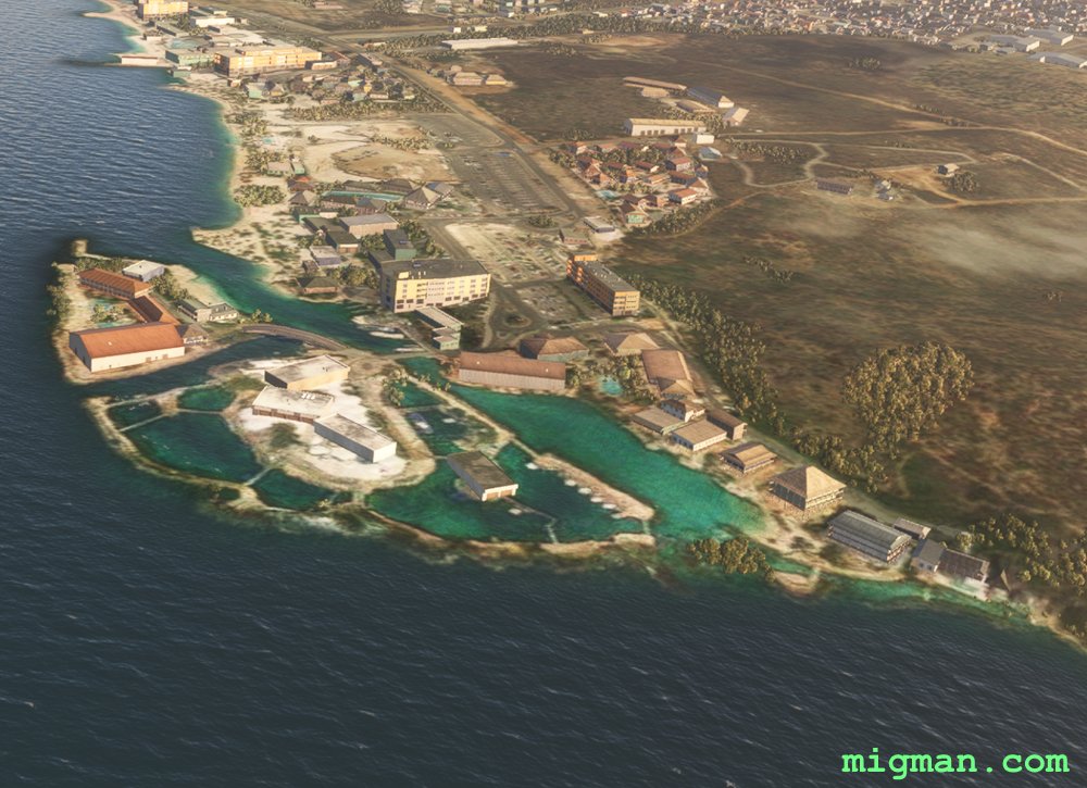
Willemstad East
AboutTake off from Willemstad Airport TNCC, aka Hato International Airport and fly to the east end of Curacao. At the eastern end of Curacao youi can see the tiny uninhabited island of Klein Curacao about 6 nm offshore.
Return flights:
4 nm: Piscadera Bay
10 nm: Willemstad Harbour
15 nm: Curacao Sea Aquarium & Dolphin Academy
20 nm: Sint Joris Bay
31 nm: Eastpoint / Oostpunt
35 nm: Entire route
Return flights:
4 nm: Piscadera Bay
10 nm: Willemstad Harbour
15 nm: Curacao Sea Aquarium & Dolphin Academy
20 nm: Sint Joris Bay
31 nm: Eastpoint / Oostpunt
35 nm: Entire route
 Curacao
location_cityWillemstad
flight_takeoffTNCC Willemstad
airline_seat_recline_extraCaribbean 2
Curacao
location_cityWillemstad
flight_takeoffTNCC Willemstad
airline_seat_recline_extraCaribbean 2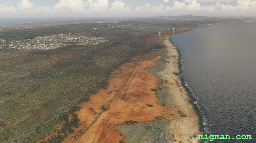
Willemstad West
AboutExplore the high ground to the west of Willemstad Airport on Curacao.
4nm: Bullenbaai Oil Depot
26nm: Christoffel Mountain
35 nm: Entire route
4nm: Bullenbaai Oil Depot
26nm: Christoffel Mountain
35 nm: Entire route
Curacao
location_cityWillemstad
flight_takeoffTNCC Willemstad
airline_seat_recline_extraCaribbean 2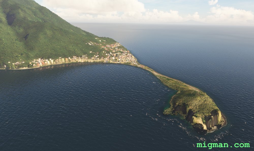
Dominica's Rugged Coastline
AboutFollow the rugged coastline around the Island country of Dominica in the east Caribbean, north of Guyana and Venezuela. It's closest neighbours are Base-Terre to the north and Martinique to the south.
Routes (return distance):
3 nm: South to Roseau
15 nm: Scotts Head
28 nm: Straight line to Douglas-Charles Airport at WP 4
64 nm: Entire route
Routes (return distance):
3 nm: South to Roseau
15 nm: Scotts Head
28 nm: Straight line to Douglas-Charles Airport at WP 4
64 nm: Entire route
 Dominica
location_cityRoseau
flight_takeoffTDCF Roseau-Canefield
airline_seat_recline_extraCaribbean 2
tagCoastal flight
tagAiports
Dominica
location_cityRoseau
flight_takeoffTDCF Roseau-Canefield
airline_seat_recline_extraCaribbean 2
tagCoastal flight
tagAiports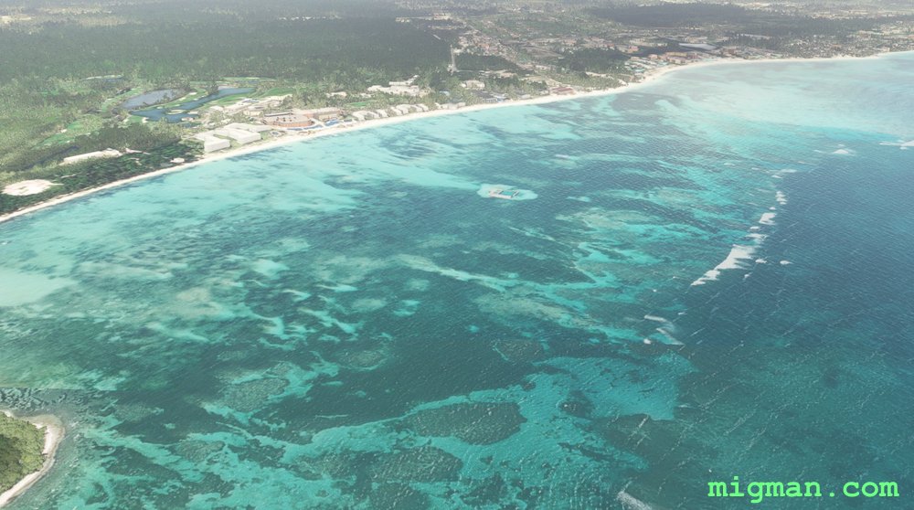
Last Resort
AboutPunta Cana is a resort town at the easternmost point of the Dominican Republic. Check out 34 miles of resorts to the NE and return via the El Prieto and La Colora mountains.
Return flights: 17 nm: Punta Espada at WP 4 | 70 nm: Laguna del Limon | 91 nm: Entire route
Return flights: 17 nm: Punta Espada at WP 4 | 70 nm: Laguna del Limon | 91 nm: Entire route
 Dominican Republic
location_cityPunta Cana
flight_takeoffMDPC Punta Cana
airline_seat_recline_extraCaribbean 2
Dominican Republic
location_cityPunta Cana
flight_takeoffMDPC Punta Cana
airline_seat_recline_extraCaribbean 2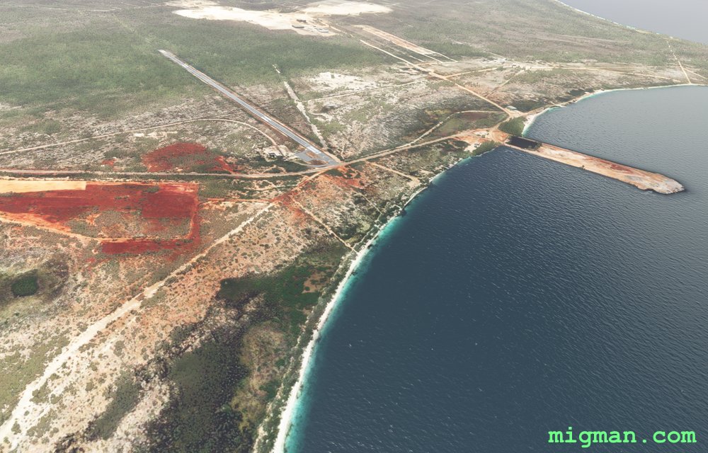
Natural Wonders
AboutFly out of Santa Cruz de Barahona 60 nautical miles east of the Dominican Republic's capital Santo Domingo and marvel at the natural wonders in the Sierra de Bahoruco National Park.
NOTAM: The Haiti / Dominican Republic border runs through the mid point of Playita de Punta dam. The border ascends into the mountains after WP 2 and there are no visible clues as to where it is. WP 3-4 take you straight along the border from 5 miles after WP 3.
Return flights:
44 nm: NW to Lake Enriquillo
101 nm: Coastal flight, straight to WP 4 - Pedernales Beach, return along the coast via WP 5-8
155 nm: Entire route
Dominican Republic
location_citySanta Cruz de Barahona
flight_takeoffMDBH Maria Montez
airline_seat_recline_extraCaribbean 2
tagBorder Patrol
tagAiports
tagDam spotting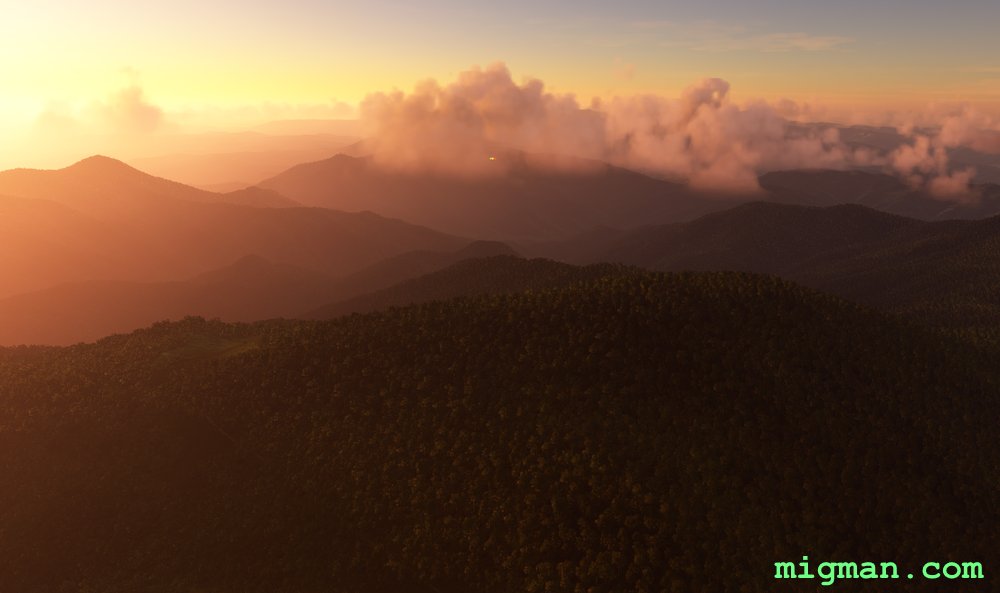
Pico Duarte
AboutGo to the highest point in the entire Caribbean. At 10,164 ft the Pico Duarte is located almost exactly in thecentre of the island continent of Haiti / Dominican Republic.
Return flights:
35 nm: WP 1 - Port town of Puerto Viejo
44 nm: WP 7 - Presa de Sanameta Yegua (Dam)
96 nm: WP 5 - Pico Duarte
148 nm: Entire route
Return flights:
35 nm: WP 1 - Port town of Puerto Viejo
44 nm: WP 7 - Presa de Sanameta Yegua (Dam)
96 nm: WP 5 - Pico Duarte
148 nm: Entire route
Dominican Republic
location_citySanta Cruz de Barahona
flight_takeoffMDBH Maria Montez
airline_seat_recline_extraCaribbean 2
tagDam spotting
tagAiports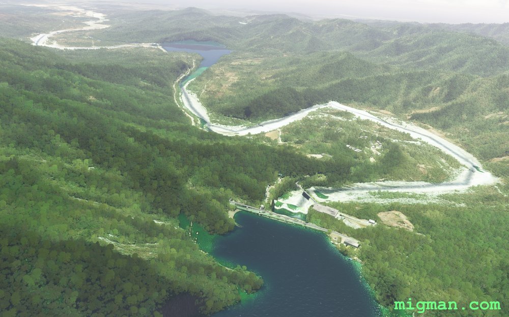
Santo Domingo NW: Dam Spotting
AboutExplore the lush valleys and go dam-spotting to the north west of the Dominican Republic's capital Santo Domingo.
53 nm: Fly across Santo Domingo to WP 1, return along the coast via WP 8,9,10
72 nm: Fly across Santo Domingo to WP 1, 2 dams at WP 6, return along the coast via WP 7,8,9,10
130 nm: Entire route
53 nm: Fly across Santo Domingo to WP 1, return along the coast via WP 8,9,10
72 nm: Fly across Santo Domingo to WP 1, 2 dams at WP 6, return along the coast via WP 7,8,9,10
130 nm: Entire route
Dominican Republic
location_citySanto Domingo
flight_takeoffMDSD Las Americas
airline_seat_recline_extraCaribbean 2
tagAiports
tagDam spotting
tagCanyon runs & Mach Loops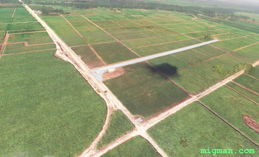
Santo Domingo East
AboutFly east of the Dominican Republic's capital Santo Domingo to San Pedro De Macoris then go inland to a small strip near San Jose de los Llanos.
Return trips:
31 nm: San Jose de los Llanos
40 nm: San Pedro de Macoris
50 nm: Entire route
Return trips:
31 nm: San Jose de los Llanos
40 nm: San Pedro de Macoris
50 nm: Entire route
Dominican Republic
location_citySanto Domingo
flight_takeoffMDSD Las Americas
airline_seat_recline_extraCaribbean 2
tagAiports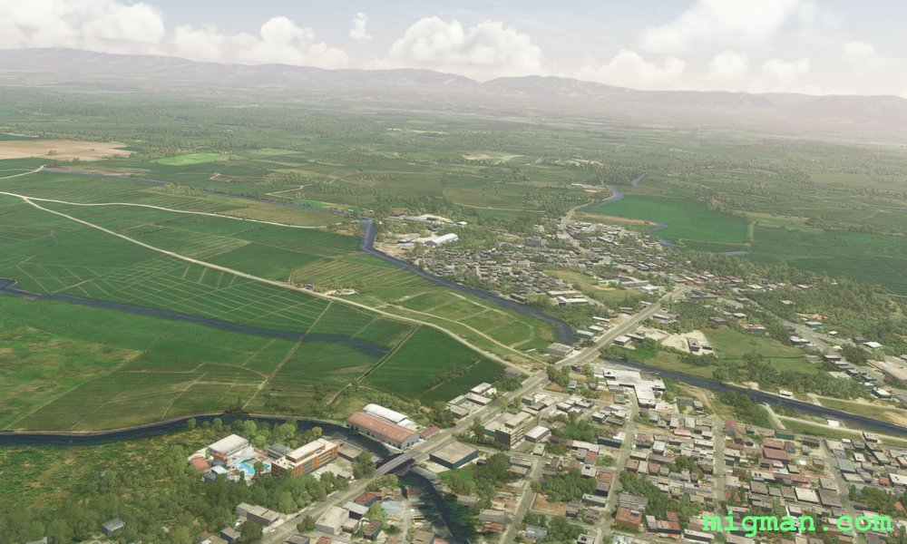
Sosua, the North West Coast
AboutCover beaches, mountainous National Parks, fertile plains and two large dams in this varied flight.
40 nm: Playa Cambiaso | 64 nm: Playa El Castillo | 111 nm: Entire route
40 nm: Playa Cambiaso | 64 nm: Playa El Castillo | 111 nm: Entire route
Dominican Republic
location_citySosua
flight_takeoffMDPP Gregorio Luperon
airline_seat_recline_extraCaribbean 2
tagCoastal flight
tagDam spotting