Caribbean 3 | Missions in the MiGMan’s World Tour DLC
El Gran Tour
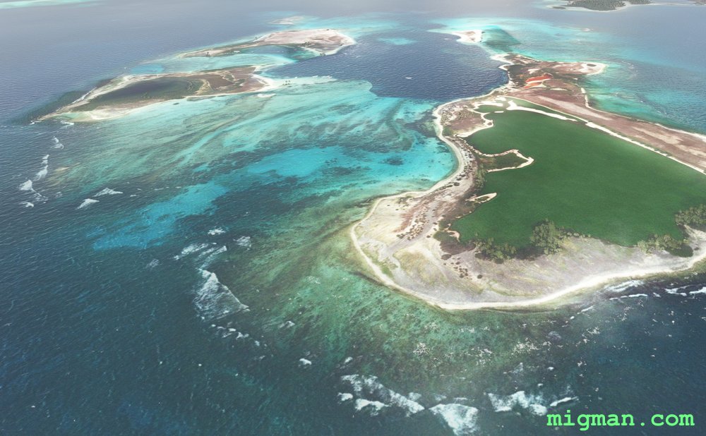
AboutTake off from Los Roques Airport and check out the many small islands of the Federal Dependencies of Venezuela.
Round trips: 51 nm: Entire route | 60 nm: Isla La Orchila. A rather barren island HDG 120 for 20 nm. Mysteriously, it does have a 9,839 ft runway!
NOTAM: Los Roques runway is only 2,652 ft long, so choose a suitable aircraft for your flight. Dos Mosquisos has a small strip at 1,635 ft.
Round trips: 51 nm: Entire route | 60 nm: Isla La Orchila. A rather barren island HDG 120 for 20 nm. Mysteriously, it does have a 9,839 ft runway!
NOTAM: Los Roques runway is only 2,652 ft long, so choose a suitable aircraft for your flight. Dos Mosquisos has a small strip at 1,635 ft.
 Federal Dependencies of Venezuela
location_cityIsla Gran Roque
flight_takeoffSVRS El Gran Roque
airline_seat_recline_extraCaribbean 3
tagAiports
Federal Dependencies of Venezuela
location_cityIsla Gran Roque
flight_takeoffSVRS El Gran Roque
airline_seat_recline_extraCaribbean 3
tagAiports
Carriacou: Land of Reefs
AboutCarriacou (meaning Land of Reefs) lays about 14 m north of the main island of Grenada. More picturesque than the main island, check out it's charming bays and beaches as well as the islands of Petite Martinique NE and Large Island to the south.
NOTAM: Lauriston TGPZ runway is 2,615 ft.
Entire route: 21 nm
NOTAM: Lauriston TGPZ runway is 2,615 ft.
Entire route: 21 nm
 Grenada
location_cityCarriacou
flight_takeoffTGPZ Lauriston
airline_seat_recline_extraCaribbean 3
Grenada
location_cityCarriacou
flight_takeoffTGPZ Lauriston
airline_seat_recline_extraCaribbean 3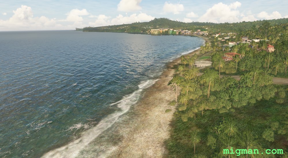
Grenada
AboutFollow the coastline at the Caribbean continent of Grenada, about 70 m north off the north coast of Venezuela.
Entire route: 37 nm
Entire route: 37 nm
Grenada
location_citySaint Georges
flight_takeoffTGPY Point Salines
airline_seat_recline_extraCaribbean 3
tagCoastal flight
tagAiports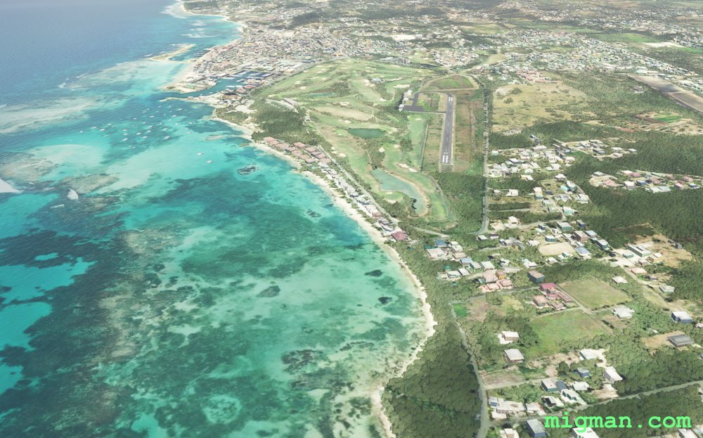
Guadeloupe
AboutGuadelope is a Caribbean region of France with six inhabited islands: Basse-Terre, Grande-Terre, Marie-Galante, La Desirade, two Iles des Saintes. Take off from Pointe-a-Pitre TFFR in the capital Les Abymes and visit all six main islands. Alternatively you can make shorter trips using the suggested routes. The island of La Desirade has spectacular cliff faces on the northern shore.
139 nm: Entire route
Round trips to local airports: 30 nm: Saint-Francois TFFC 1965 ft at WP 6 | 40 nm: Bailliff TFFB, 1999 ft at WP 2 | 48 nm: Le Saintes TFFS, 1897 ft at WP 3 | 52 nm: Desirade TFFA, 1979 ft at WP 5 | 54 nm: Maria Galante TFFM, 4060 ft at WP 4
139 nm: Entire route
Round trips to local airports: 30 nm: Saint-Francois TFFC 1965 ft at WP 6 | 40 nm: Bailliff TFFB, 1999 ft at WP 2 | 48 nm: Le Saintes TFFS, 1897 ft at WP 3 | 52 nm: Desirade TFFA, 1979 ft at WP 5 | 54 nm: Maria Galante TFFM, 4060 ft at WP 4
 Guadeloupe
location_cityBasse-Terre
flight_takeoffTFFR Pointe-a-Pitre
airline_seat_recline_extraCaribbean 3
Guadeloupe
location_cityBasse-Terre
flight_takeoffTFFR Pointe-a-Pitre
airline_seat_recline_extraCaribbean 3
The Colours of Nan Fort
AboutFly from Cap Haitien on Haiti's north coast to the westernmost point on the island, about 45 west of Cuba. Start by flying west over the rugged terrain of the Gros-Morne Arrondissement (adminstrative area), Nan Palmiste, then follow the spectacular coastline south and east back to Gonaives.
Return trips: 68 nm: Gonaives | 101 nm: Gonaives and Nan Fort | 162 nm: Entire route
Return trips: 68 nm: Gonaives | 101 nm: Gonaives and Nan Fort | 162 nm: Entire route
 Haiti
location_cityCap Haitien
flight_takeoffMTCH Cap Haitien
airline_seat_recline_extraCaribbean 3
tagCoastal flight
tagCanyon runs & Mach Loops
Haiti
location_cityCap Haitien
flight_takeoffMTCH Cap Haitien
airline_seat_recline_extraCaribbean 3
tagCoastal flight
tagCanyon runs & Mach Loops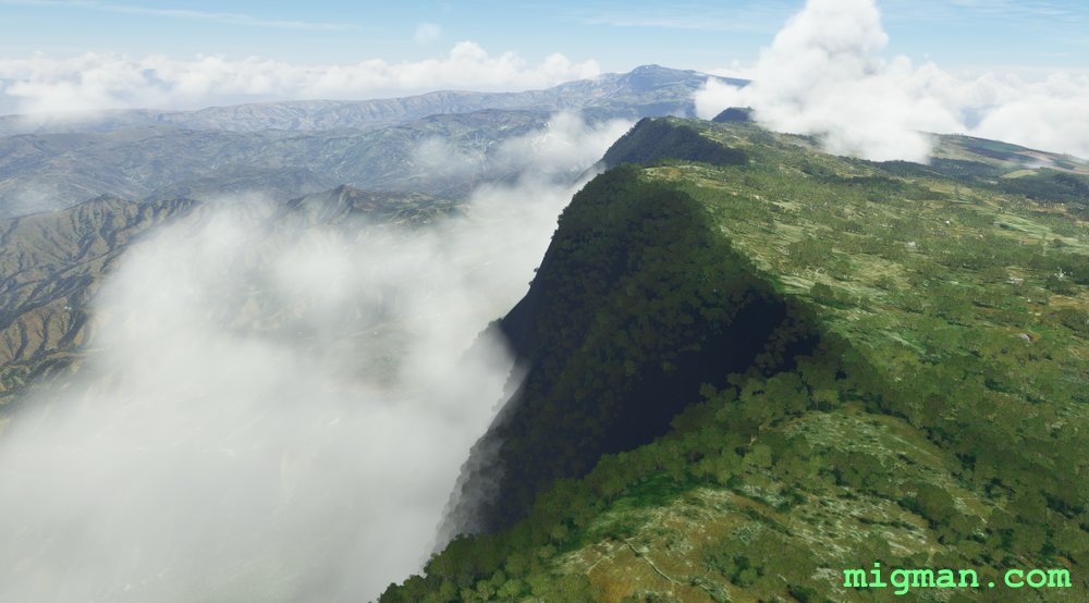
Pic la Selle
AboutFly out of Port-au-Prince to the highest peak in Haiti, a challenging 9 hour drive, or a short and comfortable flight in your aircraft!
Return flights: 44 nm: Direct to Pic la Selle | 48 nm: Direct to Malpasse Dam | 65 nm: Entire route
Return flights: 44 nm: Direct to Pic la Selle | 48 nm: Direct to Malpasse Dam | 65 nm: Entire route
Haiti
location_cityPort au Prince
flight_takeoffMTTP Toussaint Louverture
airline_seat_recline_extraCaribbean 3
tagDam spotting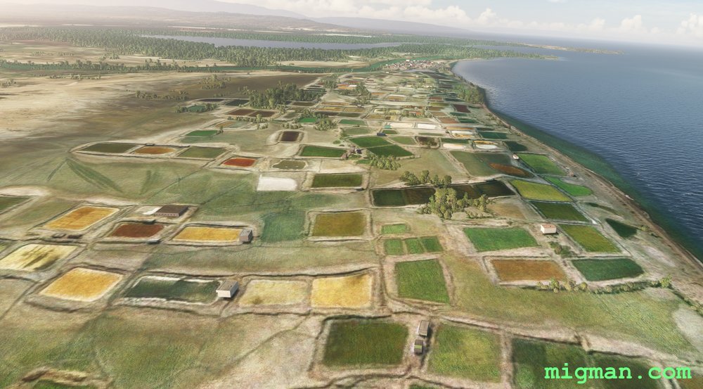
Port-au-Prince to Grand Saline
AboutExplore the coastline and rugged terrain north of Port-au-Prince, capital of Haiti.
Return flights: 31 nm: WP 6 | 59 nm: WP 1 and 2 | Entire route: 136 nm
Return flights: 31 nm: WP 6 | 59 nm: WP 1 and 2 | Entire route: 136 nm
Haiti
location_cityPort au Prince
flight_takeoffMTTP Toussaint Louverture
airline_seat_recline_extraCaribbean 3
tagCoastal flight
tagDam spotting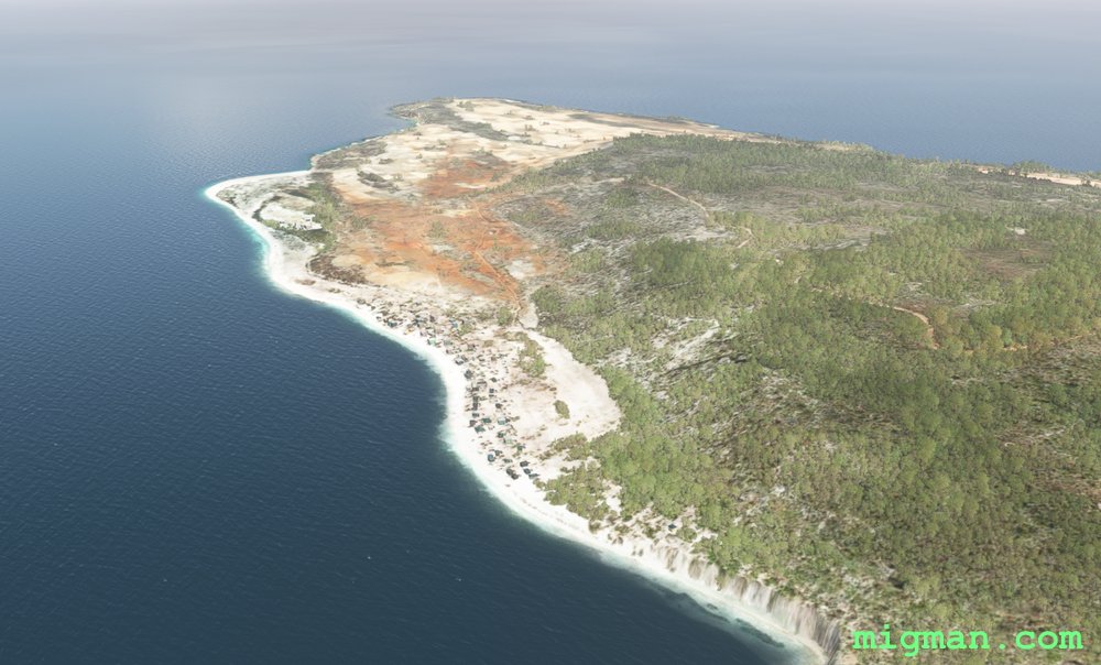
Cap Haitien to Tortuga
AboutFly out of Cap Haitien on Haiti's north coast to the island of Tortuga. Pass the coastal areas of the Baie de I'Acul, Boyeou, Chouchou, Le Borgne, Grand Fond, Anse a Foleur, Cap Rouge, Saint-Louis-du-Nord and La Pointe.
Return flights: 30 nm: Boyeou, Chouchou | 40 nm: Le Borgne | 50 nm: Grand Fond, Anse a Foleur | 60 nm: Cap Rouge, Saint-Louis-du-Nord | 107 nm: Entire route
Return flights: 30 nm: Boyeou, Chouchou | 40 nm: Le Borgne | 50 nm: Grand Fond, Anse a Foleur | 60 nm: Cap Rouge, Saint-Louis-du-Nord | 107 nm: Entire route
Haiti
location_cityCap Haitien
flight_takeoffMTCH Cap Haitien
airline_seat_recline_extraCaribbean 3
tagCoastal flight
tagAiports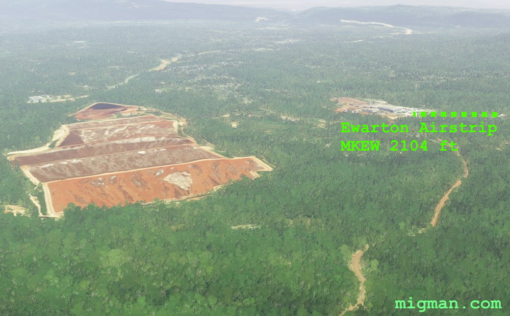
Dr. No
AboutFly around the rugged scenery in Jamaica's eastern region and stop for a martini, shaken, not stirred, at James Bond Beach on the northern shoreline. This beach featured in the movie 'Dr. No', starring Sean Connery as Bond and based on the book of the same name by ex-secret agent and author Ian Fleming.
Fly back south via the bauxite mines at Ewarton.
Round trips: 31 nm: Great Pond of Yallahs at Pamphret, WP 1 | 40 nm: Bauxite mine at Ewarton WP 7 | 58 nm: Bath Airfield MKGO 2794 ft WP 1,2 | 80 nm: Ian Fleming International Airport via WP 8,7,6,5 | 132 nm: Entire route
Fly back south via the bauxite mines at Ewarton.
Round trips: 31 nm: Great Pond of Yallahs at Pamphret, WP 1 | 40 nm: Bauxite mine at Ewarton WP 7 | 58 nm: Bath Airfield MKGO 2794 ft WP 1,2 | 80 nm: Ian Fleming International Airport via WP 8,7,6,5 | 132 nm: Entire route
 Jamaica
location_cityKingston
flight_takeoffMKJP Norman Manley
airline_seat_recline_extraCaribbean 3
tagAiports
Jamaica
location_cityKingston
flight_takeoffMKJP Norman Manley
airline_seat_recline_extraCaribbean 3
tagAiports
Cockpit Country
AboutExplore the western regions of Jamaica, flying out from Sangster International Airport at Montego Bay. Fly down the west coast and return over Cockpit Country, which refers to the proliferation of shallow caves in that region. Along the way fly over several smaller aerodromes: Negril, Port Esquivel, Kirkvine and Silent Hill. Check the runway lengths before attempting any landings!
Round trips: 20 nm: Falmouth Harbour
27 nm: Grand Palladium Jamaica Resort / Lucea Harbour
53 nm: WP 1, WP 2 - Negril Aerodrome MKNG 2490 ft
72 nm: Direct to Kirkvine Airstrip MKWI 2219 ft
Entire route: 168 nm
Round trips: 20 nm: Falmouth Harbour
27 nm: Grand Palladium Jamaica Resort / Lucea Harbour
53 nm: WP 1, WP 2 - Negril Aerodrome MKNG 2490 ft
72 nm: Direct to Kirkvine Airstrip MKWI 2219 ft
Entire route: 168 nm
Jamaica
location_cityMontego Bay
flight_takeoffMKJS Sangster
airline_seat_recline_extraCaribbean 3
tagCoastal flight
tagAiports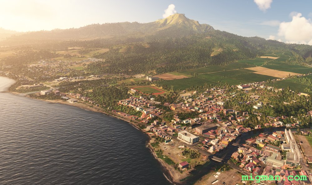
Montagne Pelee
AboutFort-de-France is the capital of the Caribbean island of Martinique, a French overseas territory. Take off from Le Lamentin (TFFF) 9842 ft. There are two distinctive mountains which are visible from all points on the island. At the north end Montagne Pelee at an elevation of 4583 ft/1397 m. and 6 miles south "Twin Peaks" (my nomenclature) at 3871 ft/1180 m.
Round trips:
20 nm: Le Marin
24 nm: Tartane
34 nm: Montagne Pelee
74 nm: Entire route
Round trips:
20 nm: Le Marin
24 nm: Tartane
34 nm: Montagne Pelee
74 nm: Entire route
 Martinique
location_cityFort-de-France
flight_takeoffTFFF Aime Cesaire
airline_seat_recline_extraCaribbean 3
Martinique
location_cityFort-de-France
flight_takeoffTFFF Aime Cesaire
airline_seat_recline_extraCaribbean 3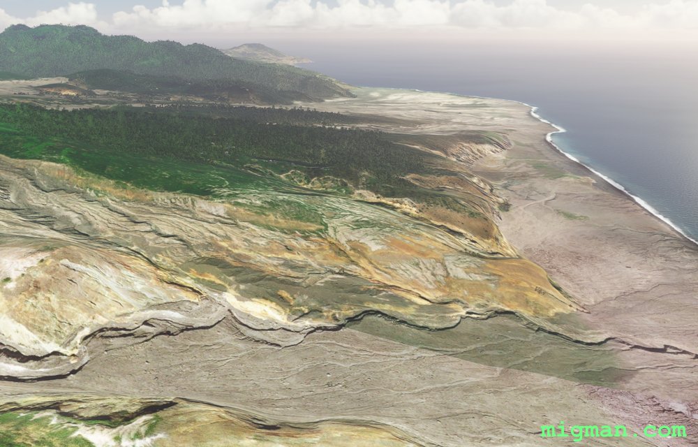
Caveat Aviator
AboutTake off with caution from Gerald’s / John A. Osborne International Airport TRPG located on a hill in the centre of the island. I say carefully not so much because of the volcano at Soufriere Hills, but because the runway is only 1,935 ft in length. The Soufriere Hills volcano last erupted in the 1990s.
Entire route (as the crow flies): 16 nm
Circumnavigation: 23 nm
Entire route (as the crow flies): 16 nm
Circumnavigation: 23 nm
 Montserrat
location_cityGerald’s
flight_takeoffTRPG Gerald’s
airline_seat_recline_extraCaribbean 3
tagVolcano
Montserrat
location_cityGerald’s
flight_takeoffTRPG Gerald’s
airline_seat_recline_extraCaribbean 3
tagVolcano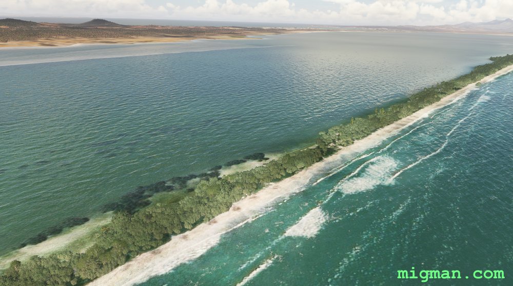
Spartan Ferrum
AboutNueva Esparta (New Sparta) has red soil, characteristic of high levels of Iron (Latin: Ferrum). It is a Caribbean province of Venezuela consisting of three islands: Margarita Island, Coche Island and Cubagua Island. Take off from Santiago Marino airport SVMG in the capital Porlamar and fly to the extreme compass points.
Round trips:
23 nm: WP 9 El Guamache (southernmost point of Isla de Coche)
34 nm: WP 2 Hill at Cabo Negro (most northerly point on Isla de Margarita)
54 nm: WP 7 Beach: Playa Punta Arenas (most westerly point on Isla de Margarita)
113 nm: Entire route
Round trips:
23 nm: WP 9 El Guamache (southernmost point of Isla de Coche)
34 nm: WP 2 Hill at Cabo Negro (most northerly point on Isla de Margarita)
54 nm: WP 7 Beach: Playa Punta Arenas (most westerly point on Isla de Margarita)
113 nm: Entire route
 Nueva Esparta
location_cityPorlamar
flight_takeoffSVMG Santiago Marino
airline_seat_recline_extraCaribbean 3
tagCoastal flight
Nueva Esparta
location_cityPorlamar
flight_takeoffSVMG Santiago Marino
airline_seat_recline_extraCaribbean 3
tagCoastal flight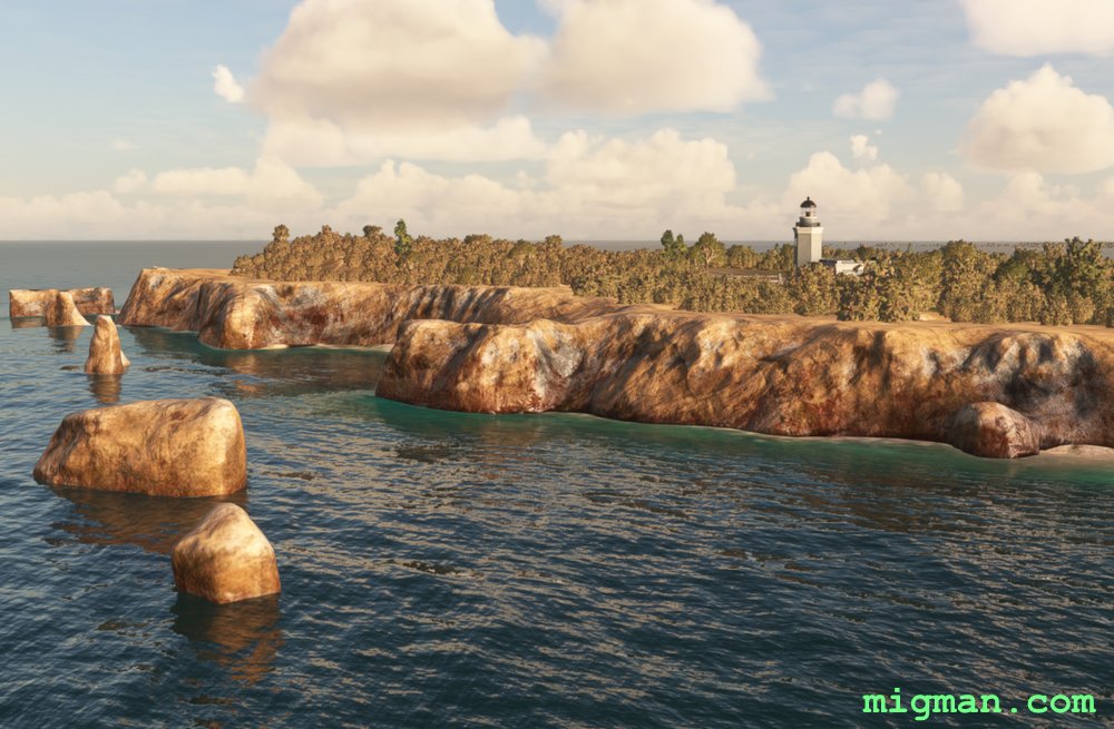
Lighter than Air
AboutTake a light aircraft and have fun landing at this selection of tiny airstrips. Aerostato de Lajas is a launching station for lighter-than-air vehicles (blimps). You will be flying out of Rafael Hernandez International TJBQ near Aguadilla Pueblo on Puerto Rico's north west coast. Cabo Rojo Lighthouse is on the south west extremity of the island.
Return flights:
13 nm: WP 1 - Communication Facility
68 nm: WP 4 - Cabo Rojo Lighthouse
98 nm: Entire route
Return flights:
13 nm: WP 1 - Communication Facility
68 nm: WP 4 - Cabo Rojo Lighthouse
98 nm: Entire route
 Puerto Rico
location_cityAguadilla Pueblo
flight_takeoffTJBQ Rafael Hernandez
airline_seat_recline_extraCaribbean 3
tagCoastal flight
tagAiports
Puerto Rico
location_cityAguadilla Pueblo
flight_takeoffTJBQ Rafael Hernandez
airline_seat_recline_extraCaribbean 3
tagCoastal flight
tagAiports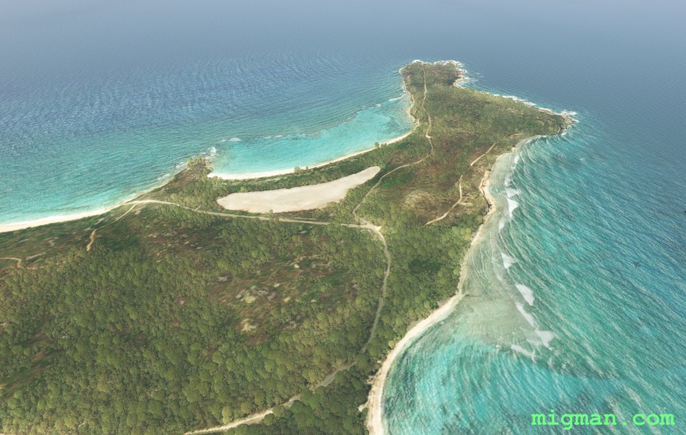
Vieques Island
AboutFly out of Mercedita airport in Ponce, cruise the south coast and then travel to Puerto Rico's second largest island, Vieques.
NOTAM: You may want to do an airshow at Salinas Speedway? Antonio Rivera Rodríguez Airport TJVQ 4296 ft is 3,5 nm west of Vieques City (WP 6).
Return flights:
36 nm: Salinas Speedway
152 nm: Entire route
NOTAM: You may want to do an airshow at Salinas Speedway? Antonio Rivera Rodríguez Airport TJVQ 4296 ft is 3,5 nm west of Vieques City (WP 6).
Return flights:
36 nm: Salinas Speedway
152 nm: Entire route
Puerto Rico
location_cityPonce
flight_takeoffTJPS Mercedita
airline_seat_recline_extraCaribbean 3
tagCoastal flight
tagAiports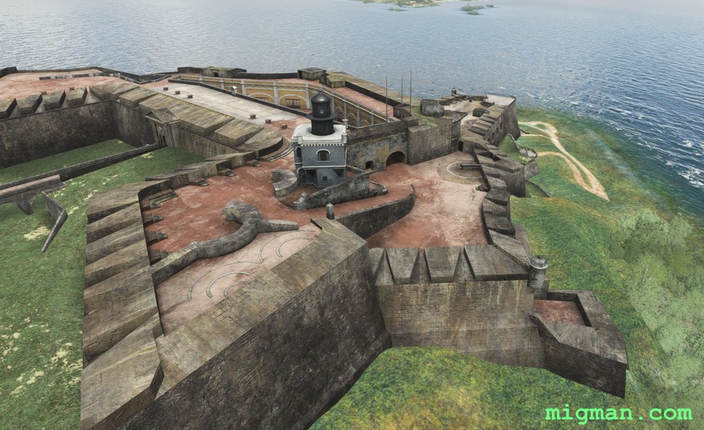
San Juan East
AboutTake off from Luis Munoz Marin International Airport and explore the north eastern corner of Puerto Rico's main island. Some of the coastal resorts you will see are Fajardo, Playa Fortuna, Coco Beach Golf Club, Suarez, and the capital San Juan.
Return flights:
12 nm: WP 2 - Carraizo Dam
15 nm: WP 1 - San Felipe del Morro Castle on San Juan Bay
23 nm: WP 6 - Fajardo Harbour
77 nm: Entire route
Return flights:
12 nm: WP 2 - Carraizo Dam
15 nm: WP 1 - San Felipe del Morro Castle on San Juan Bay
23 nm: WP 6 - Fajardo Harbour
77 nm: Entire route
Puerto Rico
location_citySan Juan
flight_takeoffTJSJ Luis Munoz
airline_seat_recline_extraCaribbean 3
tagCoastal flight
tagDam spotting
tagAiports
San Juan and west to Arecibo
AboutVisit the famous radio telescope at Arecibo and enjoy the beachs of Puerto Rico's central north coast.
NOTAM: Antonio/Nery/Juarbe Regional Airport Pol TJAB 3979 ft is 2 nm SE of Arecibo. You will pass it on the N and W.
Return flights:
31 nm: West along the coast to Dorado
68 nm: West along the coast to Los Molinos
96 nm: Entire route
NOTAM: Antonio/Nery/Juarbe Regional Airport Pol TJAB 3979 ft is 2 nm SE of Arecibo. You will pass it on the N and W.
Return flights:
31 nm: West along the coast to Dorado
68 nm: West along the coast to Los Molinos
96 nm: Entire route
Puerto Rico
location_citySan Juan
flight_takeoffTJSJ Luis Munoz
airline_seat_recline_extraCaribbean 3
tagCoastal flight
tagDam spotting
St. Barts, World's most Dangerous Beach?
AboutSaint Barthelemy aka Saint Barts boasts a very short runway which ends right at the beach and, incredibly, accepts heavy aircraft from international destinations! Search the web for St. Barts landings and hang on to your towel!
NOTAM: The runway at Saint Barthelemy / Gustaf III Airport TFFJ is only 2107 ft long, so dress appropriately.
NOTAM: The runway at Saint Barthelemy / Gustaf III Airport TFFJ is only 2107 ft long, so dress appropriately.
 Saint Barthelemy
location_cityGustavia
flight_takeoffTFFJ Saint Barthelemy
airline_seat_recline_extraCaribbean 3
Saint Barthelemy
location_cityGustavia
flight_takeoffTFFJ Saint Barthelemy
airline_seat_recline_extraCaribbean 3
Saint Kitts and Nevis
AboutSaint Kitts and Nevis is a Commonwealth nation and the capital city is Basseterre, located on the larger island of Saint Kitts. Take off from Bradshaw TKPK 7221 ft on St Kitts and fly around both islands.
Entire route: 48 nm
Entire route: 48 nm
 Saint Kitts and Nevis
location_cityBasseterre
flight_takeoffTKPK Bradshaw
airline_seat_recline_extraCaribbean 3
Saint Kitts and Nevis
location_cityBasseterre
flight_takeoffTKPK Bradshaw
airline_seat_recline_extraCaribbean 3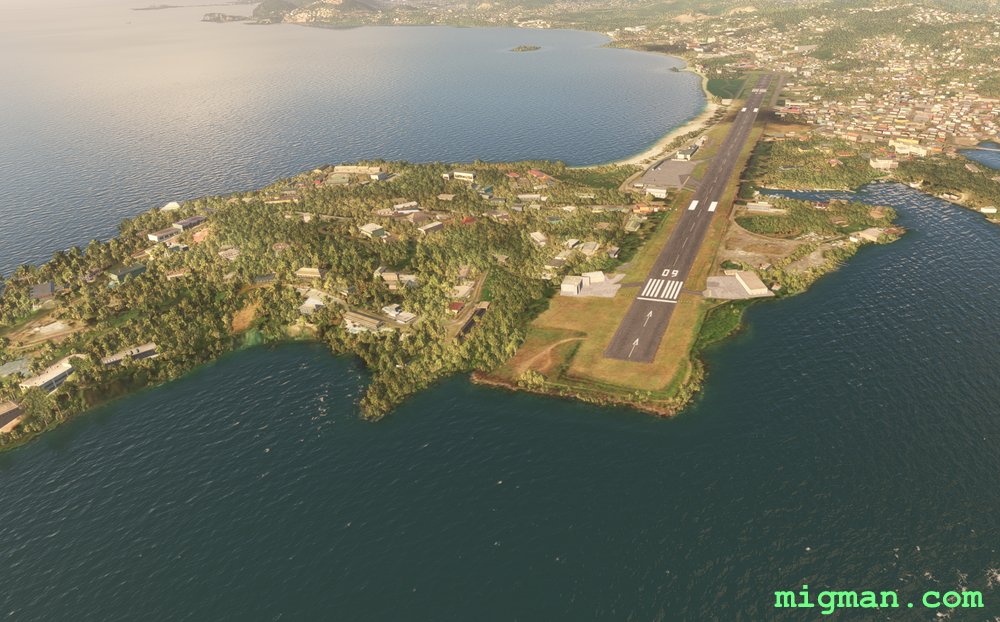
Tale of two Airports
AboutTake off from George F. Charles TLPC 6237ft and fly down to Hewanorra International at the southern end of the island country of Saint Lucia.
 Saint Lucia
location_cityCastries
flight_takeoffTLPC George F. L. Charles
airline_seat_recline_extraCaribbean 3
tagAiports
Saint Lucia
location_cityCastries
flight_takeoffTLPC George F. L. Charles
airline_seat_recline_extraCaribbean 3
tagAiports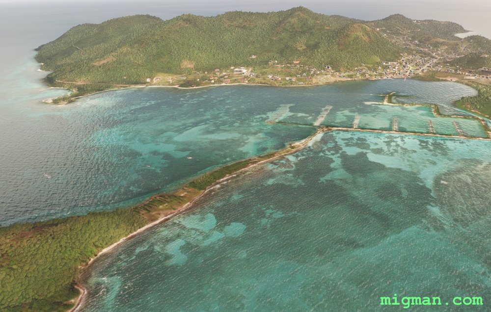
32 Islands
AboutClimb to the volcano at the north of Saint Vincent and then take a leisurely flight down the rigged west coast. Hit the open waters to visit a few of the 32 islands in the Grenadines group to the south: Bequia, Canouan, Mayreau, Union Island, Palm Island, Petit Saint Vincent, Mustique, Baliceauz and Battowia.
NOTAM: Plan your ascent to La Souffrie carefully as the lip is about 4200ft in elevation. Better to gain altitude over the water than risk stalling into the mountainside during a max performance climb. Not that it ever happened to me!
NOTAM: Plan your ascent to La Souffrie carefully as the lip is about 4200ft in elevation. Better to gain altitude over the water than risk stalling into the mountainside during a max performance climb. Not that it ever happened to me!
 Saint Vincent and the Grenadines
location_cityKingstown
flight_takeoffTVSA Argyle
airline_seat_recline_extraCaribbean 3
tagCoastal flight
tagVolcano
Saint Vincent and the Grenadines
location_cityKingstown
flight_takeoffTVSA Argyle
airline_seat_recline_extraCaribbean 3
tagCoastal flight
tagVolcano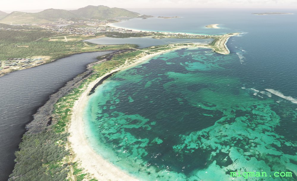
Tale of two Countries: Saint-Martin
AboutThe caribbean island of Saint Martin is shared by two separate countries. In the north Saint-Martin (France), and in the south Sint Maarten (Netherlands). In this flight you take off from Aeroport de Grand-Case and follow the border between Saint-Martin and Sint Maarten to the south.
 Saint-Martin
location_cityGrand Case
flight_takeoffTFFG Grand Case-Esperance
airline_seat_recline_extraCaribbean 3
tagBorder Patrol
Saint-Martin
location_cityGrand Case
flight_takeoffTFFG Grand Case-Esperance
airline_seat_recline_extraCaribbean 3
tagBorder Patrol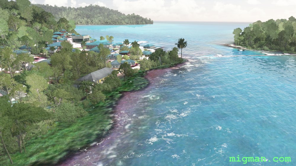
Treacherous Reefs
AboutSan Andres and Providencia are territories of Colombia consisting of three islands: San Andres to the south and Providencia and Santa Catalina 50 nm to the north. Take off from El Embrujo SKPV 4232ft and cruise the coast, from Santa Catalina in the north to the treacherous reefs extending up the east coast.
 San Andres and Providencia
location_cityProvidencia
flight_takeoffSKPV El Embrujo
airline_seat_recline_extraCaribbean 3
tagCoastal flight
San Andres and Providencia
location_cityProvidencia
flight_takeoffSKPV El Embrujo
airline_seat_recline_extraCaribbean 3
tagCoastal flight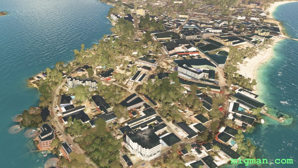
San Andres
AboutSan Andres and Providencia are territories of Colombia consisting of three islands: San Andres to the south and Providencia and Santa Catalina 50 nm to the north. Take a flight along the coast on San Andres, from Gustavo Rojas Pinilla Airport SKSP 7788ft.
San Andres and Providencia
location_citySan Andres
flight_takeoffSKSP Gustavo Rojas Pinilla
airline_seat_recline_extraCaribbean 3
tagCoastal flight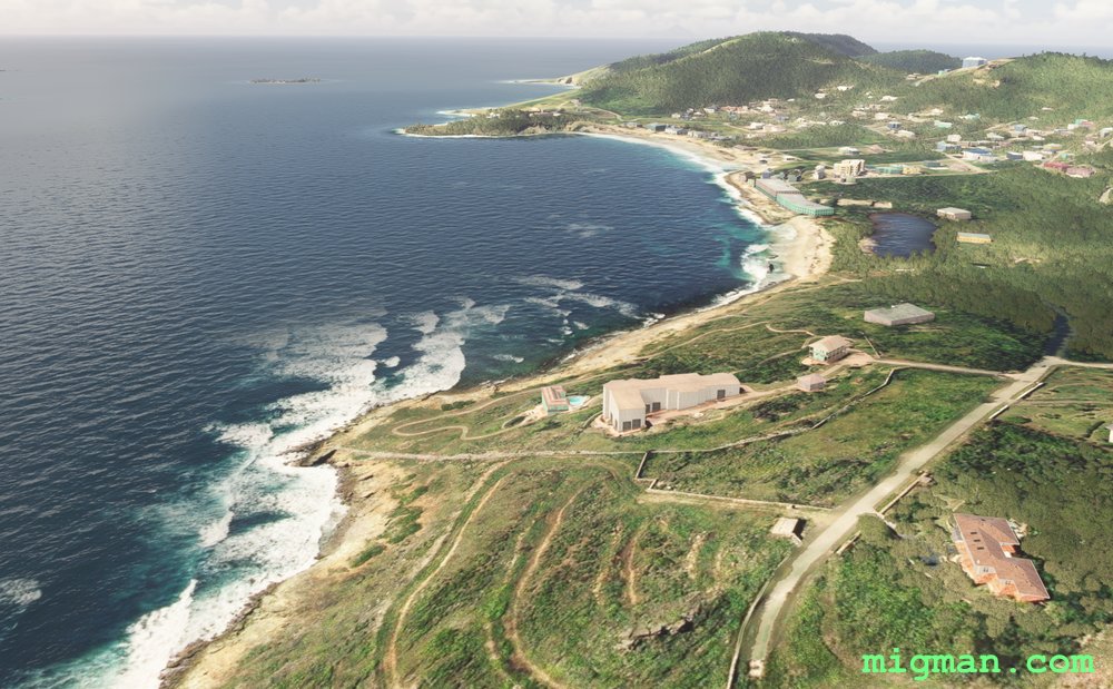
Tale of two Countries: Sint Maarten
AboutThe caribbean island of Saint Martin is shared by two separate countries. In the north Saint-Martin (France), and in the south Sint Maarten (Netherlands). In this flight you take off from Princess Juliana International TNCM 7537ft in the capital Philipsburg and follow the border of Sint Maarten.
Entire route: 16nm
Entire route: 16nm
 Sint Maarten
location_cityPhilipsburg
flight_takeoffTNCM Princess Juliana
airline_seat_recline_extraCaribbean 3
tagBorder Patrol
Sint Maarten
location_cityPhilipsburg
flight_takeoffTNCM Princess Juliana
airline_seat_recline_extraCaribbean 3
tagBorder Patrol