Middle East 1 | Missions in the MiGMan’s World Tour DLC
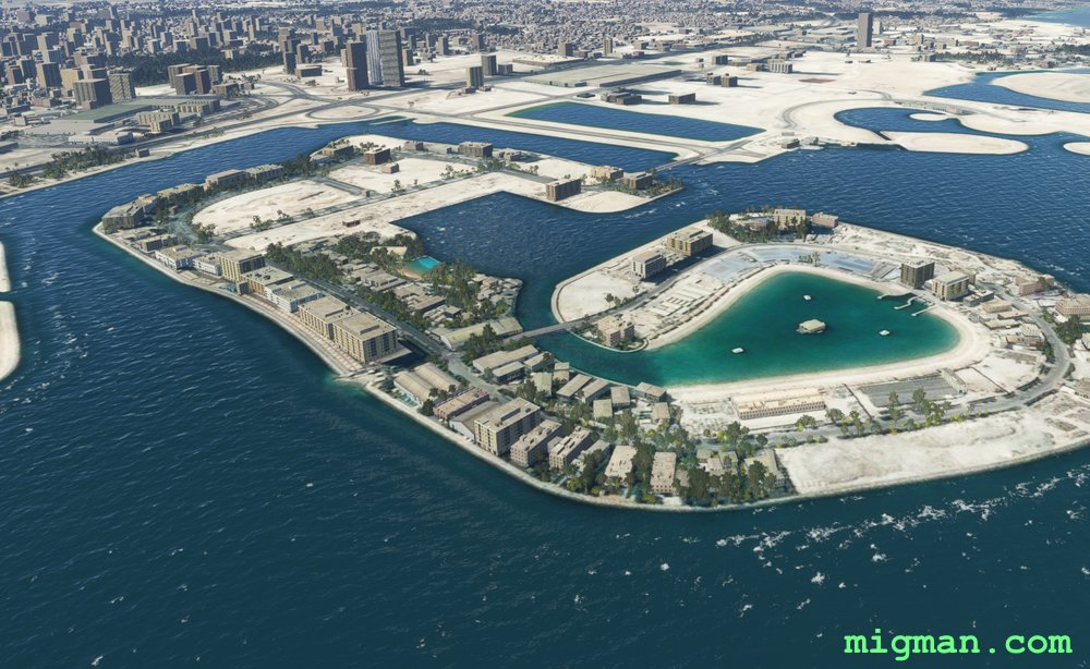
Manama local
AboutBahrain is an island country on the Persian Gulf, consisting of 50 natural islands and 33 artificial islands. Fly around the capital, Manama. Start by flying across the northern shoreline to WP1.
 Bahrain
location_cityManama
flight_takeoffOBBI Bahrain
airline_seat_recline_extraMiddle East 1
Bahrain
location_cityManama
flight_takeoffOBBI Bahrain
airline_seat_recline_extraMiddle East 1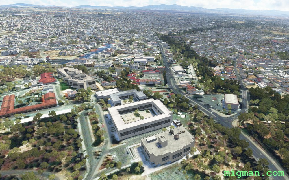
Larnaca to Nicosia
AboutFly a round trip from the main international airport serving the Greek part of Cyprus to the capital, Nicosia. From Mosfiloti Quarry you have the option of following the main highway NNW into Nicosia.
 Cyprus
location_cityNicosia
flight_takeoffLCLK Larnaca
airline_seat_recline_extraMiddle East 1
tagAiports
Cyprus
location_cityNicosia
flight_takeoffLCLK Larnaca
airline_seat_recline_extraMiddle East 1
tagAiports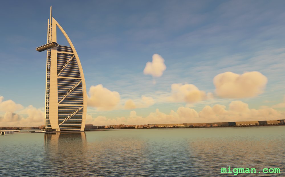
Architectural Extravaganza
AboutCheck out some of the most fanciful creations in 20c architecture as you fly around the capital of Dubai.
The "World Islands" are a manmade group of 300 islands in the shape of a world map. Palm Jumeirah is a group of artificial harbours in the shape of a palm tree. Burj Al Arab is a 321m (1,053ft) tall luxury hotel, with a helipad at 210m (689ft). Burj Khalifa Tower is the world's tallest building at 830m (2723ft).
The "World Islands" are a manmade group of 300 islands in the shape of a world map. Palm Jumeirah is a group of artificial harbours in the shape of a palm tree. Burj Al Arab is a 321m (1,053ft) tall luxury hotel, with a helipad at 210m (689ft). Burj Khalifa Tower is the world's tallest building at 830m (2723ft).
 Dubai
location_cityDubai City
flight_takeoffOMDB Dubai
airline_seat_recline_extraMiddle East 1
tagArchitectural Wonders
Dubai
location_cityDubai City
flight_takeoffOMDB Dubai
airline_seat_recline_extraMiddle East 1
tagArchitectural Wonders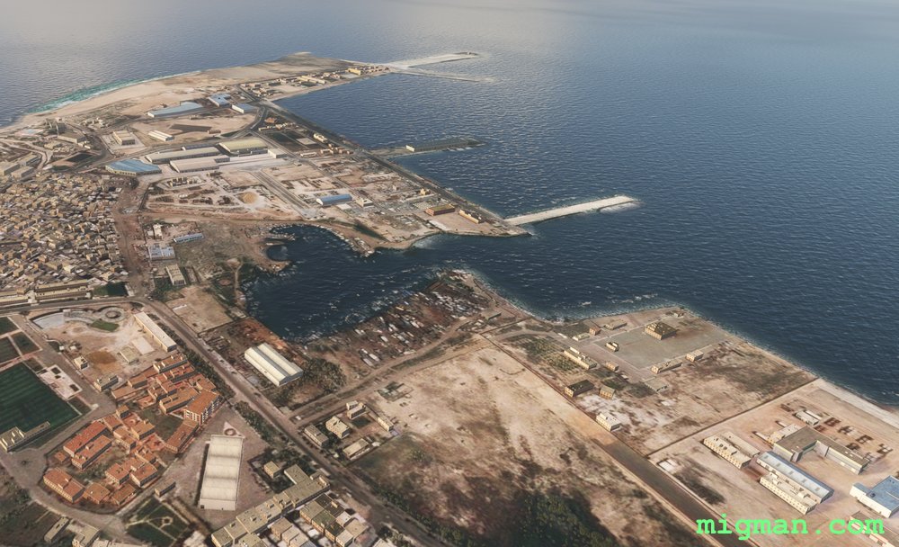
Alexandria the Great
AboutEnjoy the beautiful resorts on the Mediterranean coastline near Alexandria, established by Alexander the Great in about 3331 BC.
NOTAM: 20 nm: Fly to WP 1 and return over Alexandria 78 nm: Entire route The airport is bounded by Airport Farm Lake to the NE and Lake Mariout to the SW.
NOTAM: 20 nm: Fly to WP 1 and return over Alexandria 78 nm: Entire route The airport is bounded by Airport Farm Lake to the NE and Lake Mariout to the SW.
 Egypt
location_cityAlexandria
flight_takeoffHEAX Alexandria
airline_seat_recline_extraMiddle East 1
tagBridges
tagCoastal flight
tagAiports
Egypt
location_cityAlexandria
flight_takeoffHEAX Alexandria
airline_seat_recline_extraMiddle East 1
tagBridges
tagCoastal flight
tagAiports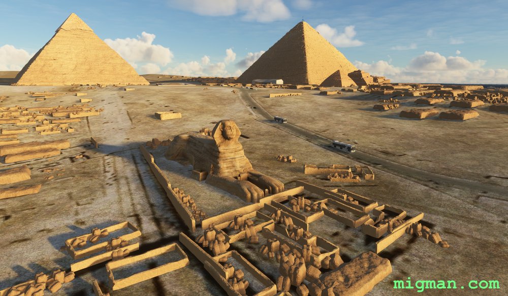
Cairo's Pyramids
AboutAs soon as you take off on HDG 240, you will see the Giza Pyramids. Fly directly west over Cairo to the Tahya Misr bridge Turn south and take a leisurely flight along the Nile River and through Cairo.
At the Marazeek Bridge turn west to the Bent Pyramid and proceed north, saving the magnificent Giza Pyramid complex for last!
The largest collection of monuments is at the Giza Pyramids, with the Giza, Khafre and Menjaure pyramids and the Great Sphinx. NOTAM: You will see spectacular lighting on the faces of the Giza pyramids at about 0550 hrs.
Egypt
location_cityCairo
flight_takeoffHECA Cairo
airline_seat_recline_extraMiddle East 1
tagBridges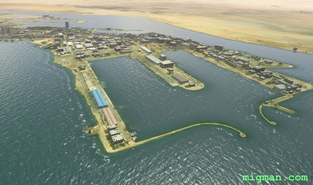
Suez Canal South
AboutExplore the southern portion of this geopolitically crucial waterway. Fly out of Faid on the Suez Canal at Great Bitter Lake to the southern entrance to the Suez Canal.
NOTAM: 32 nm: Fly around Great Bitter Lake
74 nm: Entire route
NOTAM: 32 nm: Fly around Great Bitter Lake
74 nm: Entire route
Egypt
location_citySuez
flight_takeoffHE1F Faid
airline_seat_recline_extraMiddle East 1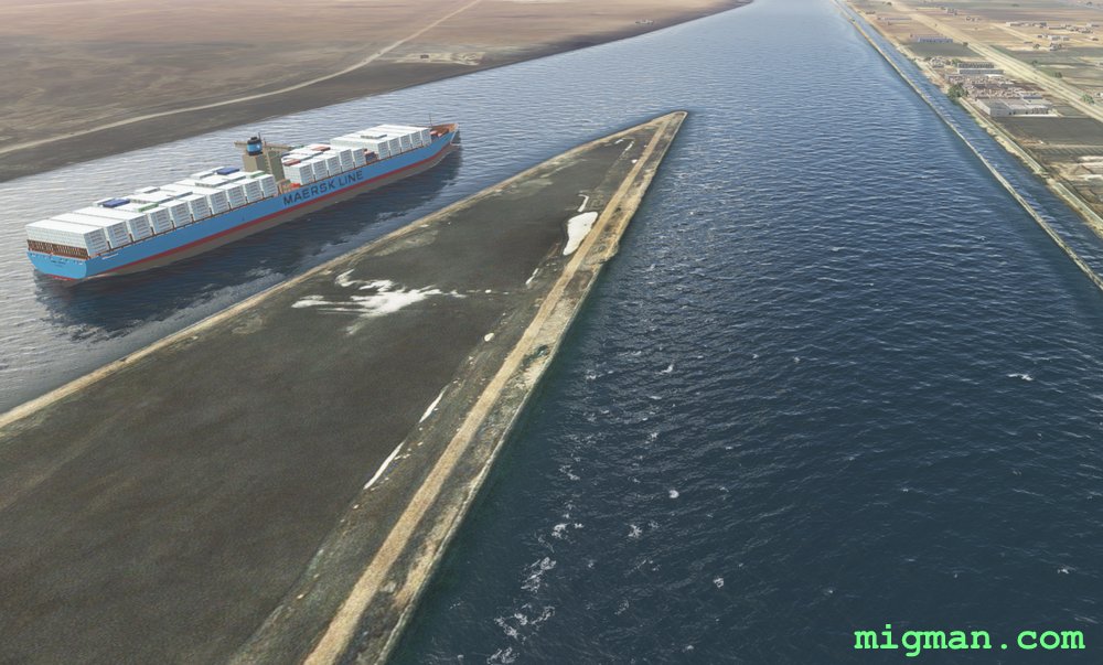
Suez Canal North
AboutExplore the northern portion of this geopolitically crucial waterway. Fly out of Port Said and down the Suez Canal for about 50nm.
Return via the territory west of the canal, which is lush for about 100 nm. The east is barren desert all the way to Israel.
NOTAM: Follow the canal from WP1 to WP4. On the way fly past 4 aiports: Al Ismaillia Airport (HE44), Ismaillia Airport (HEIS), Abu Suwayr airport (HE35) and As Salihiyah Airport (HE39). It's always good to be familiar with local places to land! 16 nm: Fly around Port Said 121 nm: Entire route
Egypt
location_cityPort Said
flight_takeoffHEPS Port Said
airline_seat_recline_extraMiddle East 1
tagBridges
tagAiports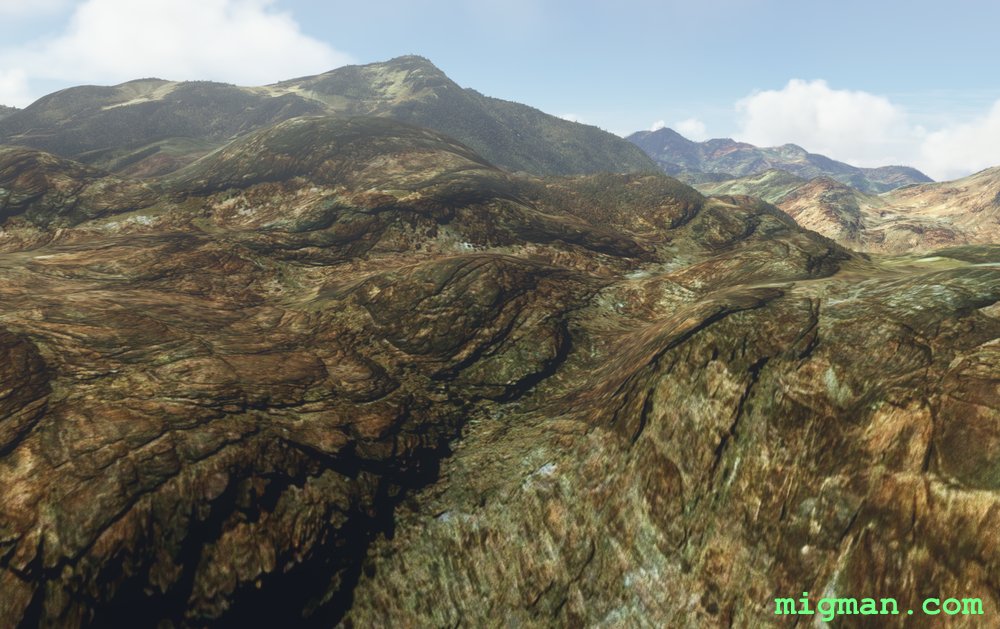
Sinai Peninsula: Mount Catherine
AboutFly out of St Catherine on the Sinai Peninsula and visit Mount Catherine (Gabal Katrine) at 2,629 m (8,625 ft), the highest mountain in Egypt.
NOTAM: 24 nm: Mount Catherine at WP 4 | 83 nm: Entire route including two valley runs. Airport elev. 4,333 ft
EASTER EGG: About 11.6 nm past WP5 there appears to be a crash site to the right of track.
NOTAM: 24 nm: Mount Catherine at WP 4 | 83 nm: Entire route including two valley runs. Airport elev. 4,333 ft
EASTER EGG: About 11.6 nm past WP5 there appears to be a crash site to the right of track.
Egypt
location_citySaint Catherine
flight_takeoffHESC Saint Catherine
airline_seat_recline_extraMiddle East 1
tagCanyon runs & Mach Loops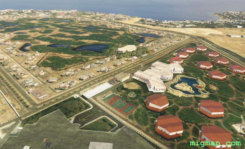
Sinai Peninsula: Sharm El-Sheikh Resorts
AboutFly out of Sharm El-Sheikh International on the Sinai Peninsula at the entrance to the Gulf of Aqaba. Check out the local resorts and then fly overland to the southern entrance to the Gulf of Suez.
NOTAM: 16 nm: Fly to the El Fanar Beach and return 83 nm: Entire route
NOTAM: 16 nm: Fly to the El Fanar Beach and return 83 nm: Entire route
Egypt
location_citySharm El-Sheikh
flight_takeoffHESH Sharm El-Sheikh
airline_seat_recline_extraMiddle East 1
tagCanyon runs & Mach Loops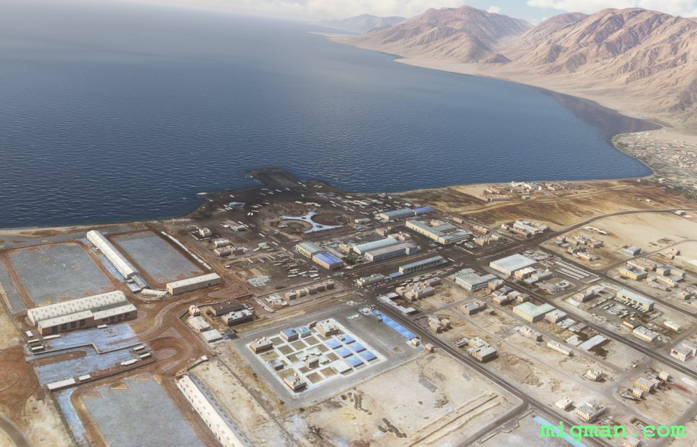
Gulf of Aqaba: Taba to Nuweibaa Port
AboutCheck out the many resorts on the Gulf of Aqaba as you fly out of Taba International on the Sinai Peninsula. This flight is I-Follow-Coasts down to Nuweibaa Port. On the return leg enjoy I-Follow-Roads, along the solitary winding road as it passes through mountains and then across the desert.
At Taba, on the left, you can see Pharaoh's Island, with the ruins of Salah El Din Citadel.
NOTAM: 20 nm: Fly to Taba
87 nm: Entire route
At Taba, on the left, you can see Pharaoh's Island, with the ruins of Salah El Din Citadel.
NOTAM: 20 nm: Fly to Taba
87 nm: Entire route
Egypt
location_cityTaba
flight_takeoffHETB Taba
airline_seat_recline_extraMiddle East 1
tagAiports
tagDam spotting
tagCanyon runs & Mach Loops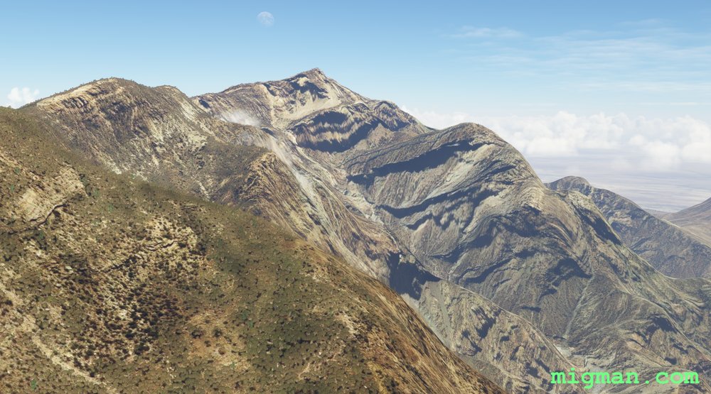
Bandar Abbas, on the Knife Edge
AboutFly out of Bandar Abbas on the northern shore of the Strait of Hormuz. Enjoy the spectacular knife edge ridges north of the city.
For a short flight along the Bandar Abbas shoreline fly to WP 1.
20 nm: WP 1 | 104 nm: Entire route
NOTAM: Plan for the high altitude. You have 10 nm after WP 1 to climb to 8000 ft.
For a short flight along the Bandar Abbas shoreline fly to WP 1.
20 nm: WP 1 | 104 nm: Entire route
NOTAM: Plan for the high altitude. You have 10 nm after WP 1 to climb to 8000 ft.
 Iran
location_cityBandar Abbas
flight_takeoffOIKB Bandar Abbas
airline_seat_recline_extraMiddle East 1
tagDam spotting
Iran
location_cityBandar Abbas
flight_takeoffOIKB Bandar Abbas
airline_seat_recline_extraMiddle East 1
tagDam spotting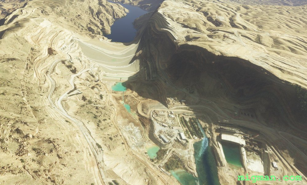
Karun River Gorge
AboutFollow the steep gorges along the Karun River from Karun to Abbaspur Dam. Continue deep into the valleys and then climb back to the west to spot the third dam near Anbar.
At WP 7 you can optionally fly slightly east of track to follow the Karun river back to Masjed Soleyman.
10 nm: Fly S for 5 nm from the airport for a local flight over Masjed Soleyman | 98 nm: Entire route
At WP 7 you can optionally fly slightly east of track to follow the Karun river back to Masjed Soleyman.
10 nm: Fly S for 5 nm from the airport for a local flight over Masjed Soleyman | 98 nm: Entire route
Iran
location_cityMasjed Soleyman
flight_takeoffOIAI Masjed Soleiman
airline_seat_recline_extraMiddle East 1
tagDam spotting
tagCanyon runs & Mach Loops
Tehran Local
AboutTake off from Mehrabad Intl and fly across the northern border of Iran's capital, Tehran.
Notes on the landmarks and their location in Tehran:
WP 1-3 are in a straight line along the N edge.
Chitgar Lake is about 5nm from the NW corner.
Milad Tower, Iran's tallest structure, a good navigation reference point.
Imam Hossein University is the last building complex on the NE corner.
Ghale Morgi Airport OIIG is 5nm S of Milad Tower and 2.5nm from RWT 29 at Mehrabad Intl.
NOTAM: RWY ALT is 3,281 ft. Cruise at 5,500 feet as the ground rises to the north.
Iran
location_cityTehran
flight_takeoffOIII Mehrabad
airline_seat_recline_extraMiddle East 1
tagBorder Patrol
tagAiports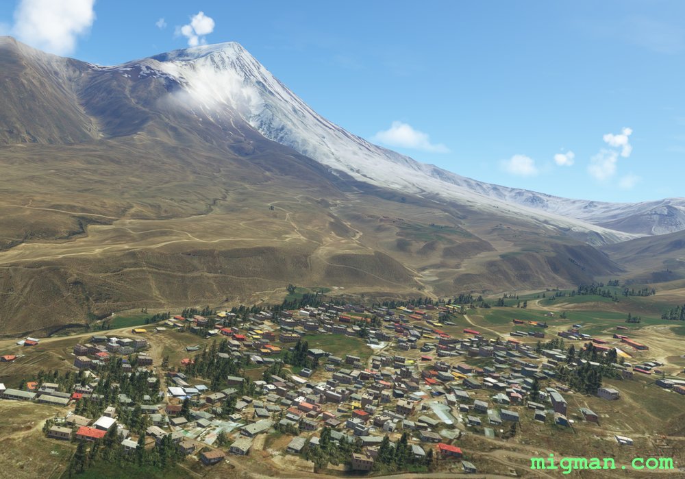
Mount Damavand
AboutAt 18,400 ft Mount Damavand, located about 30 nm NE of Tehran, is both one of the highest the highest peaks and the highest volcano in Asia. It features prominently in Persian folklore.
The flight plan mixes valley runs with ridge hopping and WP 4-8 take you around the base of Mt Damavand. The ridgelines and valleys around Mt Damavand in particular are spectacular so take plenty of polaroids.
NOTAM: RWY ALT is 3,281 ft. The ground rises steeply to the north.
The flight plan mixes valley runs with ridge hopping and WP 4-8 take you around the base of Mt Damavand. The ridgelines and valleys around Mt Damavand in particular are spectacular so take plenty of polaroids.
NOTAM: RWY ALT is 3,281 ft. The ground rises steeply to the north.
Iran
location_cityTehran
flight_takeoffOIII Mehrabad
airline_seat_recline_extraMiddle East 1
tagDam spotting
tagCanyon runs & Mach Loops
tagVolcano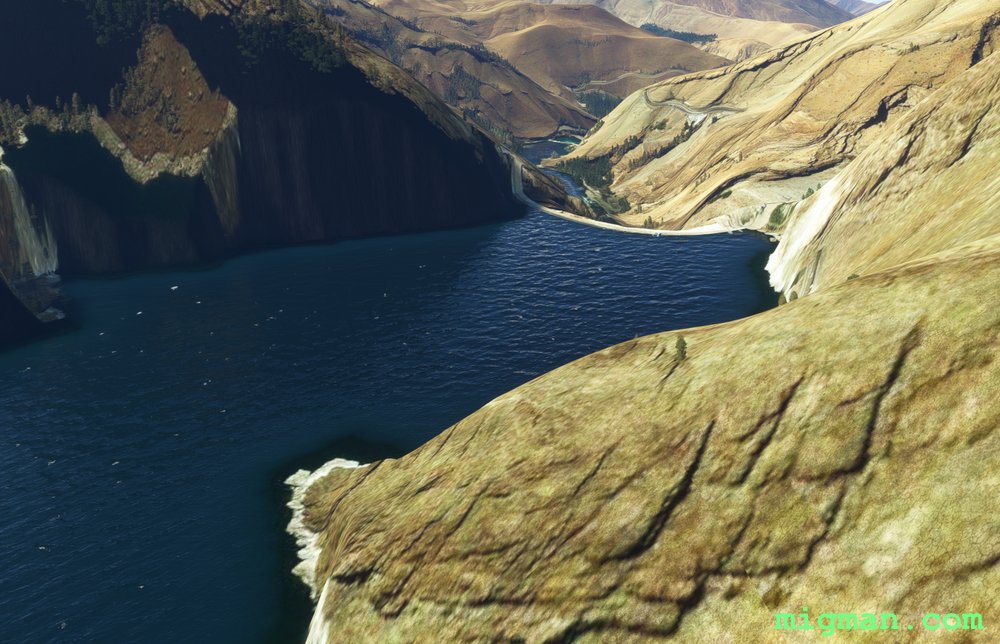
Amir Kabir Dam
AboutExplore the valleys to the north of Iran's capital, Tehran as you visit Amir Kabir Dam. Exercise caution between WP 6 and WP 7 as the valley is both narrow and meandering.
NOTAM: RWY ALT is 3,281 ft. The ground rises steeply to the north.
NOTAM: RWY ALT is 3,281 ft. The ground rises steeply to the north.
Iran
location_cityTehran
flight_takeoffOIII Mehrabad
airline_seat_recline_extraMiddle East 1
tagDam spotting
tagCanyon runs & Mach Loops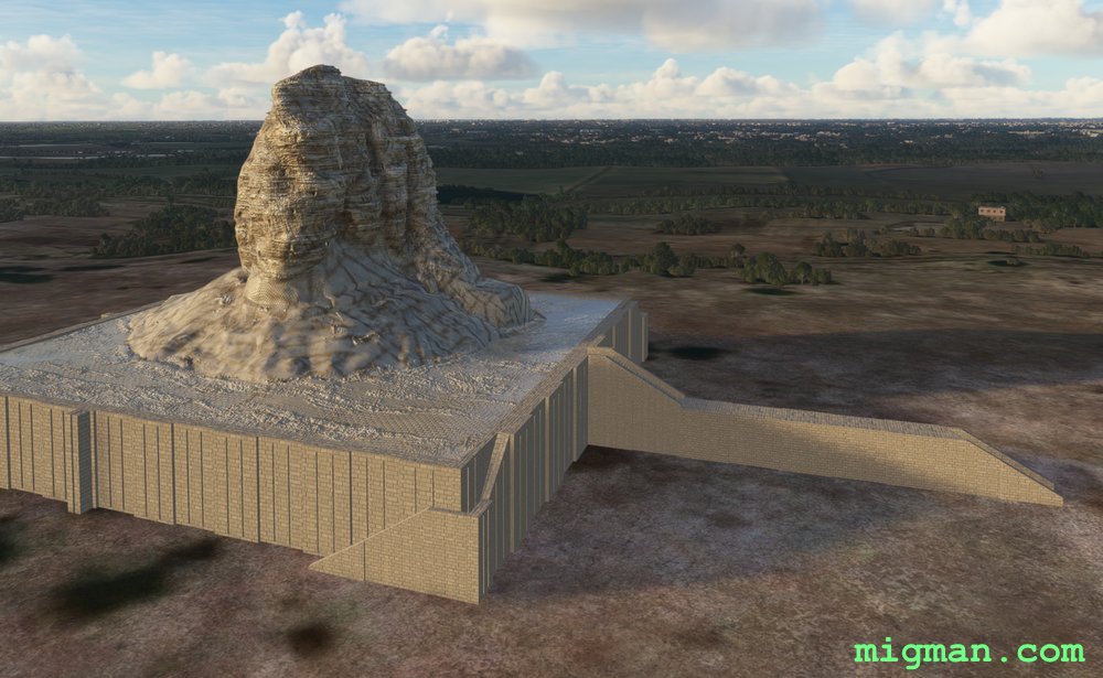
Baghdad on the Tigris
AboutTake a leisurely flight down the Tigris River in Baghdad, the capital of Iraq.
Take a leisurely flight down the Tigris River in Baghdad, the capital of Iraq. Note the eastern border of Baghdad Airport hosts Al-Faw palace and Saddam Hussein's palace, surrounded by spectacular water features.
NOTAM: Recommend a light aircraft which is able to follow the bends in the Tigris River.
 Iraq
location_cityBaghdad
flight_takeoffORBI Baghdad
airline_seat_recline_extraMiddle East 1
tagBorder Patrol
tagBridges
tagDam spotting
Iraq
location_cityBaghdad
flight_takeoffORBI Baghdad
airline_seat_recline_extraMiddle East 1
tagBorder Patrol
tagBridges
tagDam spotting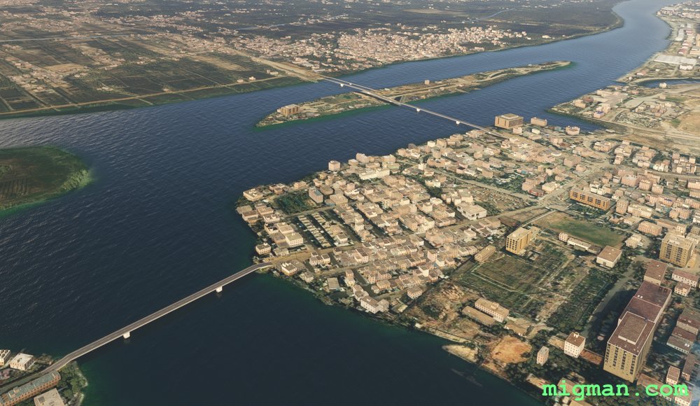
Basrah, Iran and Kuwait
AboutFly out of Basrah in the southern part of Iraq, where Iraq narrows to a 20nm strip between Iran and Kuwait.
SHORT route:44nm | Basrah City
MED: 89nm | Visit the borders with Iran and Kuwait. At WP 2 the Iran/Iraq border flows from the N to the Arvand River. From that point on remain on the S side of the river. At Al Seeba you will be within 2 nm of Abadan Airport in Iran. At Hajjam Island you will be within 3 nm of Umm Qasr Airport in Kuwait.
LONG: 126nm | Go to the mouth of the Arvand River on the Persian Gulf.
Iraq
location_cityBasrah
flight_takeoffORMM Basrah
airline_seat_recline_extraMiddle East 1
tagBorder Patrol
tagBridges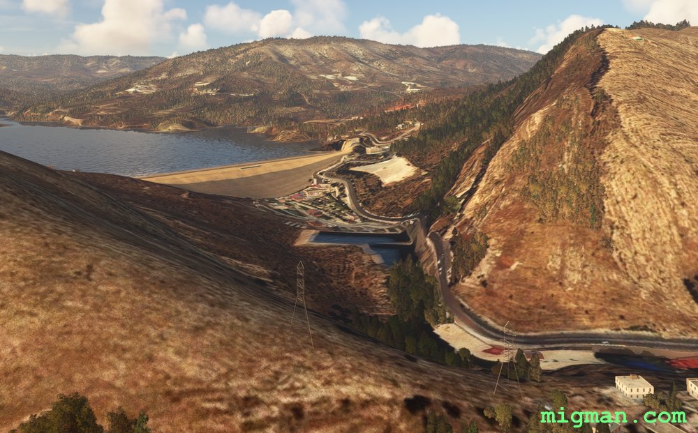
Mosul and Duhok Dams
AboutThe first two legs to the Mosul Dam make a nice 50nm flight.
Either fly in a straight line to WP 1, or you can take a leisurely flight along the Tigris River in the shade of the palms.
If you have the time or the available speed, carry on to a second dam at Duhok and return through the lush valleys found in this part of northern Iraq.
Following the road after WP 3 will take you slightly S of the track and set you up nicely to fly through the gap in the range to Duhok Dam.
Iraq
location_cityMosul
flight_takeoffORBM Mosul
airline_seat_recline_extraMiddle East 1
tagDam spotting
tagCanyon runs & Mach Loops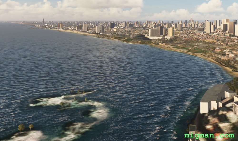
Tel Aviv's Mediterranean Beaches
AboutA short hop around Tel Aviv on the coast of the Mediterranean, which was the capital of Israel until 1949.
NOTAM: Just 0.2 nm SE of the threshold to RWY 02 at Sde Nov Airport is an enormous chimney belonging to Reading Power Station. This is one of the most amazing hazards I've seen in 250 countries! I don't know which was there first, airport or power station?
NOTAM: Just 0.2 nm SE of the threshold to RWY 02 at Sde Nov Airport is an enormous chimney belonging to Reading Power Station. This is one of the most amazing hazards I've seen in 250 countries! I don't know which was there first, airport or power station?
 Israel
location_cityTel Aviv
flight_takeoffLLBG Ben Gurion
airline_seat_recline_extraMiddle East 1
tagCoastal flight
tagAiports
Israel
location_cityTel Aviv
flight_takeoffLLBG Ben Gurion
airline_seat_recline_extraMiddle East 1
tagCoastal flight
tagAiports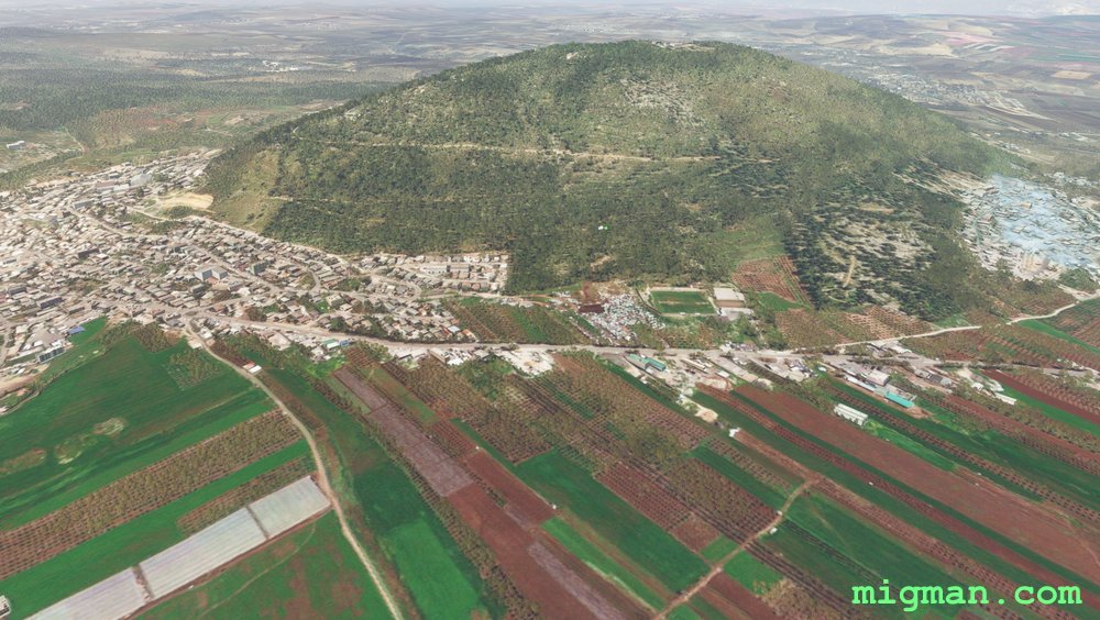
Haifa Coastline to the Sea of Galilee
AboutExplore the northern coast of Israel near Haifa. and the Sea of Galilee, 23nm west.
31nm: Fly to WP1 and WP2: Coast from Haifa to Nansholim and return over Mount Carmel.
118nm: Entire route: Coast from Haifa to Nansholim, where you will be able to see Tel Aviv, some 30nm south. Inland past Ramat David, Nazareth and Mount Tabor. Sea of Galilee. Return to the coast along the border with Lebanon. North coast.
Israel
location_cityHaifa
flight_takeoffLLHA Haifa
airline_seat_recline_extraMiddle East 1
tagBorder Patrol
tagCoastal flight
tagAiports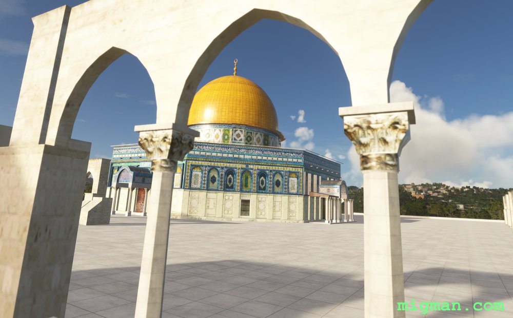
Jerusalem, Bethlehem and the Dead Sea
About20nm: Fly over the biblical towns of Jerusalem and Bethlehem.
120nm: The border between Jordan and Israel runs up the centre of the Dead Sea. Fly across the biblical towns of Jerusalem and Bethlehem and Jerusalem, look at the vast hydro projects at the south end of the Dead Sea and return at low level along the western shore.
NOTAM: Jerusalem RWY is 2,461 ft. The Dead Sea is below sea level, so if you have an analogue altimeter it will bottom out if you fly at low level.
Israel
location_cityJerusalem
flight_takeoffLLJR Jerusalem
airline_seat_recline_extraMiddle East 1
tagBorder Patrol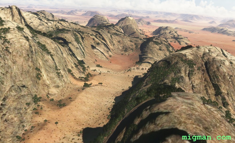
Valley of the Moon
AboutPatrol Jordan's border with Saudi Arabia as you fly to Jabal Umm ad Dami, Jordan's highest mountain in Jordan at 6.082 ft (1,854m). Return via the spectacular rock formations of Wadi Rum (Valley of the Moon), including the "Seven Pillars of Wisdom".
70 nm: Fly to WP 1, 2 and 3.
118 nm: Fly entire route.
70 nm: Fly to WP 1, 2 and 3.
118 nm: Fly entire route.
 Jordan
location_cityAqaba
flight_takeoffOJAQ Aqaba / King Hussein
airline_seat_recline_extraMiddle East 1
tagBorder Patrol
tagDam spotting
tagCanyon runs & Mach Loops
Jordan
location_cityAqaba
flight_takeoffOJAQ Aqaba / King Hussein
airline_seat_recline_extraMiddle East 1
tagBorder Patrol
tagDam spotting
tagCanyon runs & Mach Loops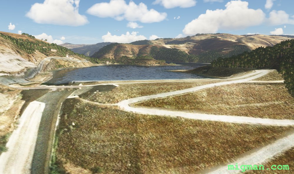
Amman to the Dead Sea
AboutFly over beautiful Ammam, ancient Roman city and capital of Jordan since 1921.
30 nm: Fly to the border crossing at WP 2
70 nm: Fly to Jordan's tallest mountain, Jabal Umm ad Dami, at WP 3
118 nm: Fly entire route
NOTAM: Marka Intnl elev. 2,506 ft. WP 4-6 descend below sea level, so if you have an analogue altimeter it will bottom out.
30 nm: Fly to the border crossing at WP 2
70 nm: Fly to Jordan's tallest mountain, Jabal Umm ad Dami, at WP 3
118 nm: Fly entire route
NOTAM: Marka Intnl elev. 2,506 ft. WP 4-6 descend below sea level, so if you have an analogue altimeter it will bottom out.
Jordan
location_cityAmman
flight_takeoffOJAM Marka
airline_seat_recline_extraMiddle East 1
tagBorder Patrol
tagDam spotting
tagCanyon runs & Mach Loops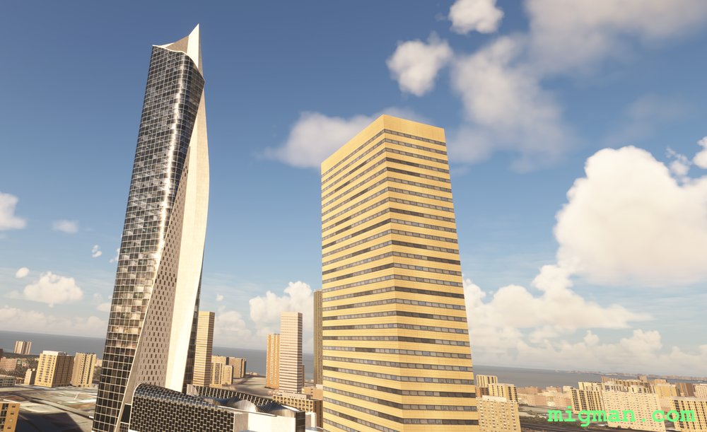
Kuwait City
AboutExplore one of the geographically smaller gulf nations, at 91 by 75 miles in dimension.
Located next to Iraq, Iran and Saudi Arabia at the NW corner of the Persian Gulf, Kuwait is in a strategically important location.
The Sheikh Jaber Al-Ahmad Causeway is a bridge that runs 12 miles NE across Kuwait Bay to Shumaymah, near the borders of Iraq and Iran.
Fly NW out of Kuwait International to Al Jahra and return via the shoreline.
27 nm WP 3,4,5 | 78 nm Entire route
 Kuwait
location_cityKuwait City
flight_takeoffOKBK Kuwait
airline_seat_recline_extraMiddle East 1
tagBorder Patrol
tagBridges
Kuwait
location_cityKuwait City
flight_takeoffOKBK Kuwait
airline_seat_recline_extraMiddle East 1
tagBorder Patrol
tagBridges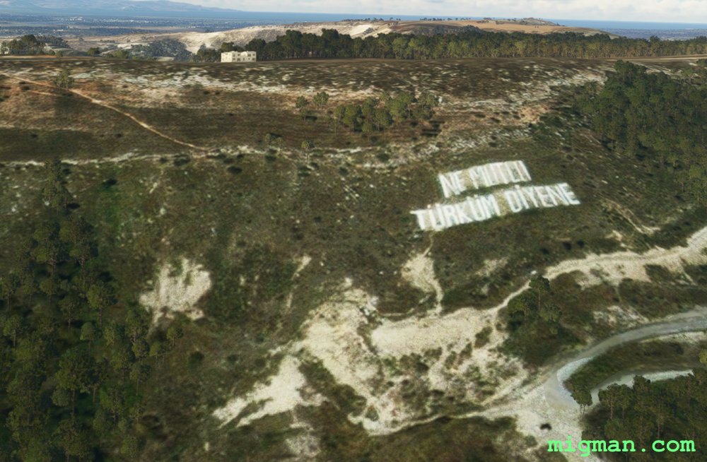
North of Nicosia
AboutEnjoy the charm of the Meditteranean on the northern shores of Cyprus.
There is a large water treatment plant 3 nm NE of Ercan International airport which can be seen from quite a distance, making it a good visual navaid. If you fly directly west from that point you will be just on Turkey's side of the border.
NOTAM: At WP 2 "Ne mutlu Türküm diyene" (motto of the Republic of Turkey) is painted on a hillside.
 Northern Cyprus
location_cityNicosia
flight_takeoffLCEN Ercan
airline_seat_recline_extraMiddle East 1
tagBorder Patrol
tagDam spotting
tagCanyon runs & Mach Loops
Northern Cyprus
location_cityNicosia
flight_takeoffLCEN Ercan
airline_seat_recline_extraMiddle East 1
tagBorder Patrol
tagDam spotting
tagCanyon runs & Mach Loops