Middle East 2 | Missions in the MiGMan’s World Tour DLC
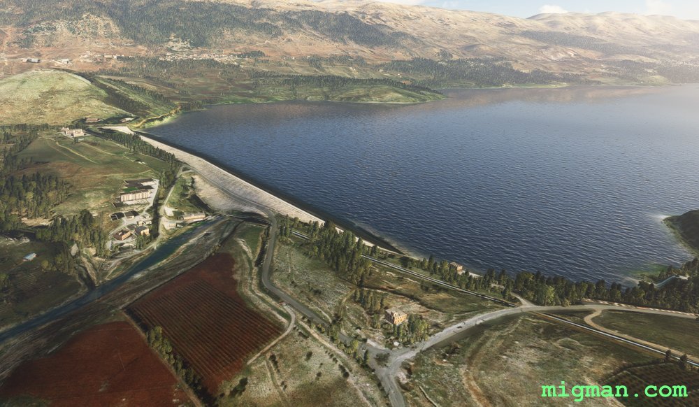
Beirut, Paris of the Mediterranean
AboutFly out of Beirut, capital of Lebanon and explore the spectacular terrain towards the Syrian border.
At WP 4 turn right (west), fly over the valley wall and then along any of the many many valleys which lead back to the coast.
Entire route: 74 nm | Shorter return flight: WP 1 and 2 = 15 nm
At WP 4 turn right (west), fly over the valley wall and then along any of the many many valleys which lead back to the coast.
Entire route: 74 nm | Shorter return flight: WP 1 and 2 = 15 nm
 Lebanon
location_cityBeirut
flight_takeoffOLBA Beirut
airline_seat_recline_extraMiddle East 2
tagBorder Patrol
tagCoastal flight
tagDam spotting
Lebanon
location_cityBeirut
flight_takeoffOLBA Beirut
airline_seat_recline_extraMiddle East 2
tagBorder Patrol
tagCoastal flight
tagDam spotting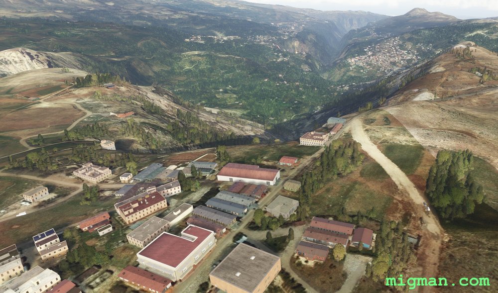
The Cedars of God
AboutTripoli is the second largest town in Lebanon and the centre of a province in the NW near the border with Syria. Skirt the mountainous slopes as you fly south, visit the dramatic Kadisha Valley at the Cedars of God and return past Tripoli, along the splendid coastline to Rene Mouawad Airbase.
Return trip to: Tripoli at WP 5, 26 nm | Cedars of God at WP 3, 42 nm | Entire route: 71 nm
Return trip to: Tripoli at WP 5, 26 nm | Cedars of God at WP 3, 42 nm | Entire route: 71 nm
Lebanon
location_cityTripoli (Lebanon)
flight_takeoffOLKA Rene Mouawad
airline_seat_recline_extraMiddle East 2
tagBorder Patrol
tagCoastal flight
tagCanyon runs & Mach Loops
Dibs on the Strait of Hormuz
AboutKhasab Airbase overlooks the strategically important Strait of Hormuz, joining the Persian Gulf and the Gulf of Oman. The airport is in a small valley with mountains on three sides.
31 nm: WP 2 and 7 | 99 nm: Entire route
NOTAM: WP 1: Dib Dibba, 2891 ft, is at the northernmost point of the island group overlooking the Strait of Hormuz.
WP 2: Follow the coast south from Khasab Airport, 1725 ft (not Khasab Airbase).
WP 3: The city of Dibba is divided into three parts: Dibba Al-Fujairah (UAE), Dibba Al-Hisn (UAE) and Dibba Al-Baya (Oman). Fly along the Oman / UAE border
WP 4-6: Return along the Oman / UAE border, which bisects the peninsula north to south.
WP 7 - Enter the valley and return to Khasab Airbase.
 Oman
location_cityAl Khasab
flight_takeoffOOKB Khasab Airbase
airline_seat_recline_extraMiddle East 2
tagCanyon runs & Mach Loops
tagAiports
tagCanyon runs & Mach Loops
Oman
location_cityAl Khasab
flight_takeoffOOKB Khasab Airbase
airline_seat_recline_extraMiddle East 2
tagCanyon runs & Mach Loops
tagAiports
tagCanyon runs & Mach Loops
Arabian Sea’s Towering Cliffs at Salalah
AboutSalalah is the capital of Dhofar province, subject to monsoonal weather and known for it's role in the spice trade. Fly SW along the plateau and return at low level via the spectacular cliffs lining the Arabian Sea.
NOTAM: 20 nm: Local flight over Salalah | 114 nm: Entire route
NOTAM: 20 nm: Local flight over Salalah | 114 nm: Entire route
Oman
location_citySalalah
flight_takeoffOOSA Salalah
airline_seat_recline_extraMiddle East 2
tagCoastal flight
Muscat Maverick
AboutExplore the dramatic terrain south of Muscat at the entrance to the Persian Gulf. If you're flying a sedate mission, enjoy the spectacular scenery and use your cell phone to take lots of snaps. If you want more high-octane excitement fly a 'Top Gun: Maverick' style low level profile flight. Turn on 'G effects' for maximum drama! The flight works well either way. If you fail, do not pass go. Rather, go to the prison at WP 7.
21 nm: WP 1 and 7 | 119 nm: Entire route
NOTAM: WP 2-3: Keep the ridge on your left and the smaller hills on your right. | WP 4 - Enter the valley and follow the road. | WP 5 - If you have enough 'smash', perform a max G pullup and go inverted over the ridge. If you're flying more sedately, use the large valley to perform climbing turns. | WP 7 - Check your fuel state and if necessary divert straight to the airport.
Oman
location_cityMuscat
flight_takeoffOOMS Seeb
airline_seat_recline_extraMiddle East 2
tagBridges
tagCanyon runs & Mach Loops
Doha, capital of Qatar
AboutFly around Doha, the capital of Qatar on the Persian Gulf.
15 nm: WP1,2,3 | 51 nm: Entire route
15 nm: WP1,2,3 | 51 nm: Entire route
 Qatar
location_cityDoha
flight_takeoffOTHH Hamad
airline_seat_recline_extraMiddle East 2
Qatar
location_cityDoha
flight_takeoffOTHH Hamad
airline_seat_recline_extraMiddle East 2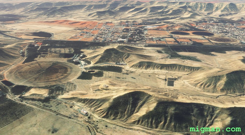
Riyadh Wadis
AboutExplore some of the lush wadis to the west and south of Riyadh City.
35 nm: WP 7 across Riyadh and return | 82 nm: Entire route
NOTAM: Ap elevation is 2035 ft.
35 nm: WP 7 across Riyadh and return | 82 nm: Entire route
NOTAM: Ap elevation is 2035 ft.
 Saudi Arabia
location_cityRiyadh
flight_takeoffOERK King Khaled
airline_seat_recline_extraMiddle East 2
tagBridges
Saudi Arabia
location_cityRiyadh
flight_takeoffOERK King Khaled
airline_seat_recline_extraMiddle East 2
tagBridges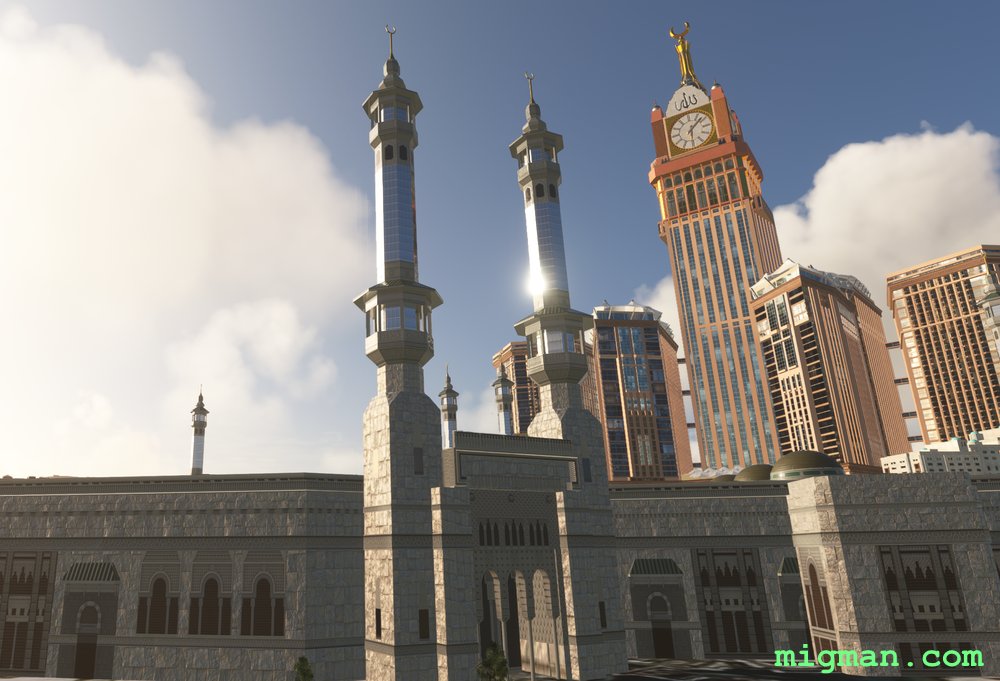
Pilgrimage to Mecca
AboutFollow the 4th Ring Road around Mecca in Saudi Arabia.
In the centre of Mecca and visible from all directions is the Masjid al-Haram, also known as the Great Mosque of Mecca. Adjacent to the mosque is the Makkah Clock Tower, topped by a gold crescent.
20 nm: Fly to the Great Mosque and retyrn | 37 nm: Entire route
In the centre of Mecca and visible from all directions is the Masjid al-Haram, also known as the Great Mosque of Mecca. Adjacent to the mosque is the Makkah Clock Tower, topped by a gold crescent.
20 nm: Fly to the Great Mosque and retyrn | 37 nm: Entire route
Saudi Arabia
location_cityMecca
flight_takeoffOE49 Mecca East
airline_seat_recline_extraMiddle East 2
Aleppo, the Turkish Border and Maydanki Dam
AboutFly out of Syria's second largest city, Aleppo, follow the Turkish border to the west and return via Maydanki Dam.
12 nm: Fly 6 nm NE to across Aleppo | 62 nm: WP 6, Maydanki Dam | 117 nm: Entire route
NOTAM: At WP 2 and 3 the outpost are on the Turkish side of the border. At WP 4 you will see Karasu Dam 2.5 nm N and on the Turkish side of the border.
12 nm: Fly 6 nm NE to across Aleppo | 62 nm: WP 6, Maydanki Dam | 117 nm: Entire route
NOTAM: At WP 2 and 3 the outpost are on the Turkish side of the border. At WP 4 you will see Karasu Dam 2.5 nm N and on the Turkish side of the border.
 Syria
location_cityAleppo
flight_takeoffOSAP Aleppo
airline_seat_recline_extraMiddle East 2
tagBorder Patrol
tagDam spotting
Syria
location_cityAleppo
flight_takeoffOSAP Aleppo
airline_seat_recline_extraMiddle East 2
tagBorder Patrol
tagDam spotting
The Road to Damascus
AboutFly out of Syria's capital, Damascus and patrol the border with Lebanon and Israel.
Between WP 2 and WP 3 fly on the E side of the valley.
WP 4 and return takes you across Damascus: 30 nm | Entire route: 98 nm
Between WP 2 and WP 3 fly on the E side of the valley.
WP 4 and return takes you across Damascus: 30 nm | Entire route: 98 nm
Syria
location_cityDamascus
flight_takeoffOSDI Damascus
airline_seat_recline_extraMiddle East 2
tagBorder Patrol
tagDam spotting
tagCanyon runs & Mach Loops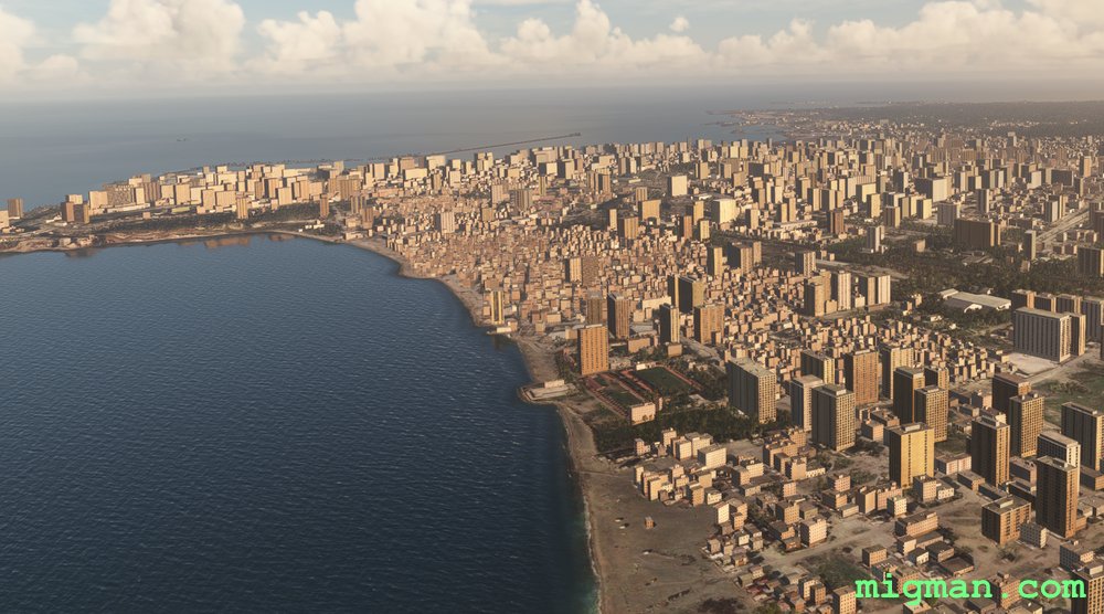
Latakia, Principal Port of Syria
AboutLatakia is the principal port city of Syria. Fly east out of Hamah to the Mediterranean coast, up to Latakia and return by way of four dams.
6 nm: NE for 3 miles to cross tha city of Hama | 22 nm: WP 7 - Mahardah Dam and return | 42 nm: WP 7 and WP 6 and return | 86 nm: WP 1, Tartus Port and return | 148 nm Entire route
6 nm: NE for 3 miles to cross tha city of Hama | 22 nm: WP 7 - Mahardah Dam and return | 42 nm: WP 7 and WP 6 and return | 86 nm: WP 1, Tartus Port and return | 148 nm Entire route
Syria
location_cityHama
flight_takeoffOS58 Hama
airline_seat_recline_extraMiddle East 2
tagCoastal flight
tagDam spotting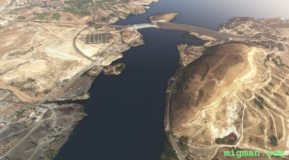
Tishrin Dam
AboutFly out of Jirah Military Airbase at Lake Assad, up the Euphrates River past Tishrin Dam and return following the main roads.
NOTAM: Follow the river to WP 3 and then main roads from WP 3 to the end of the flight.
46 nm: WP 2, Tishrin dam and return | 24 nm: WP 7 Rasm al-Abed Airport OS66 and return | 106 nm: Entire route
NOTAM: Follow the river to WP 3 and then main roads from WP 3 to the end of the flight.
46 nm: WP 2, Tishrin dam and return | 24 nm: WP 7 Rasm al-Abed Airport OS66 and return | 106 nm: Entire route
Syria
location_cityTishrin Dam
flight_takeoffOS62 Jirah
airline_seat_recline_extraMiddle East 2
tagBridges
tagDam spotting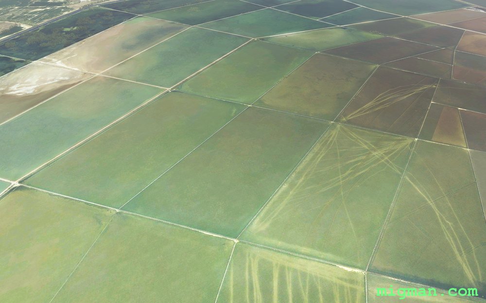
Izmir on the Agean
AboutIzmir is the second largest city on the Agean Sea, after Athens and the third largest population centre in Turkey.
Explore the broad valley to the east, and the resorts and shoreline to the north and west.
The second half of the flight is a coastal run which takes you over the colourful alluvial flood plains to the NE of Izmir.
Take off from Adnan Menderes Airport, fly past Sirinyer Racecourse and Kulturpark Izmir to Izmir Docks at WP 1. Then fly east to the major centre of Turgutlu and NW past Manisa to Guselhisar Dam.
Return distances:
19 nm: Izmir
40 nm: Manisa at WP 3
56 nm: Turgutlu at WP 2
60 nm: Guzelhisar Dam at WP 4
62 nm: Coastal route to Foca and the alluvial flood plains
121 nm: Entire route
 Turkey
location_cityIzmir
flight_takeoffLTBJ Adnan Menderes
airline_seat_recline_extraMiddle East 2
tagCoastal flight
tagDam spotting
tagCanyon runs & Mach Loops
Turkey
location_cityIzmir
flight_takeoffLTBJ Adnan Menderes
airline_seat_recline_extraMiddle East 2
tagCoastal flight
tagDam spotting
tagCanyon runs & Mach Loops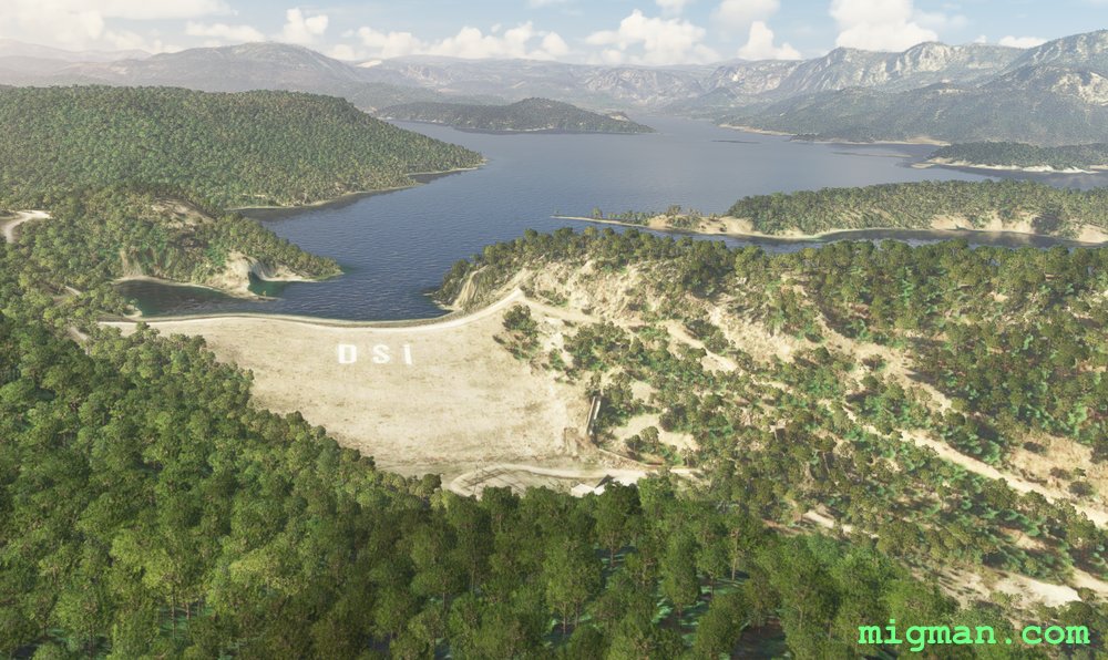
Antalya North and East: Dams, Mountains, Valleys and Coastal Resorts
AboutExplore the valleys, dams and mountains to the NE of Antalya, including the Aksus, Karacaoren, Oymapinar and Manavgat dams and the magnificent Sutculer Mountains.
On the way back pass the coastal resorts at Ilica, Perakende and Belek.
54 nm: Dam on Karacaoren-1 Lake
72 nm: Coast to Manavgat Airport LTKI
82 nm: WP 5,6,7: Two dams and coast from Manavgat Airport LTKI
136 nm: Entire route
On the way back pass the coastal resorts at Ilica, Perakende and Belek.
54 nm: Dam on Karacaoren-1 Lake
72 nm: Coast to Manavgat Airport LTKI
82 nm: WP 5,6,7: Two dams and coast from Manavgat Airport LTKI
136 nm: Entire route
Turkey
location_cityAntalya
flight_takeoffLTAI Antalya
airline_seat_recline_extraMiddle East 2
tagCoastal flight
tagDam spotting
tagCanyon runs & Mach Loops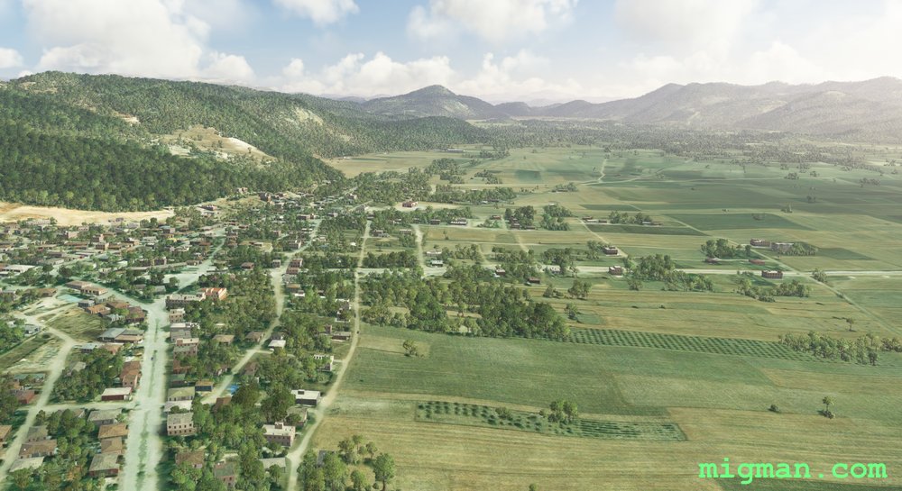
Antalya North West Valleys
AboutEnjoy the pastoral valleys to the NW of Antalya, one of the largest citiess in Turkey andthe capital of Antalya Province.
31 nm: Across Antalya to WP 7 and return
71 nm: Entire route
31 nm: Across Antalya to WP 7 and return
71 nm: Entire route
Turkey
location_cityAntalya
flight_takeoffLTAI Antalya
airline_seat_recline_extraMiddle East 2
tagCanyon runs & Mach Loops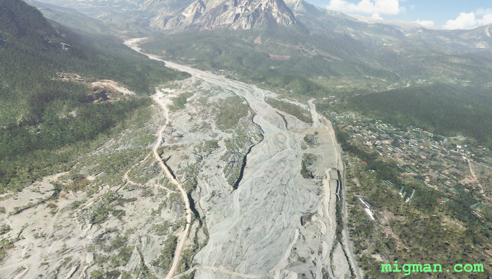
Antalya: Bey Mountains and the South West Coast
AboutEnter a valley west of the city, fly over the Bey Mountains and return along the beautiful coastline to the SW of Antalya.
20 nm: Along the shoreline at Antalya to WP 6, South Antalya Marina and return
90 nm: WP 1 and 2 - Bey Mountains and dam near Karamik and return
129 nm: Entire route
20 nm: Along the shoreline at Antalya to WP 6, South Antalya Marina and return
90 nm: WP 1 and 2 - Bey Mountains and dam near Karamik and return
129 nm: Entire route
Turkey
location_cityAntalya
flight_takeoffLTAI Antalya
airline_seat_recline_extraMiddle East 2
tagCoastal flight
tagDam spotting
tagCanyon runs & Mach Loops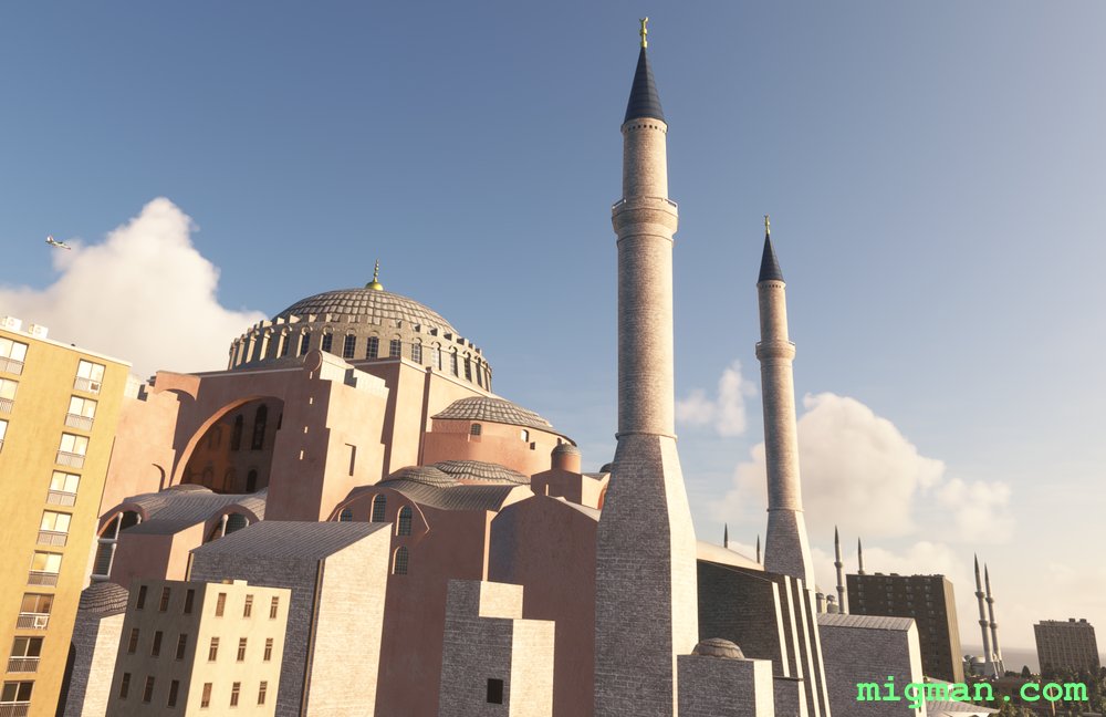
Istanbul, Back to the Bosphorus.
AboutYour first waypoint is the Hagia Sophia which was built in 537 A.D. by the Roman emperor Justinian I.
Fly along the mighty Bosphorus River from the Sea of Marmara to the Black Sea in the north. Pass the three main bridges on the Bosphorus river: Bosphorus Bridge, Fatih Sultan Mehmet Bridge and the Yavuz Sultan Selim Bridge.
Explore the Black Sea coast to Sile, fly south past the Darlik Dam and to the Osmangazi Bridge on the Gulf of İzmit.
Fly past Gebze, Darica, Tuzla, Pendik and Kartal as you return along the coast of the Sea of Marmara, back to the Bosphorus River.
16 nm: WP 1 - Mouth of the Bosphorus / Mosque: Hagia Sophia
42 nm: WP1,2,3 and return
44 nm: Along the coast of the Gulf of Izmit to WP 6 and return
104 nm: Entire route
Turkey
location_cityIstanbul
flight_takeoffLTBA Ataturk
airline_seat_recline_extraMiddle East 2
tagBridges
tagCoastal flight
tagDam spotting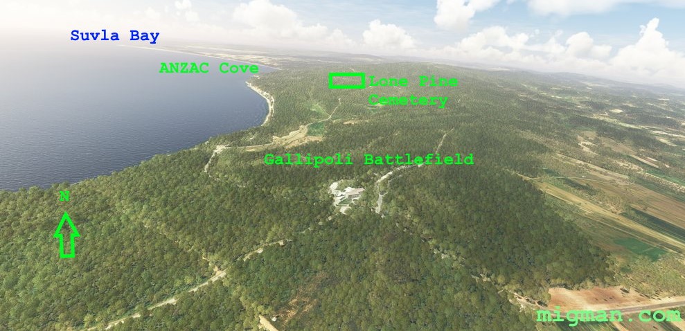
ANZAC
AboutFly the length of the strategically important Dardanelles Strait which connects the Agean Sea to the Sea of Marmara.
During World War I, on April 25th 1915 the Australia New Zealand Army Corp (ANZAC) landed south of Suvla bay as part of an offensive to open the Dardenelles Straits to Allied warships. The campaign lasted 11 months, ended in stalemate, and the forces were withdrawn in January 1916. The ANZAC Corp were assisted by British, Indian, Irish, French, and Newfoundland troops. The Gallipoli Campaign is commemorated annually in Australia and New Zealand and is the most significant day on their calendar remembering military casualties.
Helles - British landings on April 25th, 1915. Anzac Cove - Beach where ANZAC forces landed. Suvla Bay - Site where the British IX Corps landed on August 6th 1915.
Round trip distances:
7 nm: Cannakale and Canakkale Port Services Command, 1nm before WP 7
14 nm: WP 2 - Gallipoli Battlefield
40 nm: WP 6 - Town of Geliboli
81 nm: Entire route
Turkey
location_cityGallipoli
flight_takeoffLTBH Canakkale
airline_seat_recline_extraMiddle East 2
tagCoastal flight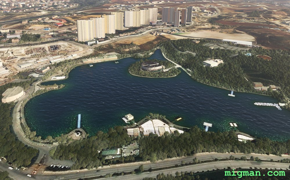
Ankara Local
AboutTake in the sights of Turkey's capital Ankara via three local lakes.
21 nm: WP 4, Esertepe Vadis Park and return
25 nm: WP 1 , Bayindir Dami and return
36 nm: WP 2 , Susuz Golu and return
62 nm: Entire route
21 nm: WP 4, Esertepe Vadis Park and return
25 nm: WP 1 , Bayindir Dami and return
36 nm: WP 2 , Susuz Golu and return
62 nm: Entire route
Turkey
location_cityAnkara
flight_takeoffLTAC Esenboga
airline_seat_recline_extraMiddle East 2
tagDam spotting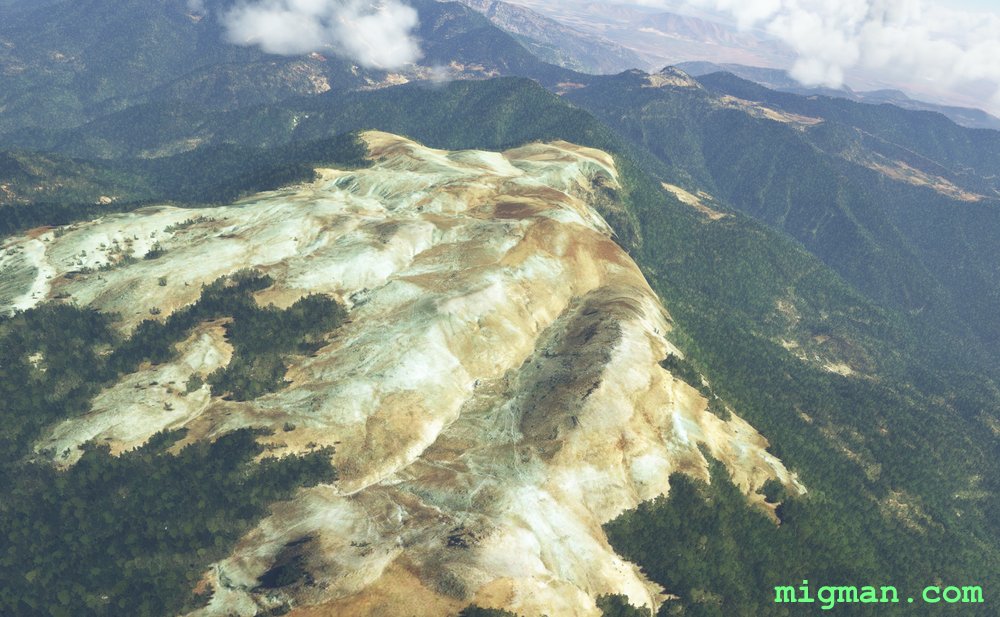
Hatay Province North
AboutHatay Province lays between the eastern end of the Mediterranean and the border with Syria. Take off from Haty ap LTDA near the town of Aktas. Have a trip along the Med shore, over the mountain range and return along the Turkey / Syria border.
29 nm: Fly to the coast at WP 1 and return | 103 nm: Entire route
29 nm: Fly to the coast at WP 1 and return | 103 nm: Entire route
Turkey
location_cityHatay
flight_takeoffLTDA Hatay
airline_seat_recline_extraMiddle East 2
tagBorder Patrol
tagBridges
tagCoastal flight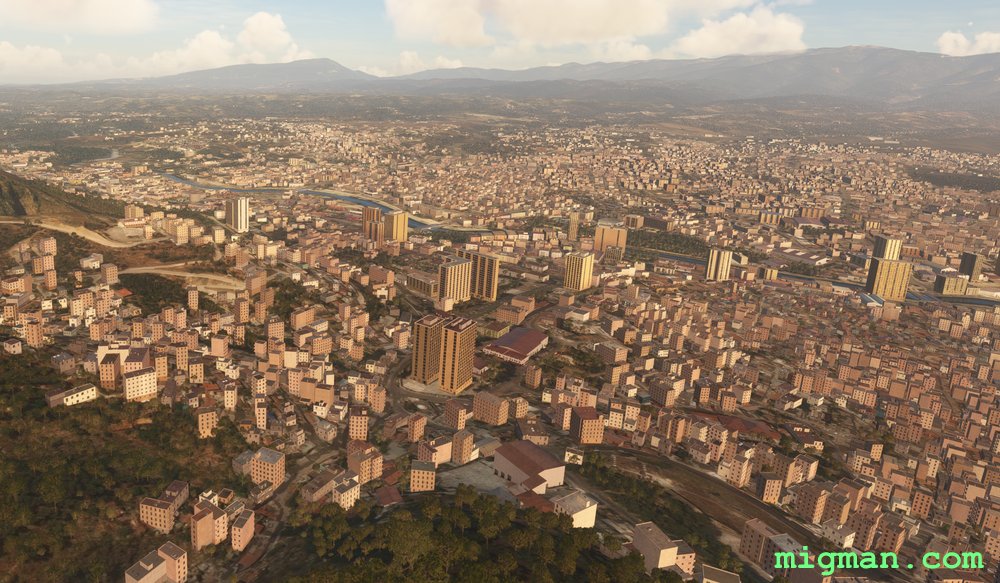
Antioch and Hatay Province South
AboutThe ancient Greek city of Antioch (Antakya) is in Hatay province, near the Syrian border and on the east end of the Mediterranean.
Fly south through Antioch and return along the Med shore to the west. The compound at WP 3 is only about 100 yds from the border.
25 nm: Fly to Antioch at WP 1 and return | 107 nm: Entire route
Fly south through Antioch and return along the Med shore to the west. The compound at WP 3 is only about 100 yds from the border.
25 nm: Fly to Antioch at WP 1 and return | 107 nm: Entire route
Turkey
location_cityHatay
flight_takeoffLTDA Hatay
airline_seat_recline_extraMiddle East 2
tagBorder Patrol
tagBridges
tagCoastal flight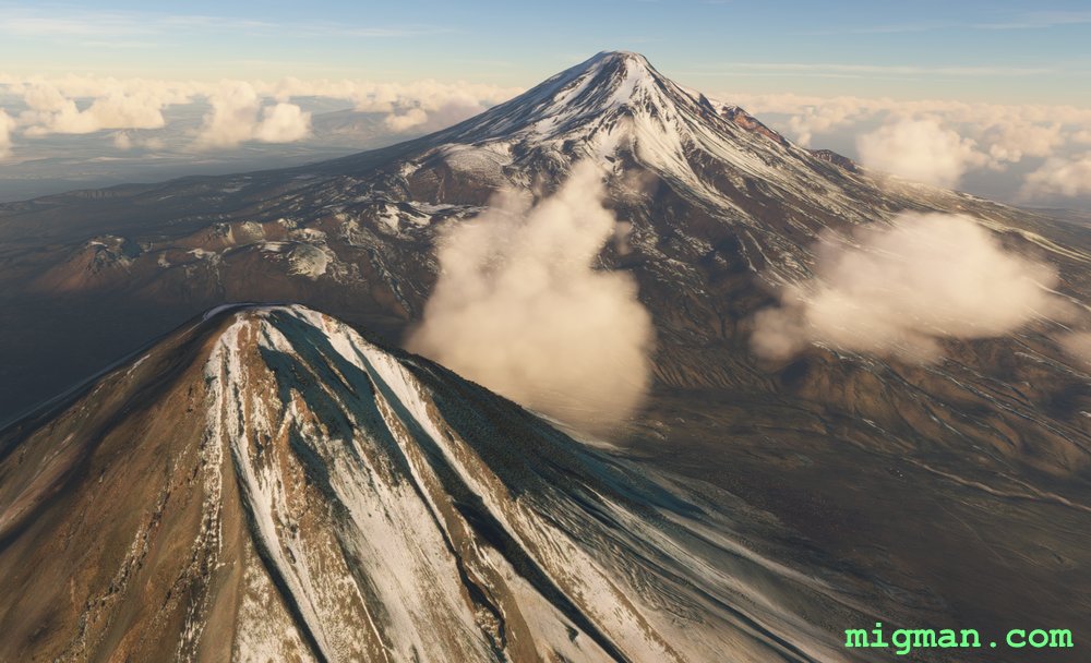
Mount Ararat and the Turkey / Armenia / Iran Border
AboutIgdir Province is adjacent to NE Turkey and borders Armenia, Azerbaijab and Iran. Igdir Airport is adjacent to the town of Kulluk
Fly out of Igdir, patrol the border with Armenia between WP 1 and 2. Between WP 2 and 3 fly along the border with Iran. Then return via the biblical location of Noah's Ark, Mount Ararat.
NOTAM: WP 2, Aralık is located in a bulge on the Turkey - Armenia - Iran border. Mount Ararat is 16853 ft (5,137 m) tall, so take an oxygen supply and use anti-icing measures.
38 nm: Lake Balik at WP 4 and return
50 nm: Mount Ararat at WP 3 and return
75 nm: Border patrol WP1,2,3 and return
114 nm: Entire route
Turkey
location_cityIgdir Province
flight_takeoffLTCT Igdir
airline_seat_recline_extraMiddle East 2
tagBorder Patrol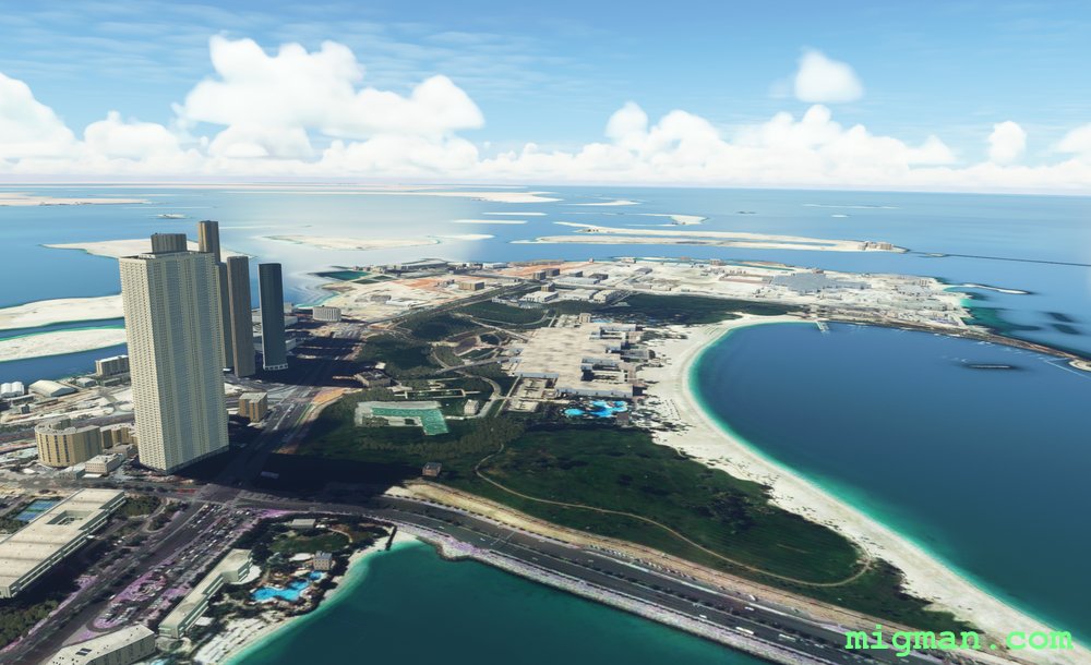
Abhu Dabi
AboutFly around the water-lined border outskirts of Abu Dhabi, capital of the United Arab Emirates.
 United Arab Emirates
location_cityAbu Dhabi
flight_takeoffOMAA Abu Dhabi
airline_seat_recline_extraMiddle East 2
tagBorder Patrol
United Arab Emirates
location_cityAbu Dhabi
flight_takeoffOMAA Abu Dhabi
airline_seat_recline_extraMiddle East 2
tagBorder Patrol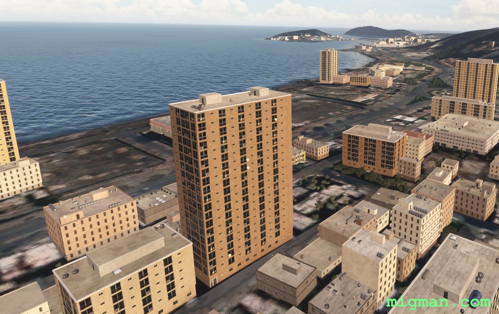
Gulf of Aden
AboutFly out of Yemen's Aden, on the Gulf of Aden and follow the rugged coastline to the SW.
NOTAM: 10 nm: WP 5, over Aden city | 33 nm: Entire route
NOTAM: 10 nm: WP 5, over Aden city | 33 nm: Entire route
 Yemen
location_cityAden
flight_takeoffOYAA Aden
airline_seat_recline_extraMiddle East 2
tagCoastal flight
Yemen
location_cityAden
flight_takeoffOYAA Aden
airline_seat_recline_extraMiddle East 2
tagCoastal flight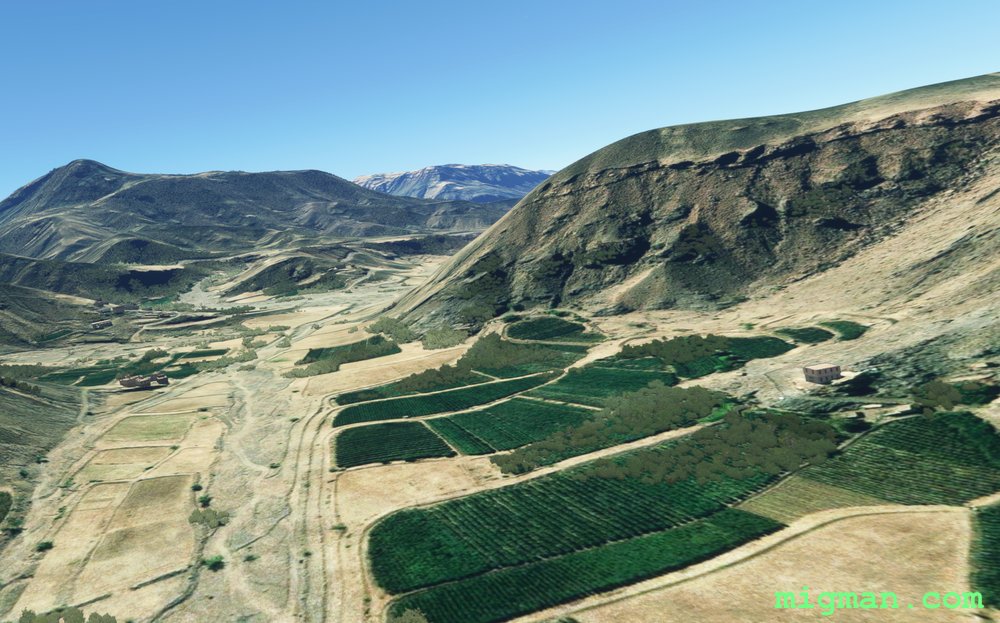
Sanaa Cross Country
AboutFly out of Yemen's capital Sanaa, and explore the rugged surrounding valleys.
NOTAM: 22nm: Sanaa | 78nm: Entire route
NOTAM: 22nm: Sanaa | 78nm: Entire route
Yemen
location_citySanaa
flight_takeoffOYSN Sanaa
airline_seat_recline_extraMiddle East 2
tagCanyon runs & Mach Loops