MiGMan’s World Tour Valley flights
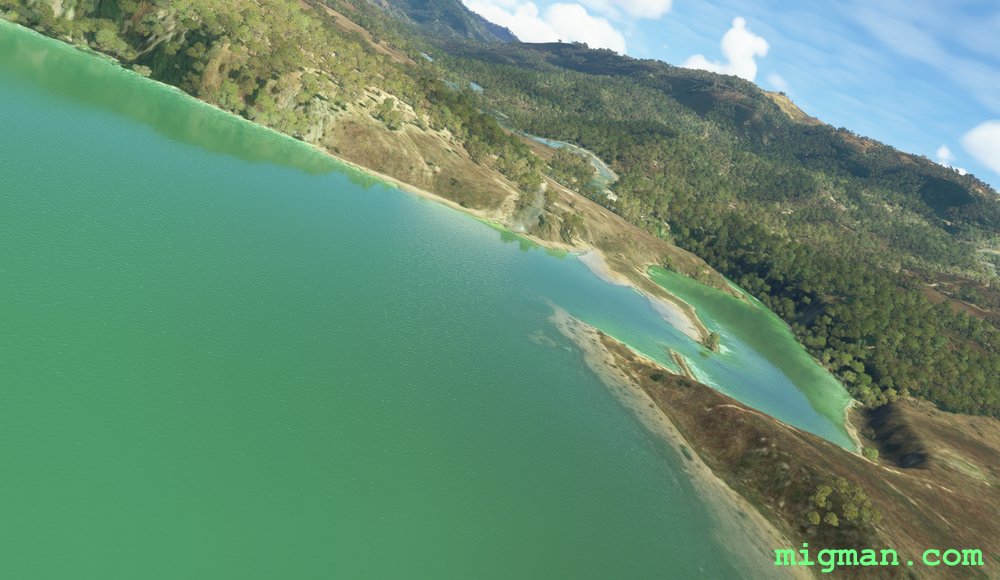
Bouroumi Dam
AboutVisit Bouroumi Dam and explore the valleys south of Blida.
 Algeria
location_cityAlgiers
flight_takeoffDAAK Boufarik
airline_seat_recline_extraAfrica 1
tagDam spotting
tagCanyon runs & Mach Loops
Algeria
location_cityAlgiers
flight_takeoffDAAK Boufarik
airline_seat_recline_extraAfrica 1
tagDam spotting
tagCanyon runs & Mach Loops
Hidden Valley
AboutNavigate to to this delightful area west of Gaborone, capital of Botswana.
 Botswana
location_cityGaborone
flight_takeoffFBSK Sir Seretse Khama
airline_seat_recline_extraAfrica 1
tagCanyon runs & Mach Loops
tagDam spotting
tagBorder Patrol
Botswana
location_cityGaborone
flight_takeoffFBSK Sir Seretse Khama
airline_seat_recline_extraAfrica 1
tagCanyon runs & Mach Loops
tagDam spotting
tagBorder Patrol
NW Hills District
AboutFly amongst the spectacular hills to the NW of Cameroon's capital, Yaounde.
 Cameroon
location_cityYaounde
flight_takeoffFKKY Yaounde/Ville
airline_seat_recline_extraAfrica 1
tagDam spotting
tagCanyon runs & Mach Loops
Cameroon
location_cityYaounde
flight_takeoffFKKY Yaounde/Ville
airline_seat_recline_extraAfrica 1
tagDam spotting
tagCanyon runs & Mach Loops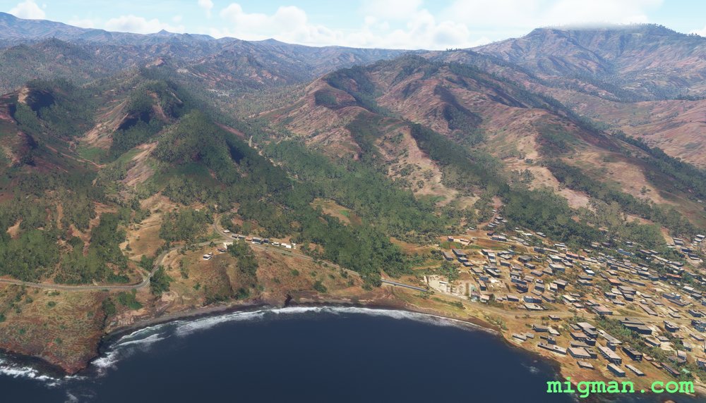
Secret City
AboutFly out of Cape Verde's capital Praia to the mountainous interior and explore the plateau cities of Santa Catarina and Pico d'Antonia. Return to the coast via a 'smuggler's run' down steep valleys and along the southern coast.
 Cape Verde
location_cityPraia
flight_takeoffGVNP Mandela
airline_seat_recline_extraAfrica 1
tagCoastal flight
tagCanyon runs & Mach Loops
Cape Verde
location_cityPraia
flight_takeoffGVNP Mandela
airline_seat_recline_extraAfrica 1
tagCoastal flight
tagCanyon runs & Mach Loops
East of Kinshasa
AboutTour the fertile valleys and plateaus to the East of the capital, Kinshasa.
 Congo
location_cityKinshasa
flight_takeoffFZAA N’Djili
airline_seat_recline_extraAfrica 2
tagCanyon runs & Mach Loops
Congo
location_cityKinshasa
flight_takeoffFZAA N’Djili
airline_seat_recline_extraAfrica 2
tagCanyon runs & Mach Loops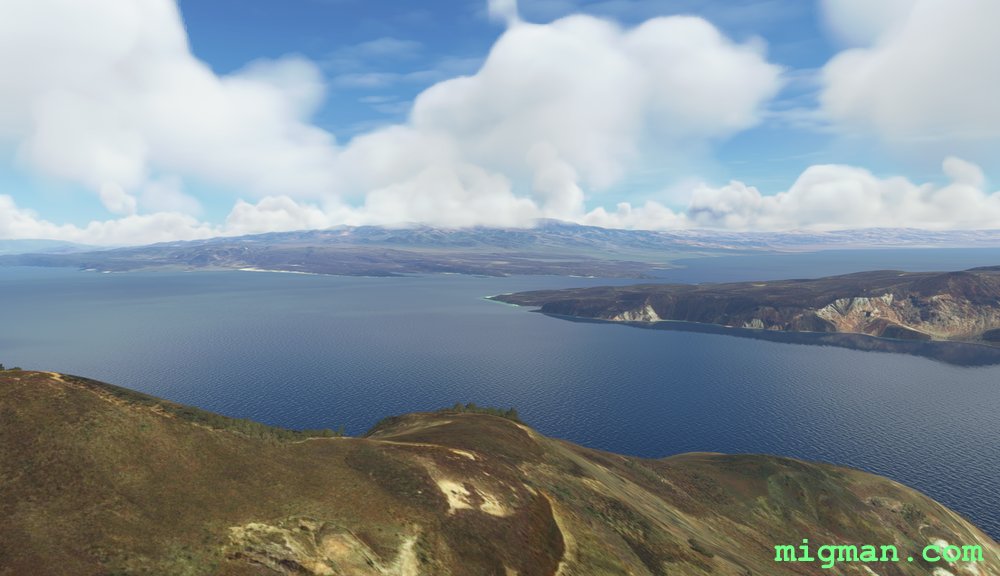
Djibouti West
AboutFly to the salt flats west of Djibouti and return along the dramatic shoreline of the Gulf of Tadjoura.
 Djibouti
location_cityDjibouti City
flight_takeoffHDAM Ambouli
airline_seat_recline_extraAfrica 2
tagCoastal flight
tagDam spotting
tagCanyon runs & Mach Loops
Djibouti
location_cityDjibouti City
flight_takeoffHDAM Ambouli
airline_seat_recline_extraAfrica 2
tagCoastal flight
tagDam spotting
tagCanyon runs & Mach Loops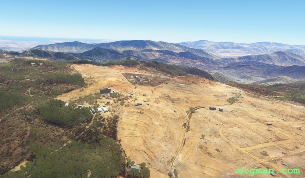
Cornucopia
AboutFly out of Eritrea's capital Malobo. This elevated plateau city offers spectaular views of the Red Sea, 9,000 feet below!
Runway altitude is 7,658 ft, so fly at 9,000 ft.
 Eritrea
location_cityAsmara
flight_takeoffHHAS Asmara
airline_seat_recline_extraAfrica 2
tagCanyon runs & Mach Loops
Eritrea
location_cityAsmara
flight_takeoffHHAS Asmara
airline_seat_recline_extraAfrica 2
tagCanyon runs & Mach Loops
Asmara: Valleys to the East
AboutExplore a couple of the many valleys to the east of Eritrea's capital Asmara. Runway altitude is 7,658 ft, so fly at 9,000 ft.
Eritrea
location_cityAsmara
flight_takeoffHHAS Asmara
airline_seat_recline_extraAfrica 2
tagCanyon runs & Mach Loops
Mbabane and Lupohohlo Dam
AboutTake a scenic side trip via Lupohohlo Dam as you fly to Eswatini's capital, Mbabane.
 Eswatini
location_cityMbabane
flight_takeoffFDMS Matsapha
airline_seat_recline_extraAfrica 2
tagDam spotting
tagCanyon runs & Mach Loops
Eswatini
location_cityMbabane
flight_takeoffFDMS Matsapha
airline_seat_recline_extraAfrica 2
tagDam spotting
tagCanyon runs & Mach Loops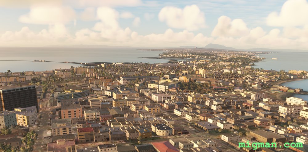
Air, Land and Sea
AboutFly along the Conakry peninsula with a side trip to a valley in the north.
 Guinea
location_cityConakry
flight_takeoffGUCY Gbessia
airline_seat_recline_extraAfrica 2
tagCanyon runs & Mach Loops
Guinea
location_cityConakry
flight_takeoffGUCY Gbessia
airline_seat_recline_extraAfrica 2
tagCanyon runs & Mach Loops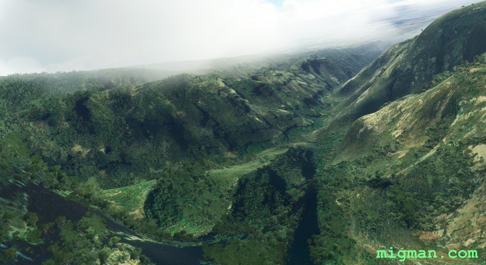
Mount Kukal Slalom
AboutFly a thrillseeker route over Mount Kulal Biosphere Reserve on Lake Turkana in nothern Kenya.
 Kenya
location_cityLoyangalani
flight_takeoffHKLY Loyangalani
airline_seat_recline_extraAfrica 3
tagCanyon runs & Mach Loops
Kenya
location_cityLoyangalani
flight_takeoffHKLY Loyangalani
airline_seat_recline_extraAfrica 3
tagCanyon runs & Mach Loops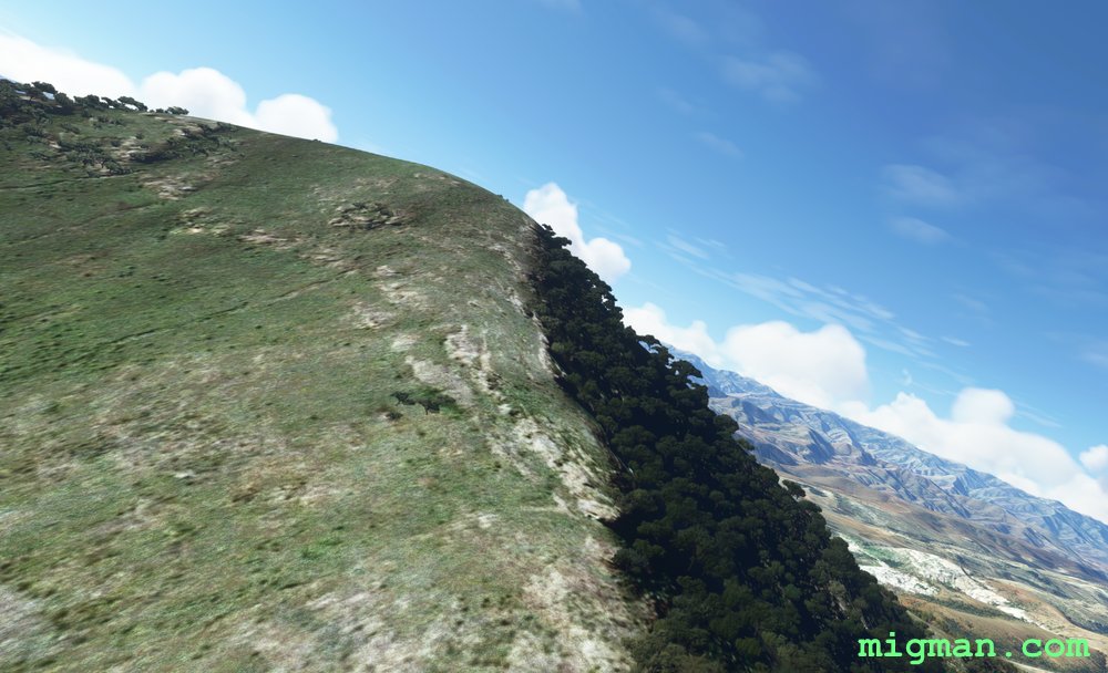
South of Maseru
AboutExplore the spectacular terrain south of Maseru.
 Lesotho
location_cityMaseru
flight_takeoffFXMM Moshoeshoe I
airline_seat_recline_extraAfrica 3
tagCanyon runs & Mach Loops
Lesotho
location_cityMaseru
flight_takeoffFXMM Moshoeshoe I
airline_seat_recline_extraAfrica 3
tagCanyon runs & Mach Loops
Presidential Tour
AboutVisit the Presidential Palace and surrounding countryside nead Madagascar's capital Antananarivo. Ivato airport is located between three beautiful lakes which are well worth exploring.
 Madagascar
location_cityAntananarivo
flight_takeoffFMMI Ivato
airline_seat_recline_extraAfrica 3
tagCanyon runs & Mach Loops
Madagascar
location_cityAntananarivo
flight_takeoffFMMI Ivato
airline_seat_recline_extraAfrica 3
tagCanyon runs & Mach Loops
Tolagnaro, Over the Hills and Far Away
AboutEnjoy the coast at Tolagnaro, a seaside town on the Indian Ocean at the SE tip of Madagascar.
Madagascar
location_cityTolagnaro
flight_takeoffFMSD Tolagnaro
airline_seat_recline_extraAfrica 3
tagCoastal flight
tagCanyon runs & Mach Loops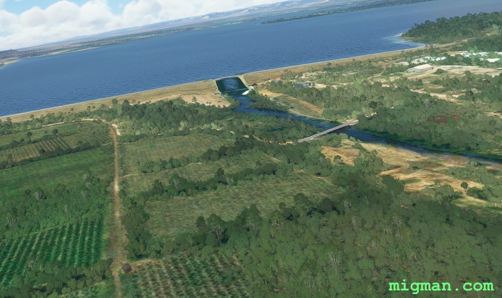
Mozambique Border Patrol
AboutFly along a section of the mountainous border between Mozambique and Eswatini.
 Mozambique
location_cityMaputo
flight_takeoffFQML Matola
airline_seat_recline_extraAfrica 4
tagBorder Patrol
tagDam spotting
tagCanyon runs & Mach Loops
Mozambique
location_cityMaputo
flight_takeoffFQML Matola
airline_seat_recline_extraAfrica 4
tagBorder Patrol
tagDam spotting
tagCanyon runs & Mach Loops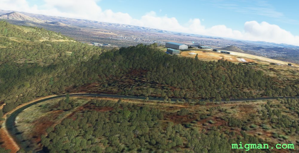
Valhalla
AboutEnter Valhalla in the rugged terrain to the south-west of Namibia's capital, Windhoek.
 Namibia
location_cityWindhoek
flight_takeoffFYWE Eros
airline_seat_recline_extraAfrica 4
tagCanyon runs & Mach Loops
Namibia
location_cityWindhoek
flight_takeoffFYWE Eros
airline_seat_recline_extraAfrica 4
tagCanyon runs & Mach Loops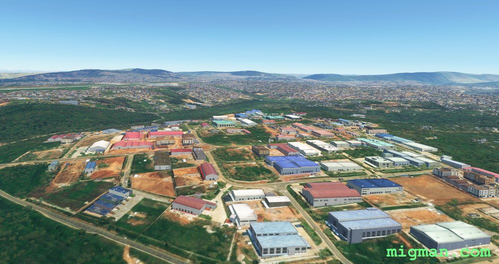
Kigali local
AboutTake a short hop around the capital, Kigali.
 Rwanda
location_cityKigali
flight_takeoffHRYR Kigali
airline_seat_recline_extraAfrica 4
tagBorder Patrol
tagCanyon runs & Mach Loops
Rwanda
location_cityKigali
flight_takeoffHRYR Kigali
airline_seat_recline_extraAfrica 4
tagBorder Patrol
tagCanyon runs & Mach Loops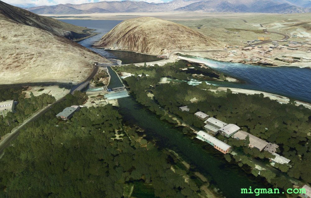
Jalalabad Local
AboutFly a short circuit over Jalalabad and admire the colours of this fertile valley about 60 nm east of Kabul.
 Afghanistan
location_cityJalalabad
flight_takeoffOAJL Jalalabad
airline_seat_recline_extraAsia 1
tagDam spotting
tagCanyon runs & Mach Loops
Afghanistan
location_cityJalalabad
flight_takeoffOAJL Jalalabad
airline_seat_recline_extraAsia 1
tagDam spotting
tagCanyon runs & Mach Loops
Thimpu Valley
AboutFly out from one of the world's most challenging airports, taking off from 7,323 ft altitude and visit the capital of Bhutan, Thimpu.
NOTAM. HIGH ALTITUDE. You will need a pressurised cabin and/or O2 supplies once you leave the valley floor. ICING. Engage anti-icing measures before flight.
Follow the valley from WP1 - WP 6.
NOTAM. HIGH ALTITUDE. You will need a pressurised cabin and/or O2 supplies once you leave the valley floor. ICING. Engage anti-icing measures before flight.
Follow the valley from WP1 - WP 6.
 Bhutan
location_cityThimphu
flight_takeoffVQPR Paro
airline_seat_recline_extraAsia 1
tagBridges
tagCanyon runs & Mach Loops
Bhutan
location_cityThimphu
flight_takeoffVQPR Paro
airline_seat_recline_extraAsia 1
tagBridges
tagCanyon runs & Mach Loops
Bride of Kangchenjunga
AboutFly out from one of the world's most challenging airports, taking off from 7,323 ft altitude. Visit Jomolhari or Chomolhari 'The Bride of Kangchenjunga', and gaze down across the border into China.
NOTAM. HIGH ALTITUDE. You will need a pressurised cabin and/or O2 supplies once you leave the valley floor. ICING. Engage anti-icing measures before flight.
NOTAM. HIGH ALTITUDE. You will need a pressurised cabin and/or O2 supplies once you leave the valley floor. ICING. Engage anti-icing measures before flight.
Bhutan
location_cityParo
flight_takeoffVQPR Paro
airline_seat_recline_extraAsia 1
tagBorder Patrol
tagCanyon runs & Mach Loops
Srinagar to Mount Kolahoi
AboutFly from the capital of Kashmir, Srinagar to the tallest point in Kashmir Valley: Mount Kolahoi (17,800 feet).
NOTAM. Srinagar RWY elevation is 5,453 ft. Mt. Kolahoi summit is 17,800ft.
 Kashmir
location_citySrinagar
flight_takeoffVISR Srinagar
airline_seat_recline_extraAsia 1
tagCanyon runs & Mach Loops
Kashmir
location_citySrinagar
flight_takeoffVISR Srinagar
airline_seat_recline_extraAsia 1
tagCanyon runs & Mach Loops
Pure as the Driven Snow, Almaty's Water
AboutThe largest city in Kazakhstan, Almaty is also the commercial and cultural centre. Go to the garden where the melting snows which feed the Almatinka River exit the valley and flow into Sairan Reservoir.
 Kazakhstan
location_cityAlmaty
flight_takeoffUAAA Almaty
airline_seat_recline_extraAsia 1
tagCanyon runs & Mach Loops
Kazakhstan
location_cityAlmaty
flight_takeoffUAAA Almaty
airline_seat_recline_extraAsia 1
tagCanyon runs & Mach Loops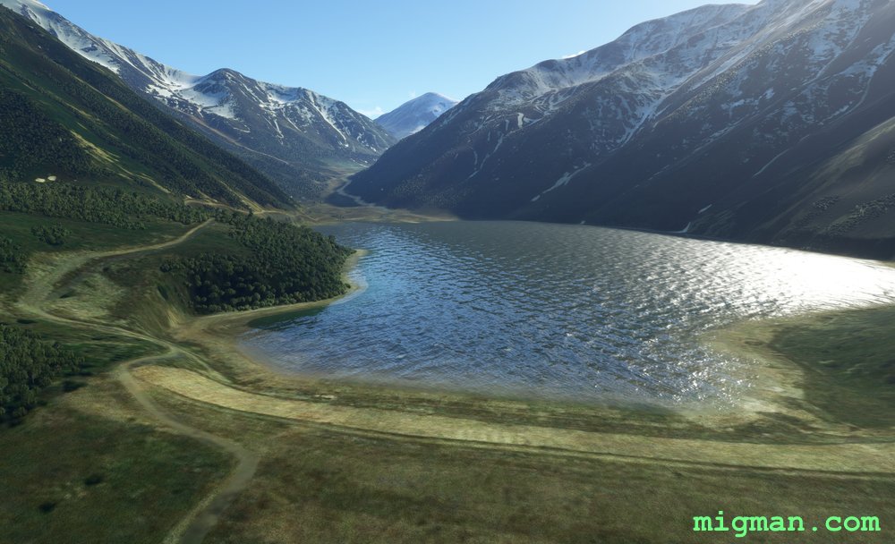
Big Almaty Lake and Pik Talgar
About Fly along the border with Kyrgyzstan and viisit Pik Talgar, 17 nm SE of Almaty AP and rising to 16,335.
NOTAM. Ap elevation 2,227 ft.
Kazakhstan
location_cityAlmaty
flight_takeoffUAAA Almaty
airline_seat_recline_extraAsia 1
tagCanyon runs & Mach Loops
Valley Run East of Vientiane
AboutThis flight is a bit longer than most, but it is rare that you get to fly 30 miles in a more or less straight line along such a beautiful broad valley! Fly east, staying on the Laos side of the Thai/Laos border (north of the Mekong River). Return with a relaxing flight along the valley to the north. Youi may want to loiter over the Nam Ngum Reservoir at WP 5. Then return to the south across Vientiane.
 Laos
location_cityVientiane
flight_takeoffVLVT Wattay
airline_seat_recline_extraAsia 2
tagBorder Patrol
tagBridges
tagCanyon runs & Mach Loops
Laos
location_cityVientiane
flight_takeoffVLVT Wattay
airline_seat_recline_extraAsia 2
tagBorder Patrol
tagBridges
tagCanyon runs & Mach Loops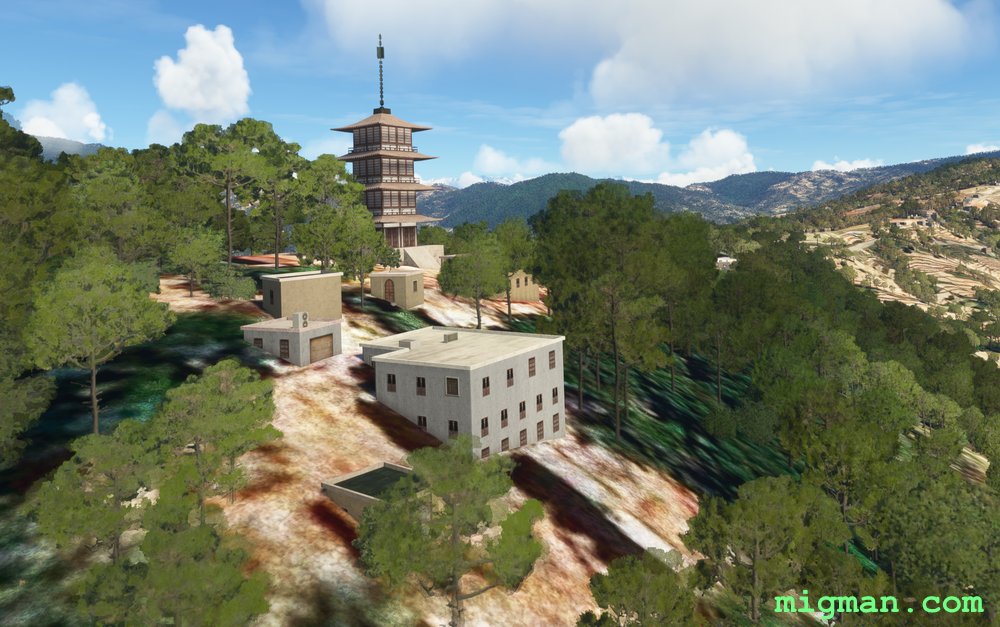
Kathmandu Local
AboutVisit the oldest temple in Nepal, Changunarayan Temple, on a hilltop overlooking Kathmandu. This flight plan circles the valley containing Kathmandu, picking up a few of the many local landmarks. This is one of the easier cities to explore visually as the valley is only about 10 miles across and bounded by mountains on all sides.
 Nepal
location_cityKathmandu
flight_takeoffVNKT Tribhuvan
airline_seat_recline_extraAsia 2
tagCanyon runs & Mach Loops
Nepal
location_cityKathmandu
flight_takeoffVNKT Tribhuvan
airline_seat_recline_extraAsia 2
tagCanyon runs & Mach Loops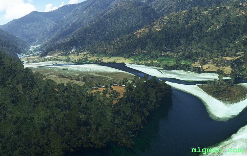
Kathmandu Cross Country
AboutKathmandu is surrounded by towering peaks and plunging chasms. Explore the Indriwati River valley to the west.
Nepal
location_cityKathmandu
flight_takeoffVNKT Tribhuvan
airline_seat_recline_extraAsia 2
tagCanyon runs & Mach Loops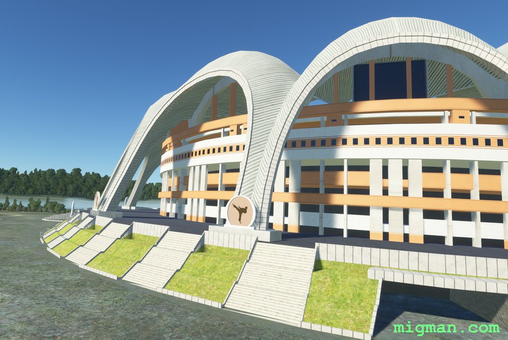
Pyongyang Local
AboutTake the rare opportunity to fly over North Korea's capital Pyongyang and approved local features. Stay on the right path!
 North Korea
location_cityPyongyang
flight_takeoffZKPY Sunan
airline_seat_recline_extraAsia 2
tagCanyon runs & Mach Loops
tagAiports
North Korea
location_cityPyongyang
flight_takeoffZKPY Sunan
airline_seat_recline_extraAsia 2
tagCanyon runs & Mach Loops
tagAiports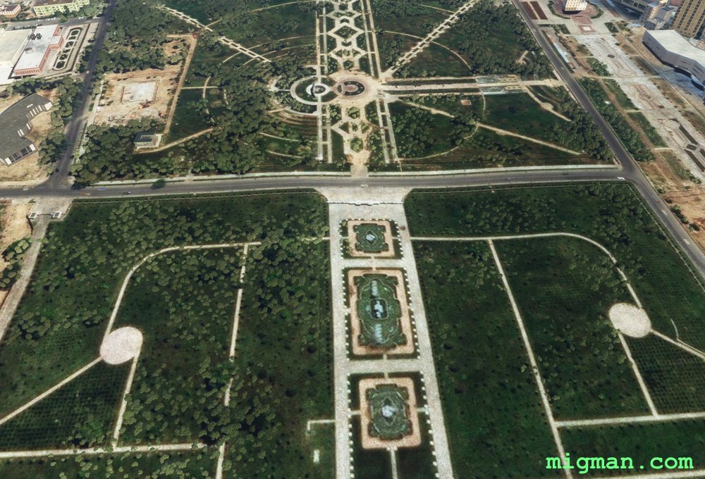
Dushanbe and the Varzob River
AboutDushanbe is in a fertile valley. Fly to the source of the water at the melting snow in the mountains to the north. NOTAM. Rec min alt 4,500 ft. Dushanbe AP ELEV 2,559 ft
 Tajikistan
location_cityDushanbe
flight_takeoffUTDD Dushanbe
airline_seat_recline_extraAsia 2
tagCanyon runs & Mach Loops
Tajikistan
location_cityDushanbe
flight_takeoffUTDD Dushanbe
airline_seat_recline_extraAsia 2
tagCanyon runs & Mach Loops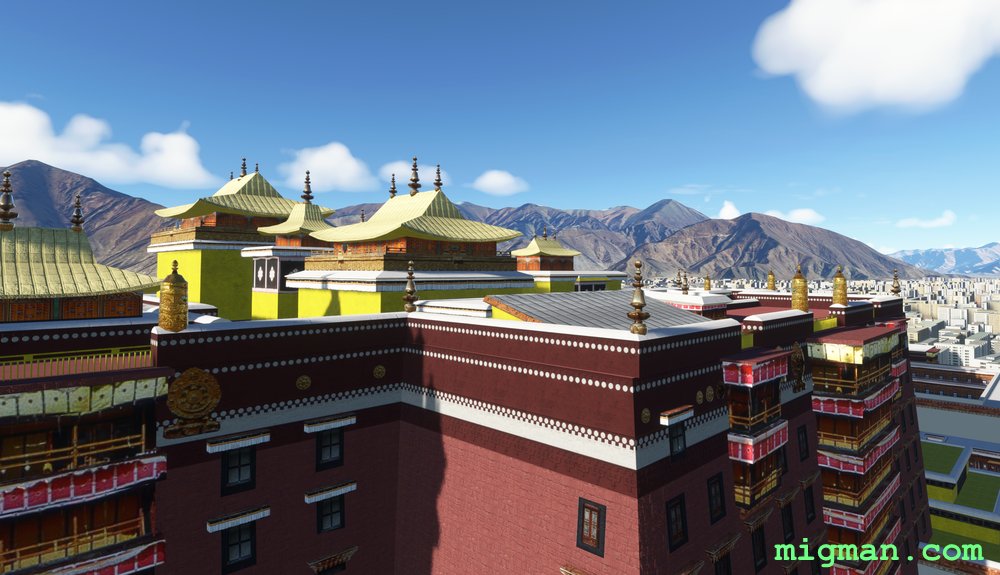
The Third Eye
AboutVisit the Potala Palace in the heartland of TIbetan Buddhism. The route is surrounded by mountains that soar up to 18,000 feet. Begin by climbing over the ridge N of the airport to the Lhasa Airport Expressway tunnel.
 Tibet
location_cityLhasa
flight_takeoffZULS Gonggar
airline_seat_recline_extraAsia 2
tagCanyon runs & Mach Loops
Tibet
location_cityLhasa
flight_takeoffZULS Gonggar
airline_seat_recline_extraAsia 2
tagCanyon runs & Mach Loops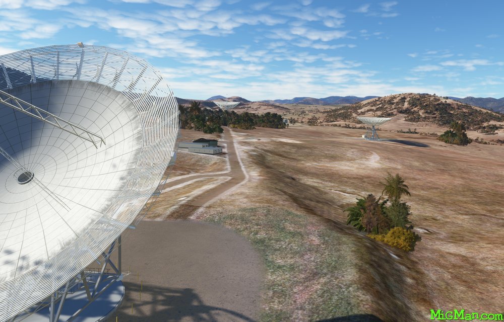
Dams and Deep Space
AboutVisit the four dams which service Canberra and Queanbeyan, and the Canberra Deep Space Communication Complex.
NOTAM. Canberra airport elevation is 1,869 ft so cruise at 3,000 ft.
NOTAM. Canberra airport elevation is 1,869 ft so cruise at 3,000 ft.
 Australia
location_cityA.C.T. (Australian Capital Territory)
flight_takeoffYSCB Canberra
airline_seat_recline_extraAustralia 1
tagDam spotting
tagCanyon runs & Mach Loops
Australia
location_cityA.C.T. (Australian Capital Territory)
flight_takeoffYSCB Canberra
airline_seat_recline_extraAustralia 1
tagDam spotting
tagCanyon runs & Mach Loops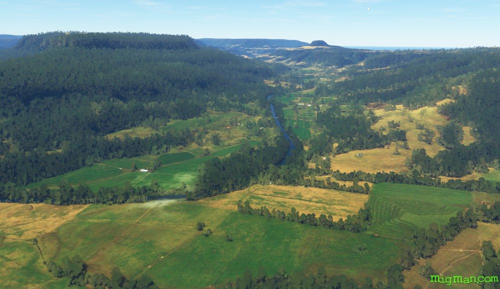
Kangaroo Valley
AboutTake a plunge off Fitzroy Falls into Kangaroo Valley in this dramatic flight. Head back to the coast and fly north past the famous Kiama Blowhole. All these locations are favourite day-trips for Sydney-siders. At the north west corner of Lake Illawarra you find a large Buddhist Temple on the Princes Highway which runs all the way from Sydney to Melbourne.
Australia
location_cityN.S.W. | Sydney & Surrounds
flight_takeoffYSHL Shellharbour
airline_seat_recline_extraAustralia 1
tagCoastal flight
tagCanyon runs & Mach Loops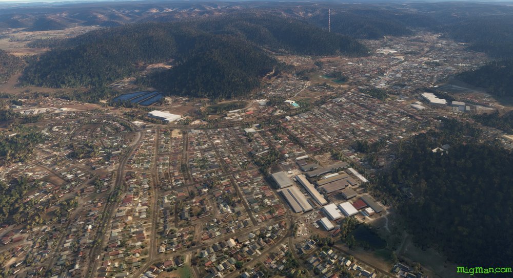
Lithgow
AboutLithgow was the site of Australia's first steel mill and is often considered to be the first country town west of Sydney. There are active mines and power stations nearby.
Fly loosely along the two main routes over the Blue Mountains from Sydney, west along the Great Western Highway and east along Bells Line of Road. It's always worth another flight to the Three Sisters. At the Three Sisters keep a sharp lookout for other traffic, as sightseers often approach along the valley from the west. The Great Western Highway continues past Blackheath and beyond Lithgow. The Hanson Clarence Quarry supplies sand, concrete ingredients and stone. Bells Line of Road passes the popular tourist spots of Mt. Wilson, Mt. Tomah Botanical Gardens and Appin, although they are not particularly easy to pick out from the air.
Australia
location_cityN.S.W. | Sydney & Surrounds
flight_takeoffYSRI RAAF Base Richmond
airline_seat_recline_extraAustralia 1
tagCanyon runs & Mach Loops
tagAiports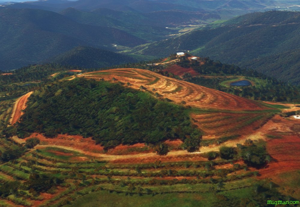
Port Macquarie and Comboyne Plateau
AboutExperience the highs and lows of this fertile region on the NSW coast.
Region: N.S.W. North Coast
Comboyne, population 454, is in the centre of a plateau notable for it's lush landscape and avocado farms.
Wauchope is home to "Timbertown Heritage Theme Park". At 87 acres, it is a sprawling recreation of the pioneering days of the timber industry in Australia. IT features a working steam train and blacksmiths.
Entire route: 70 nm Return flights. 12 nm: WP 7: Wauchope | 24 nm: WP 2: Laurieton and Queens Lake | 46 nm: WP 5: Comboyne
Australia
location_cityN.S.W. | North Coast
flight_takeoffYPMQ Port Macquarie
airline_seat_recline_extraAustralia 1
tagBridges
tagCoastal flight
tagCanyon runs & Mach Loops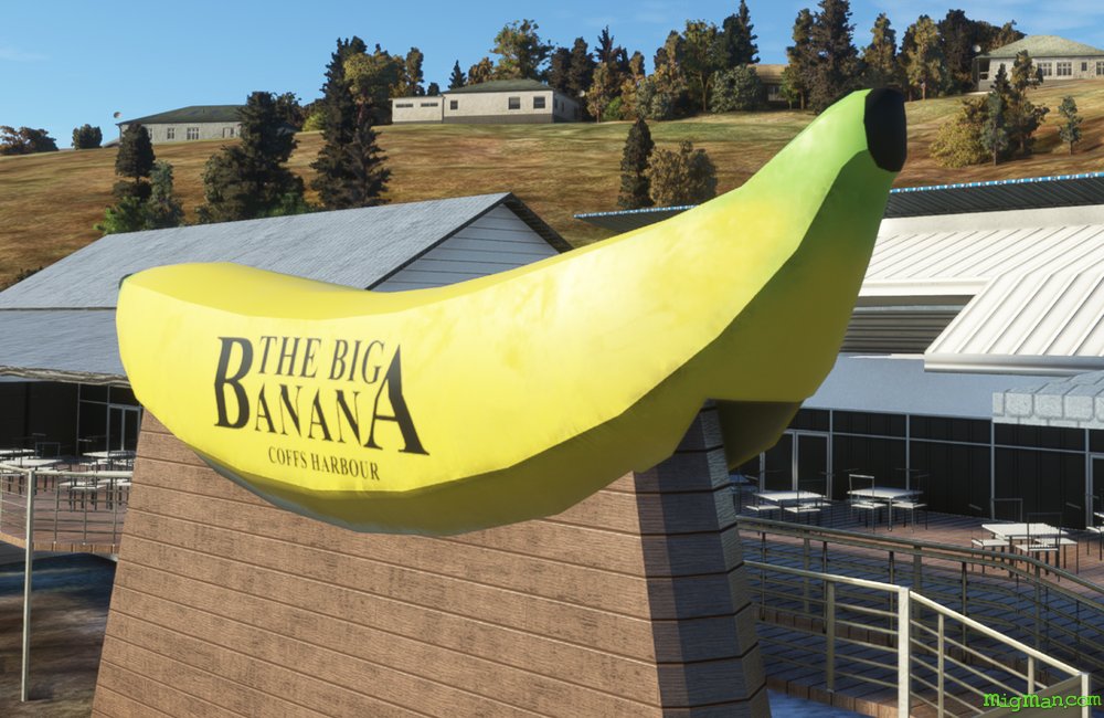
Coffs Harbour, Big Banana and Dorrigo
AboutFly out of Coffs Harbour, south along the coast and then inland to Dorrigo Plateau. Contrast the rugged bushland in the valleys on your right with the lush rolling famlands of the plateau on your left.
The Big Banana was built in 1964 to promote a roadside fruit stall and now hosts the largest water theme park between Sydney (NSW) and the Gold Coast in Queensland.
The Big Banana was built in 1964 to promote a roadside fruit stall and now hosts the largest water theme park between Sydney (NSW) and the Gold Coast in Queensland.
Australia
location_cityN.S.W. | North Coast
flight_takeoffYCFS Coffs Harbour
airline_seat_recline_extraAustralia 1
tagCoastal flight
tagDam spotting
tagCanyon runs & Mach Loops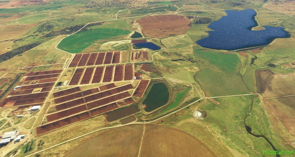
Birthplace of Australia
AboutTenterfield is where, in 1889, Sir Henry Parkes made a famous speech calling for Australia's federation, which became a reality in 1901. Today Tenterfield is in beef country and famous for it's fine wineries.
Rangers Valley was established in on the lush New England Tablelands 1839 by Oswald Bloxsome who had arrived in Sydney from the United Kingdom ten years before. Today it runs 40,000 cattle on the 12,000 acre property under the ownership of Marubeni and supplies grain fed Wagyu beef to the Japanese market.
Glenyon Dam, which feeds into Pike Creek and thence the New England Tablelands, is just across the border in Queensland and covers a massive 1,295 km2.
Australia
location_cityN.S.W. | New England North West
flight_takeoffYGLI Glen Innes
airline_seat_recline_extraAustralia 2
tagBorder Patrol
tagDam spotting
tagCanyon runs & Mach Loops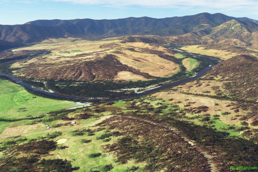
Mann and Boyd River Valleys
AboutCheck out a few of the spectacular valleys in the Great Dividing Range, to the east of the Northern Tablelands.
The Mann River and Boyd Rivers run all year and are part of the Clarence River catchment.
The Mann River and Boyd Rivers run all year and are part of the Clarence River catchment.
Australia
location_cityN.S.W. | New England North West
flight_takeoffYGLI Glen Innes
airline_seat_recline_extraAustralia 2
tagCanyon runs & Mach Loops
Inverell, Sapphire City
AboutSitting astride the Macintyre River, Inverell has been a source of diamonds and sapphires from the mid 19v onwards.
Nowadays the main activities are tourism and a variety of crop cultivation.
Nowadays the main activities are tourism and a variety of crop cultivation.
Australia
location_cityN.S.W. | New England North West
flight_takeoffYIVL Inverell
airline_seat_recline_extraAustralia 2
tagCanyon runs & Mach Loops
tagAiports
Oxley Wild River Gorges
AboutExplore the Oxley Wild Rivers National Park to the east of Armidale. Armidale is the Northern Tablelands administrative centre, about halfway between Sydney and Brisbane and also home to the University of New England.
Oxley Wild Rivers National Park covers 1,452 km2 of extremely rugged rainforest covered terrain. Get your first glimpse of the spectacular gorges at the town of Hillgrove, and then Wollomombi Falla and Oakey River Dam. These three spots are all on the northern end of valley which are just begging to be explored by you!
Waypoints 4,5 and 6 take you down the eastern border of this area, west across the bottom and back up the western border to WP 6. I suggest you explore the wider valleys heading south and then climb to about 7,000 ft at WP 4 and enjoy the view from above. But, the world is your oyster so just go for it! Of course at anytime you can curtail your exploration and head back to Armidale.
Australia
location_cityN.S.W. | New England North West
flight_takeoffYARM Armidale
airline_seat_recline_extraAustralia 2
tagBorder Patrol
tagDam spotting
tagCanyon runs & Mach Loops
Tamworth’s Valleys
AboutEnjoy the of lush river valleys to the south east of Australia's Capital of Country Music: Tamworth.
Tamworth YSTW is one of the few airports in the New England region with a control tower amd two parallel runways.
Entire route: 77 nm
Shorter return flights: 5 nm to WP 1, 200 yds S of Australia's largest guitar: 'The Big Golden Guitar'.'The Big Golden Guitar', which is currently down for maintenance. But watch that space!
6 nm to WP 5 Flagstaff Mountain
40 nm to Woolomin Airport YWOM, about 1.6 nm N of Chaffey Dam at WP 3
Tamworth YSTW is one of the few airports in the New England region with a control tower amd two parallel runways.
Entire route: 77 nm
6 nm to WP 5 Flagstaff Mountain
40 nm to Woolomin Airport YWOM, about 1.6 nm N of Chaffey Dam at WP 3
Australia
location_cityN.S.W. | New England North West
flight_takeoffYSTW Tamworth
airline_seat_recline_extraAustralia 2
tagDam spotting
tagCanyon runs & Mach Loops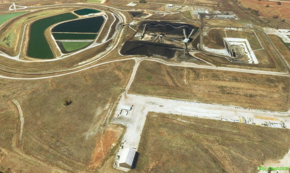
Narrabri's Massive Mines
AboutWhitehaven runs about 11 coal mining operations in the region. On this flight check out the Whitehaven, Boggabri and Maules Creek locations.
Australia
location_cityN.S.W. | New England North West
flight_takeoffYNBR Narrabri
airline_seat_recline_extraAustralia 2
tagCanyon runs & Mach Loops
Mudgee, Nest in the Hills
AboutMudgee is a favourite 'get-away' spot for Sydney-siders, being about a 3 1/2 hour drive and boasting many wineries and restaurants. Mudgee means 'nest in the hills' in Aboriginal.
Australia's transition to decimal currency happened in 1966 and Gulgong, birthplace of poet Henry Lawson, was featured on the $10 note. Gulgong is also home to Prince of Wales Opera House, Australia's first, built in 1871. Gulgong means 'deep waterhole' in Aboriginal.
Australia's transition to decimal currency happened in 1966 and Gulgong, birthplace of poet Henry Lawson, was featured on the $10 note. Gulgong is also home to Prince of Wales Opera House, Australia's first, built in 1871. Gulgong means 'deep waterhole' in Aboriginal.
Australia
location_cityN.S.W. | Central West & Orana
flight_takeoffYMDG Mudgee
airline_seat_recline_extraAustralia 2
tagBridges
tagDam spotting
tagCanyon runs & Mach Loops
Mighty Murray & Murrumbidgee
AboutFly past the two longest rivers on the mighty Australian continent. The Murray defines most of the border between NSW and Victoria and runs to 1,558 miles with the Murrumbidgee coming in a close second at 923 miles. OK, not that close perhaps, but definetely getting a silver in the river Olympics!
Australia
location_cityN.S.W. | Far West
flight_takeoffYBRN Balranald
airline_seat_recline_extraAustralia 3
tagBorder Patrol
tagBridges
tagCanyon runs & Mach Loops
Escape from Cowra
AboutIn 1944 more than 1,000 Japanese POWs broke out of Cowra Prisoner of War camp, the site of the largest POW breakout in Australian and British history. 231 Japanese died in the incident and 4 Australians. Today Cowra is known for it's vineyards, livestock and vegetables. The POW camp site is preserved with a few structures and the visitor information centre has a scale model and audio visual presentations.
Australia
location_cityN.S.W. | Central West & Orana
flight_takeoffYCWR Cowra
airline_seat_recline_extraAustralia 3
tagDam spotting
tagCanyon runs & Mach Loops
tagAiports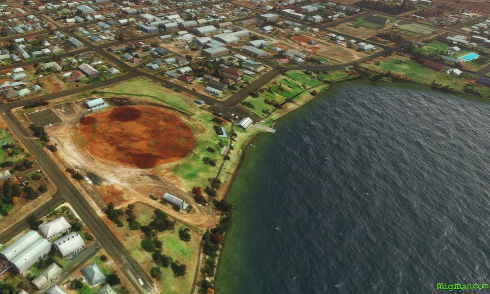
The Songs of Lake Cargelligo
AboutThe combination of wheat and fruit growing in the aread attracts a variety of birds which congregate around the lake. If you sit quietly by the lake you can hear them sing! Lake Cargelligo was first surveyed in 1817 by John Oxley, but didn't attract an appreciable population until gold was discovered by a cook in 1873.
Australia
location_cityN.S.W. | Central West & Orana
flight_takeoffYLCG Lake Cargelligo
airline_seat_recline_extraAustralia 3
tagCanyon runs & Mach Loops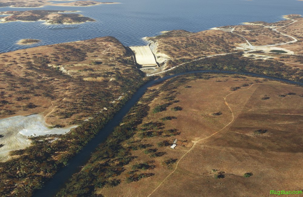
Wellington and Lake Burrendong
AboutDiscovered by John Oxley’s Lachlan River expedition in 1817 at the junction of the Bell and Macquarie Rivers, Wellington is the second oldest New South Wales settlement west of the Blue Mountains. Named after the Duke of Wellington, in 1823 the government established a settlement there with 12 cows and 40 sheep. The colony fell into some disrepair and was revived ten years later by the arrival of Lutheran missionaries. The man-made irrigation reservoir at Lake Burrendong was built over the period 1946-1967 and now holds more than three times the water of Sydney Harbour.
NOTAM: Wellington Airport YWEL runways 13 and 31 are inoperative as of May 2023 due to maintenance.
NOTAM: Wellington Airport YWEL runways 13 and 31 are inoperative as of May 2023 due to maintenance.
Australia
location_cityN.S.W. | Central West & Orana
flight_takeoffYMDG Mudgee
airline_seat_recline_extraAustralia 3
tagDam spotting
tagCanyon runs & Mach Loops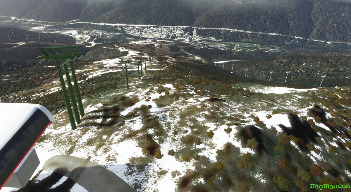
Thredbo, Perisher and Mt Kosciusko
AboutThredbo and Perisher are two of Australia's most popular ski destinations. While not the most dramatic peak, at 7,310 feet Mt Kosciusko is nonetheless Australia's tallest.
Australia
location_cityN.S.W. | South East & Tablelands
flight_takeoffYCOM Cooma
airline_seat_recline_extraAustralia 4
tagCanyon runs & Mach Loops
tagAiports
Dog on the Tuckerbox
AboutThere is a dog on a tucker box, and it's nine miles out of Gundagai. The statue was first erected in 1926, and it is a tribute to the life of a 'bullocky', a bloke who steers a team of bulls who pull a bullock dray, usually laden with timber. This is the job my grandfather started at age 13. A 'tucker box' is a food container.
Australia
location_cityN.S.W. | Riverina Murray
flight_takeoffYTMU Tumut
airline_seat_recline_extraAustralia 4
tagBridges
tagDam spotting
tagCanyon runs & Mach Loops
From Valley to Reef
AboutTake a tour of this modestly sized island nation in the eastern Carribean and it's neighbouring reef.
 Anguilla
location_cityThe Valley
flight_takeoffTQPF Wallblake
airline_seat_recline_extraCaribbean 1
tagCanyon runs & Mach Loops
Anguilla
location_cityThe Valley
flight_takeoffTQPF Wallblake
airline_seat_recline_extraCaribbean 1
tagCanyon runs & Mach Loops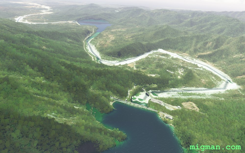
Santo Domingo NW: Dam Spotting
AboutExplore the lush valleys and go dam-spotting to the north west of the Dominican Republic's capital Santo Domingo.
53 nm: Fly across Santo Domingo to WP 1, return along the coast via WP 8,9,10
72 nm: Fly across Santo Domingo to WP 1, 2 dams at WP 6, return along the coast via WP 7,8,9,10
130 nm: Entire route
53 nm: Fly across Santo Domingo to WP 1, return along the coast via WP 8,9,10
72 nm: Fly across Santo Domingo to WP 1, 2 dams at WP 6, return along the coast via WP 7,8,9,10
130 nm: Entire route
 Dominican Republic
location_citySanto Domingo
flight_takeoffMDSD Las Americas
airline_seat_recline_extraCaribbean 2
tagAiports
tagDam spotting
tagCanyon runs & Mach Loops
Dominican Republic
location_citySanto Domingo
flight_takeoffMDSD Las Americas
airline_seat_recline_extraCaribbean 2
tagAiports
tagDam spotting
tagCanyon runs & Mach Loops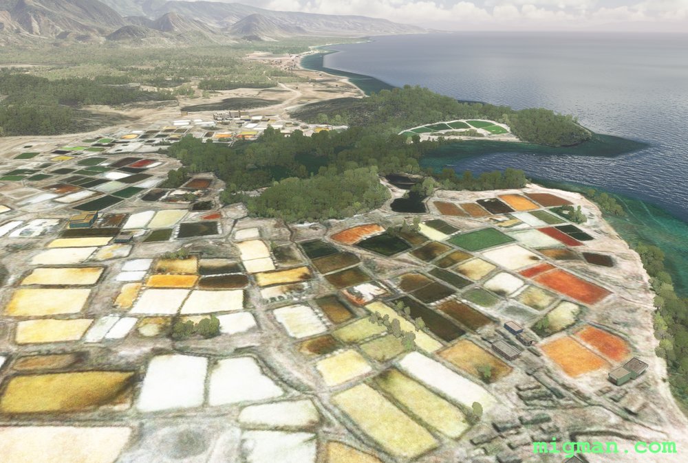
The Colours of Nan Fort
AboutFly from Cap Haitien on Haiti's north coast to the westernmost point on the island, about 45 west of Cuba. Start by flying west over the rugged terrain of the Gros-Morne Arrondissement (adminstrative area), Nan Palmiste, then follow the spectacular coastline south and east back to Gonaives.
Return trips: 68 nm: Gonaives | 101 nm: Gonaives and Nan Fort | 162 nm: Entire route
Return trips: 68 nm: Gonaives | 101 nm: Gonaives and Nan Fort | 162 nm: Entire route
 Haiti
location_cityCap Haitien
flight_takeoffMTCH Cap Haitien
airline_seat_recline_extraCaribbean 3
tagCoastal flight
tagCanyon runs & Mach Loops
Haiti
location_cityCap Haitien
flight_takeoffMTCH Cap Haitien
airline_seat_recline_extraCaribbean 3
tagCoastal flight
tagCanyon runs & Mach Loops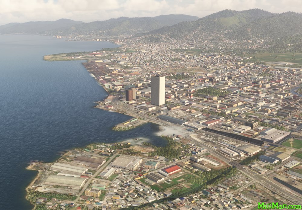
Trinidad North West
AboutJust off the north coast of Venezuela lay the islands of Trinidad and Tobago, one of the larger island chains in the West Indies. Fly out out of Piarco International Airport TTPP 10,457, across the the capital Port of Spain, explore the north east coast of Trinidad and return across the east to west mountain range.
NOTAM: At Chacachacare. Venezuela is visible 5 nautical miles to the west across Bocas del Dragon.
Round trips: 58 nm: At WP 5 Diego Martin, turn south and follow the valley south for 5nm to WP 2 - Intersection at Fort George then return to Piarco airport. 70 nm plus: Explore the north east coast: Fly directly to WP 6, follow the coast to the east. At the most easterly point turn south and follow the coast. When ready, return via WP 7 or directly to Piarco airport. 72 nm: Entire route
 Trinidad and Tobago
location_cityTrinidad
flight_takeoffTTPP Piarco
airline_seat_recline_extraCaribbean 4
tagCoastal flight
tagCanyon runs & Mach Loops
Trinidad and Tobago
location_cityTrinidad
flight_takeoffTTPP Piarco
airline_seat_recline_extraCaribbean 4
tagCoastal flight
tagCanyon runs & Mach Loops
Eastern Abkhazia
AboutExplore the eastern and northern borders with Georgia and return via the capital, Sokhumi. This flight covers almost the entire eastern half of the country, mountains on the border with Georgia and the coast from the capital Sokhumi back to Babushara.
 Abkhazia
location_citySokhumi
flight_takeoffUGSS Babushara
airline_seat_recline_extraEurope 1
tagCanyon runs & Mach Loops
tagCoastal flight
tagMountain climbing
Abkhazia
location_citySokhumi
flight_takeoffUGSS Babushara
airline_seat_recline_extraEurope 1
tagCanyon runs & Mach Loops
tagCoastal flight
tagMountain climbing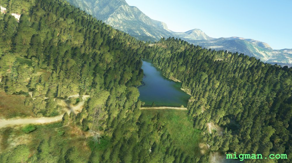
Hidden Dam
AboutExplore the valleys east of the capital, Tirana.
 Albania
location_cityTirana
flight_takeoffLATI Tirana
airline_seat_recline_extraEurope 1
tagCanyon runs & Mach Loops
tagDam spotting
Albania
location_cityTirana
flight_takeoffLATI Tirana
airline_seat_recline_extraEurope 1
tagCanyon runs & Mach Loops
tagDam spotting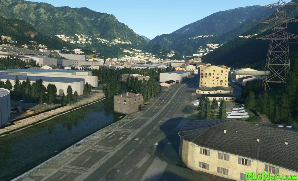
Kingdom in the Valley
AboutMost of the urban areas in Andorra are situated on the valley floors. Fly past the capital Andorra la Vella and return via broad valleys just over the border with Spain. Andorra lacks an airport, so we take off from the nearest which is La Seu d’Urgell LESU at Catalonia in Spain, just 6 nm S of the border. LESU is a spectacular airport in it's own right, being positioned on a plateau.
 Andorra
location_cityAndorra la Vella
flight_takeoffLESU La Seu d’Urgell
airline_seat_recline_extraEurope 1
tagBorder Patrol
tagCanyon runs & Mach Loops
Andorra
location_cityAndorra la Vella
flight_takeoffLESU La Seu d’Urgell
airline_seat_recline_extraEurope 1
tagBorder Patrol
tagCanyon runs & Mach Loops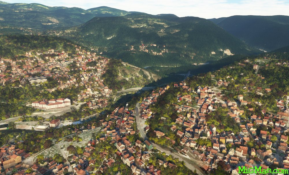
Sarajevo Valleys
AboutExplore the valleys around the capital, Sarajevo.
 Bosnia Herzegovina
location_citySarajevo
flight_takeoffLQSA Sarajevo
airline_seat_recline_extraEurope 1
tagBridges
tagCanyon runs & Mach Loops
Bosnia Herzegovina
location_citySarajevo
flight_takeoffLQSA Sarajevo
airline_seat_recline_extraEurope 1
tagBridges
tagCanyon runs & Mach Loops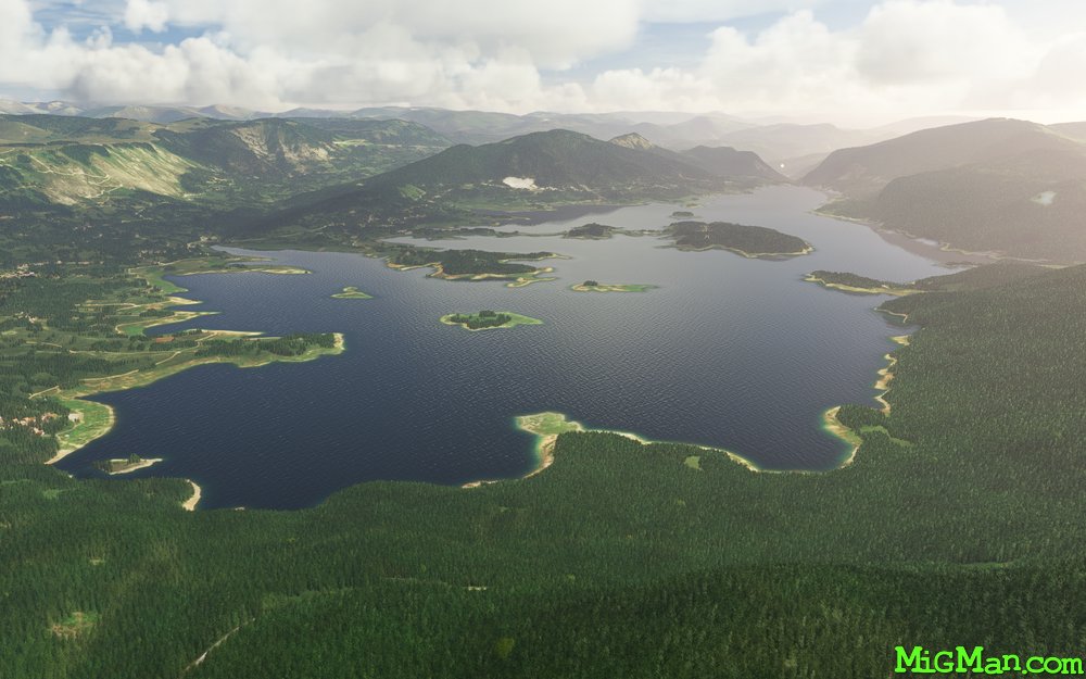
Sarajevo Cross Country
AboutAn exciting canyon run along two gorgeous mountain lakes.
Bosnia Herzegovina
location_citySarajevo
flight_takeoffLQSA Sarajevo
airline_seat_recline_extraEurope 1
tagCanyon runs & Mach Loops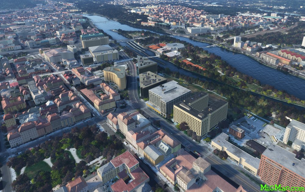
Prague's North West Energy
AboutCheck out the vast energy extraction and storage and operations on the plains north west of Prague. At WP 1, Nova Ves, note the large POL storage facility on the left just before the town (CTR MERO Nelahozeves), and the large solar panel installation on the right. Beyond the mountain range north-west of WP 3,4,5 lays Germany.
 Czech Republic
location_cityPrague
flight_takeoffLKKB Kbely
airline_seat_recline_extraEurope 2
tagCanyon runs & Mach Loops
tagAiports
Czech Republic
location_cityPrague
flight_takeoffLKKB Kbely
airline_seat_recline_extraEurope 2
tagCanyon runs & Mach Loops
tagAiports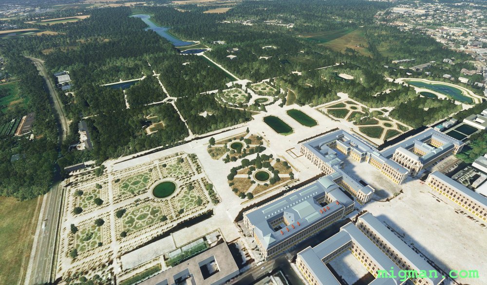
Versailles and the French Revolution
AboutFly over the enormous grounds of the Palace of Versailles and then across the southern half of central Paris.
 France
location_cityVersailles
flight_takeoffLFPN Toussus-Le-Noble
airline_seat_recline_extraEurope 2
tagCanyon runs & Mach Loops
tagAiports
France
location_cityVersailles
flight_takeoffLFPN Toussus-Le-Noble
airline_seat_recline_extraEurope 2
tagCanyon runs & Mach Loops
tagAiports
Tblisi Heights
AboutGet two perspectives on Georgia's capital Tblisi, as you fly along the towering ridge to the north and return at ground level along the Mtkvari River.
 Georgia
location_cityTblisi
flight_takeoffUGTB Lochini
airline_seat_recline_extraEurope 2
tagCanyon runs & Mach Loops
tagAiports
Georgia
location_cityTblisi
flight_takeoffUGTB Lochini
airline_seat_recline_extraEurope 2
tagCanyon runs & Mach Loops
tagAiports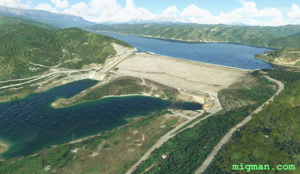
Ioannina to Pournari Dam
AboutExplore the rugged terrain to the south of Ioannina, in central west Greece.
 Greece
location_cityIoannina
flight_takeoffLGIO Ioannina
airline_seat_recline_extraEurope 2
tagBridges
tagDam spotting
tagCanyon runs & Mach Loops
Greece
location_cityIoannina
flight_takeoffLGIO Ioannina
airline_seat_recline_extraEurope 2
tagBridges
tagDam spotting
tagCanyon runs & Mach Loops
Cephalonian Idyll
AboutExplore the dramatic coastline of Cephalonia, one of the largest Greek islands, SW of the mainland. Cephalopoda are the class of molluscs which include squid and octopus, delicacies famous in Greek cuisine.
Greece
location_cityCephalonia
flight_takeoffLGKF Kefallinia
airline_seat_recline_extraEurope 2
tagCoastal flight
tagCanyon runs & Mach Loops
North of Nice
AboutExplore a few of the magnificent valleys north of Nice. The first two legs of this flight are valley runs, the third is a ridge-hopper. Great flight for a fast jet.
France
location_cityNice
flight_takeoffLFMN Nice Cote d’Azur
airline_seat_recline_extraEurope 3
tagBridges
tagCanyon runs & Mach Loops
tagAiports
Liechtenstein Border Patrol
AboutLiechtenstein is a small European country about 12 miles by 6 miles in size, and nestled between Switzerland and Austria. We fly out of Altenrhein airport, about 12 miles to the north on Lake Constance, Switzerland. The southern leg follows the border along the Rhine river, and the return leg turns on four peaks in the Alps.
There don’t seem to be any structures along this border (why would there be, as it is so inaccessible), but at the end of the flight you will be able to proudly assert that you are one of the brave few that have flown the Liechtenstein Border!
There don’t seem to be any structures along this border (why would there be, as it is so inaccessible), but at the end of the flight you will be able to proudly assert that you are one of the brave few that have flown the Liechtenstein Border!
 Liechtenstein
location_cityVaduz
flight_takeoffLSZR Altenrhein
airline_seat_recline_extraEurope 3
tagBorder Patrol
tagBridges
tagCanyon runs & Mach Loops
Liechtenstein
location_cityVaduz
flight_takeoffLSZR Altenrhein
airline_seat_recline_extraEurope 3
tagBorder Patrol
tagBridges
tagCanyon runs & Mach Loops
Luxembourg, Luxembourg
AboutFly up the Alzette River Valley to the north of Luxembourg. Visit the Goodyear tyre testing facility and land at a grass airstrip if you are game? At the border with Belgium you'll see a large car recharging station which is presumably powered by the windmills adjacent? Finally fly back across the centre of town where medieval fortresses sit protected by natural moats.
 Luxembourg
location_cityLuxembourg
flight_takeoffELLX Luxembourg
airline_seat_recline_extraEurope 3
tagAiports
tagBridges
tagCanyon runs & Mach Loops
Luxembourg
location_cityLuxembourg
flight_takeoffELLX Luxembourg
airline_seat_recline_extraEurope 3
tagAiports
tagBridges
tagCanyon runs & Mach Loops
Skopje local
AboutSkopje, capital of Macedonia is situated in a broad and pleasant valley. Fly over the city and if you are game, attempt a landing at the grass strip to the NW at WP 5, which you will fly over as you turn right from WP 4. For an entertaining look at their most famous citizen watch the movie "Alexander", directed by Oliver Stone.
 Macedonia
location_citySkopje
flight_takeoffLWSK Skopje
airline_seat_recline_extraEurope 3
tagBridges
tagCanyon runs & Mach Loops
Macedonia
location_citySkopje
flight_takeoffLWSK Skopje
airline_seat_recline_extraEurope 3
tagBridges
tagCanyon runs & Mach Loops
Chinisau and Lake Ghidighici
AboutEnjoy the bucolic rolling terrain around Chisinau, capital of the former Soviet Republic of Moldova.
 Moldova
location_cityChisinau
flight_takeoffLUKK Chisinau
airline_seat_recline_extraEurope 3
tagCanyon runs & Mach Loops
Moldova
location_cityChisinau
flight_takeoffLUKK Chisinau
airline_seat_recline_extraEurope 3
tagCanyon runs & Mach Loops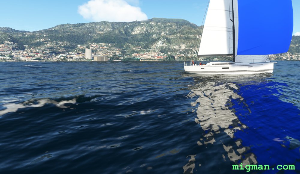
Enchantment, thou name ist Monaco
AboutProbably the most enchanting coastline I've seen yet! This flight begins and ends in France, as Monaco has a shoreline of just 2.7 nm and no airport.
 Monaco
location_cityMonaco
flight_takeoffLFMN Nice Cote d’Azur
airline_seat_recline_extraEurope 3
tagBridges
tagCoastal flight
tagCanyon runs & Mach Loops
Monaco
location_cityMonaco
flight_takeoffLFMN Nice Cote d’Azur
airline_seat_recline_extraEurope 3
tagBridges
tagCoastal flight
tagCanyon runs & Mach Loops
Podgorica Valley Run
AboutTake off from the capital of Montenegro and explore the mountains to the NE.
-/o\- CLASSIFIED: FOR YOUR EYES ONLY: You will enter Albanian airspace at WP 4. Fly at low altitude down the valley to WP 7 and take as many photos as possible, particularly looking for air defence facilities. If you are intercepted by the Albanian air force, just pretend you got lost! -/o\-
-/o\- CLASSIFIED: FOR YOUR EYES ONLY: You will enter Albanian airspace at WP 4. Fly at low altitude down the valley to WP 7 and take as many photos as possible, particularly looking for air defence facilities. If you are intercepted by the Albanian air force, just pretend you got lost! -/o\-
 Montenegro
location_cityPodgorica
flight_takeoffLYPG Podgorica
airline_seat_recline_extraEurope 3
tagCanyon runs & Mach Loops
tagAiports
Montenegro
location_cityPodgorica
flight_takeoffLYPG Podgorica
airline_seat_recline_extraEurope 3
tagCanyon runs & Mach Loops
tagAiports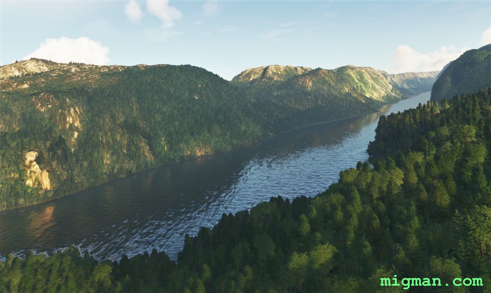
Pining for the Fjords
AboutThis is quite a long flight at 100nm. In essence it's very simple, flying along two almost parallel fjords. NE for 20nm along the first and SW for 25 nm along the second.
Note: Be aware that the water in these fjords is above sea level. At the city of Tao the land is about 500ft and the water beyond around 300ft.
Note: Be aware that the water in these fjords is above sea level. At the city of Tao the land is about 500ft and the water beyond around 300ft.
 Norway
location_cityStavanger
flight_takeoffENZV Sola
airline_seat_recline_extraEurope 3
tagDam spotting
tagCanyon runs & Mach Loops
Norway
location_cityStavanger
flight_takeoffENZV Sola
airline_seat_recline_extraEurope 3
tagDam spotting
tagCanyon runs & Mach Loops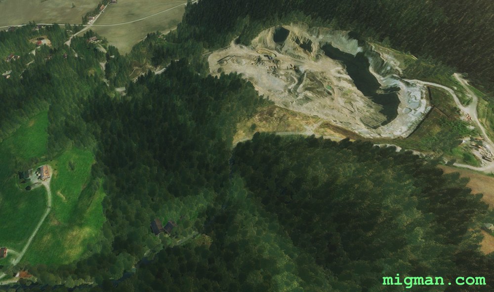
Seeking the Quarry
AboutFans of the EF2000 sim family from the 1990's will remember the sound of the Trondheim radio operator. The terrain in that sim was advanced for it's time and now we get to see what this part of Norway really looks like.
Turns out there are a lot of quarries!
Turns out there are a lot of quarries!
Norway
location_cityTrondheim
flight_takeoffENVA Vaernes
airline_seat_recline_extraEurope 3
tagCanyon runs & Mach Loops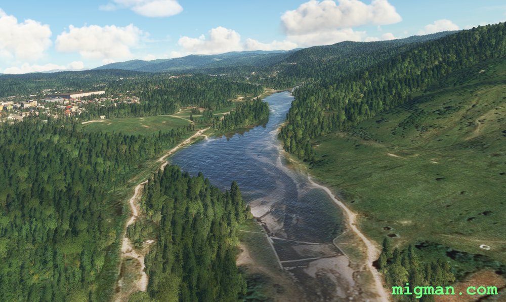
Bucharest Valley Run
AboutTake a longer flight along two of the many picturesque valleys north of Bucharest.
 Romania
location_cityBucharest
flight_takeoffLRBS Baneasa
airline_seat_recline_extraEurope 3
tagBridges
tagDam spotting
tagCanyon runs & Mach Loops
Romania
location_cityBucharest
flight_takeoffLRBS Baneasa
airline_seat_recline_extraEurope 3
tagBridges
tagDam spotting
tagCanyon runs & Mach Loops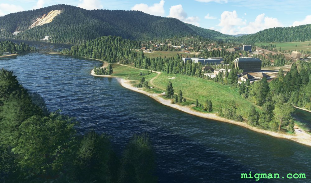
Kosice and Presov Regions
AboutKosice is the second largest city in Slovakia. Fly over Kosice and follow the motorways in a counterclockwise direction until you reach the large dam at Ruzin.
 Slovakia
location_cityKosice
flight_takeoffLZKZ Kosice
airline_seat_recline_extraEurope 4
tagDam spotting
tagCanyon runs & Mach Loops
Slovakia
location_cityKosice
flight_takeoffLZKZ Kosice
airline_seat_recline_extraEurope 4
tagDam spotting
tagCanyon runs & Mach Loops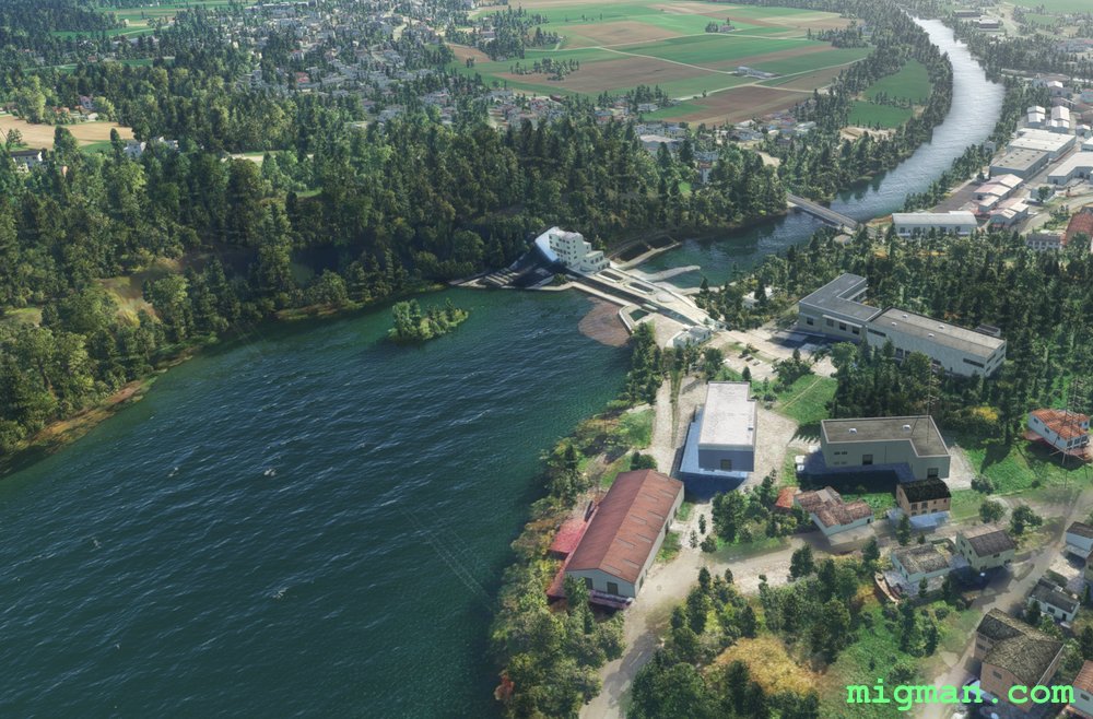
Ljubljana Local
AboutExplore the idyllic valley setting of Ljubljana, capital of Slovakia.
Start at Kranj, 3 nm W of the airport. Proceed HDG 148 for 12 nm, following the river and the parallel main road. WP 3 is a prominent landmark, a medieval hilltop fortress Ljubljanski Grad with a commanding view of Ljubljana.
Orbit over Ljubljana until you run out of film, then head up the western valley to Duplica, where you can stock up on film at the enormous shopping mall!
 Slovenia
location_cityLjubljana
flight_takeoffLJLJ Ljubljana Joze Pucnik
airline_seat_recline_extraEurope 4
tagBridges
tagCanyon runs & Mach Loops
Slovenia
location_cityLjubljana
flight_takeoffLJLJ Ljubljana Joze Pucnik
airline_seat_recline_extraEurope 4
tagBridges
tagCanyon runs & Mach Loops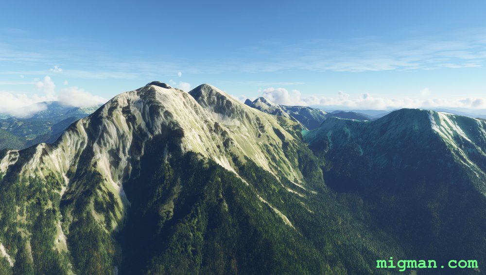
Ljubljana Highs and Lows
AboutTake a cross country jaunt past the two highest peaks in the region and return along two charming and broad valleys.
The flight can be broken into two stages:
WP 1 - WP 4: Climb to about 8,500 feet and fly E
WP 5 - WP 8: Follow the main road W along the valley floors.
The flight can be broken into two stages:
WP 1 - WP 4: Climb to about 8,500 feet and fly E
WP 5 - WP 8: Follow the main road W along the valley floors.
Slovenia
location_cityLjubljana
flight_takeoffLJLJ Ljubljana Joze Pucnik
airline_seat_recline_extraEurope 4
tagCanyon runs & Mach Loops
Frankenstein and the Valkyries
AboutFly over Lake Lucerne, where Mary Shelley conceived Frankenstein and Richard Wagner's ubermensch took flight in the Ring cycle.
 Switzerland
location_cityBuochs
flight_takeoffLSZC Buochs
airline_seat_recline_extraEurope 4
tagCanyon runs & Mach Loops
Switzerland
location_cityBuochs
flight_takeoffLSZC Buochs
airline_seat_recline_extraEurope 4
tagCanyon runs & Mach Loops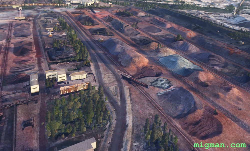
Cardiff Cross Country
AboutCardiff is the capital of Wales. The famed 'Mach Loop' of military training fame is about 100 nm north of Cardiff, but this flight has a similar feel about it. It can be regarded as having three legs:
1. Take the valleys north of Cardiff to Llwyn-on Reservoir | WP1-4
2. West to Swansea | WP 5-6
3. Follow the coast back to Cardiff | WP 7
1. Take the valleys north of Cardiff to Llwyn-on Reservoir | WP1-4
2. West to Swansea | WP 5-6
3. Follow the coast back to Cardiff | WP 7
 United Kingdom
location_cityCardiff
flight_takeoffEGFF Cardiff
airline_seat_recline_extraEurope 4
tagCoastal flight
tagDam spotting
tagCanyon runs & Mach Loops
United Kingdom
location_cityCardiff
flight_takeoffEGFF Cardiff
airline_seat_recline_extraEurope 4
tagCoastal flight
tagDam spotting
tagCanyon runs & Mach Loops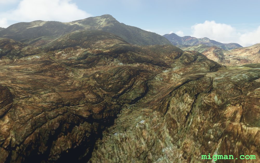
Sinai Peninsula: Mount Catherine
AboutFly out of St Catherine on the Sinai Peninsula and visit Mount Catherine (Gabal Katrine) at 2,629 m (8,625 ft), the highest mountain in Egypt.
NOTAM: 24 nm: Mount Catherine at WP 4 | 83 nm: Entire route including two valley runs. Airport elev. 4,333 ft
EASTER EGG: About 11.6 nm past WP5 there appears to be a crash site to the right of track.
NOTAM: 24 nm: Mount Catherine at WP 4 | 83 nm: Entire route including two valley runs. Airport elev. 4,333 ft
EASTER EGG: About 11.6 nm past WP5 there appears to be a crash site to the right of track.
 Egypt
location_citySaint Catherine
flight_takeoffHESC Saint Catherine
airline_seat_recline_extraMiddle East 1
tagCanyon runs & Mach Loops
Egypt
location_citySaint Catherine
flight_takeoffHESC Saint Catherine
airline_seat_recline_extraMiddle East 1
tagCanyon runs & Mach Loops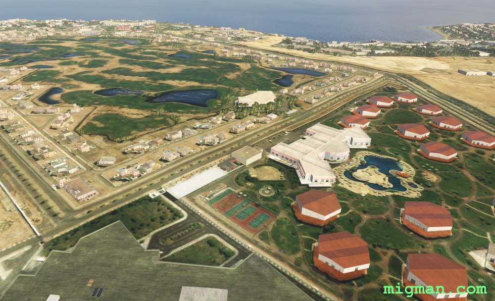
Sinai Peninsula: Sharm El-Sheikh Resorts
AboutFly out of Sharm El-Sheikh International on the Sinai Peninsula at the entrance to the Gulf of Aqaba. Check out the local resorts and then fly overland to the southern entrance to the Gulf of Suez.
NOTAM: 16 nm: Fly to the El Fanar Beach and return 83 nm: Entire route
NOTAM: 16 nm: Fly to the El Fanar Beach and return 83 nm: Entire route
Egypt
location_citySharm El-Sheikh
flight_takeoffHESH Sharm El-Sheikh
airline_seat_recline_extraMiddle East 1
tagCanyon runs & Mach Loops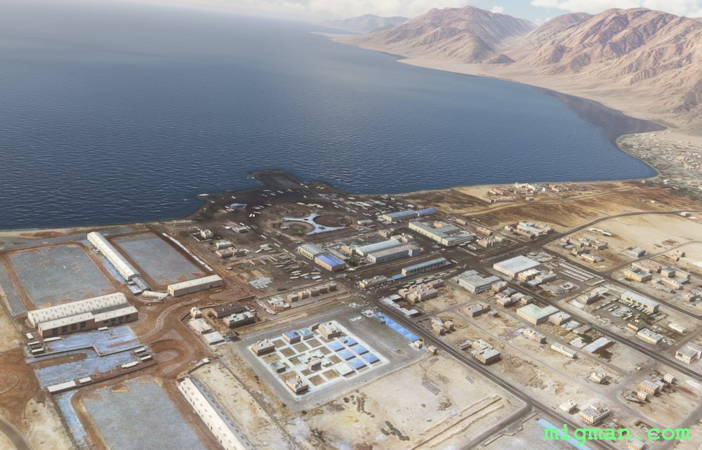
Gulf of Aqaba: Taba to Nuweibaa Port
AboutCheck out the many resorts on the Gulf of Aqaba as you fly out of Taba International on the Sinai Peninsula. This flight is I-Follow-Coasts down to Nuweibaa Port. On the return leg enjoy I-Follow-Roads, along the solitary winding road as it passes through mountains and then across the desert.
At Taba, on the left, you can see Pharaoh's Island, with the ruins of Salah El Din Citadel.
NOTAM: 20 nm: Fly to Taba
87 nm: Entire route
At Taba, on the left, you can see Pharaoh's Island, with the ruins of Salah El Din Citadel.
NOTAM: 20 nm: Fly to Taba
87 nm: Entire route
Egypt
location_cityTaba
flight_takeoffHETB Taba
airline_seat_recline_extraMiddle East 1
tagAiports
tagDam spotting
tagCanyon runs & Mach Loops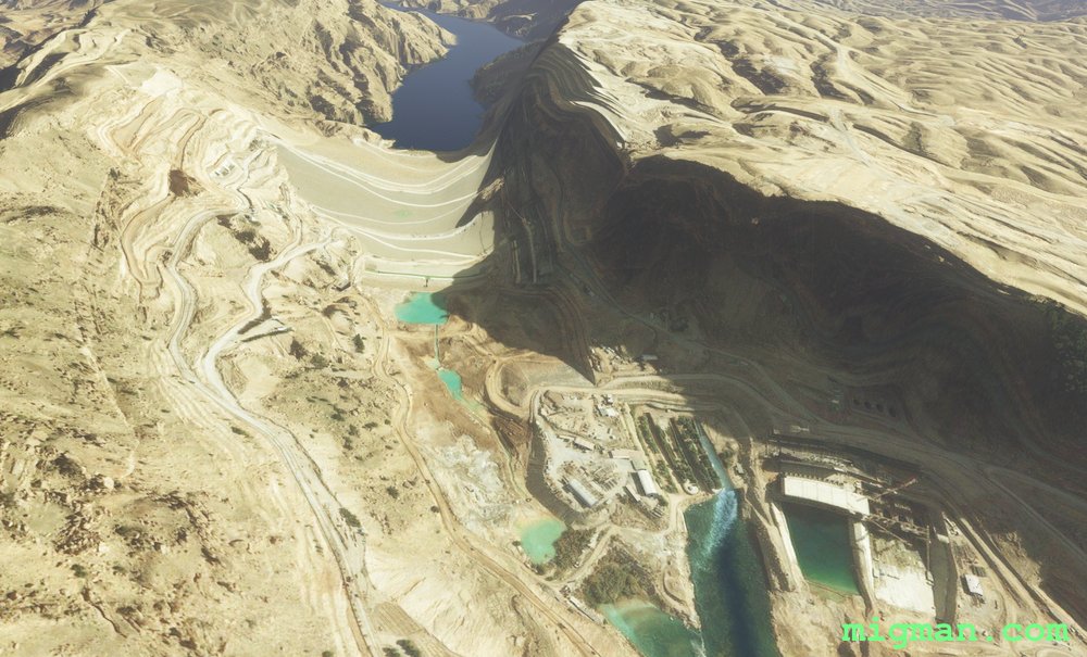
Karun River Gorge
AboutFollow the steep gorges along the Karun River from Karun to Abbaspur Dam. Continue deep into the valleys and then climb back to the west to spot the third dam near Anbar.
At WP 7 you can optionally fly slightly east of track to follow the Karun river back to Masjed Soleyman.
10 nm: Fly S for 5 nm from the airport for a local flight over Masjed Soleyman | 98 nm: Entire route
At WP 7 you can optionally fly slightly east of track to follow the Karun river back to Masjed Soleyman.
10 nm: Fly S for 5 nm from the airport for a local flight over Masjed Soleyman | 98 nm: Entire route
 Iran
location_cityMasjed Soleyman
flight_takeoffOIAI Masjed Soleiman
airline_seat_recline_extraMiddle East 1
tagDam spotting
tagCanyon runs & Mach Loops
Iran
location_cityMasjed Soleyman
flight_takeoffOIAI Masjed Soleiman
airline_seat_recline_extraMiddle East 1
tagDam spotting
tagCanyon runs & Mach Loops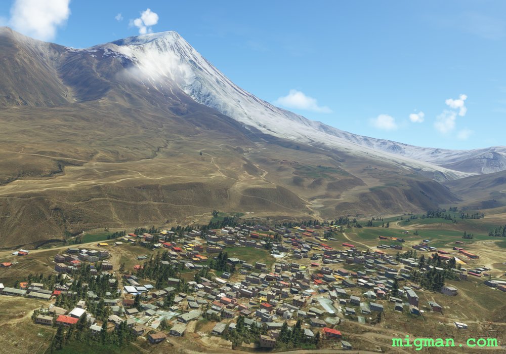
Mount Damavand
AboutAt 18,400 ft Mount Damavand, located about 30 nm NE of Tehran, is both one of the highest the highest peaks and the highest volcano in Asia. It features prominently in Persian folklore.
The flight plan mixes valley runs with ridge hopping and WP 4-8 take you around the base of Mt Damavand. The ridgelines and valleys around Mt Damavand in particular are spectacular so take plenty of polaroids.
NOTAM: RWY ALT is 3,281 ft. The ground rises steeply to the north.
The flight plan mixes valley runs with ridge hopping and WP 4-8 take you around the base of Mt Damavand. The ridgelines and valleys around Mt Damavand in particular are spectacular so take plenty of polaroids.
NOTAM: RWY ALT is 3,281 ft. The ground rises steeply to the north.
Iran
location_cityTehran
flight_takeoffOIII Mehrabad
airline_seat_recline_extraMiddle East 1
tagDam spotting
tagCanyon runs & Mach Loops
tagVolcano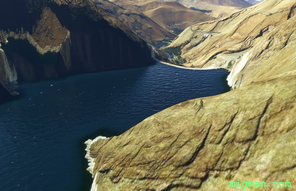
Amir Kabir Dam
AboutExplore the valleys to the north of Iran's capital, Tehran as you visit Amir Kabir Dam. Exercise caution between WP 6 and WP 7 as the valley is both narrow and meandering.
NOTAM: RWY ALT is 3,281 ft. The ground rises steeply to the north.
NOTAM: RWY ALT is 3,281 ft. The ground rises steeply to the north.
Iran
location_cityTehran
flight_takeoffOIII Mehrabad
airline_seat_recline_extraMiddle East 1
tagDam spotting
tagCanyon runs & Mach Loops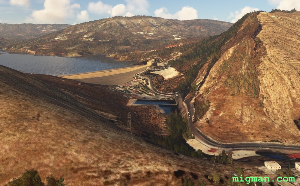
Mosul and Duhok Dams
AboutThe first two legs to the Mosul Dam make a nice 50nm flight.
Either fly in a straight line to WP 1, or you can take a leisurely flight along the Tigris River in the shade of the palms.
If you have the time or the available speed, carry on to a second dam at Duhok and return through the lush valleys found in this part of northern Iraq.
Following the road after WP 3 will take you slightly S of the track and set you up nicely to fly through the gap in the range to Duhok Dam.
 Iraq
location_cityMosul
flight_takeoffORBM Mosul
airline_seat_recline_extraMiddle East 1
tagDam spotting
tagCanyon runs & Mach Loops
Iraq
location_cityMosul
flight_takeoffORBM Mosul
airline_seat_recline_extraMiddle East 1
tagDam spotting
tagCanyon runs & Mach Loops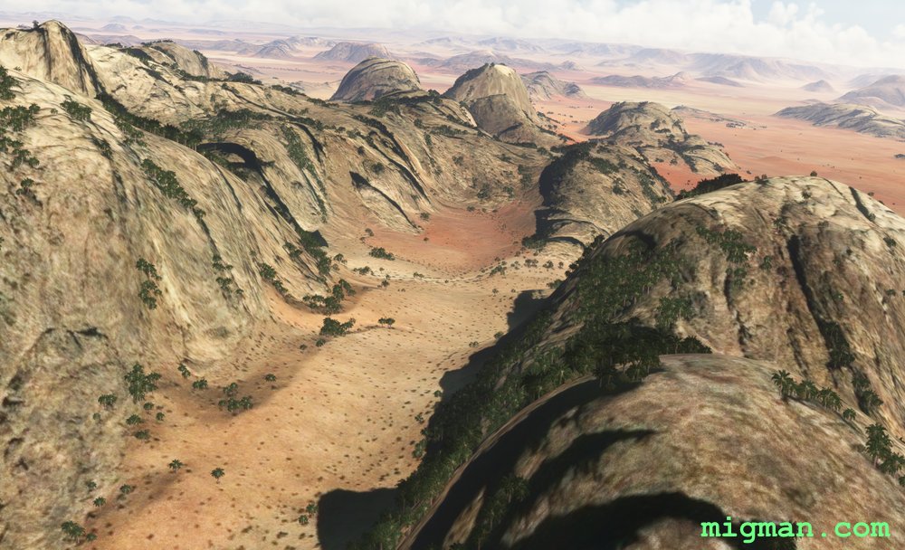
Valley of the Moon
AboutPatrol Jordan's border with Saudi Arabia as you fly to Jabal Umm ad Dami, Jordan's highest mountain in Jordan at 6.082 ft (1,854m). Return via the spectacular rock formations of Wadi Rum (Valley of the Moon), including the "Seven Pillars of Wisdom".
70 nm: Fly to WP 1, 2 and 3.
118 nm: Fly entire route.
70 nm: Fly to WP 1, 2 and 3.
118 nm: Fly entire route.
 Jordan
location_cityAqaba
flight_takeoffOJAQ Aqaba / King Hussein
airline_seat_recline_extraMiddle East 1
tagBorder Patrol
tagDam spotting
tagCanyon runs & Mach Loops
Jordan
location_cityAqaba
flight_takeoffOJAQ Aqaba / King Hussein
airline_seat_recline_extraMiddle East 1
tagBorder Patrol
tagDam spotting
tagCanyon runs & Mach Loops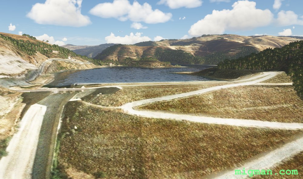
Amman to the Dead Sea
AboutFly over beautiful Ammam, ancient Roman city and capital of Jordan since 1921.
30 nm: Fly to the border crossing at WP 2
70 nm: Fly to Jordan's tallest mountain, Jabal Umm ad Dami, at WP 3
118 nm: Fly entire route
NOTAM: Marka Intnl elev. 2,506 ft. WP 4-6 descend below sea level, so if you have an analogue altimeter it will bottom out.
30 nm: Fly to the border crossing at WP 2
70 nm: Fly to Jordan's tallest mountain, Jabal Umm ad Dami, at WP 3
118 nm: Fly entire route
NOTAM: Marka Intnl elev. 2,506 ft. WP 4-6 descend below sea level, so if you have an analogue altimeter it will bottom out.
Jordan
location_cityAmman
flight_takeoffOJAM Marka
airline_seat_recline_extraMiddle East 1
tagBorder Patrol
tagDam spotting
tagCanyon runs & Mach Loops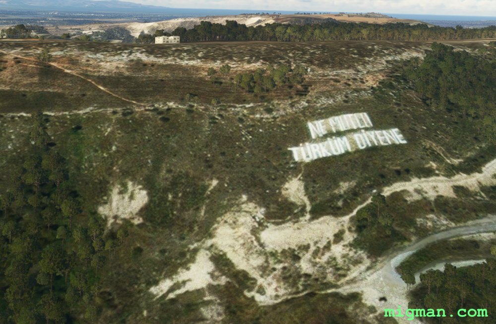
North of Nicosia
AboutEnjoy the charm of the Meditteranean on the northern shores of Cyprus.
There is a large water treatment plant 3 nm NE of Ercan International airport which can be seen from quite a distance, making it a good visual navaid. If you fly directly west from that point you will be just on Turkey's side of the border.
NOTAM: At WP 2 "Ne mutlu Türküm diyene" (motto of the Republic of Turkey) is painted on a hillside.
 Northern Cyprus
location_cityNicosia
flight_takeoffLCEN Ercan
airline_seat_recline_extraMiddle East 1
tagBorder Patrol
tagDam spotting
tagCanyon runs & Mach Loops
Northern Cyprus
location_cityNicosia
flight_takeoffLCEN Ercan
airline_seat_recline_extraMiddle East 1
tagBorder Patrol
tagDam spotting
tagCanyon runs & Mach Loops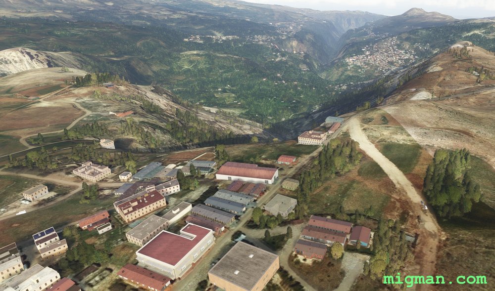
The Cedars of God
AboutTripoli is the second largest town in Lebanon and the centre of a province in the NW near the border with Syria. Skirt the mountainous slopes as you fly south, visit the dramatic Kadisha Valley at the Cedars of God and return past Tripoli, along the splendid coastline to Rene Mouawad Airbase.
Return trip to: Tripoli at WP 5, 26 nm | Cedars of God at WP 3, 42 nm | Entire route: 71 nm
Return trip to: Tripoli at WP 5, 26 nm | Cedars of God at WP 3, 42 nm | Entire route: 71 nm
 Lebanon
location_cityTripoli (Lebanon)
flight_takeoffOLKA Rene Mouawad
airline_seat_recline_extraMiddle East 2
tagBorder Patrol
tagCoastal flight
tagCanyon runs & Mach Loops
Lebanon
location_cityTripoli (Lebanon)
flight_takeoffOLKA Rene Mouawad
airline_seat_recline_extraMiddle East 2
tagBorder Patrol
tagCoastal flight
tagCanyon runs & Mach Loops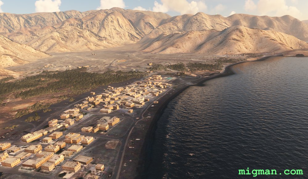
Dibs on the Strait of Hormuz
AboutKhasab Airbase overlooks the strategically important Strait of Hormuz, joining the Persian Gulf and the Gulf of Oman. The airport is in a small valley with mountains on three sides.
31 nm: WP 2 and 7 | 99 nm: Entire route
NOTAM: WP 1: Dib Dibba, 2891 ft, is at the northernmost point of the island group overlooking the Strait of Hormuz.
WP 2: Follow the coast south from Khasab Airport, 1725 ft (not Khasab Airbase).
WP 3: The city of Dibba is divided into three parts: Dibba Al-Fujairah (UAE), Dibba Al-Hisn (UAE) and Dibba Al-Baya (Oman). Fly along the Oman / UAE border
WP 4-6: Return along the Oman / UAE border, which bisects the peninsula north to south.
WP 7 - Enter the valley and return to Khasab Airbase.
 Oman
location_cityAl Khasab
flight_takeoffOOKB Khasab Airbase
airline_seat_recline_extraMiddle East 2
tagCanyon runs & Mach Loops
tagAiports
tagCanyon runs & Mach Loops
Oman
location_cityAl Khasab
flight_takeoffOOKB Khasab Airbase
airline_seat_recline_extraMiddle East 2
tagCanyon runs & Mach Loops
tagAiports
tagCanyon runs & Mach Loops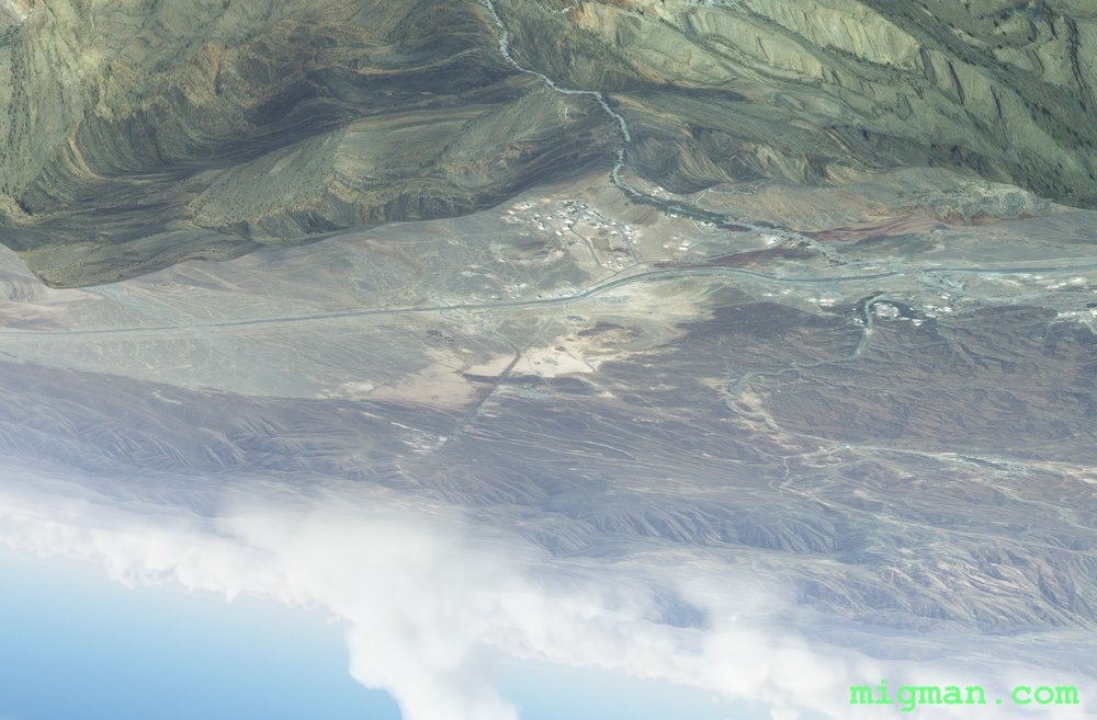
Muscat Maverick
AboutExplore the dramatic terrain south of Muscat at the entrance to the Persian Gulf. If you're flying a sedate mission, enjoy the spectacular scenery and use your cell phone to take lots of snaps. If you want more high-octane excitement fly a 'Top Gun: Maverick' style low level profile flight. Turn on 'G effects' for maximum drama! The flight works well either way. If you fail, do not pass go. Rather, go to the prison at WP 7.
21 nm: WP 1 and 7 | 119 nm: Entire route
NOTAM: WP 2-3: Keep the ridge on your left and the smaller hills on your right. | WP 4 - Enter the valley and follow the road. | WP 5 - If you have enough 'smash', perform a max G pullup and go inverted over the ridge. If you're flying more sedately, use the large valley to perform climbing turns. | WP 7 - Check your fuel state and if necessary divert straight to the airport.
Oman
location_cityMuscat
flight_takeoffOOMS Seeb
airline_seat_recline_extraMiddle East 2
tagBridges
tagCanyon runs & Mach Loops
The Road to Damascus
AboutFly out of Syria's capital, Damascus and patrol the border with Lebanon and Israel.
Between WP 2 and WP 3 fly on the E side of the valley.
WP 4 and return takes you across Damascus: 30 nm | Entire route: 98 nm
Between WP 2 and WP 3 fly on the E side of the valley.
WP 4 and return takes you across Damascus: 30 nm | Entire route: 98 nm
 Syria
location_cityDamascus
flight_takeoffOSDI Damascus
airline_seat_recline_extraMiddle East 2
tagBorder Patrol
tagDam spotting
tagCanyon runs & Mach Loops
Syria
location_cityDamascus
flight_takeoffOSDI Damascus
airline_seat_recline_extraMiddle East 2
tagBorder Patrol
tagDam spotting
tagCanyon runs & Mach Loops
Izmir on the Agean
AboutIzmir is the second largest city on the Agean Sea, after Athens and the third largest population centre in Turkey.
Explore the broad valley to the east, and the resorts and shoreline to the north and west.
The second half of the flight is a coastal run which takes you over the colourful alluvial flood plains to the NE of Izmir.
Take off from Adnan Menderes Airport, fly past Sirinyer Racecourse and Kulturpark Izmir to Izmir Docks at WP 1. Then fly east to the major centre of Turgutlu and NW past Manisa to Guselhisar Dam.
Return distances:
19 nm: Izmir
40 nm: Manisa at WP 3
56 nm: Turgutlu at WP 2
60 nm: Guzelhisar Dam at WP 4
62 nm: Coastal route to Foca and the alluvial flood plains
121 nm: Entire route
 Turkey
location_cityIzmir
flight_takeoffLTBJ Adnan Menderes
airline_seat_recline_extraMiddle East 2
tagCoastal flight
tagDam spotting
tagCanyon runs & Mach Loops
Turkey
location_cityIzmir
flight_takeoffLTBJ Adnan Menderes
airline_seat_recline_extraMiddle East 2
tagCoastal flight
tagDam spotting
tagCanyon runs & Mach Loops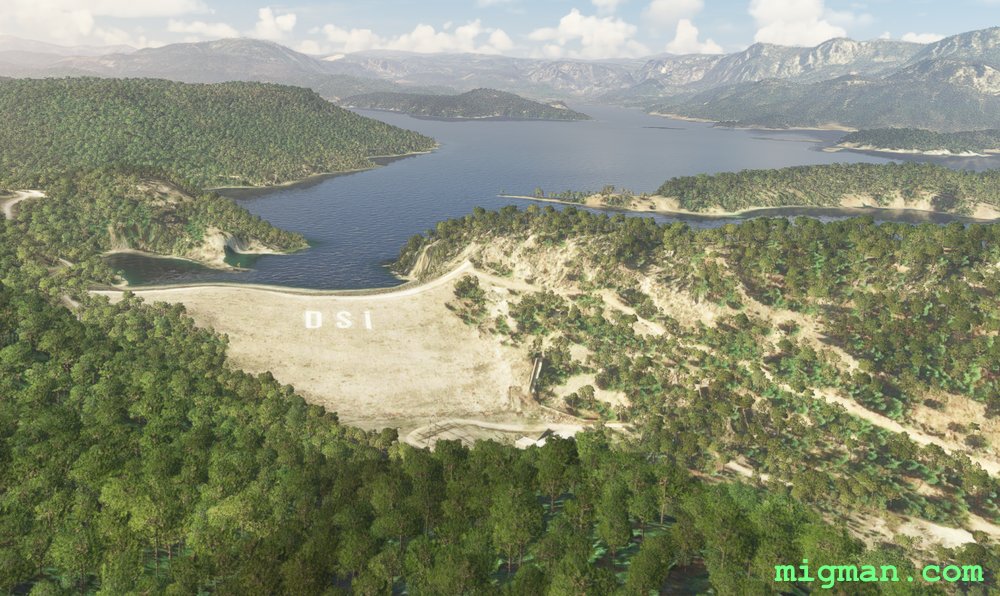
Antalya North and East: Dams, Mountains, Valleys and Coastal Resorts
AboutExplore the valleys, dams and mountains to the NE of Antalya, including the Aksus, Karacaoren, Oymapinar and Manavgat dams and the magnificent Sutculer Mountains.
On the way back pass the coastal resorts at Ilica, Perakende and Belek.
54 nm: Dam on Karacaoren-1 Lake
72 nm: Coast to Manavgat Airport LTKI
82 nm: WP 5,6,7: Two dams and coast from Manavgat Airport LTKI
136 nm: Entire route
On the way back pass the coastal resorts at Ilica, Perakende and Belek.
54 nm: Dam on Karacaoren-1 Lake
72 nm: Coast to Manavgat Airport LTKI
82 nm: WP 5,6,7: Two dams and coast from Manavgat Airport LTKI
136 nm: Entire route
Turkey
location_cityAntalya
flight_takeoffLTAI Antalya
airline_seat_recline_extraMiddle East 2
tagCoastal flight
tagDam spotting
tagCanyon runs & Mach Loops
Antalya North West Valleys
AboutEnjoy the pastoral valleys to the NW of Antalya, one of the largest citiess in Turkey andthe capital of Antalya Province.
31 nm: Across Antalya to WP 7 and return
71 nm: Entire route
31 nm: Across Antalya to WP 7 and return
71 nm: Entire route
Turkey
location_cityAntalya
flight_takeoffLTAI Antalya
airline_seat_recline_extraMiddle East 2
tagCanyon runs & Mach Loops
Antalya: Bey Mountains and the South West Coast
AboutEnter a valley west of the city, fly over the Bey Mountains and return along the beautiful coastline to the SW of Antalya.
20 nm: Along the shoreline at Antalya to WP 6, South Antalya Marina and return
90 nm: WP 1 and 2 - Bey Mountains and dam near Karamik and return
129 nm: Entire route
20 nm: Along the shoreline at Antalya to WP 6, South Antalya Marina and return
90 nm: WP 1 and 2 - Bey Mountains and dam near Karamik and return
129 nm: Entire route
Turkey
location_cityAntalya
flight_takeoffLTAI Antalya
airline_seat_recline_extraMiddle East 2
tagCoastal flight
tagDam spotting
tagCanyon runs & Mach Loops
Sanaa Cross Country
AboutFly out of Yemen's capital Sanaa, and explore the rugged surrounding valleys.
NOTAM: 22nm: Sanaa | 78nm: Entire route
NOTAM: 22nm: Sanaa | 78nm: Entire route
 Yemen
location_citySanaa
flight_takeoffOYSN Sanaa
airline_seat_recline_extraMiddle East 2
tagCanyon runs & Mach Loops
Yemen
location_citySanaa
flight_takeoffOYSN Sanaa
airline_seat_recline_extraMiddle East 2
tagCanyon runs & Mach Loops
Julian Alps
AboutPut on your long johns and take a run along the alpine ridges west of Bled.
Slovenia
location_cityBled
flight_takeoffLJBL Bled
airline_seat_recline_extraSlovenia 1
tagMountain climbing
tagCanyon runs & Mach Loops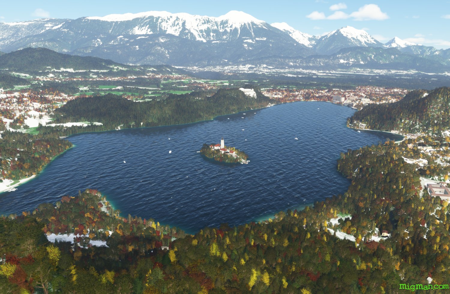
Postcard from Bled
AboutFly to Slovenia's 3rd highest peak at Mangart and it's most iconic scenery at Lake Bled.
Slovenia
location_cityBled
flight_takeoffLJBL Bled
airline_seat_recline_extraSlovenia 1
tagMountain climbing
tagCanyon runs & Mach Loops
Ski Resorts west of Bled
AboutVisit six ski resorts west of Bled and return via the valley to the north.
Slovenia
location_cityBled
flight_takeoffLJBL Bled
airline_seat_recline_extraSlovenia 1
tagCanyon runs & Mach Loops
tagAiports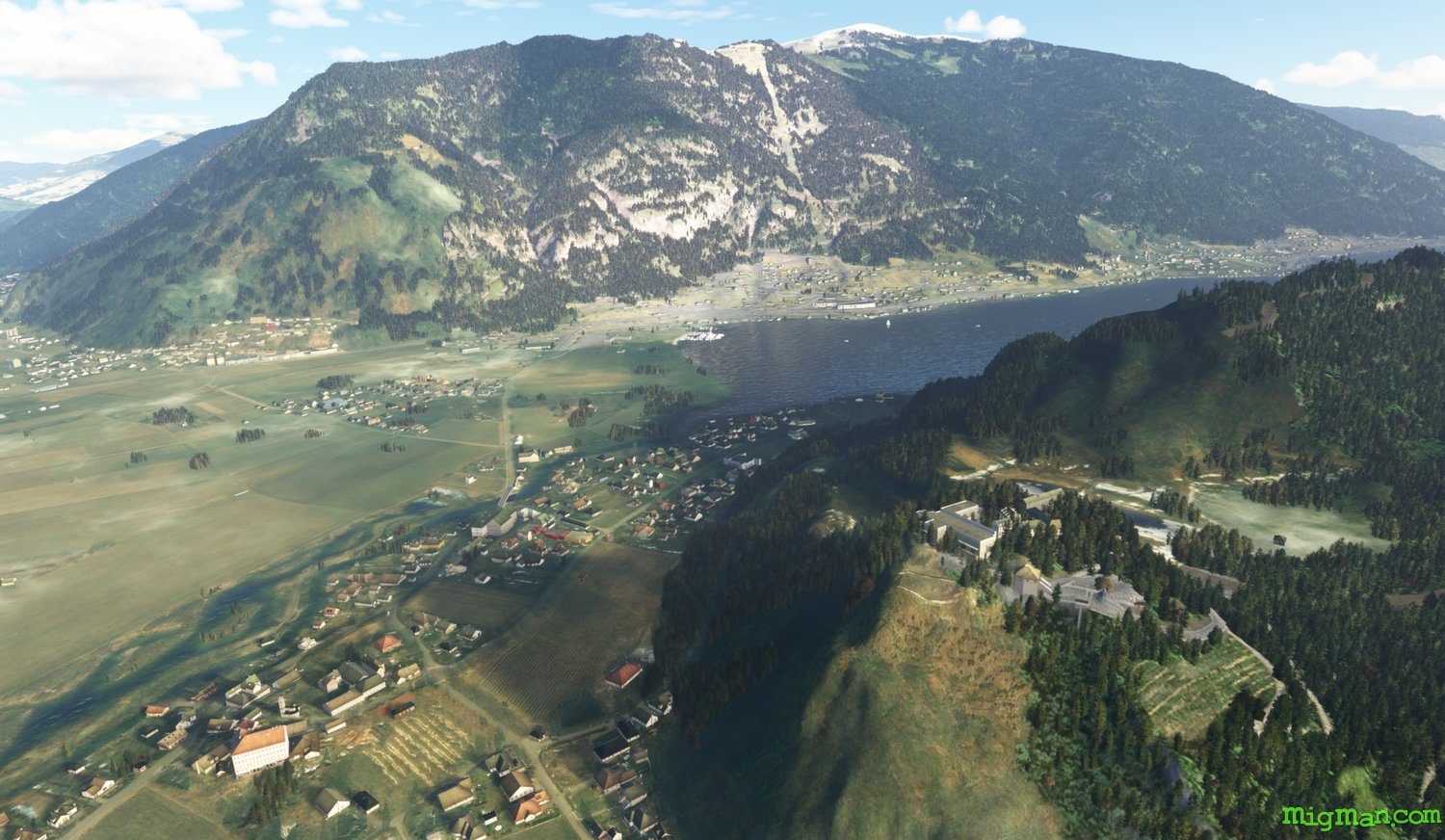
North East of Bovec, Austria
AboutHop over the alps and enjoy some of the beautiful scenery north of Bovec, Austria.
Slovenia
location_cityBled
flight_takeoffLJBL Bled
airline_seat_recline_extraSlovenia 1
tagCanyon runs & Mach Loops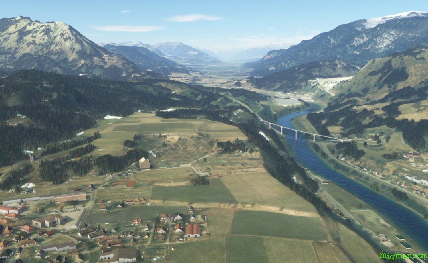
Triborder
AboutExplore the stunning Millstatter Lake in Austria and return via the Triborder of Austria, Italy and Slovenia.
Slovenia
location_cityBled
flight_takeoffLJBL Bled
airline_seat_recline_extraSlovenia 1
tagBorder Patrol
tagCanyon runs & Mach Loops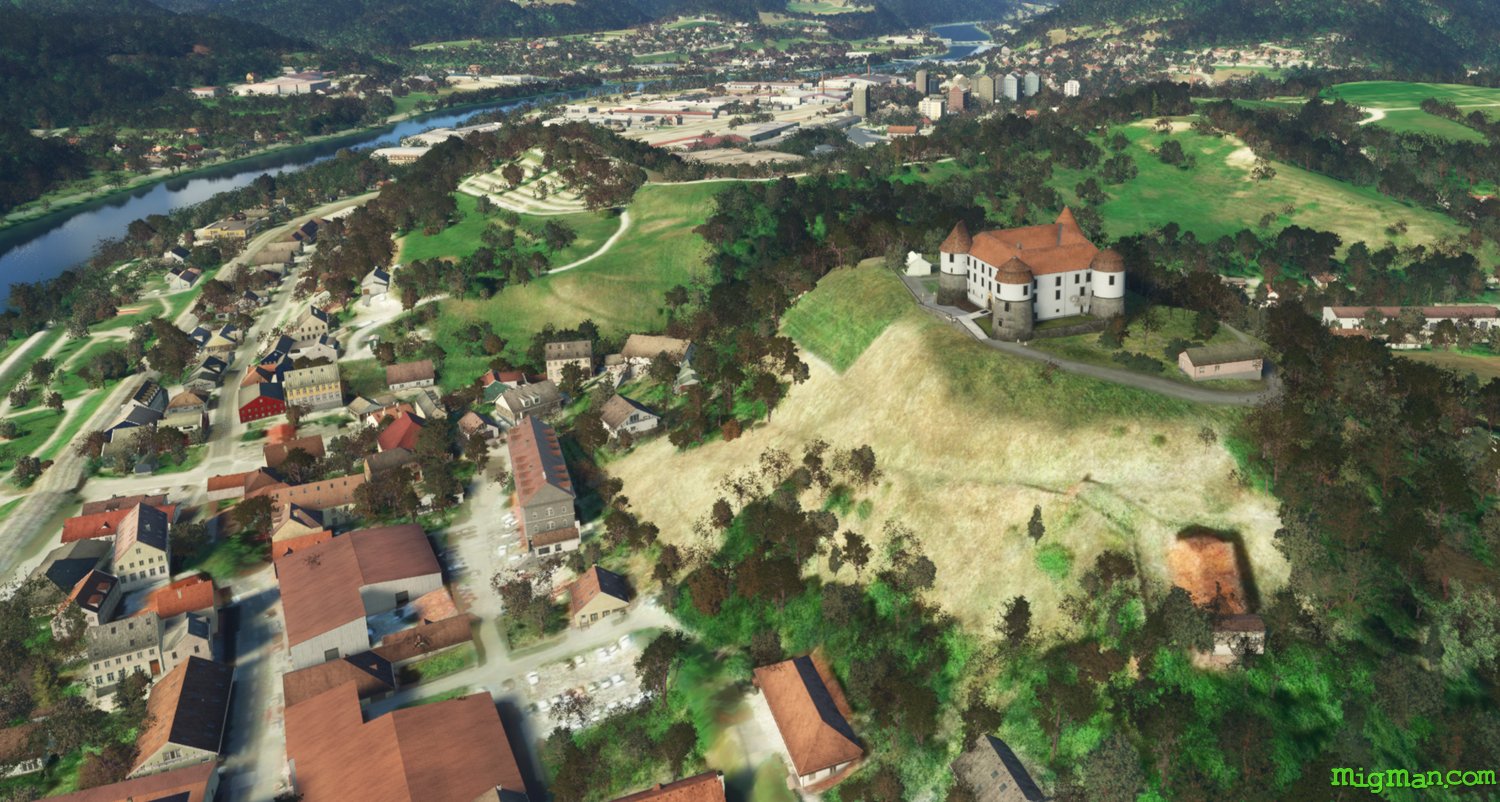
Rajhenburg and Sevnica Castles
AboutVisit two iconic castles on the Sava River.
Slovenia
location_cityCerklje
flight_takeoffLJCE Cerklje Military
airline_seat_recline_extraSlovenia 1
tagCanyon runs & Mach Loops
Otocec Castle and Novo Mesto
AboutLower Carniola (Carniola Bianca or White Carniola) is a region in the south of Slovenia, on the border with Croatia. Novo Mesto is the economic and cultural centre of the region.
Slovenia
location_cityCerklje
flight_takeoffLJCE Cerklje Military
airline_seat_recline_extraSlovenia 1
tagBorder Patrol
tagBridges
tagCanyon runs & Mach Loops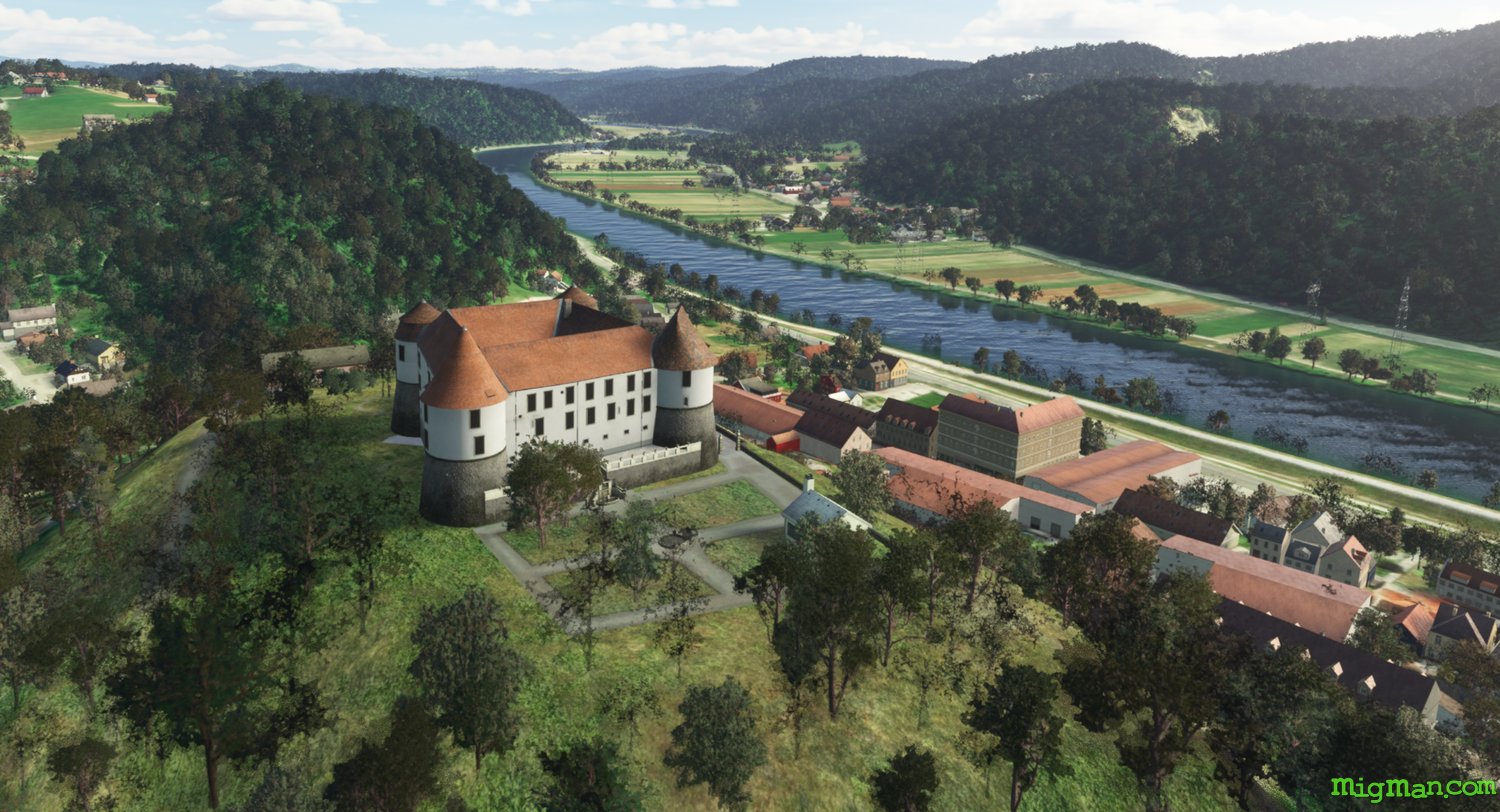
West of Cerklje
AboutFly west out of Cerklje and return along the Sava River. It's definitely rewarding flying both directions along many of the valleys and rivers in Slovenia.
Slovenia
location_cityCerklje
flight_takeoffLJCE Cerklje Military
airline_seat_recline_extraSlovenia 1
tagBridges
tagCanyon runs & Mach Loops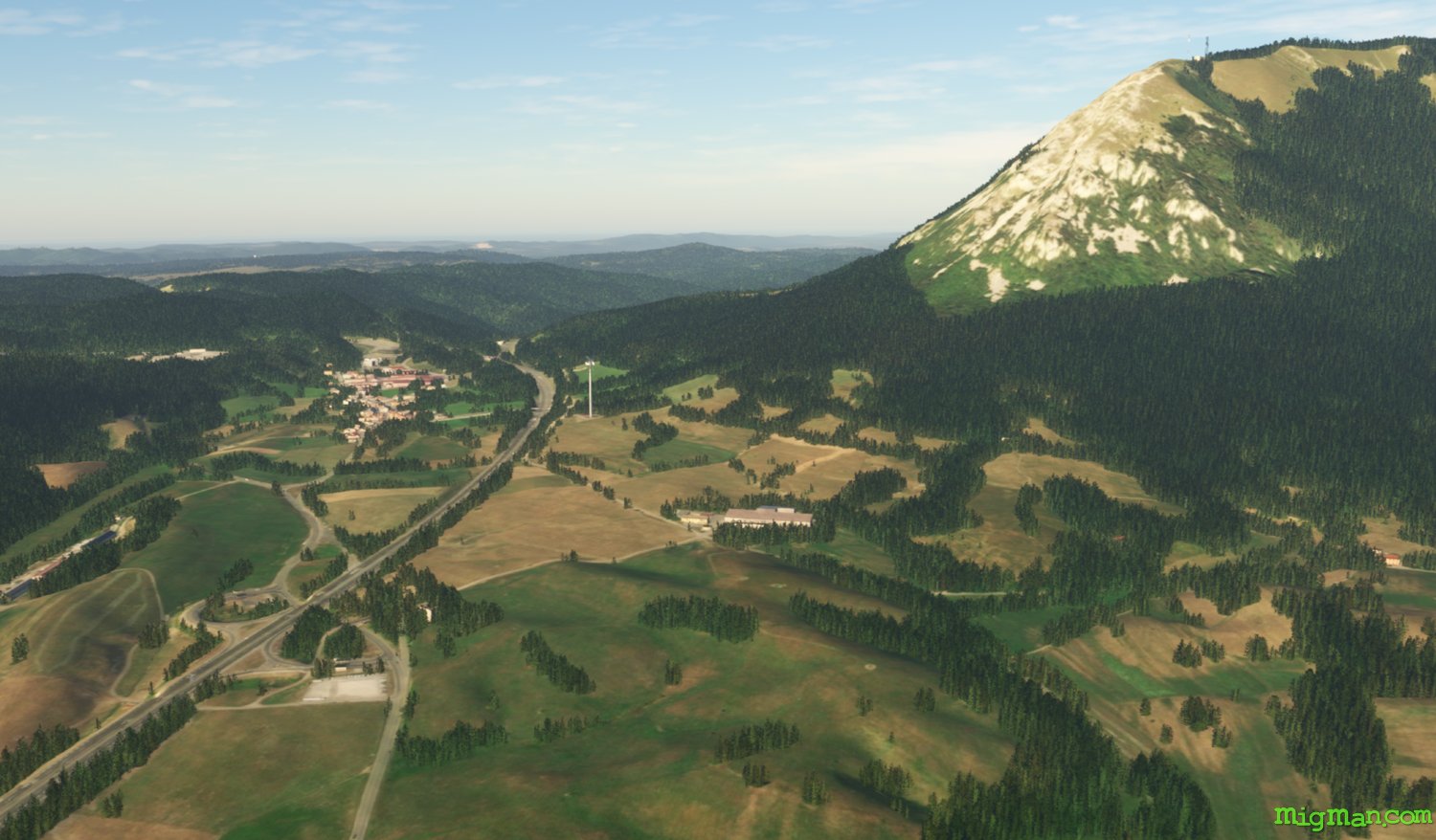
Sneznik Castle
AboutExplore the valleys, plateau and castles east of Divaca.
Slovenia
location_cityDivaca
flight_takeoffLJDI Divaca
airline_seat_recline_extraSlovenia 1
tagCanyon runs & Mach Loops
Rijeka, Croatia
AboutFly south into Croatia and explore the Adriatic coast at Rijeka.
Slovenia
location_cityPostojna
flight_takeoffLJDI Divaca
airline_seat_recline_extraSlovenia 1
tagCoastal flight
tagCanyon runs & Mach Loops
tagAiports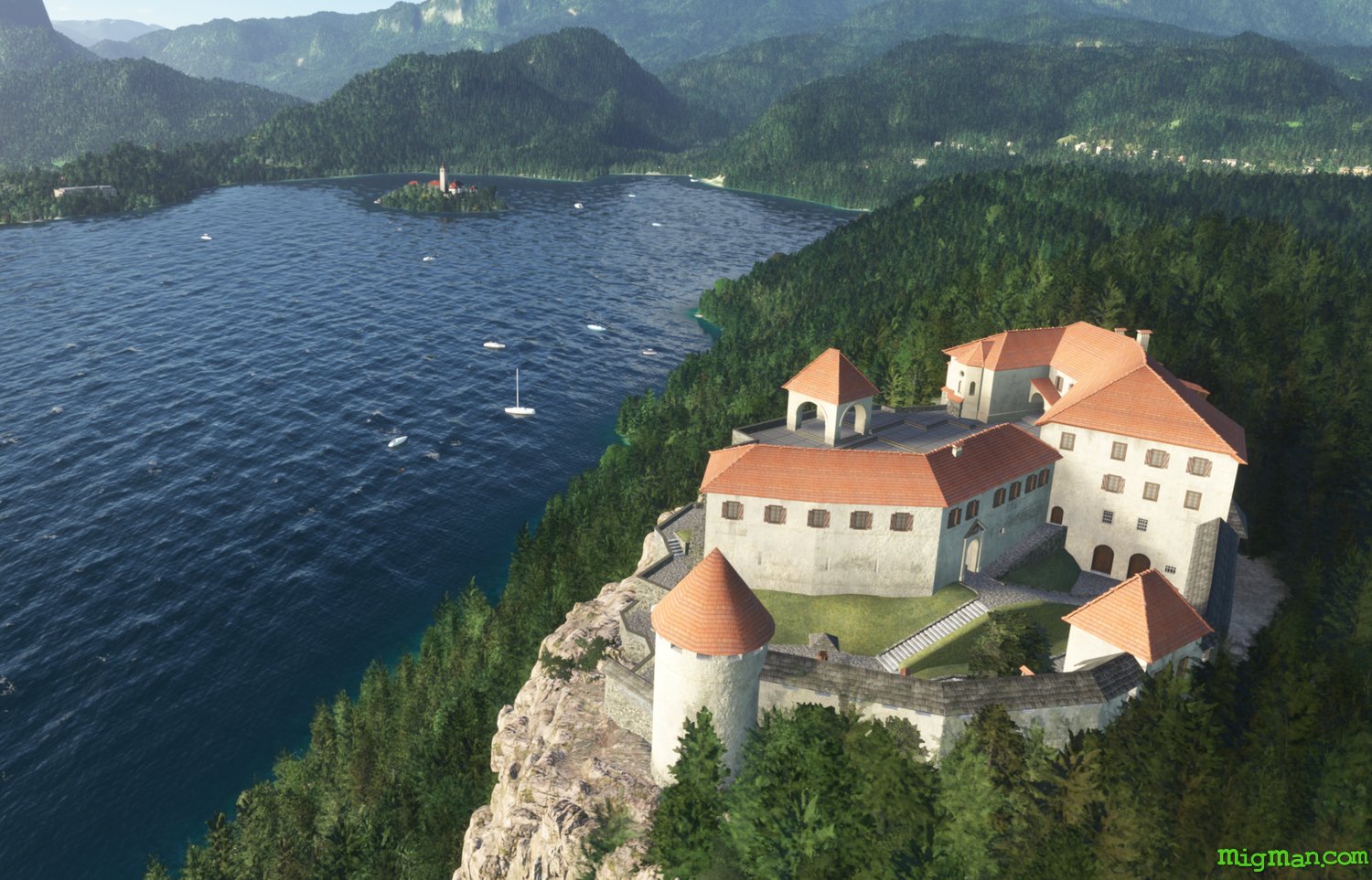
Brdo and Bled Castles
AboutFly to the most iconic scene in Slovenia and explore the valleys to the west of Ljubljana airport.
Slovenia
location_cityLjubljana
flight_takeoffLJLJ Ljubljana Joze Pucnik
airline_seat_recline_extraSlovenia 1
tagDam spotting
tagCanyon runs & Mach Loops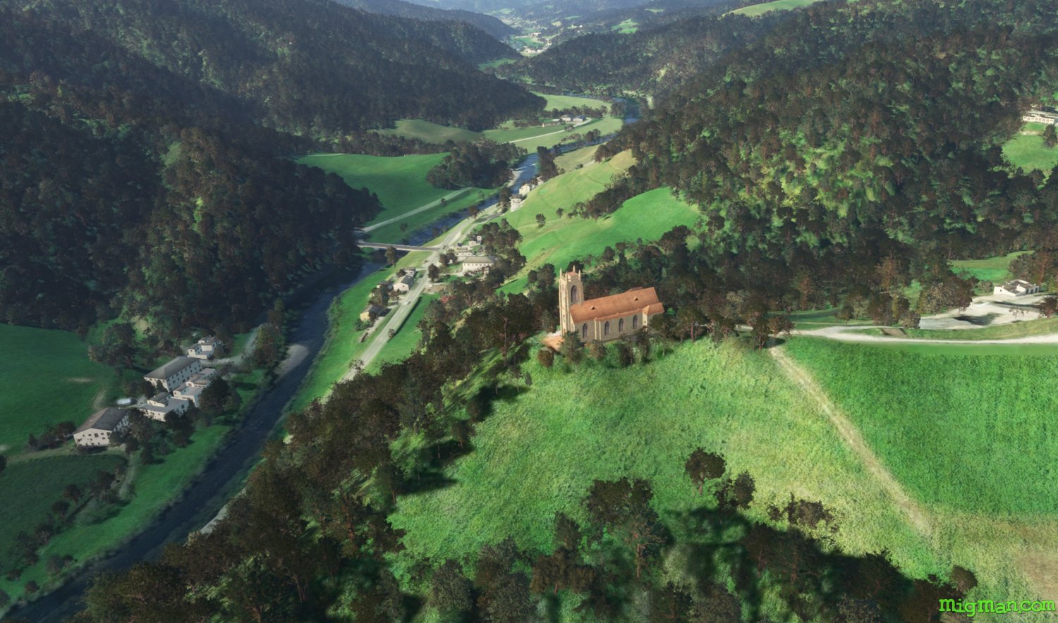
Skofja Loka Castle
AboutExplore to the south west of Ljubljana airport.
Slovenia
location_cityLjubljana
flight_takeoffLJLJ Ljubljana Joze Pucnik
airline_seat_recline_extraSlovenia 1
tagCanyon runs & Mach Loops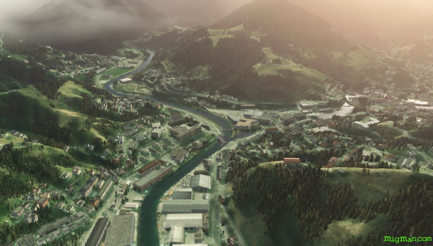
Church of St. Thomas and Blegos
AboutExplore the valleys about 20 nm south west of Ljubljana airport. From the grassy peak at Blegos (the second highest mountain in this region at 1562 m) you can see the Julian, Karawanks and Kamnik–Savinja Alps.
Slovenia
location_cityLjubljana
flight_takeoffLJLJ Ljubljana Joze Pucnik
airline_seat_recline_extraSlovenia 1
tagCanyon runs & Mach Loops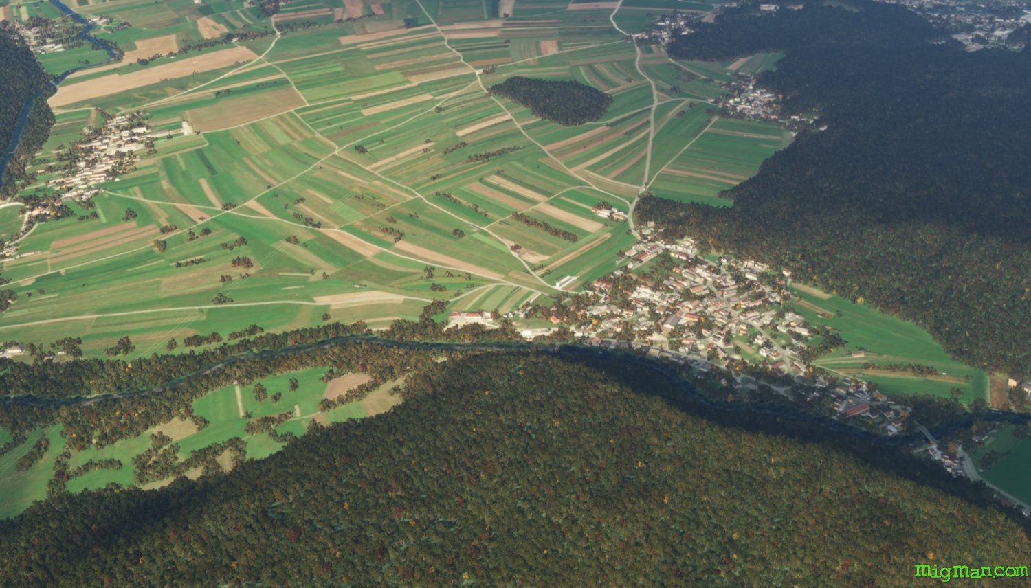
Babno Polje, at the border with Croatia
AboutFly to the border crossing with Croatia at Babno Polje, south of Ljubljana.
Slovenia
location_cityLjubljana
flight_takeoffLJLJ Ljubljana Joze Pucnik
airline_seat_recline_extraSlovenia 1
tagBorder Patrol
tagCanyon runs & Mach Loops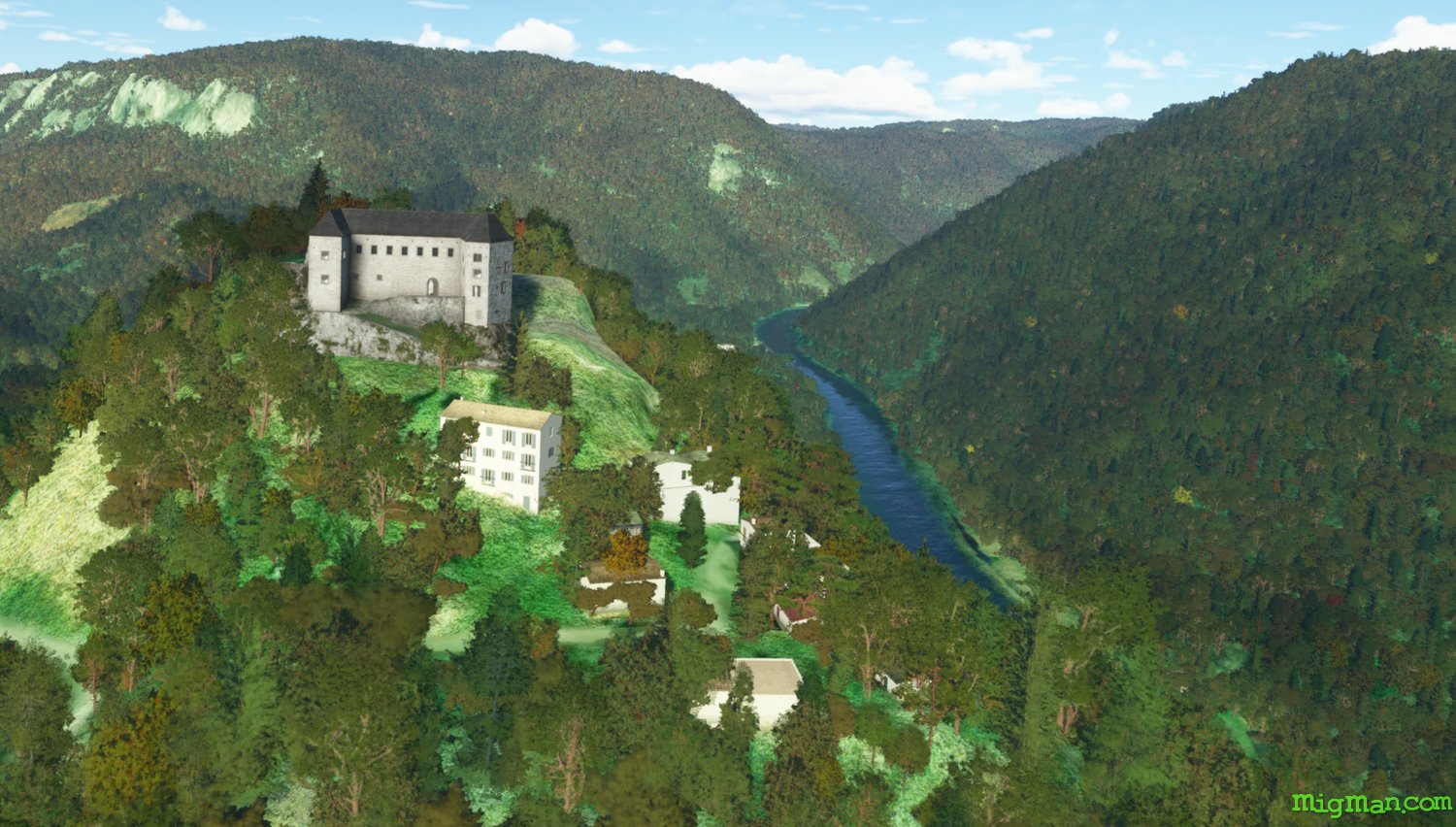
Border keep, Kostel Castle
AboutFollow the border with Croatia on the Cabranka River from Brod na Kupi to Kostel Castle. Return to Ljubljana north along the 106 motorway.
Slovenia
location_cityLjubljana
flight_takeoffLJLJ Ljubljana Joze Pucnik
airline_seat_recline_extraSlovenia 1
tagBorder Patrol
tagCanyon runs & Mach Loops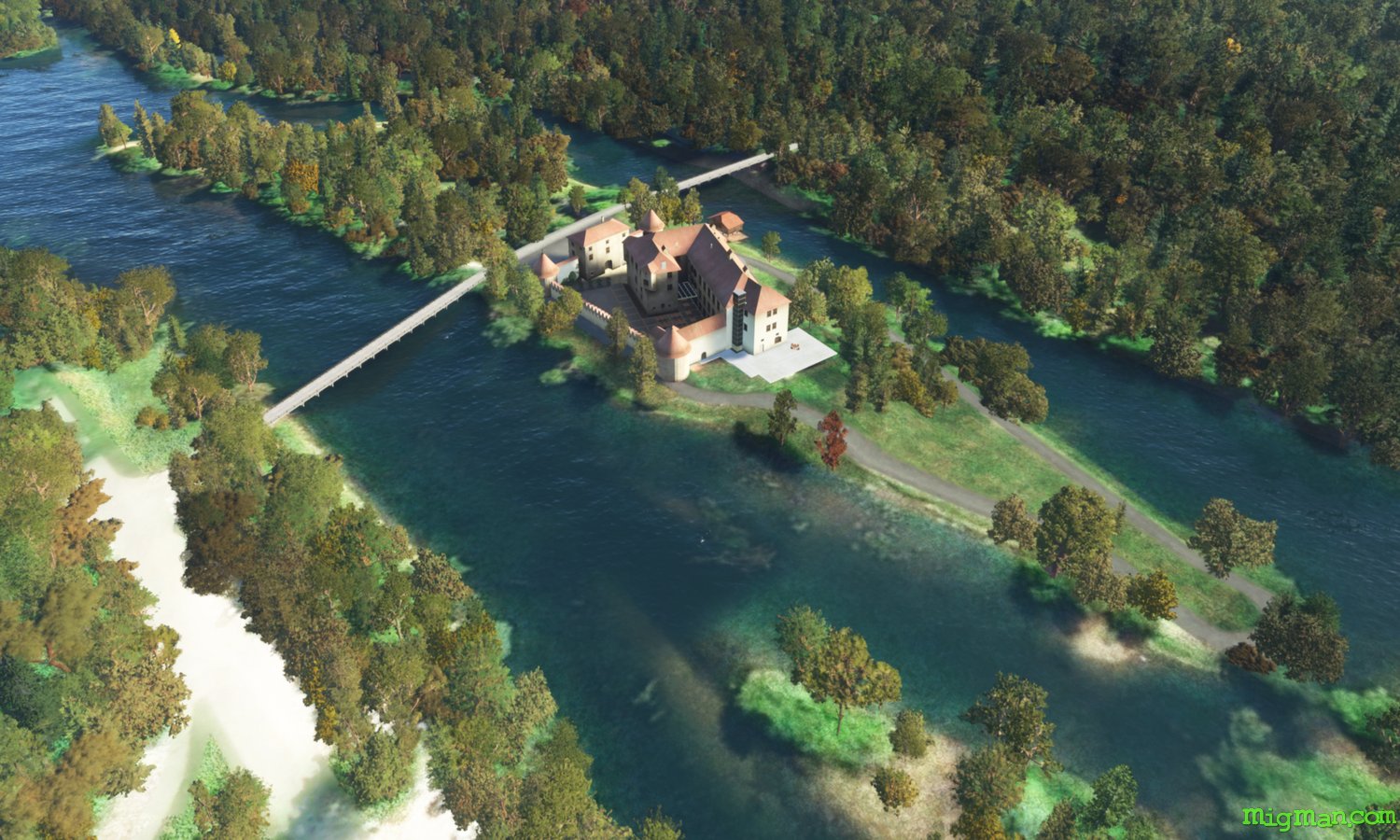
Zuzemberk and Otoceck Castles
AboutFly south east of Ljubljana and visit two of Slovenia's iconic castles.
Slovenia
location_cityLjubljana
flight_takeoffLJLJ Ljubljana Joze Pucnik
airline_seat_recline_extraSlovenia 1
tagCanyon runs & Mach Loops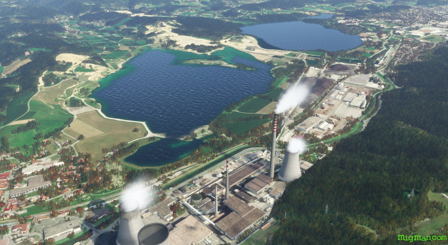
Lake Sostanj
AboutHead 26 miles north east of Ljubljana airport to Lake Sostanj. Lake Sostanj features three large bodies of water, from west to east: Druzmirsko jezero, Sostanjsko Jezero and Skalsko jezero
Slovenia
location_cityLjubljana
flight_takeoffLJLJ Ljubljana Joze Pucnik
airline_seat_recline_extraSlovenia 1
tagCanyon runs & Mach Loops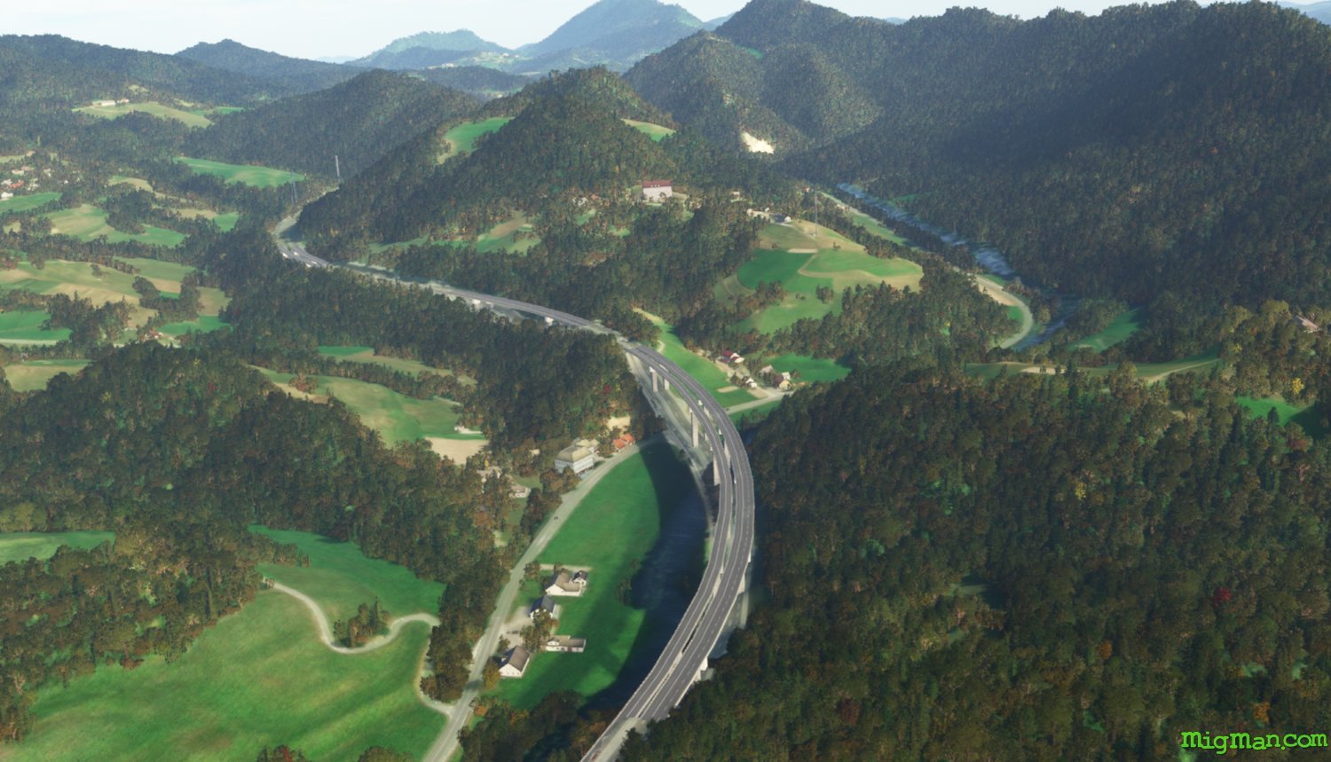
Velika Planina
AboutVelika Planina is a plateau with high elevation pastures and more than 140 shepherd's huts, and popular ski resorts.
Slovenia
location_cityLjubljana
flight_takeoffLJLJ Ljubljana Joze Pucnik
airline_seat_recline_extraSlovenia 1
tagDam spotting
tagCanyon runs & Mach Loops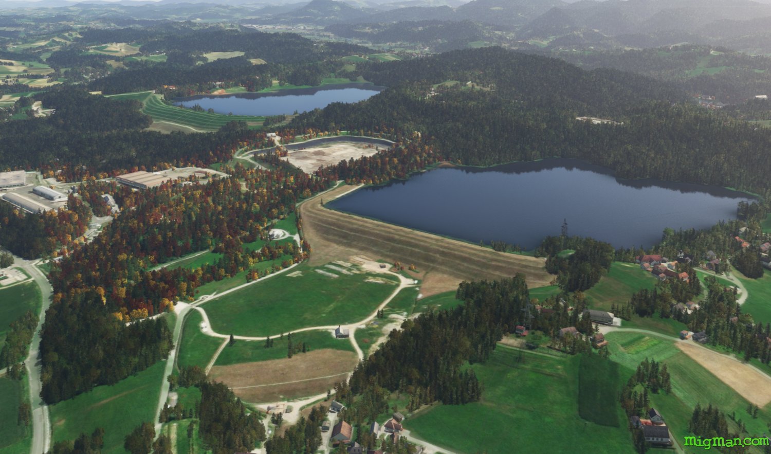
Celje
AboutVisit Celje, the fourth largest city in Slovenia.
Slovenia
location_cityMaribor
flight_takeoffLJMB Maribor
airline_seat_recline_extraSlovenia 2
tagDam spotting
tagCanyon runs & Mach Loops
Slovenj Gradec
AboutIn the beautiful Mislinja Valley Slovenj Gradec was largely German speaking until 1945. Gradec is Slovene for "little castle".
Slovenia
location_cityMaribor
flight_takeoffLJMB Maribor
airline_seat_recline_extraSlovenia 2
tagDam spotting
tagCanyon runs & Mach Loops
tagAiports
Croatian Border and Dams
AboutTake a short flight along the Croatian border near Portoroz and return via the coast.
Slovenia
location_cityPortoroz
flight_takeoffLJPZ Portoroz
airline_seat_recline_extraSlovenia 2
tagBorder Patrol
tagCanyon runs & Mach Loops
tagDam spotting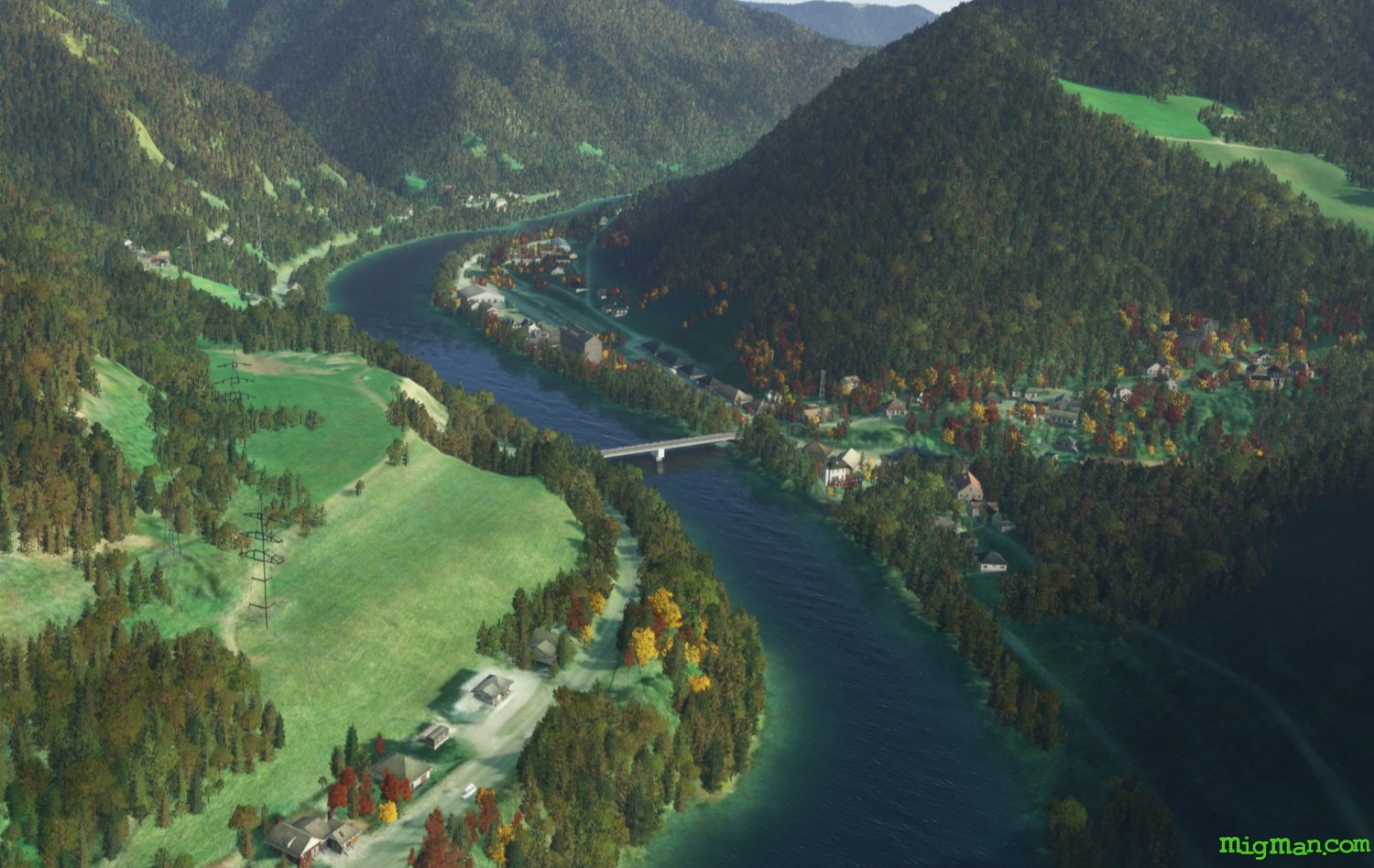
Drava River, Slovenj Gradec to Maribor
AboutFly along the steep and winding Drava River valley to Maribor and return via the wider valley to the south.
Slovenia
location_citySlovenj Gradec
flight_takeoffLJSG Slovenj Gradec
airline_seat_recline_extraSlovenia 2
tagBridges
tagCanyon runs & Mach Loops
Meza River
AboutExplore the Meza River valley west of Slovenj Gradec.
Slovenia
location_citySlovenj Gradec
flight_takeoffLJSG Slovenj Gradec
airline_seat_recline_extraSlovenia 2
tagCanyon runs & Mach Loops
Slovenske Konjice West
AboutExplore the dams and valleys west of Slovenske Konjice.
Slovenia
location_citySlovenske Konjice
flight_takeoffLJSK Slovenske Konjice
airline_seat_recline_extraSlovenia 2
tagDam spotting
tagCanyon runs & Mach Loops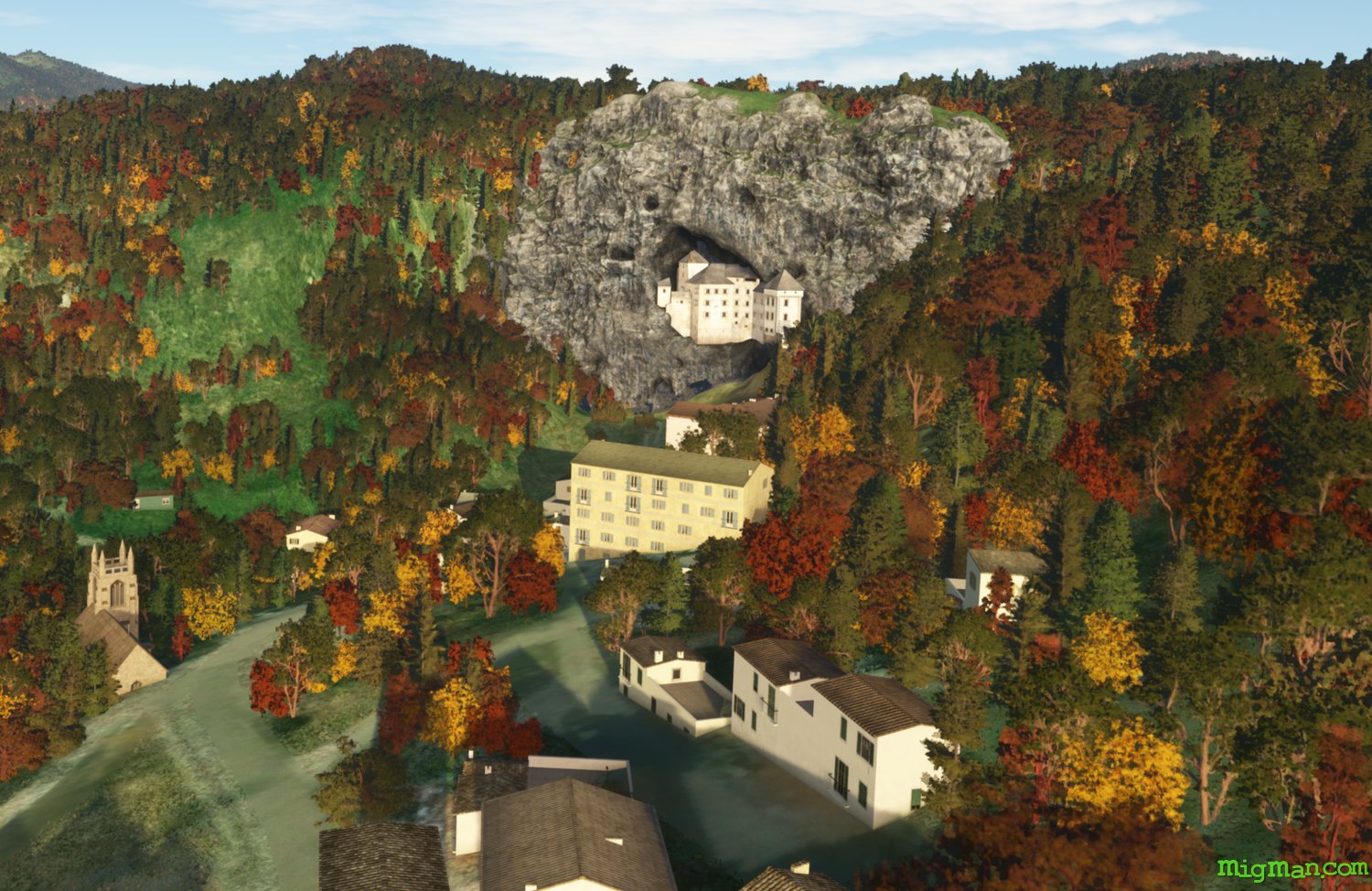
Predjama Castle
AboutVisit Predjama Castle and explore valleys NE of Gorizia.
Slovenia
location_cityTrieste
flight_takeoffLIPQ Trieste | Ronchi Dei Legionari
airline_seat_recline_extraSlovenia 2
tagCanyon runs & Mach Loops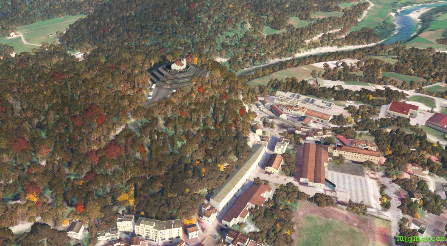
Ossuary of Italian WWI Soldiers
AboutThis memorial to Italian soldiers who fell in World War I was built by the Italian state in 1938. It is on the site of the chapel of Saint Anthony of Padua (completed 1696). Fly north out of Trieste and return south along the Soca River valley.
Slovenia
location_cityTrieste
flight_takeoffLIPQ Trieste | Ronchi Dei Legionari
airline_seat_recline_extraSlovenia 2
tagCanyon runs & Mach Loops
tagBridges
tagDam spotting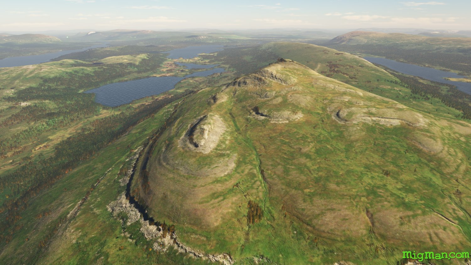
Ladtjo Valley & Jortajaure
AboutExplore the spectacular Ladto valley all the way to Jortajaure, a lake 890 m above sea level in Gallivare municipality, Lapland and part of the Torne and Kalix river system.
 Sweden
location_cityNorbotten
flight_takeoffESNQ Kiruna
airline_seat_recline_extra
tagCanyon runs & Mach Loops
Sweden
location_cityNorbotten
flight_takeoffESNQ Kiruna
airline_seat_recline_extra
tagCanyon runs & Mach Loops