MiGMan’s World Tour Coastal flights
Palm Beach
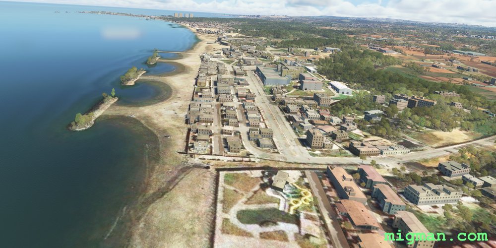
AboutTour the Mediterranean beaches on the north west of Algiers.
 Algeria
location_cityAlgiers
flight_takeoffDAAK Boufarik
airline_seat_recline_extraAfrica 1
tagCoastal flight
tagBridges
tagDam spotting
Algeria
location_cityAlgiers
flight_takeoffDAAK Boufarik
airline_seat_recline_extraAfrica 1
tagCoastal flight
tagBridges
tagDam spotting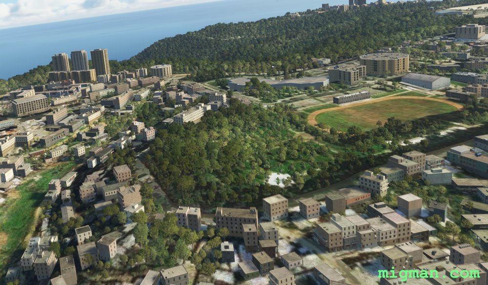
Algiers Heights
AboutTake a joyflight around the coastal heights of Algiers.
Algeria
location_cityAlgiers
flight_takeoffDAAG Houari Boumediene
airline_seat_recline_extraAfrica 1
tagCoastal flight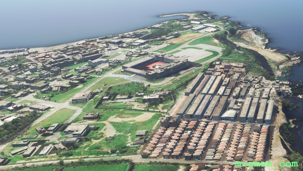
Bay Watch
AboutFollow the shoreline east to west including the Bay of Algiers.
Algeria
location_cityAlgiers
flight_takeoffDAAG Houari Boumediene
airline_seat_recline_extraAfrica 1
tagCoastal flight
tagBridges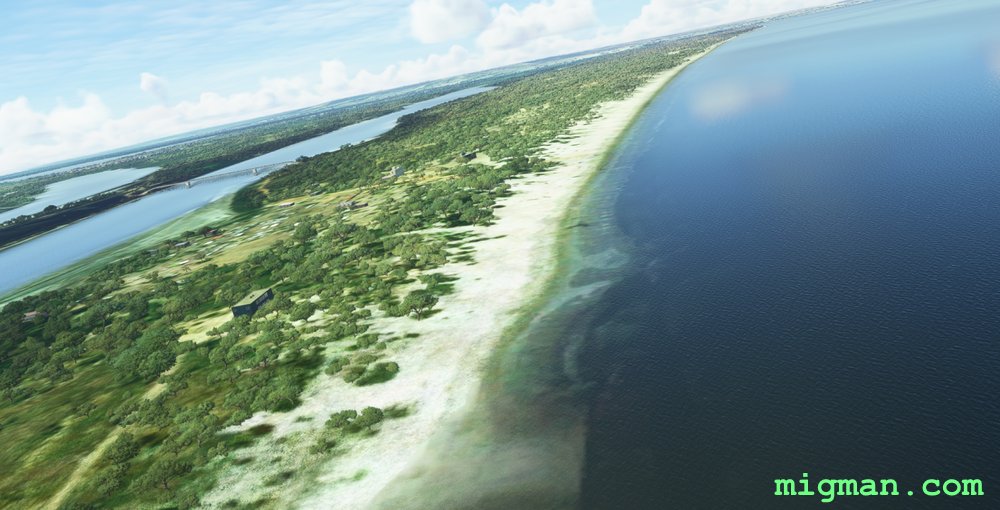
Luanda North Coast
AboutFly along the beaches and coast to the north of Luanda.
 Angola
location_cityLuanda
flight_takeoffFNLU 4th of February
airline_seat_recline_extraAfrica 1
tagBridges
tagCoastal flight
tagArchitectural Wonders
Angola
location_cityLuanda
flight_takeoffFNLU 4th of February
airline_seat_recline_extraAfrica 1
tagBridges
tagCoastal flight
tagArchitectural Wonders
The African Connection
AboutSee where different cultures connect on this great continent.
Angola
location_cityLuanda
flight_takeoffFNLU 4th of February
airline_seat_recline_extraAfrica 1
tagArchitectural Wonders
tagBridges
tagCoastal flight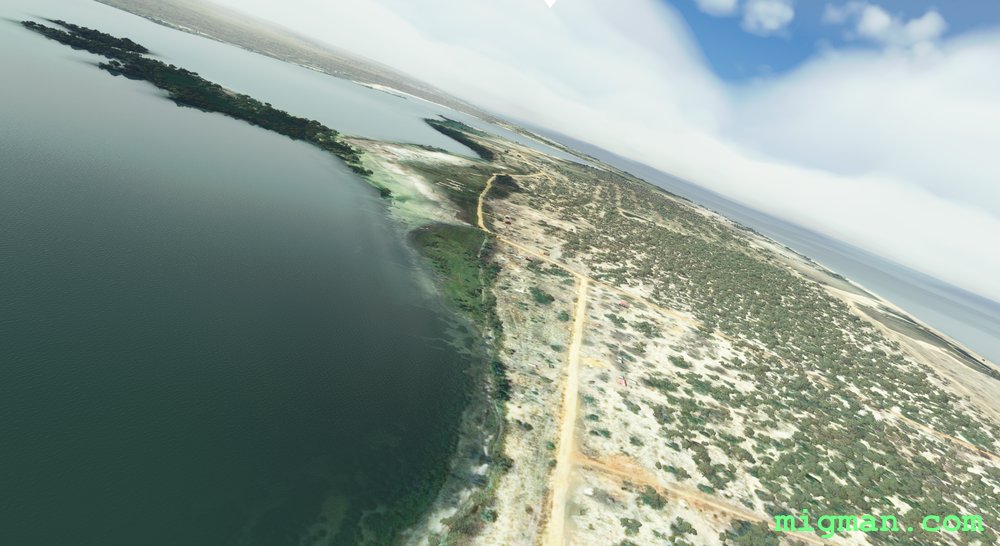
Luanda South Coast
AboutEnjoy the stunning Atlantic coastline on the southern side of Luanda.
Angola
location_cityLuanda
flight_takeoffFNLU 4th of February
airline_seat_recline_extraAfrica 1
tagCoastal flight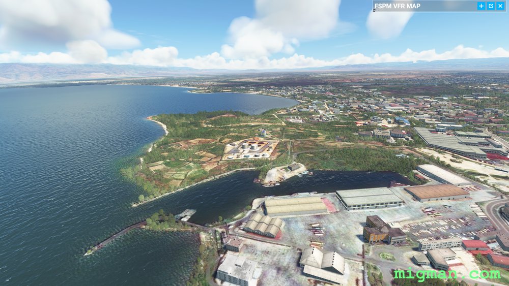
Bujumbura local
AboutExplore the varied terrain at Burundi's capital Bujumbura on Lake Tanganyika.
 Burundi
location_cityBujumbura
flight_takeoffHBBA Bujumbura
airline_seat_recline_extraAfrica 1
tagCoastal flight
tagBorder Patrol
tagBridges
Burundi
location_cityBujumbura
flight_takeoffHBBA Bujumbura
airline_seat_recline_extraAfrica 1
tagCoastal flight
tagBorder Patrol
tagBridges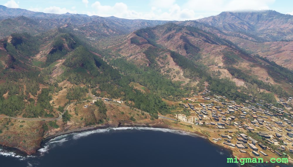
Secret City
AboutFly out of Cape Verde's capital Praia to the mountainous interior and explore the plateau cities of Santa Catarina and Pico d'Antonia. Return to the coast via a 'smuggler's run' down steep valleys and along the southern coast.
 Cape Verde
location_cityPraia
flight_takeoffGVNP Mandela
airline_seat_recline_extraAfrica 1
tagCoastal flight
tagCanyon runs & Mach Loops
Cape Verde
location_cityPraia
flight_takeoffGVNP Mandela
airline_seat_recline_extraAfrica 1
tagCoastal flight
tagCanyon runs & Mach Loops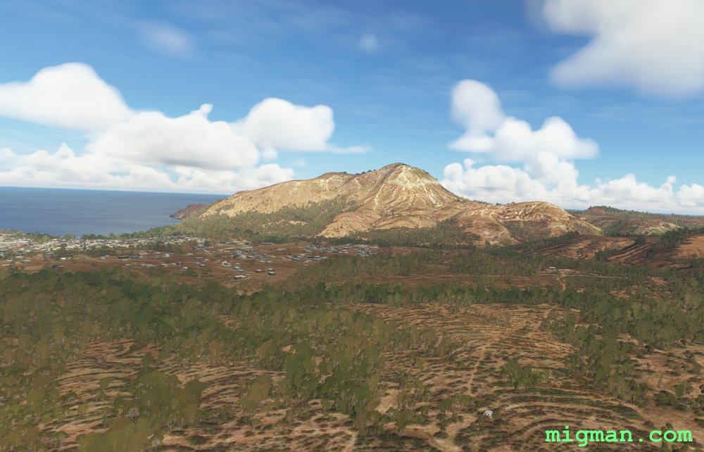
Monte Graciosa
AboutFollow the roads from the capital Praia in the south, through the mountainous centre and to Monte Graciosa in the north west. Fly back down the west coast of the island.
Cape Verde
location_cityPraia
flight_takeoffGVNP Mandela
airline_seat_recline_extraAfrica 1
tagCoastal flight
Djibouti West
AboutFly to the salt flats west of Djibouti and return along the dramatic shoreline of the Gulf of Tadjoura.
 Djibouti
location_cityDjibouti City
flight_takeoffHDAM Ambouli
airline_seat_recline_extraAfrica 2
tagCoastal flight
tagDam spotting
tagCanyon runs & Mach Loops
Djibouti
location_cityDjibouti City
flight_takeoffHDAM Ambouli
airline_seat_recline_extraAfrica 2
tagCoastal flight
tagDam spotting
tagCanyon runs & Mach Loops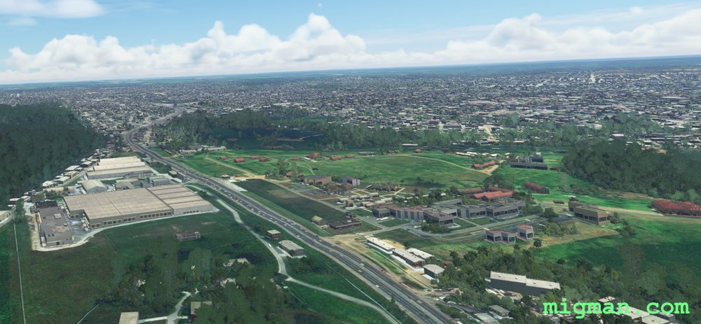
Abidjan local
AboutExplore the capital of the Ivory Coast, Abidjan.
 Ivory Coast
location_cityAbidjan
flight_takeoffDIAP Felix Houphouet-Boigny
airline_seat_recline_extraAfrica 3
tagCoastal flight
Ivory Coast
location_cityAbidjan
flight_takeoffDIAP Felix Houphouet-Boigny
airline_seat_recline_extraAfrica 3
tagCoastal flight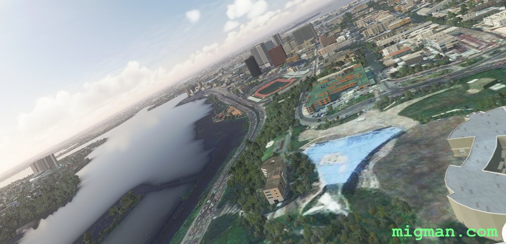
A Walk in the Park
AboutExplore the coastline, waterways and forests of the Ivory Coast's capital, Abidjan.
Ivory Coast
location_cityAbidjan
flight_takeoffDIAP Felix Houphouet-Boigny
airline_seat_recline_extraAfrica 3
tagCoastal flight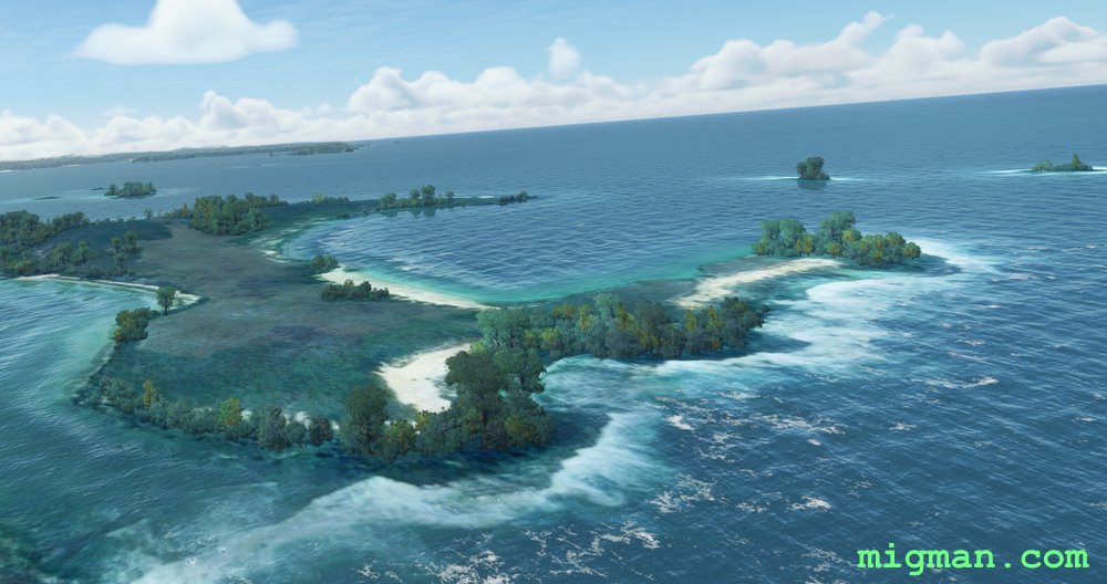
Antsiranana Bay
AboutExplore the north coast of Madagascar at Antasiranana Bay.
 Madagascar
location_cityAntsiranana
flight_takeoffFMNK Andrakaka Navy
airline_seat_recline_extraAfrica 3
tagCoastal flight
Madagascar
location_cityAntsiranana
flight_takeoffFMNK Andrakaka Navy
airline_seat_recline_extraAfrica 3
tagCoastal flight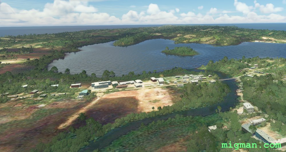
Boraha Island
AboutVisit Ambodifototra, on the charming Boraha Island off the NE coast of Madagascar.
Madagascar
location_cityAmbodifototra
flight_takeoffFMNK Andrakaka Navy
airline_seat_recline_extraAfrica 3
tagCoastal flight
tagDam spotting
Tolagnaro, Over the Hills and Far Away
AboutEnjoy the coast at Tolagnaro, a seaside town on the Indian Ocean at the SE tip of Madagascar.
Madagascar
location_cityTolagnaro
flight_takeoffFMSD Tolagnaro
airline_seat_recline_extraAfrica 3
tagCoastal flight
tagCanyon runs & Mach Loops
Cross country to Port Louis
AboutFly coast to coast over lush countryside as you visit the capital, Port Louis.
 Mauritius
location_cityPort Louis
flight_takeoffFIMP Mauritius
airline_seat_recline_extraAfrica 3
tagCoastal flight
tagDam spotting
Mauritius
location_cityPort Louis
flight_takeoffFIMP Mauritius
airline_seat_recline_extraAfrica 3
tagCoastal flight
tagDam spotting
Mauritius South Coast
AboutFly along the stunning southern coast of Mauritius to Le Morne and the Black River.
Mauritius
location_cityLe Morne
flight_takeoffFIMP Mauritius
airline_seat_recline_extraAfrica 3
tagCoastal flight
The Little Island on the Equator
AboutExplore the rugged coastline of Sao Tome, an island country which sits exactly on the equator.
 Sao Tome
location_citySao Tome
flight_takeoffFPST Sao Tome
airline_seat_recline_extraAfrica 4
tagCoastal flight
Sao Tome
location_citySao Tome
flight_takeoffFPST Sao Tome
airline_seat_recline_extraAfrica 4
tagCoastal flight
Free Flight in Freetown
AboutFly across Tagrin Bay and explore the coastal aspects of Freetown.
 Sierra Leone
location_cityFreetown
flight_takeoffGFLL Lungi
airline_seat_recline_extraAfrica 4
tagCoastal flight
Sierra Leone
location_cityFreetown
flight_takeoffGFLL Lungi
airline_seat_recline_extraAfrica 4
tagCoastal flight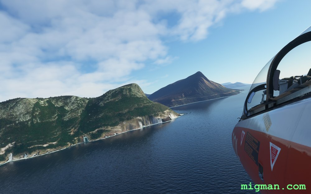
The Cape
AboutFly in comfort along one of the most infamous stretches of coastline in the annals of shipping.
 South Africa
location_cityCape Town
flight_takeoffFACT Cape Town
airline_seat_recline_extraAfrica 4
tagCoastal flight
South Africa
location_cityCape Town
flight_takeoffFACT Cape Town
airline_seat_recline_extraAfrica 4
tagCoastal flight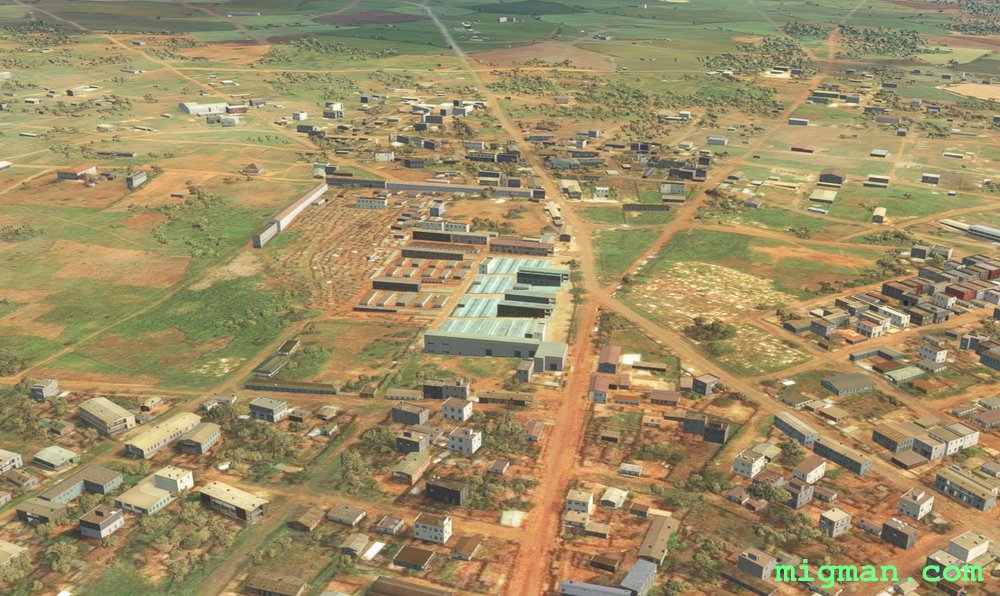
Hitchiker’s Guide to Togo
AboutTake a coastal and lake tour of Togo's capital.
 Togo
location_cityLome
flight_takeoffDXXX Lome-Tokoin
airline_seat_recline_extraAfrica 4
tagCoastal flight
Togo
location_cityLome
flight_takeoffDXXX Lome-Tokoin
airline_seat_recline_extraAfrica 4
tagCoastal flight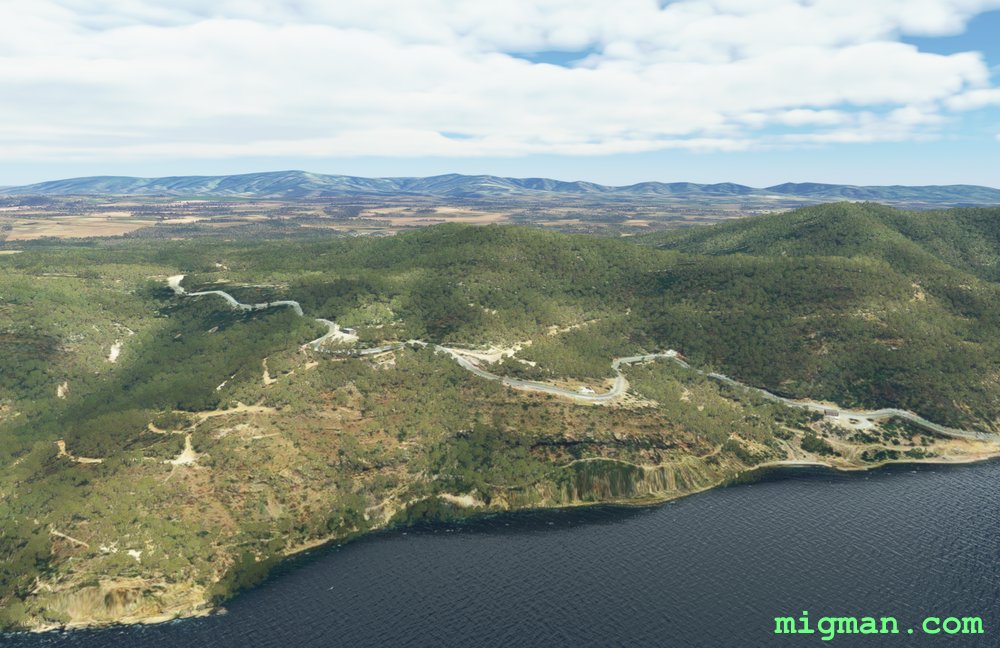
A Night in Tunisia
AboutSkirt the coast at Tunis.
 Tunisia
location_cityTunis
flight_takeoffDTTA Carthage
airline_seat_recline_extraAfrica 4
tagCoastal flight
Tunisia
location_cityTunis
flight_takeoffDTTA Carthage
airline_seat_recline_extraAfrica 4
tagCoastal flight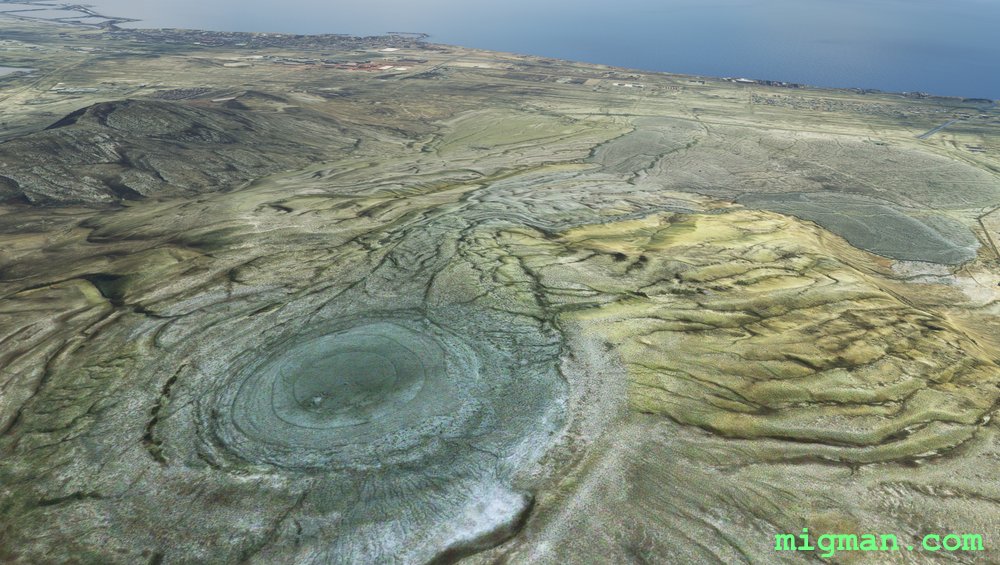
Baku West and the Mud Volcanoes
AboutExplore Baku city and the other-worldly terrain to the west.
 Azerbaijan
location_cityBaku
flight_takeoffUBBB Heydar Aliyev
airline_seat_recline_extraAsia 1
tagCoastal flight
tagVolcano
Azerbaijan
location_cityBaku
flight_takeoffUBBB Heydar Aliyev
airline_seat_recline_extraAsia 1
tagCoastal flight
tagVolcano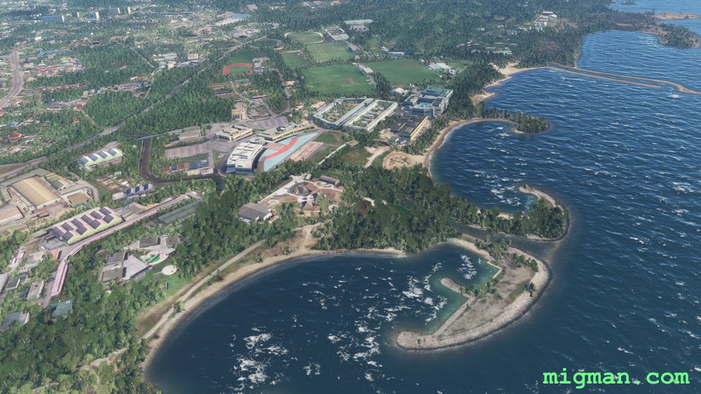
Bandar Seri Begawani Beaches
AboutFollow the rivers and coastline around Bandar Seri Begawani, the capital of Brunei. This small nation is on the NW coast of Borneo. It is in two parts, both on Brunei Bay and separated by the Malaysian province of Limbang.
 Brunei
location_cityBandar Seri Begawan
flight_takeoffWBSB Brunei
airline_seat_recline_extraAsia 1
tagCoastal flight
Brunei
location_cityBandar Seri Begawan
flight_takeoffWBSB Brunei
airline_seat_recline_extraAsia 1
tagCoastal flight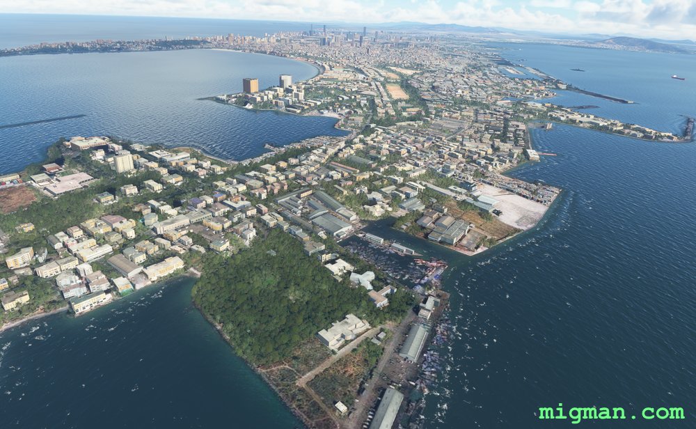
Mumbai Metropolis
AboutOn the west coast and with a population of more than 15 million, Mumbai is India's largest port and commercial centre. Explore the complex and picturesque coastline around this bustling metropolis.
 India
location_cityMumbai
flight_takeoffVABB Chhatrapati Shivaji
airline_seat_recline_extraAsia 1
tagBridges
tagCoastal flight
India
location_cityMumbai
flight_takeoffVABB Chhatrapati Shivaji
airline_seat_recline_extraAsia 1
tagBridges
tagCoastal flight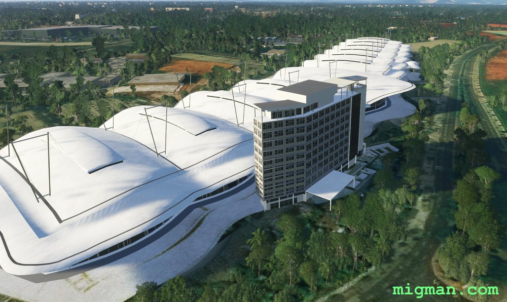
Jakarta West
AboutVisit the western half of Indonesia's capital, Jakarta and take in the shoreline of Jakarta Bay.
 Indonesia
location_cityJakarta
flight_takeoffWIII Soekarno-Hatta
airline_seat_recline_extraAsia 1
tagCoastal flight
tagAiports
Indonesia
location_cityJakarta
flight_takeoffWIII Soekarno-Hatta
airline_seat_recline_extraAsia 1
tagCoastal flight
tagAiports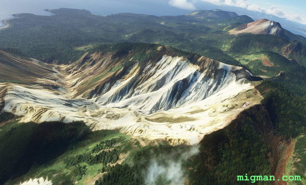
Checking the Temperature
AboutThe Kuril Islands form a 600 nm archipelago of 56 islands between Japan and Russia. The lower two islands, Kunashi and Iterup have been in territorial dispute since the 19c. Conduct a routine patrol on Iturup. Check the local facilities and that the local volcanoes are inactive.
 Kuril Islands
location_cityIturup
flight_takeoffUHSI Iturup
airline_seat_recline_extraAsia 1
tagCoastal flight
tagVolcano
tagAiports
Kuril Islands
location_cityIturup
flight_takeoffUHSI Iturup
airline_seat_recline_extraAsia 1
tagCoastal flight
tagVolcano
tagAiports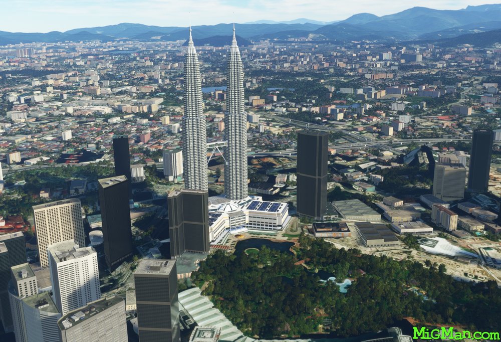
Architecture of Kuala Lumpur
AboutKuala Lumpur is one of the largest and most colourful capital cities in Asia. Bracketed by ocean to the south and moutains to the north, it features some impressive examples of modern architecture. Petronas Towers are twin skyscrapers 88 stories high.
 Malaysia
location_cityKuala Lumpur
flight_takeoffWMKK Kuala Lumpur
airline_seat_recline_extraAsia 2
tagArchitectural Wonders
tagCoastal flight
tagDam spotting
Malaysia
location_cityKuala Lumpur
flight_takeoffWMKK Kuala Lumpur
airline_seat_recline_extraAsia 2
tagArchitectural Wonders
tagCoastal flight
tagDam spotting
Sentinels of Manila Bay
AboutFly around Manila Bay and visit the two dormant volcanoes which guard the entrance. Manila city lays on the eastern shore of Manila Bay, which is itself approximately 30 miles N-S and 20 miles E-W.
Mount Mariveles: 4,587 ft. Dormant volcano overlooking the northern entrance to Manila Bay. Highest point in Bataan province.
Mount Pico De Loro, 2,257 ft. Dormant volcano overlooking the southern entrance to Manila Bay.
Mount Mariveles: 4,587 ft. Dormant volcano overlooking the northern entrance to Manila Bay. Highest point in Bataan province.
Mount Pico De Loro, 2,257 ft. Dormant volcano overlooking the southern entrance to Manila Bay.
 Philippines
location_cityManila
flight_takeoffRPLL Ninoy Aquino
airline_seat_recline_extraAsia 2
tagCoastal flight
tagVolcano
Philippines
location_cityManila
flight_takeoffRPLL Ninoy Aquino
airline_seat_recline_extraAsia 2
tagCoastal flight
tagVolcano
Air, Fire and Water
AboutExplore lakes and volcanos on the southern border of Manila city.
Features:
Cavite Economic Zone (Cavite Export Processing Zone) covers 680 acreson the southern shore of Manila Bay.
Wind Residences high-rise residential development with dramatic views of Taal Lake.
Taal Volcano is a large water filled caldera. The volcano in the centre is still active, with 38 recorded historical eruptions.
Mount Macolod is a dormant volcano. Elev. 1,998 ft.
Mount Makiling is a dormant volcano at the SW corner of Laguna Bay. Elev. 3576 ft.
Laguna Lake (Laguna de Bay) is the largest lake in the Philippines and borders the southern edge of Manila.
Philippines
location_cityManila
flight_takeoffRPLL Ninoy Aquino
airline_seat_recline_extraAsia 2
tagBorder Patrol
tagCoastal flight
tagVolcano
Columbo, Coastal Capital
AboutCruise the tropical beaches on Sri Lanka's west coast at the capital, Columbo.
 Sri Lanka
location_cityColombo
flight_takeoffVCBI Bandaranaike
airline_seat_recline_extraAsia 2
tagCoastal flight
Sri Lanka
location_cityColombo
flight_takeoffVCBI Bandaranaike
airline_seat_recline_extraAsia 2
tagCoastal flight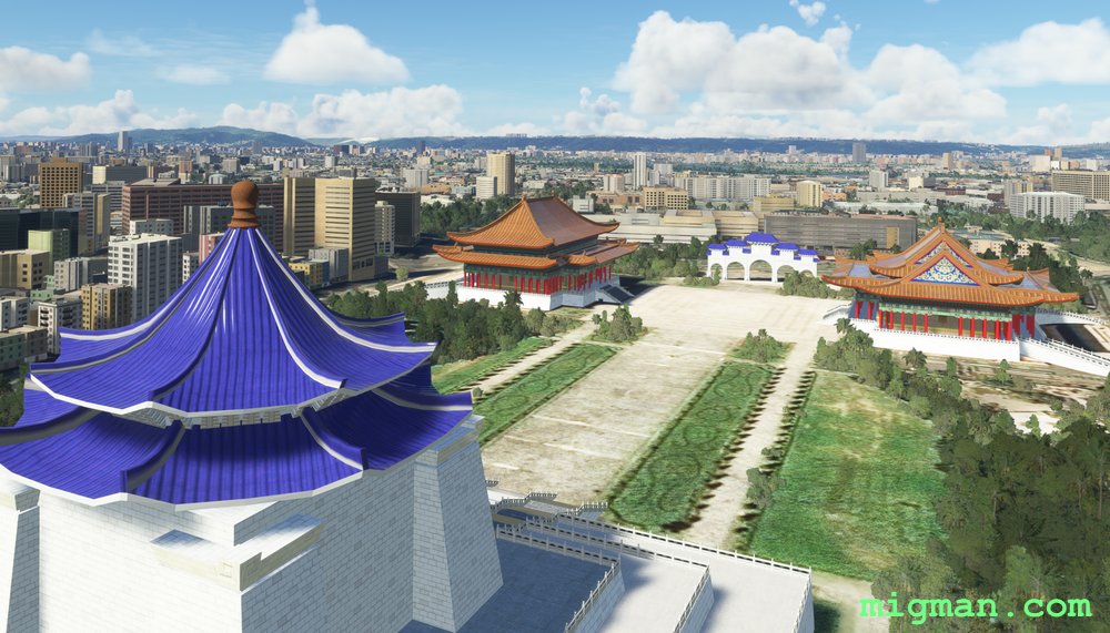
Taipei Tour
AboutTake a flight around the capital of Taiwan, Taipei on the NW coast. Chiang Kai-shek was the President of the Republic of China from 1928 until 1949, then until 1975 in exile on Taiwan. Sun Yat-Sen was the first president of the ROC and the first leader of the Kuomintang (Nationalist Party of China). Takeoff and fly east along the coast to the mouth of the Tamsui River.
 Taiwan
location_cityTaipei
flight_takeoffRCTP Chiang Kai-Shek
airline_seat_recline_extraAsia 2
tagBorder Patrol
tagCoastal flight
Taiwan
location_cityTaipei
flight_takeoffRCTP Chiang Kai-Shek
airline_seat_recline_extraAsia 2
tagBorder Patrol
tagCoastal flight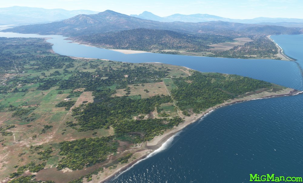
Mount Tatamailau
AboutFly to Mount Tatamailau, the highest point in Timor-Leste at 9,800 ft, and get a birds-eye view of this spectacular island.
 Timor-Leste
location_cityDili
flight_takeoffWPDL President Nicolau Lobato
airline_seat_recline_extraAsia 2
tagCoastal flight
Timor-Leste
location_cityDili
flight_takeoffWPDL President Nicolau Lobato
airline_seat_recline_extraAsia 2
tagCoastal flight
The Gong
AboutVisit 'The Gong' (Wollongong), home to Aunty Jack and the Port Kembla Steelworks, both icons to the post-boomer generation of Aussies. It was a simpler world back then with irreverant humour and school trips to the most dangerous workplaces. Great fun. Loiter over Wollongong and check out the steelworks. Then travel up one what is probably the most beautiful parts of Australia's east coast to Sydney's eastern suburbs. At Bondi Beach you will see lots of Poms and Kiwis mixing it up with the Great Whites. Just when you think it couldn't get any better, turn into Sydney Harbour and pass the Opera House and Harbour Bridge.
 Australia
location_cityN.S.W. | Sydney & Surrounds
flight_takeoffYSCN Camden
airline_seat_recline_extraAustralia 1
tagCoastal flight
tagDam spotting
Australia
location_cityN.S.W. | Sydney & Surrounds
flight_takeoffYSCN Camden
airline_seat_recline_extraAustralia 1
tagCoastal flight
tagDam spotting
Kangaroo Valley
AboutTake a plunge off Fitzroy Falls into Kangaroo Valley in this dramatic flight. Head back to the coast and fly north past the famous Kiama Blowhole. All these locations are favourite day-trips for Sydney-siders. At the north west corner of Lake Illawarra you find a large Buddhist Temple on the Princes Highway which runs all the way from Sydney to Melbourne.
Australia
location_cityN.S.W. | Sydney & Surrounds
flight_takeoffYSHL Shellharbour
airline_seat_recline_extraAustralia 1
tagCoastal flight
tagCanyon runs & Mach Loops
Ulladulla, Sussex Inlet, Jervis Bay and Shoalhaven Heads
AboutFly south over the rugged terrain of the Yerriyong State Forest and Morton National Park, then return along the coast.
Speaking Astrayan: Let's head down the south coast for the weekend, is a phrase often heard in Sydney households. Although it may sound to the outsider like "Wanna go downa coast? We'll avagoodweegend!"
Round trips from north to south: 21 nm HDG 025: Jaspers Brush Airfield YBEY (3344 ft) 12 nm HDG 032: Bomaderry 24 nm HDG 057: Shoalhaven Heads 16 nm HDG 125: Huskisson on Jervis Bay. 28 nm HDG 130: Jervis Bay Military YJBY and Royal Australian Navy (RAN) base HMAS Creswell. 40 nm HDG 185: Mouth of Lake Conjola at WP 3 28 nm HDG 171: Swan Lake and Sussex Inlet 52 nm HDG 190: Ulladulla, at WP 2, has been a fishing town and popular recreational area since the 19th century.
Australia
location_cityN.S.W. | Sydney & Surrounds
flight_takeoffYSNW Nowra Military
airline_seat_recline_extraAustralia 1
tagBridges
tagCoastal flight
tagAiports
The Central Coast
AboutJust to the north of Sydney, across Broken Bay lays a fantasmagoria of beaches and lakes. Known locally as "The Central Coast", this area has always been a favoured holiday destination for Sydney-siders. Many locals commute to Sydney by train, and you can see the rail bridge about 4 nm west of WP 4, Lion Island. Round trips: 50 nm: Entire route, 7 nm: Mardi Dam HDG 190, 25 nm: Gosford
Australia
location_cityN.S.W. | Sydney & Surrounds
flight_takeoffYWVA Warnervale
airline_seat_recline_extraAustralia 1
tagBridges
tagCoastal flight
tagDam spotting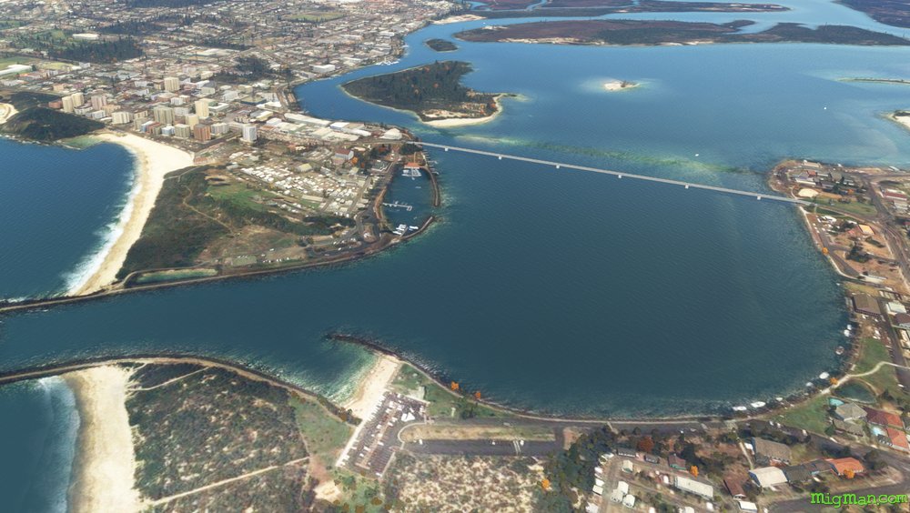
Forster and Tuncurry
AboutForster and Tuncurry guard the entrance to a complex series of lakes. The three main lakes to the south are Wallis Lake. Smith's Lake and Myall Lake. In this flight take the coast south and return inland along the Pacific Highway.
Australia
location_cityN.S.W. | Newcastle & Hunter
flight_takeoffYFST Forster
airline_seat_recline_extraAustralia 1
tagCoastal flight
Taree and the Old Bar Airmail
AboutTaree is an agricultural centre near the east coast of N.S.W. which was settled in 1831. In the 1920s George Bunyan built the Old Bar Airfield for Australia's earlist passenger and airmail services.
Australia
location_cityN.S.W. | Newcastle & Hunter
flight_takeoffYTRE Taree
airline_seat_recline_extraAustralia 1
tagBridges
tagCoastal flight
tagAiports
Port Macquarie and Comboyne Plateau
AboutExperience the highs and lows of this fertile region on the NSW coast.
Region: N.S.W. North Coast
Comboyne, population 454, is in the centre of a plateau notable for it's lush landscape and avocado farms.
Wauchope is home to "Timbertown Heritage Theme Park". At 87 acres, it is a sprawling recreation of the pioneering days of the timber industry in Australia. IT features a working steam train and blacksmiths.
Entire route: 70 nm Return flights. 12 nm: WP 7: Wauchope | 24 nm: WP 2: Laurieton and Queens Lake | 46 nm: WP 5: Comboyne
Australia
location_cityN.S.W. | North Coast
flight_takeoffYPMQ Port Macquarie
airline_seat_recline_extraAustralia 1
tagBridges
tagCoastal flight
tagCanyon runs & Mach Loops
Kempsey, Slim Dusty and the Akubra
AboutKempsey is the birthplace of Australian country music legend Slim Dusty, and also of that iconic Aussie hat, the Akubra.
Australia
location_cityN.S.W. | North Coast
flight_takeoffYKMP Kempsey
airline_seat_recline_extraAustralia 1
tagBridges
tagCoastal flight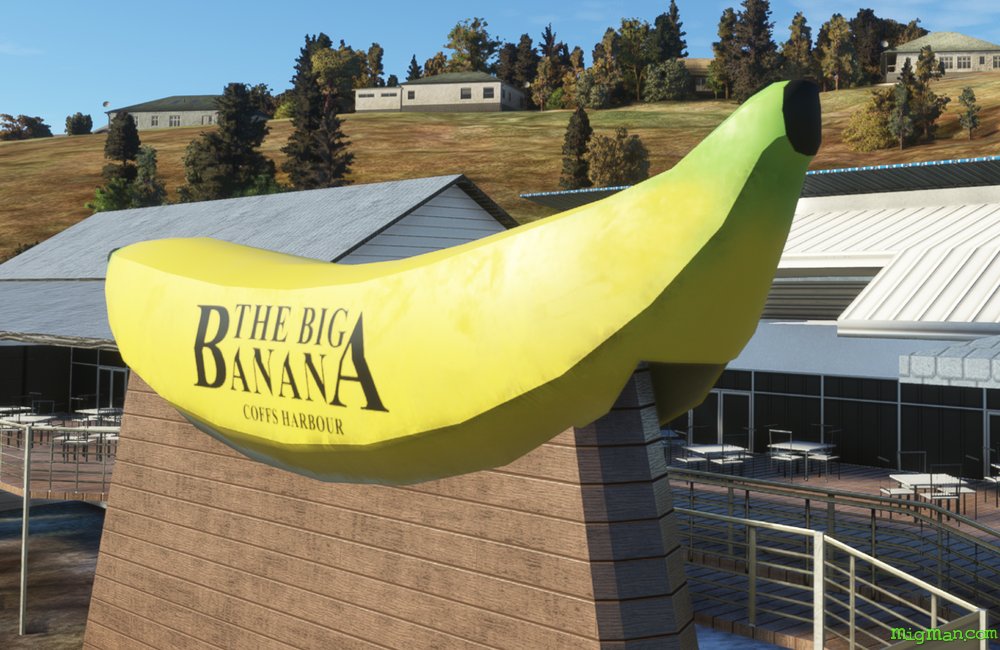
Coffs Harbour, Big Banana and Dorrigo
AboutFly out of Coffs Harbour, south along the coast and then inland to Dorrigo Plateau. Contrast the rugged bushland in the valleys on your right with the lush rolling famlands of the plateau on your left.
The Big Banana was built in 1964 to promote a roadside fruit stall and now hosts the largest water theme park between Sydney (NSW) and the Gold Coast in Queensland.
The Big Banana was built in 1964 to promote a roadside fruit stall and now hosts the largest water theme park between Sydney (NSW) and the Gold Coast in Queensland.
Australia
location_cityN.S.W. | North Coast
flight_takeoffYCFS Coffs Harbour
airline_seat_recline_extraAustralia 1
tagCoastal flight
tagDam spotting
tagCanyon runs & Mach Loops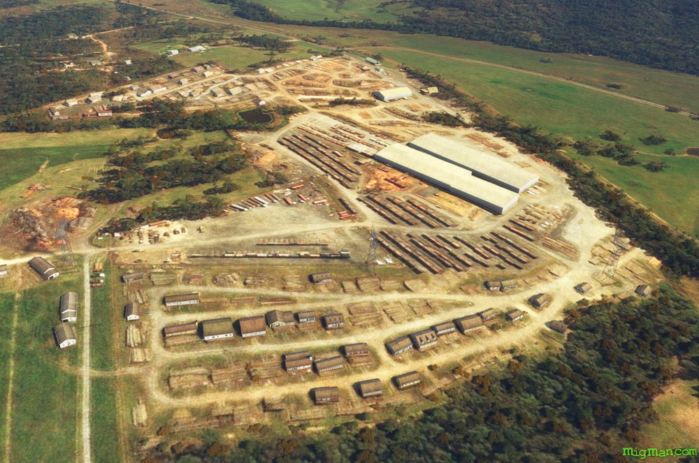
Glenreagh, Timber Town
AboutVisit one of Australia's oldest 'timber towns', Glenreagh in the Clarence Valley, population 900.
Return to Coffs Harbour via the coast, passing from Wooli: Freshwater, Corindi, Safety, Sandy, Emerald and Sapphire beaches.
Return to Coffs Harbour via the coast, passing from Wooli: Freshwater, Corindi, Safety, Sandy, Emerald and Sapphire beaches.
Australia
location_cityN.S.W. | North Coast
flight_takeoffYCFS Coffs Harbour
airline_seat_recline_extraAustralia 1
tagBridges
tagCoastal flight
tagDam spotting
Grafton Coast and the Clarence River
AboutThe Jacaranda capital of Australia, Grafton lays astride the Clarence river and features Edwardian and Victorian architecture.
Fly east of Grafton to the coast and then north to the coastal towns of Wooli, Minnie Water, Sandon, Brooms Head, Angourie Point and Yamba. Then return to Grafton via the Clarence River.
Fly east of Grafton to the coast and then north to the coastal towns of Wooli, Minnie Water, Sandon, Brooms Head, Angourie Point and Yamba. Then return to Grafton via the Clarence River.
Australia
location_cityN.S.W. | North Coast
flight_takeoffYGFN Grafton
airline_seat_recline_extraAustralia 2
tagCoastal flight
tagBridges
Ballina to Byron via Twin Towns
AboutByron Bay was traditionally a sanctuary for 'Age of Aquarians', which peaked in the 1960s. Nowadays it remains a popular tourist resort and hosts an annual blues festival which looks back longingly to Woodstock and Australia's own Sunbury. Tweed Head (NSW) and Coolangatta (QLD) sit astride the N.S.W./Queensland border and are known as the "Twin Towns".
Australia
location_cityN.S.W. | North Coast
flight_takeoffYBNA Ballina
airline_seat_recline_extraAustralia 2
tagBorder Patrol
tagCoastal flight
tagDam spotting
Mount Warning, but 'Bob's your uncle'
AboutLismore is one of the largest regional centres in northern N.S.W. and is a locus for the boomer era counter-culture, much like Ballina, Byron Bay and Nimbin. Mount Warning is a volcanic plug, with about half the crater walls remaining and forming a very distinctive landmark. It last erupted about 23 million years back so 'Bob's your uncle' as we say down under. **
But you never know!
** Translation: Conditions are optimal. Luck not required.
But you never know!
** Translation: Conditions are optimal. Luck not required.
Australia
location_cityN.S.W. | North Coast
flight_takeoffYLIS Lismore
airline_seat_recline_extraAustralia 2
tagBridges
tagCoastal flight
tagDam spotting
Bega & Bermagui
AboutBega is synonymous in Australia with a popular brand of cheese, the South East & Tablelands being a rich dairy producing region. The entire coastline in this region is breathtaking. Bermagui is probably derived from the aboriginal word permageua (canoe).
Australia
location_cityN.S.W. | South East & Tablelands
flight_takeoffYMER Merimbula
airline_seat_recline_extraAustralia 4
tagBridges
tagCoastal flight
tagDam spotting
Batemans Bay, Pearl of the South
AboutWhere the Clyde river flows into the Pacific Ocean, oysters thrive at Batemans Bay and this has become the basis of a thriving industry. About 10 miles west the Great Dividing Range rises out of the dense bush, forming an impressive backdrop to the golden beaches.
Australia
location_cityN.S.W. | South East & Tablelands
flight_takeoffYMRY Moruya
airline_seat_recline_extraAustralia 4
tagBridges
tagCoastal flight
Barbuda Beaches
AboutVisit Princess Diana Beach, Beach Barbuda and 11 Mile Beach on the sunny island of Barbuda, the northern part of Antigua-Barbuda. Take off from the short (2,265 ft) runway at Codrington.
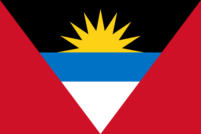 Antigua and Barbuda
location_cityCodrington
flight_takeoffTAPH Codrington
airline_seat_recline_extraCaribbean 1
tagCoastal flight
Antigua and Barbuda
location_cityCodrington
flight_takeoffTAPH Codrington
airline_seat_recline_extraCaribbean 1
tagCoastal flight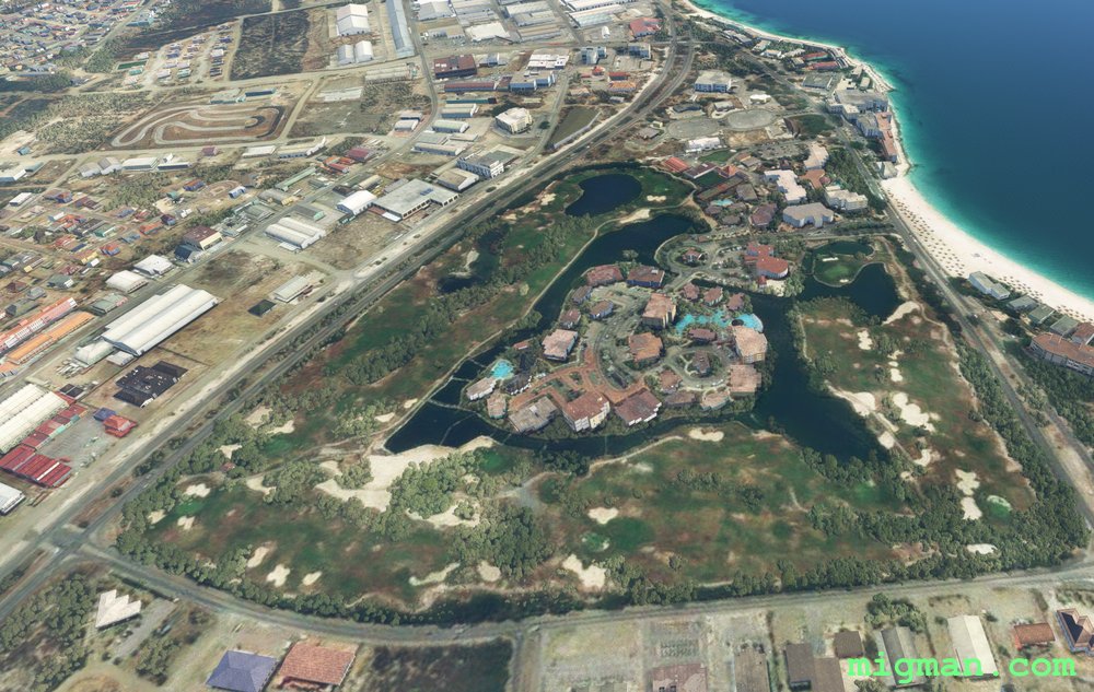
Babies, Birds and Birdies
AboutCheck out Baby Beach, the Bird Sanctuary and Aruba Golf Course at Aruba. Aruba is an island nation 14nm off the north coast of Venezuela.
 Aruba
location_cityOranjestad
flight_takeoffTNCA Queen Beatrix
airline_seat_recline_extraCaribbean 1
tagCoastal flight
Aruba
location_cityOranjestad
flight_takeoffTNCA Queen Beatrix
airline_seat_recline_extraCaribbean 1
tagCoastal flight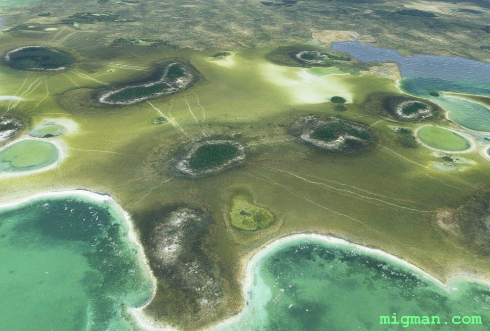
The Colours of Andros
AboutFollow the coast from Andros Town airport (length: 4,396ft) and enjoy the spectacular colours and textures in the nothern part of the Bahamas. NOTAM: WP 8 - The main lumber road is best seen by looking north, out your left window. Not a turn point. it is about 1/2 way across the island and at the only forest in this flight. Note that the entire route up to WP 7 can be flown by merely following the coast.
 Bahamas
location_cityThe Bahamas
flight_takeoffMYAF Andros Town
airline_seat_recline_extraCaribbean 1
tagCoastal flight
Bahamas
location_cityThe Bahamas
flight_takeoffMYAF Andros Town
airline_seat_recline_extraCaribbean 1
tagCoastal flight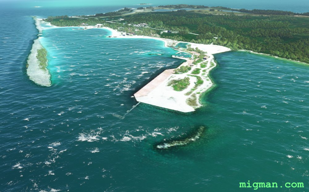
Castaway Cay, Disney in the Bahamas
AboutFly from Moore's Island to Castaway Cay. Castaway Cay is under a 99 year lease to Disney as a private tourist destination. NOTAM: Moore's Island AP is only 3036ft in length.
Castaway Cay is only 1.3nm wide and the facilities are on the west coast. There is a runway: Castaway Cay MYXB RWY 32/14, 1954 ft, which may or may not be servicable. It should be possible to land a seaplane at the beach/south side of the jetty.
Bahamas
location_cityCastaway Cay
flight_takeoffMYAO Mores Island
airline_seat_recline_extraCaribbean 1
tagCoastal flight
Feline Groovy at Cat Island
AboutCat Island is 40 miles long and about half a mile wide in most places, yet it boasts three airports. Take off from the northernmost and have a leisurely cruise along the coast, past the other two. Perform touch and go's if you're feline good!
Bahamas
location_cityCat Island
flight_takeoffMYCA Arthurs Town
airline_seat_recline_extraCaribbean 1
tagCoastal flight
tagAiports
Grand Bahama West
AboutExplore the western third of Grand Bahama. Take off and fly RWY HDG 24 to the entrance to Freeport harbour, which is visible immediately after takeoff. When you reach WP 4 Crab Cay and turn HDG 290 to WP5 West End, you initially won't be able to see West End as it is 18 nm away. Just keep the coast on your left, or alternatively you can hug the coast... which may be the safer option, because if you miss West End the next landfall is 54nm away at Florida, U.S.A.!
Bahamas
location_cityGrand Bahama
flight_takeoffMYGF Grand Bahama
airline_seat_recline_extraCaribbean 1
tagCoastal flight
tagAiports
Grand Bahama East
AboutFollow the coast around East Grand Bahama.
Bahamas
location_cityGrand Bahama
flight_takeoffMYXZ Deep Water Cay
airline_seat_recline_extraCaribbean 1
tagCoastal flight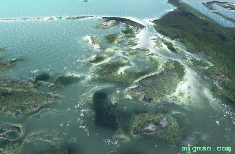
Long Island South: Deadman's Cay to Sandy Cay
AboutThe area between Sandy and Deadman's Cay is a spectacular array of peninsula and islands. Follow the coast in a clockwise direction south from Deadman's Cay, starting on the east coast.
Bahamas
location_cityLong Island
flight_takeoffMYLD Deadmans Cay
airline_seat_recline_extraCaribbean 1
tagCoastal flight
Barbados Circumnavigation
AboutCircumnavigate the island continent of Barbados. Keep the green on your left and the blue on your right and you'll be OK! The east coast features long beaches and the west sports numerous cultural features.
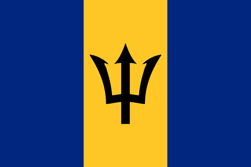 Barbados
location_cityBridgetown
flight_takeoffTBPB Grantley Adams
airline_seat_recline_extraCaribbean 1
tagCoastal flight
Barbados
location_cityBridgetown
flight_takeoffTBPB Grantley Adams
airline_seat_recline_extraCaribbean 1
tagCoastal flight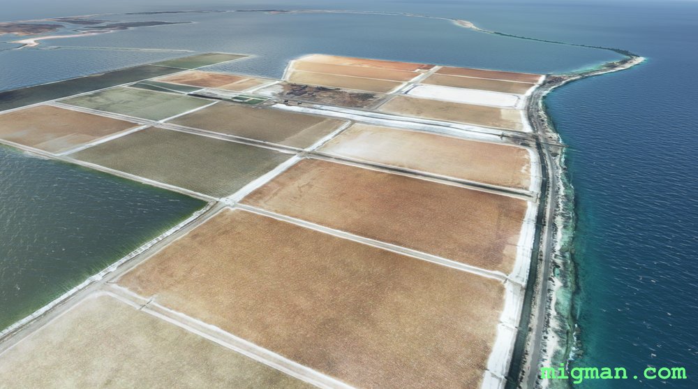
Bonaire, Salt of the Earth
AboutCaribbean Netherlands consists of the islands of Bonaire, Sint Eustatius and Saba. Bonaire is about 40 nm N of Venezuela. Follow the coast of Bonaire, visiting the enormous saltworks and their colourful drying pans south of the airport.
 Caribbean Netherlands
location_cityBonaire
flight_takeoffTNCB Bonaire
airline_seat_recline_extraCaribbean 2
tagCoastal flight
Caribbean Netherlands
location_cityBonaire
flight_takeoffTNCB Bonaire
airline_seat_recline_extraCaribbean 2
tagCoastal flight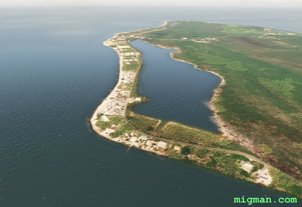
Cayman Brac and Little Cayman
AboutTake off from Gerrard-Smith International MWCB and explore the two smaller islands of the Cayman trilogy. Follow South Side Road along the southern shoreline to Pollard Bay and fly around the coast, back to the airport and then cross 5 miles of shark infested ocean to Little Cayman.
 Cayman Islands
location_cityCayman Brac
flight_takeoffMWCB Gerrard-Smith
airline_seat_recline_extraCaribbean 2
tagCoastal flight
tagAiports
Cayman Islands
location_cityCayman Brac
flight_takeoffMWCB Gerrard-Smith
airline_seat_recline_extraCaribbean 2
tagCoastal flight
tagAiports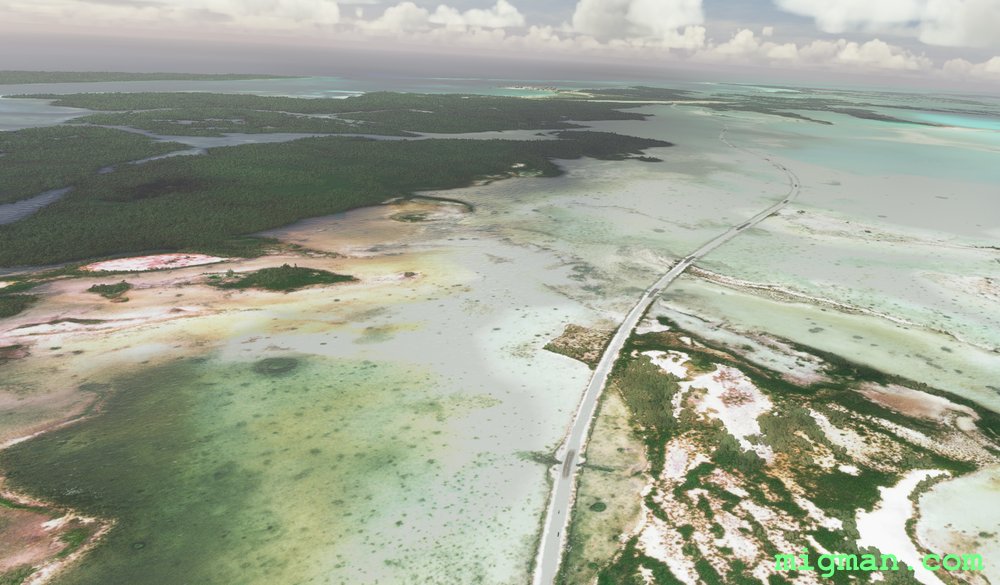
Cayo Santa Maria Causeway
AboutThe Cayo Santa Maria Causeway extends about 8 miles off the north coast of Cuba and connects to an extensive island chain.
This flight plan provides a beautiful setting to practice basic flight skills at a generous runway.
 Cuba
location_cityVilla Clara
flight_takeoffMUBR Las Brujas
airline_seat_recline_extraCaribbean 2
tagCoastal flight
Cuba
location_cityVilla Clara
flight_takeoffMUBR Las Brujas
airline_seat_recline_extraCaribbean 2
tagCoastal flight
Havana to the South Coast
AboutTake off from Jose Marti International Airport in Cuba's capital city Havana and explore the countryside down to the south coast. Along the way familiarise yourself with the location of three other airports.
The lake at WP 1 is a good reference for approaching RWY 24, being 3 miles from the threshold.
Return trip options:
20 nm: San Antonio de los Banos Airport MUSA at WP 6
34 nm: Batabano Airport MUBO (Agricultural) at WP 5
40 nm: Lake at WP 1 and the dam at WP 2
56 nm: Juan de la Cruz Airport MUGU at WP 5
75 nm: Entire route
Cuba
location_cityHavana
flight_takeoffMUHA Jose Marti
airline_seat_recline_extraCaribbean 2
tagCoastal flight
tagDam spotting
tagAiports
Havana's Northern Shores
AboutFly out of Jose Marti International Airport in Cuba's capital city Havana and explore the local coastline. The lake at WP 1 is a good reference for approaching RWY 24, being 3 miles from the threshold.
Return trip options:
17 nm: Centre of Havana, WP 4
37 nm: NE shore and Havana: WP 1,2,3,4
48 nm: NW shore and Havana: WP 4,5,6
69 nm: Entire route
Return trip options:
17 nm: Centre of Havana, WP 4
37 nm: NE shore and Havana: WP 1,2,3,4
48 nm: NW shore and Havana: WP 4,5,6
69 nm: Entire route
Cuba
location_cityHavana
flight_takeoffMUHA Jose Marti
airline_seat_recline_extraCaribbean 2
tagCoastal flight
tagAiports
Matanzas North West Coast
AboutLocated 45 nm east of Havana, Matanzas is capital of the Province of Matanzas. Take off from Juan G. Gomez International Airport. Fly to Matanzas, over several large lakes and return along the coast from Santa Cruz del Norte, about 20 miles east of Havana.
Return flights:
15 nm: WP 1, Matanzas
36 nm: WP 1,2 - Caunavaco Dam
60 nm: Entire route
Return flights:
15 nm: WP 1, Matanzas
36 nm: WP 1,2 - Caunavaco Dam
60 nm: Entire route
Cuba
location_cityMatanzas
flight_takeoffMUVR Juan G. Gomez
airline_seat_recline_extraCaribbean 2
tagBridges
tagCoastal flight
tagDam spotting
Dominica's Rugged Coastline
AboutFollow the rugged coastline around the Island country of Dominica in the east Caribbean, north of Guyana and Venezuela. It's closest neighbours are Base-Terre to the north and Martinique to the south.
Routes (return distance):
3 nm: South to Roseau
15 nm: Scotts Head
28 nm: Straight line to Douglas-Charles Airport at WP 4
64 nm: Entire route
Routes (return distance):
3 nm: South to Roseau
15 nm: Scotts Head
28 nm: Straight line to Douglas-Charles Airport at WP 4
64 nm: Entire route
 Dominica
location_cityRoseau
flight_takeoffTDCF Roseau-Canefield
airline_seat_recline_extraCaribbean 2
tagCoastal flight
tagAiports
Dominica
location_cityRoseau
flight_takeoffTDCF Roseau-Canefield
airline_seat_recline_extraCaribbean 2
tagCoastal flight
tagAiports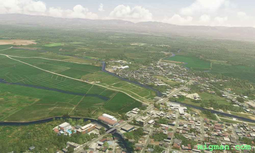
Sosua, the North West Coast
AboutCover beaches, mountainous National Parks, fertile plains and two large dams in this varied flight.
40 nm: Playa Cambiaso | 64 nm: Playa El Castillo | 111 nm: Entire route
40 nm: Playa Cambiaso | 64 nm: Playa El Castillo | 111 nm: Entire route
 Dominican Republic
location_citySosua
flight_takeoffMDPP Gregorio Luperon
airline_seat_recline_extraCaribbean 2
tagCoastal flight
tagDam spotting
Dominican Republic
location_citySosua
flight_takeoffMDPP Gregorio Luperon
airline_seat_recline_extraCaribbean 2
tagCoastal flight
tagDam spotting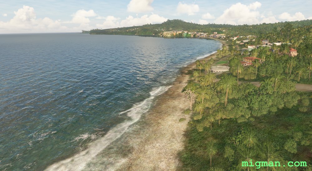
Grenada
AboutFollow the coastline at the Caribbean continent of Grenada, about 70 m north off the north coast of Venezuela.
Entire route: 37 nm
Entire route: 37 nm
 Grenada
location_citySaint Georges
flight_takeoffTGPY Point Salines
airline_seat_recline_extraCaribbean 3
tagCoastal flight
tagAiports
Grenada
location_citySaint Georges
flight_takeoffTGPY Point Salines
airline_seat_recline_extraCaribbean 3
tagCoastal flight
tagAiports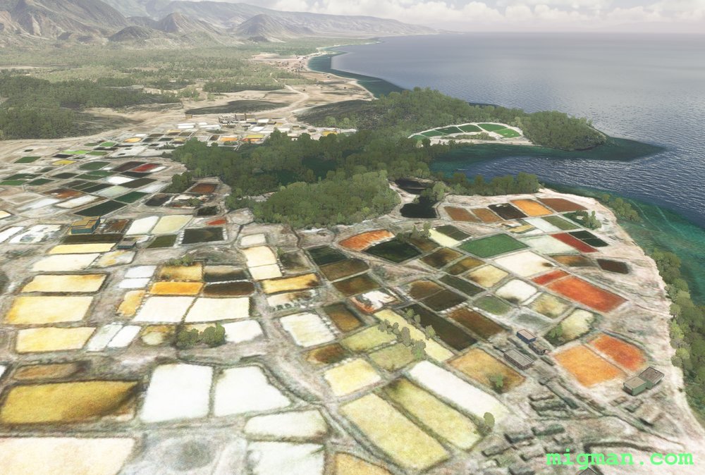
The Colours of Nan Fort
AboutFly from Cap Haitien on Haiti's north coast to the westernmost point on the island, about 45 west of Cuba. Start by flying west over the rugged terrain of the Gros-Morne Arrondissement (adminstrative area), Nan Palmiste, then follow the spectacular coastline south and east back to Gonaives.
Return trips: 68 nm: Gonaives | 101 nm: Gonaives and Nan Fort | 162 nm: Entire route
Return trips: 68 nm: Gonaives | 101 nm: Gonaives and Nan Fort | 162 nm: Entire route
 Haiti
location_cityCap Haitien
flight_takeoffMTCH Cap Haitien
airline_seat_recline_extraCaribbean 3
tagCoastal flight
tagCanyon runs & Mach Loops
Haiti
location_cityCap Haitien
flight_takeoffMTCH Cap Haitien
airline_seat_recline_extraCaribbean 3
tagCoastal flight
tagCanyon runs & Mach Loops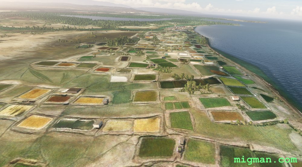
Port-au-Prince to Grand Saline
AboutExplore the coastline and rugged terrain north of Port-au-Prince, capital of Haiti.
Return flights: 31 nm: WP 6 | 59 nm: WP 1 and 2 | Entire route: 136 nm
Return flights: 31 nm: WP 6 | 59 nm: WP 1 and 2 | Entire route: 136 nm
Haiti
location_cityPort au Prince
flight_takeoffMTTP Toussaint Louverture
airline_seat_recline_extraCaribbean 3
tagCoastal flight
tagDam spotting
Cap Haitien to Tortuga
AboutFly out of Cap Haitien on Haiti's north coast to the island of Tortuga. Pass the coastal areas of the Baie de I'Acul, Boyeou, Chouchou, Le Borgne, Grand Fond, Anse a Foleur, Cap Rouge, Saint-Louis-du-Nord and La Pointe.
Return flights: 30 nm: Boyeou, Chouchou | 40 nm: Le Borgne | 50 nm: Grand Fond, Anse a Foleur | 60 nm: Cap Rouge, Saint-Louis-du-Nord | 107 nm: Entire route
Return flights: 30 nm: Boyeou, Chouchou | 40 nm: Le Borgne | 50 nm: Grand Fond, Anse a Foleur | 60 nm: Cap Rouge, Saint-Louis-du-Nord | 107 nm: Entire route
Haiti
location_cityCap Haitien
flight_takeoffMTCH Cap Haitien
airline_seat_recline_extraCaribbean 3
tagCoastal flight
tagAiports
Cockpit Country
AboutExplore the western regions of Jamaica, flying out from Sangster International Airport at Montego Bay. Fly down the west coast and return over Cockpit Country, which refers to the proliferation of shallow caves in that region. Along the way fly over several smaller aerodromes: Negril, Port Esquivel, Kirkvine and Silent Hill. Check the runway lengths before attempting any landings!
Round trips: 20 nm: Falmouth Harbour
27 nm: Grand Palladium Jamaica Resort / Lucea Harbour
53 nm: WP 1, WP 2 - Negril Aerodrome MKNG 2490 ft
72 nm: Direct to Kirkvine Airstrip MKWI 2219 ft
Entire route: 168 nm
Round trips: 20 nm: Falmouth Harbour
27 nm: Grand Palladium Jamaica Resort / Lucea Harbour
53 nm: WP 1, WP 2 - Negril Aerodrome MKNG 2490 ft
72 nm: Direct to Kirkvine Airstrip MKWI 2219 ft
Entire route: 168 nm
 Jamaica
location_cityMontego Bay
flight_takeoffMKJS Sangster
airline_seat_recline_extraCaribbean 3
tagCoastal flight
tagAiports
Jamaica
location_cityMontego Bay
flight_takeoffMKJS Sangster
airline_seat_recline_extraCaribbean 3
tagCoastal flight
tagAiports
Spartan Ferrum
AboutNueva Esparta (New Sparta) has red soil, characteristic of high levels of Iron (Latin: Ferrum). It is a Caribbean province of Venezuela consisting of three islands: Margarita Island, Coche Island and Cubagua Island. Take off from Santiago Marino airport SVMG in the capital Porlamar and fly to the extreme compass points.
Round trips:
23 nm: WP 9 El Guamache (southernmost point of Isla de Coche)
34 nm: WP 2 Hill at Cabo Negro (most northerly point on Isla de Margarita)
54 nm: WP 7 Beach: Playa Punta Arenas (most westerly point on Isla de Margarita)
113 nm: Entire route
Round trips:
23 nm: WP 9 El Guamache (southernmost point of Isla de Coche)
34 nm: WP 2 Hill at Cabo Negro (most northerly point on Isla de Margarita)
54 nm: WP 7 Beach: Playa Punta Arenas (most westerly point on Isla de Margarita)
113 nm: Entire route
 Nueva Esparta
location_cityPorlamar
flight_takeoffSVMG Santiago Marino
airline_seat_recline_extraCaribbean 3
tagCoastal flight
Nueva Esparta
location_cityPorlamar
flight_takeoffSVMG Santiago Marino
airline_seat_recline_extraCaribbean 3
tagCoastal flight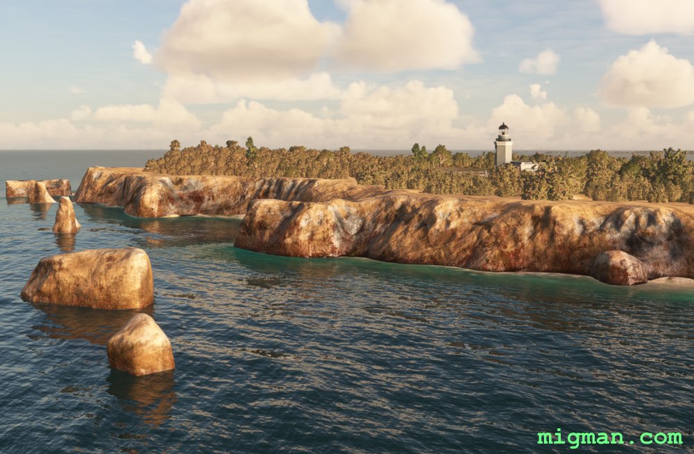
Lighter than Air
AboutTake a light aircraft and have fun landing at this selection of tiny airstrips. Aerostato de Lajas is a launching station for lighter-than-air vehicles (blimps). You will be flying out of Rafael Hernandez International TJBQ near Aguadilla Pueblo on Puerto Rico's north west coast. Cabo Rojo Lighthouse is on the south west extremity of the island.
Return flights:
13 nm: WP 1 - Communication Facility
68 nm: WP 4 - Cabo Rojo Lighthouse
98 nm: Entire route
Return flights:
13 nm: WP 1 - Communication Facility
68 nm: WP 4 - Cabo Rojo Lighthouse
98 nm: Entire route
 Puerto Rico
location_cityAguadilla Pueblo
flight_takeoffTJBQ Rafael Hernandez
airline_seat_recline_extraCaribbean 3
tagCoastal flight
tagAiports
Puerto Rico
location_cityAguadilla Pueblo
flight_takeoffTJBQ Rafael Hernandez
airline_seat_recline_extraCaribbean 3
tagCoastal flight
tagAiports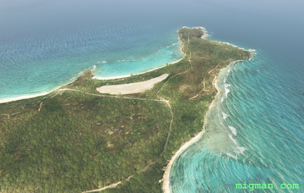
Vieques Island
AboutFly out of Mercedita airport in Ponce, cruise the south coast and then travel to Puerto Rico's second largest island, Vieques.
NOTAM: You may want to do an airshow at Salinas Speedway? Antonio Rivera Rodríguez Airport TJVQ 4296 ft is 3,5 nm west of Vieques City (WP 6).
Return flights:
36 nm: Salinas Speedway
152 nm: Entire route
NOTAM: You may want to do an airshow at Salinas Speedway? Antonio Rivera Rodríguez Airport TJVQ 4296 ft is 3,5 nm west of Vieques City (WP 6).
Return flights:
36 nm: Salinas Speedway
152 nm: Entire route
Puerto Rico
location_cityPonce
flight_takeoffTJPS Mercedita
airline_seat_recline_extraCaribbean 3
tagCoastal flight
tagAiports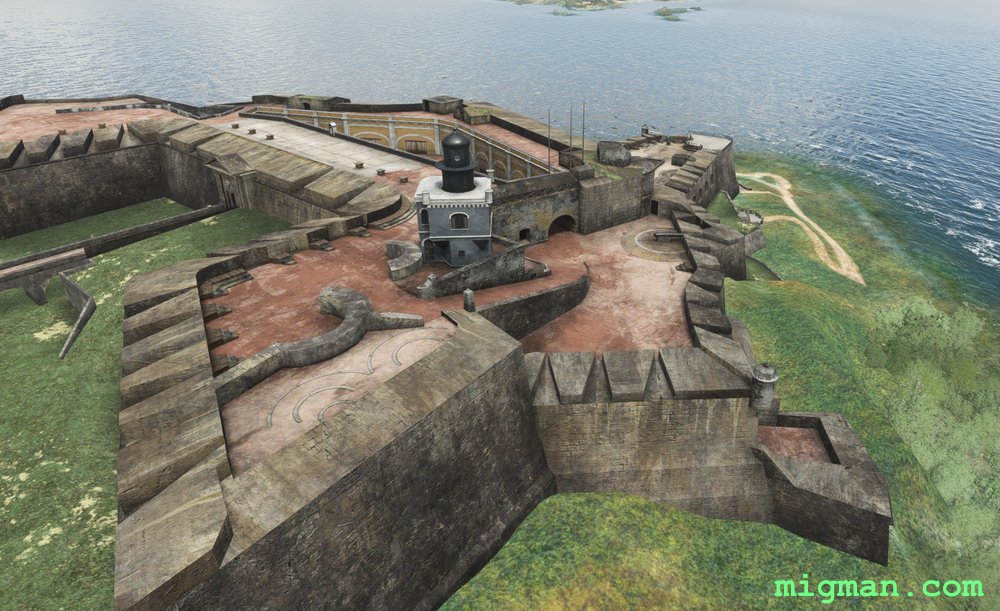
San Juan East
AboutTake off from Luis Munoz Marin International Airport and explore the north eastern corner of Puerto Rico's main island. Some of the coastal resorts you will see are Fajardo, Playa Fortuna, Coco Beach Golf Club, Suarez, and the capital San Juan.
Return flights:
12 nm: WP 2 - Carraizo Dam
15 nm: WP 1 - San Felipe del Morro Castle on San Juan Bay
23 nm: WP 6 - Fajardo Harbour
77 nm: Entire route
Return flights:
12 nm: WP 2 - Carraizo Dam
15 nm: WP 1 - San Felipe del Morro Castle on San Juan Bay
23 nm: WP 6 - Fajardo Harbour
77 nm: Entire route
Puerto Rico
location_citySan Juan
flight_takeoffTJSJ Luis Munoz
airline_seat_recline_extraCaribbean 3
tagCoastal flight
tagDam spotting
tagAiports
San Juan and west to Arecibo
AboutVisit the famous radio telescope at Arecibo and enjoy the beachs of Puerto Rico's central north coast.
NOTAM: Antonio/Nery/Juarbe Regional Airport Pol TJAB 3979 ft is 2 nm SE of Arecibo. You will pass it on the N and W.
Return flights:
31 nm: West along the coast to Dorado
68 nm: West along the coast to Los Molinos
96 nm: Entire route
NOTAM: Antonio/Nery/Juarbe Regional Airport Pol TJAB 3979 ft is 2 nm SE of Arecibo. You will pass it on the N and W.
Return flights:
31 nm: West along the coast to Dorado
68 nm: West along the coast to Los Molinos
96 nm: Entire route
Puerto Rico
location_citySan Juan
flight_takeoffTJSJ Luis Munoz
airline_seat_recline_extraCaribbean 3
tagCoastal flight
tagDam spotting
32 Islands
AboutClimb to the volcano at the north of Saint Vincent and then take a leisurely flight down the rigged west coast. Hit the open waters to visit a few of the 32 islands in the Grenadines group to the south: Bequia, Canouan, Mayreau, Union Island, Palm Island, Petit Saint Vincent, Mustique, Baliceauz and Battowia.
NOTAM: Plan your ascent to La Souffrie carefully as the lip is about 4200ft in elevation. Better to gain altitude over the water than risk stalling into the mountainside during a max performance climb. Not that it ever happened to me!
NOTAM: Plan your ascent to La Souffrie carefully as the lip is about 4200ft in elevation. Better to gain altitude over the water than risk stalling into the mountainside during a max performance climb. Not that it ever happened to me!
 Saint Vincent and the Grenadines
location_cityKingstown
flight_takeoffTVSA Argyle
airline_seat_recline_extraCaribbean 3
tagCoastal flight
tagVolcano
Saint Vincent and the Grenadines
location_cityKingstown
flight_takeoffTVSA Argyle
airline_seat_recline_extraCaribbean 3
tagCoastal flight
tagVolcano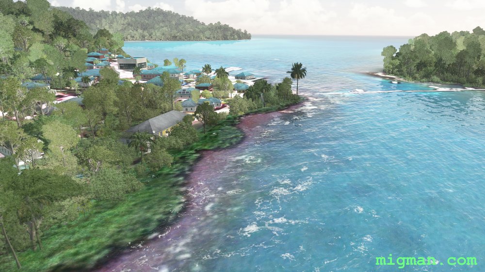
Treacherous Reefs
AboutSan Andres and Providencia are territories of Colombia consisting of three islands: San Andres to the south and Providencia and Santa Catalina 50 nm to the north. Take off from El Embrujo SKPV 4232ft and cruise the coast, from Santa Catalina in the north to the treacherous reefs extending up the east coast.
 San Andres and Providencia
location_cityProvidencia
flight_takeoffSKPV El Embrujo
airline_seat_recline_extraCaribbean 3
tagCoastal flight
San Andres and Providencia
location_cityProvidencia
flight_takeoffSKPV El Embrujo
airline_seat_recline_extraCaribbean 3
tagCoastal flight
San Andres
AboutSan Andres and Providencia are territories of Colombia consisting of three islands: San Andres to the south and Providencia and Santa Catalina 50 nm to the north. Take a flight along the coast on San Andres, from Gustavo Rojas Pinilla Airport SKSP 7788ft.
San Andres and Providencia
location_citySan Andres
flight_takeoffSKSP Gustavo Rojas Pinilla
airline_seat_recline_extraCaribbean 3
tagCoastal flight
San Fernando and the South-West Coast
AboutExplore the many coastal towns and beaches in Trinidad's south west. The Point-A-Pierre POL (Petroleum, Oil, Liquid storage facility) is at the north end of the large coastal city of San Fernando. Follow the coastline all the way to Icacos Point which is the southernmost point on Trinidad.
Round trips:
24 nm: WP 1 Camden Airfield TTCO 3742 feet
38 nm: WP 1 and 2 to San Fernando
112 nm: Entire route
150 nm: South East Region. Trinidad's south eastern area is sparsely populated and covered by forest. If you want to experience that region then fly to WP 5 at San Francique, turn east and follow the coast. After about 40 nm the coast turns north at Galeota Port and continues for another 43 nm to Galera Point.
 Trinidad and Tobago
location_citySan Fernando
flight_takeoffTTPP Piarco
airline_seat_recline_extraCaribbean 4
tagCoastal flight
tagDam spotting
Trinidad and Tobago
location_citySan Fernando
flight_takeoffTTPP Piarco
airline_seat_recline_extraCaribbean 4
tagCoastal flight
tagDam spotting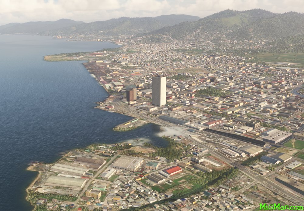
Trinidad North West
AboutJust off the north coast of Venezuela lay the islands of Trinidad and Tobago, one of the larger island chains in the West Indies. Fly out out of Piarco International Airport TTPP 10,457, across the the capital Port of Spain, explore the north east coast of Trinidad and return across the east to west mountain range.
NOTAM: At Chacachacare. Venezuela is visible 5 nautical miles to the west across Bocas del Dragon.
Round trips: 58 nm: At WP 5 Diego Martin, turn south and follow the valley south for 5nm to WP 2 - Intersection at Fort George then return to Piarco airport. 70 nm plus: Explore the north east coast: Fly directly to WP 6, follow the coast to the east. At the most easterly point turn south and follow the coast. When ready, return via WP 7 or directly to Piarco airport. 72 nm: Entire route
Trinidad and Tobago
location_cityTrinidad
flight_takeoffTTPP Piarco
airline_seat_recline_extraCaribbean 4
tagCoastal flight
tagCanyon runs & Mach Loops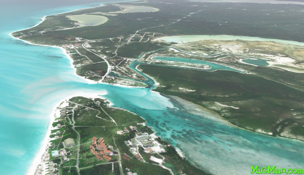
Providenciales, North and West Caicos
AboutFly past some of the most gorgeous resorts and beaches in teh Caribbean by taking off from Providenciales International Airport MBPV 9199 ft and following the northern shoreline to Little Water Cay (Iguana Island). Continue along the northern shores to the northern end of North Caicos. Fly down the east coast of North Caicos and back over Providenciales to West Caicos.
Round Trips:
24 nm: Lake Catherine, West Caicos
24 nm: Pine Cay Airport MBPI at Leeward Settlement
28 nm: Northwest Point National Park
85 nm: Entire route
Round Trips:
24 nm: Lake Catherine, West Caicos
24 nm: Pine Cay Airport MBPI at Leeward Settlement
28 nm: Northwest Point National Park
85 nm: Entire route
 Turks and Caicos Islands
location_cityProvidenciales
flight_takeoffMBPV Providenciales
airline_seat_recline_extraCaribbean 4
tagBridges
tagCoastal flight
tagAiports
Turks and Caicos Islands
location_cityProvidenciales
flight_takeoffMBPV Providenciales
airline_seat_recline_extraCaribbean 4
tagBridges
tagCoastal flight
tagAiports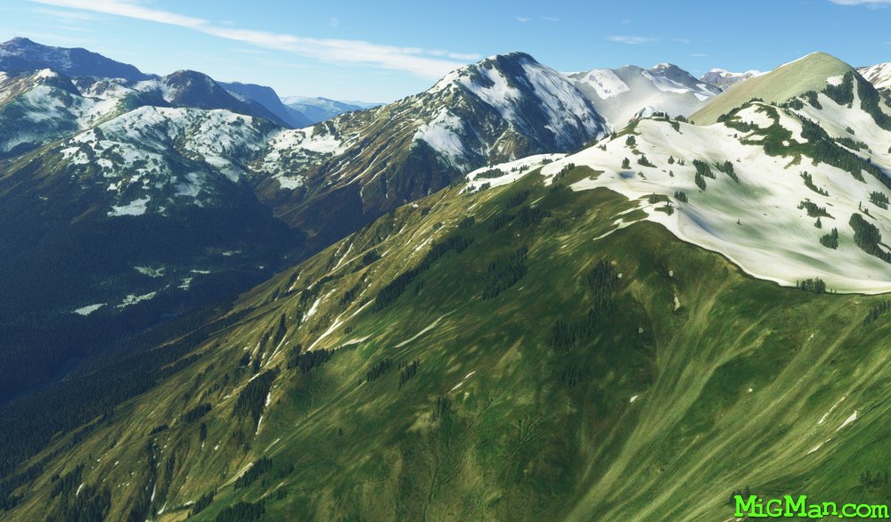
Eastern Abkhazia
AboutExplore the eastern and northern borders with Georgia and return via the capital, Sokhumi. This flight covers almost the entire eastern half of the country, mountains on the border with Georgia and the coast from the capital Sokhumi back to Babushara.
 Abkhazia
location_citySokhumi
flight_takeoffUGSS Babushara
airline_seat_recline_extraEurope 1
tagCanyon runs & Mach Loops
tagCoastal flight
tagMountain climbing
Abkhazia
location_citySokhumi
flight_takeoffUGSS Babushara
airline_seat_recline_extraEurope 1
tagCanyon runs & Mach Loops
tagCoastal flight
tagMountain climbing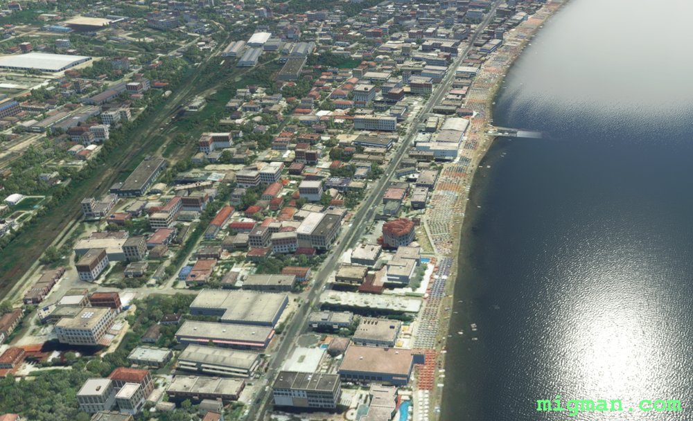
Adriatic Sea Holiday
AboutEnjoy the spectacular coastal terrain and fly over the thousands of sun-lovers at the beach near Durres, popular holiday resort on the Adriatic Sea.
 Albania
location_cityTirana
flight_takeoffLATI Tirana
airline_seat_recline_extraEurope 1
tagCoastal flight
Albania
location_cityTirana
flight_takeoffLATI Tirana
airline_seat_recline_extraEurope 1
tagCoastal flight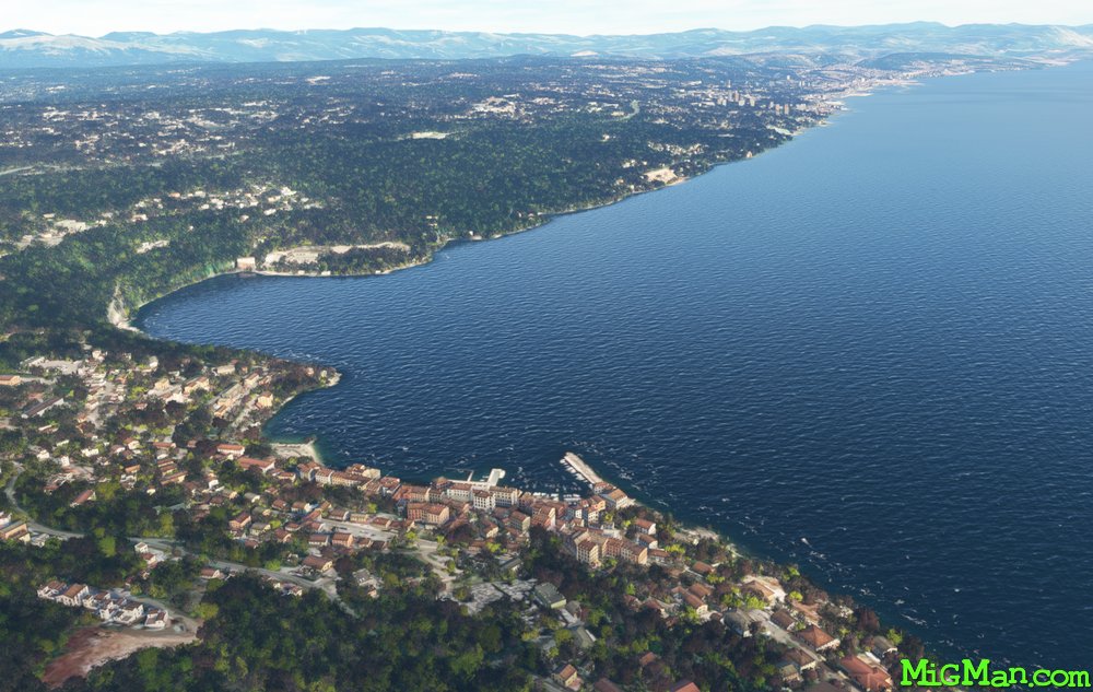
Rijeka, Jewel of the Adriatic
AboutExplore the rugged coastline on the Adriatic Sea at Rijeka.
 Croatia
location_cityRijeka
flight_takeoffLDRI Rijeka
airline_seat_recline_extraEurope 1
tagCoastal flight
Croatia
location_cityRijeka
flight_takeoffLDRI Rijeka
airline_seat_recline_extraEurope 1
tagCoastal flight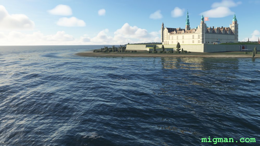
Kronborg Slot, Helsingor
AboutVisit the 16th century castle, Kronborg Slot, at Helsingor on the east coast of Denmark. Fly up the coast and return via the Helsingormotorvejen (Helsingor Motorway).
 Denmark
location_cityCopenhagen
flight_takeoffEKCH Kastrup
airline_seat_recline_extraEurope 2
tagCoastal flight
Denmark
location_cityCopenhagen
flight_takeoffEKCH Kastrup
airline_seat_recline_extraEurope 2
tagCoastal flight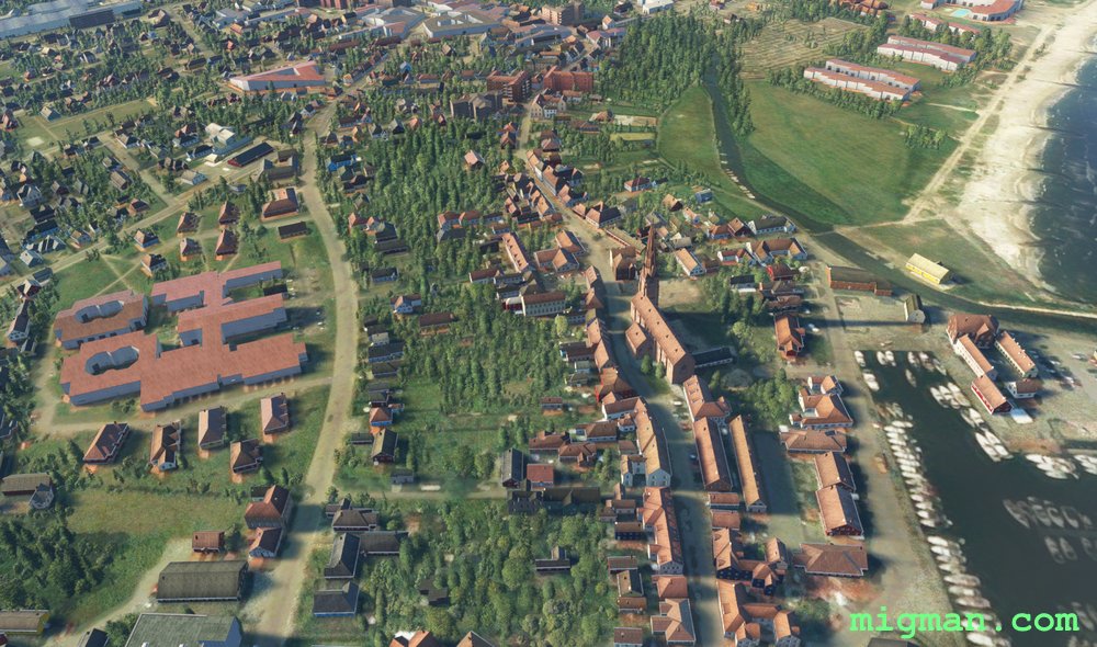
Saeby to Strandby
AboutExplore the NE coast of Denmark.
Denmark
location_citySindal
flight_takeoffEKSN Sindal
airline_seat_recline_extraEurope 2
tagBridges
tagCoastal flight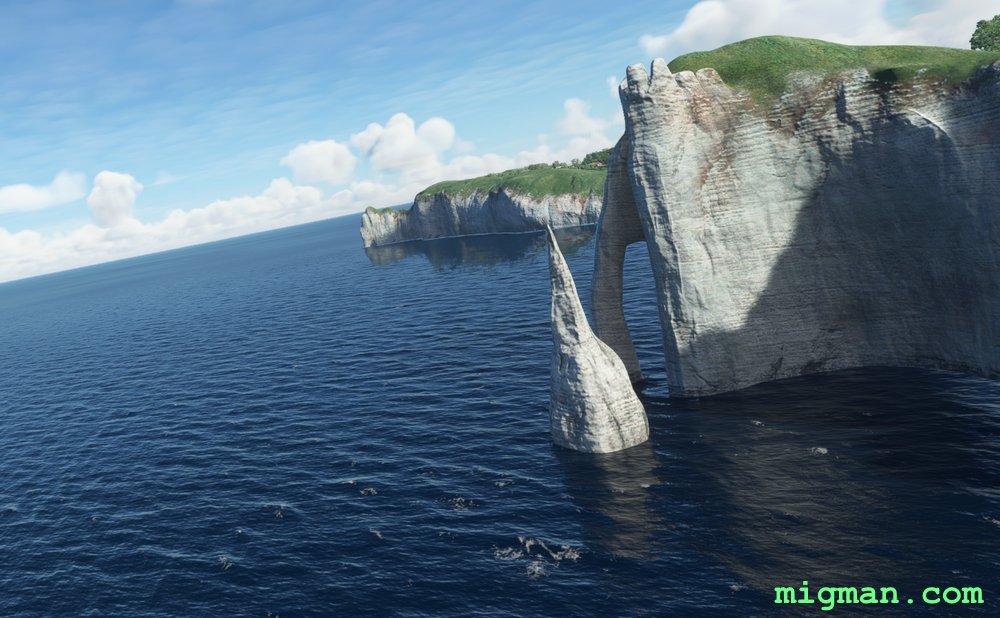
Monet, Artistic Revolution at Etretat
AboutVisit the stunning chalk cliffs where Claude Monet almost drowned, and did not drown, but did however paint some of the most iconic seascapes in the Impressionist repertoire. This flight plan is slightly unusual in that we take two runs past the same stretch of coast (the chalk at Etretat), and in opposite directions.
 France
location_cityEtretat
flight_takeoffLFOH Octeville
airline_seat_recline_extraEurope 2
tagCoastal flight
France
location_cityEtretat
flight_takeoffLFOH Octeville
airline_seat_recline_extraEurope 2
tagCoastal flight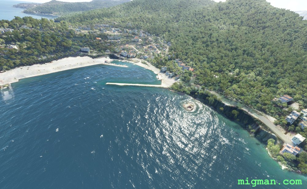
Cephalonian Idyll
AboutExplore the dramatic coastline of Cephalonia, one of the largest Greek islands, SW of the mainland. Cephalopoda are the class of molluscs which include squid and octopus, delicacies famous in Greek cuisine.
 Greece
location_cityCephalonia
flight_takeoffLGKF Kefallinia
airline_seat_recline_extraEurope 2
tagCoastal flight
tagCanyon runs & Mach Loops
Greece
location_cityCephalonia
flight_takeoffLGKF Kefallinia
airline_seat_recline_extraEurope 2
tagCoastal flight
tagCanyon runs & Mach Loops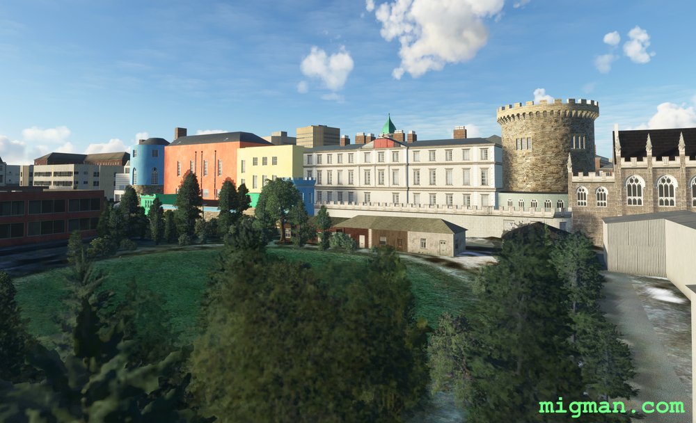
Dublin North
AboutFollow the River Liffey through the centre of Dublin then follow the gorgeous coastlines on the north side. Dublin Castle is 1.6nm after WP 1 and on the right, near Christ Church Cathedral. It's quite difficult to spot on a fly-by as Dublin centre is densely packed with interesting buildings.
 Ireland
location_cityDublin
flight_takeoffEIDW Dublin
airline_seat_recline_extraEurope 2
tagCoastal flight
Ireland
location_cityDublin
flight_takeoffEIDW Dublin
airline_seat_recline_extraEurope 2
tagCoastal flight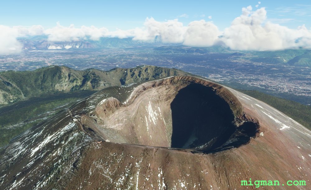
Fire and Fun: Mount Vesuvius to The Isle of Capri
AboutFly over Mt. Vesuvius, past Pompei and along the spectacular coast to the sunny island of Capri. Vesuvius is 4,200 ft at the summit, so plan your ascent according to your aircraft performance.
 Italy
location_cityNaples
flight_takeoffLIRN Capodichino
airline_seat_recline_extraEurope 2
tagCoastal flight
tagVolcano
Italy
location_cityNaples
flight_takeoffLIRN Capodichino
airline_seat_recline_extraEurope 2
tagCoastal flight
tagVolcano
Riga local
AboutTake a cruise through the centres of Latvia's capital, Riga.
 Latvia
location_cityRiga
flight_takeoffEVRA Riga
airline_seat_recline_extraEurope 3
tagBridges
tagCoastal flight
tagDam spotting
Latvia
location_cityRiga
flight_takeoffEVRA Riga
airline_seat_recline_extraEurope 3
tagBridges
tagCoastal flight
tagDam spotting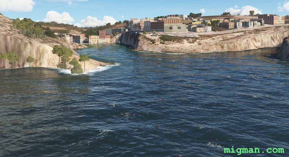
Circumnavigation
AboutFly all the way around the islands of Malta, located in a strategically vital location in the centre of the Meditteranean. Noticably barren, Malta often has to import fresh water.
 Malta
location_cityValletta
flight_takeoffLMML Luqa
airline_seat_recline_extraEurope 3
tagCoastal flight
Malta
location_cityValletta
flight_takeoffLMML Luqa
airline_seat_recline_extraEurope 3
tagCoastal flight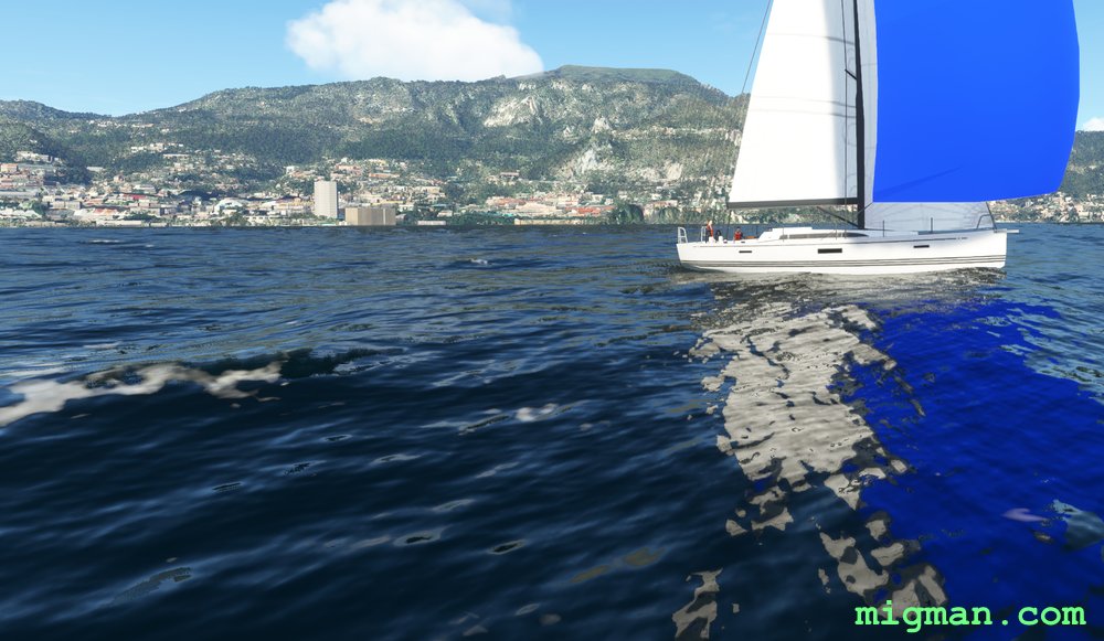
Enchantment, thou name ist Monaco
AboutProbably the most enchanting coastline I've seen yet! This flight begins and ends in France, as Monaco has a shoreline of just 2.7 nm and no airport.
 Monaco
location_cityMonaco
flight_takeoffLFMN Nice Cote d’Azur
airline_seat_recline_extraEurope 3
tagBridges
tagCoastal flight
tagCanyon runs & Mach Loops
Monaco
location_cityMonaco
flight_takeoffLFMN Nice Cote d’Azur
airline_seat_recline_extraEurope 3
tagBridges
tagCoastal flight
tagCanyon runs & Mach Loops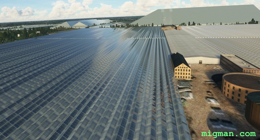
The Effect of Greenhouses
AboutThe area around Lelystad is a testament to human ingenuity and labour, being 3 metres below sea level.
Visit two enormous complexes where the controlled environment allows year-round production of flowering plants and vegetables: WP 2 - De Tuindershoek is a large complex of greenhouses run entirely by robots. Apparently. WP 3 - Grimme Groencentrum in Luttelgeest is a nursery covering more than 2 hectares.
There are also hundreds of wind turbines between WP 5, 6 and 7.
At WP 7, Houtribsluizen is a lock at the start of a 26km road on the Houtribdgk dam.
 Netherlands
location_cityLelystad
flight_takeoffEHLE Lelystad
airline_seat_recline_extraEurope 3
tagCoastal flight
tagDam spotting
Netherlands
location_cityLelystad
flight_takeoffEHLE Lelystad
airline_seat_recline_extraEurope 3
tagCoastal flight
tagDam spotting
Lisbon's Beaches
AboutFly around Lisbon and along it's southern beaches.
The flight plan is simplicity itself:
1. WNW to the Airbase
2. WSW to the coast
3. Follow the coast E
The final waypoint Forte de Monsanto, is a 19c fort (now a prison) and distinctive landmark 2.5nm SW of Lisbon Airport.
The flight plan is simplicity itself:
1. WNW to the Airbase
2. WSW to the coast
3. Follow the coast E
The final waypoint Forte de Monsanto, is a 19c fort (now a prison) and distinctive landmark 2.5nm SW of Lisbon Airport.
 Portugal
location_cityLisbon
flight_takeoffLPPT Lisbon Portela
airline_seat_recline_extraEurope 3
tagCoastal flight
Portugal
location_cityLisbon
flight_takeoffLPPT Lisbon Portela
airline_seat_recline_extraEurope 3
tagCoastal flight
Borders within Borders
AboutSan Marino is a geographically small country located within the borders of Italy. The nearest airport is Rimini Military, on the east coast of Italy and about 5 nm from the San Marino Border.
This flight incorporates the capital, which is 1 nm long atop a central ridge, and the S and W borders. Consider WP 4 optional. The Italians won't mind a minor transgression into their airspace, it happens all the time over San Marino.
An alternate approach to seeing all of San Marino would be to fly to the capital at WP 2 and then clockwise around the ridge.
NB: A slow aircraft is recommended (cruise speed 80-100 kts). Jet aircraft will find very difficult to stay within the borders.
Between WP 6 and 7 you will see Tiro a Volo San Marino (Shooting Club) on the left.
 San Marino
location_citySan Marino
flight_takeoffLIPR Federico Fellini
airline_seat_recline_extraEurope 4
tagBorder Patrol
tagCoastal flight
San Marino
location_citySan Marino
flight_takeoffLIPR Federico Fellini
airline_seat_recline_extraEurope 4
tagBorder Patrol
tagCoastal flight
Barcelona by the Balearic
AboutBarcelona is the second largest city in Spain and has a gorgeous coast on the Balearic Sea. The city is rich in old and new architecture and was host to the 1992 Olympics.
As far as viewing Gaudi's fantastic creations, photogrammetry renders the entire city as a cross between Gaudi and Salvador Dali!
As far as viewing Gaudi's fantastic creations, photogrammetry renders the entire city as a cross between Gaudi and Salvador Dali!
 Spain
location_cityBarcelona
flight_takeoffLEBL El Prat
airline_seat_recline_extraEurope 4
tagArchitectural Wonders
tagBridges
tagCoastal flight
Spain
location_cityBarcelona
flight_takeoffLEBL El Prat
airline_seat_recline_extraEurope 4
tagArchitectural Wonders
tagBridges
tagCoastal flight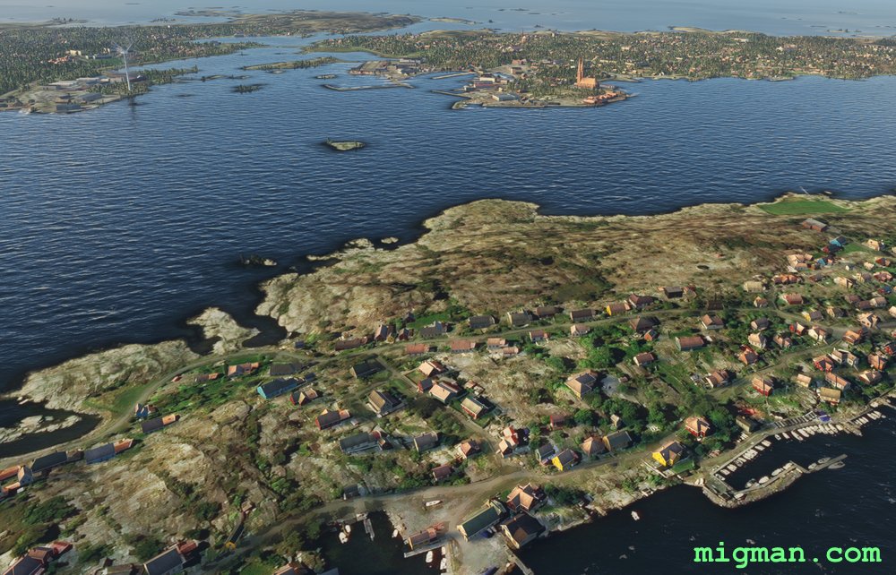
Gothenburg's Rocky Coast
AboutLooking directly across the water to Denmark, Gothenburg is Sweden's second largest city. This flight plan looks a little convoluted, but it is essentially following the river, harbour shore, and back to the river.
 Sweden
location_city
flight_takeoffESGG Landvetter
airline_seat_recline_extraEurope 4
tagBridges
tagCoastal flight
Sweden
location_city
flight_takeoffESGG Landvetter
airline_seat_recline_extraEurope 4
tagBridges
tagCoastal flight
Cardiff Cross Country
AboutCardiff is the capital of Wales. The famed 'Mach Loop' of military training fame is about 100 nm north of Cardiff, but this flight has a similar feel about it. It can be regarded as having three legs:
1. Take the valleys north of Cardiff to Llwyn-on Reservoir | WP1-4
2. West to Swansea | WP 5-6
3. Follow the coast back to Cardiff | WP 7
1. Take the valleys north of Cardiff to Llwyn-on Reservoir | WP1-4
2. West to Swansea | WP 5-6
3. Follow the coast back to Cardiff | WP 7
 United Kingdom
location_cityCardiff
flight_takeoffEGFF Cardiff
airline_seat_recline_extraEurope 4
tagCoastal flight
tagDam spotting
tagCanyon runs & Mach Loops
United Kingdom
location_cityCardiff
flight_takeoffEGFF Cardiff
airline_seat_recline_extraEurope 4
tagCoastal flight
tagDam spotting
tagCanyon runs & Mach Loops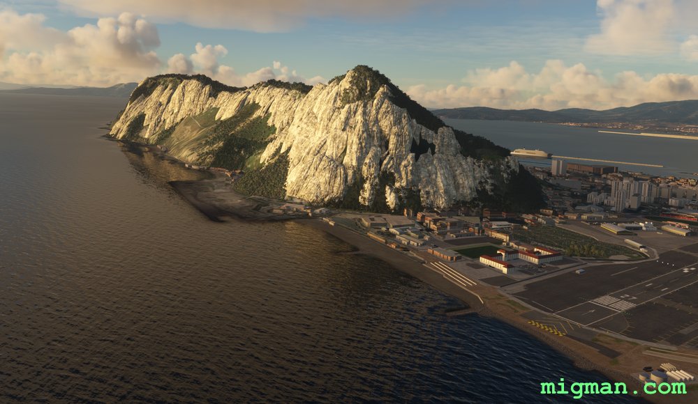
Gibraltar Cross Country
AboutTake a cross country flight from the British outpost which guards the straits of Gibraltar. Fly west across the bay to the port of Algeciras, follow the Jerez los Barrios motorway to Barbate Dam, and return along the coast to the south.
United Kingdom
location_cityGibraltar
flight_takeoffLXGB Gibraltar
airline_seat_recline_extraEurope 4
tagCoastal flight
tagDam spotting
Alexandria the Great
AboutEnjoy the beautiful resorts on the Mediterranean coastline near Alexandria, established by Alexander the Great in about 3331 BC.
NOTAM: 20 nm: Fly to WP 1 and return over Alexandria 78 nm: Entire route The airport is bounded by Airport Farm Lake to the NE and Lake Mariout to the SW.
NOTAM: 20 nm: Fly to WP 1 and return over Alexandria 78 nm: Entire route The airport is bounded by Airport Farm Lake to the NE and Lake Mariout to the SW.
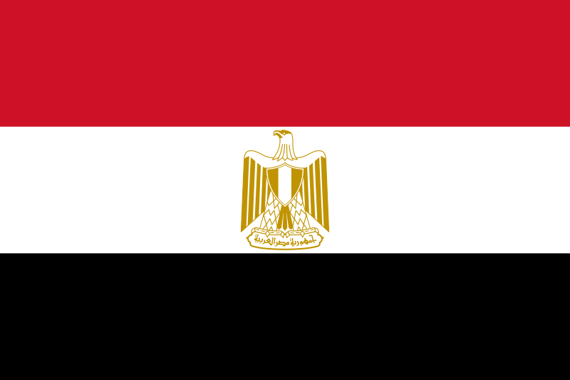 Egypt
location_cityAlexandria
flight_takeoffHEAX Alexandria
airline_seat_recline_extraMiddle East 1
tagBridges
tagCoastal flight
tagAiports
Egypt
location_cityAlexandria
flight_takeoffHEAX Alexandria
airline_seat_recline_extraMiddle East 1
tagBridges
tagCoastal flight
tagAiports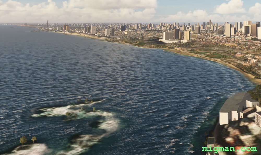
Tel Aviv's Mediterranean Beaches
AboutA short hop around Tel Aviv on the coast of the Mediterranean, which was the capital of Israel until 1949.
NOTAM: Just 0.2 nm SE of the threshold to RWY 02 at Sde Nov Airport is an enormous chimney belonging to Reading Power Station. This is one of the most amazing hazards I've seen in 250 countries! I don't know which was there first, airport or power station?
NOTAM: Just 0.2 nm SE of the threshold to RWY 02 at Sde Nov Airport is an enormous chimney belonging to Reading Power Station. This is one of the most amazing hazards I've seen in 250 countries! I don't know which was there first, airport or power station?
 Israel
location_cityTel Aviv
flight_takeoffLLBG Ben Gurion
airline_seat_recline_extraMiddle East 1
tagCoastal flight
tagAiports
Israel
location_cityTel Aviv
flight_takeoffLLBG Ben Gurion
airline_seat_recline_extraMiddle East 1
tagCoastal flight
tagAiports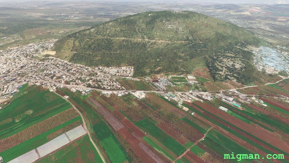
Haifa Coastline to the Sea of Galilee
AboutExplore the northern coast of Israel near Haifa. and the Sea of Galilee, 23nm west.
31nm: Fly to WP1 and WP2: Coast from Haifa to Nansholim and return over Mount Carmel.
118nm: Entire route: Coast from Haifa to Nansholim, where you will be able to see Tel Aviv, some 30nm south. Inland past Ramat David, Nazareth and Mount Tabor. Sea of Galilee. Return to the coast along the border with Lebanon. North coast.
Israel
location_cityHaifa
flight_takeoffLLHA Haifa
airline_seat_recline_extraMiddle East 1
tagBorder Patrol
tagCoastal flight
tagAiports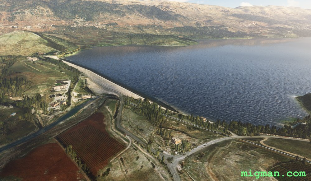
Beirut, Paris of the Mediterranean
AboutFly out of Beirut, capital of Lebanon and explore the spectacular terrain towards the Syrian border.
At WP 4 turn right (west), fly over the valley wall and then along any of the many many valleys which lead back to the coast.
Entire route: 74 nm | Shorter return flight: WP 1 and 2 = 15 nm
At WP 4 turn right (west), fly over the valley wall and then along any of the many many valleys which lead back to the coast.
Entire route: 74 nm | Shorter return flight: WP 1 and 2 = 15 nm
 Lebanon
location_cityBeirut
flight_takeoffOLBA Beirut
airline_seat_recline_extraMiddle East 2
tagBorder Patrol
tagCoastal flight
tagDam spotting
Lebanon
location_cityBeirut
flight_takeoffOLBA Beirut
airline_seat_recline_extraMiddle East 2
tagBorder Patrol
tagCoastal flight
tagDam spotting
The Cedars of God
AboutTripoli is the second largest town in Lebanon and the centre of a province in the NW near the border with Syria. Skirt the mountainous slopes as you fly south, visit the dramatic Kadisha Valley at the Cedars of God and return past Tripoli, along the splendid coastline to Rene Mouawad Airbase.
Return trip to: Tripoli at WP 5, 26 nm | Cedars of God at WP 3, 42 nm | Entire route: 71 nm
Return trip to: Tripoli at WP 5, 26 nm | Cedars of God at WP 3, 42 nm | Entire route: 71 nm
Lebanon
location_cityTripoli (Lebanon)
flight_takeoffOLKA Rene Mouawad
airline_seat_recline_extraMiddle East 2
tagBorder Patrol
tagCoastal flight
tagCanyon runs & Mach Loops
Arabian Sea’s Towering Cliffs at Salalah
AboutSalalah is the capital of Dhofar province, subject to monsoonal weather and known for it's role in the spice trade. Fly SW along the plateau and return at low level via the spectacular cliffs lining the Arabian Sea.
NOTAM: 20 nm: Local flight over Salalah | 114 nm: Entire route
NOTAM: 20 nm: Local flight over Salalah | 114 nm: Entire route
 Oman
location_citySalalah
flight_takeoffOOSA Salalah
airline_seat_recline_extraMiddle East 2
tagCoastal flight
Oman
location_citySalalah
flight_takeoffOOSA Salalah
airline_seat_recline_extraMiddle East 2
tagCoastal flight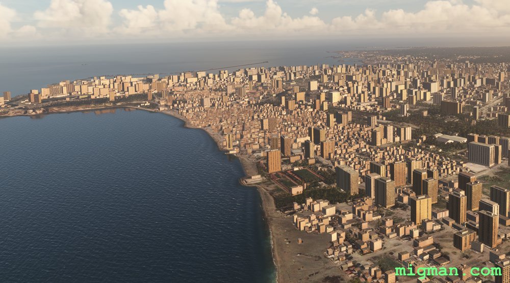
Latakia, Principal Port of Syria
AboutLatakia is the principal port city of Syria. Fly east out of Hamah to the Mediterranean coast, up to Latakia and return by way of four dams.
6 nm: NE for 3 miles to cross tha city of Hama | 22 nm: WP 7 - Mahardah Dam and return | 42 nm: WP 7 and WP 6 and return | 86 nm: WP 1, Tartus Port and return | 148 nm Entire route
6 nm: NE for 3 miles to cross tha city of Hama | 22 nm: WP 7 - Mahardah Dam and return | 42 nm: WP 7 and WP 6 and return | 86 nm: WP 1, Tartus Port and return | 148 nm Entire route
 Syria
location_cityHama
flight_takeoffOS58 Hama
airline_seat_recline_extraMiddle East 2
tagCoastal flight
tagDam spotting
Syria
location_cityHama
flight_takeoffOS58 Hama
airline_seat_recline_extraMiddle East 2
tagCoastal flight
tagDam spotting
Izmir on the Agean
AboutIzmir is the second largest city on the Agean Sea, after Athens and the third largest population centre in Turkey.
Explore the broad valley to the east, and the resorts and shoreline to the north and west.
The second half of the flight is a coastal run which takes you over the colourful alluvial flood plains to the NE of Izmir.
Take off from Adnan Menderes Airport, fly past Sirinyer Racecourse and Kulturpark Izmir to Izmir Docks at WP 1. Then fly east to the major centre of Turgutlu and NW past Manisa to Guselhisar Dam.
Return distances:
19 nm: Izmir
40 nm: Manisa at WP 3
56 nm: Turgutlu at WP 2
60 nm: Guzelhisar Dam at WP 4
62 nm: Coastal route to Foca and the alluvial flood plains
121 nm: Entire route
 Turkey
location_cityIzmir
flight_takeoffLTBJ Adnan Menderes
airline_seat_recline_extraMiddle East 2
tagCoastal flight
tagDam spotting
tagCanyon runs & Mach Loops
Turkey
location_cityIzmir
flight_takeoffLTBJ Adnan Menderes
airline_seat_recline_extraMiddle East 2
tagCoastal flight
tagDam spotting
tagCanyon runs & Mach Loops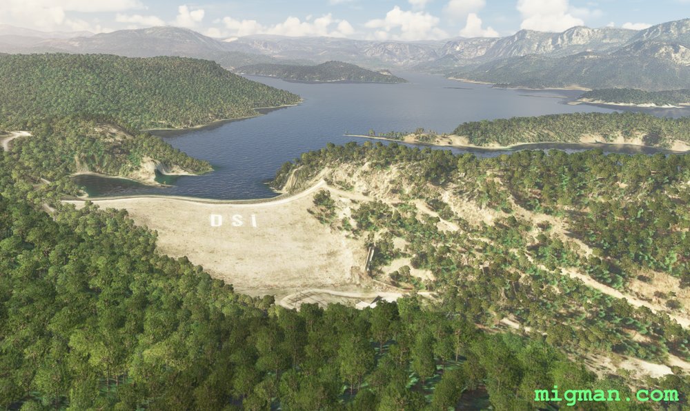
Antalya North and East: Dams, Mountains, Valleys and Coastal Resorts
AboutExplore the valleys, dams and mountains to the NE of Antalya, including the Aksus, Karacaoren, Oymapinar and Manavgat dams and the magnificent Sutculer Mountains.
On the way back pass the coastal resorts at Ilica, Perakende and Belek.
54 nm: Dam on Karacaoren-1 Lake
72 nm: Coast to Manavgat Airport LTKI
82 nm: WP 5,6,7: Two dams and coast from Manavgat Airport LTKI
136 nm: Entire route
On the way back pass the coastal resorts at Ilica, Perakende and Belek.
54 nm: Dam on Karacaoren-1 Lake
72 nm: Coast to Manavgat Airport LTKI
82 nm: WP 5,6,7: Two dams and coast from Manavgat Airport LTKI
136 nm: Entire route
Turkey
location_cityAntalya
flight_takeoffLTAI Antalya
airline_seat_recline_extraMiddle East 2
tagCoastal flight
tagDam spotting
tagCanyon runs & Mach Loops
Antalya: Bey Mountains and the South West Coast
AboutEnter a valley west of the city, fly over the Bey Mountains and return along the beautiful coastline to the SW of Antalya.
20 nm: Along the shoreline at Antalya to WP 6, South Antalya Marina and return
90 nm: WP 1 and 2 - Bey Mountains and dam near Karamik and return
129 nm: Entire route
20 nm: Along the shoreline at Antalya to WP 6, South Antalya Marina and return
90 nm: WP 1 and 2 - Bey Mountains and dam near Karamik and return
129 nm: Entire route
Turkey
location_cityAntalya
flight_takeoffLTAI Antalya
airline_seat_recline_extraMiddle East 2
tagCoastal flight
tagDam spotting
tagCanyon runs & Mach Loops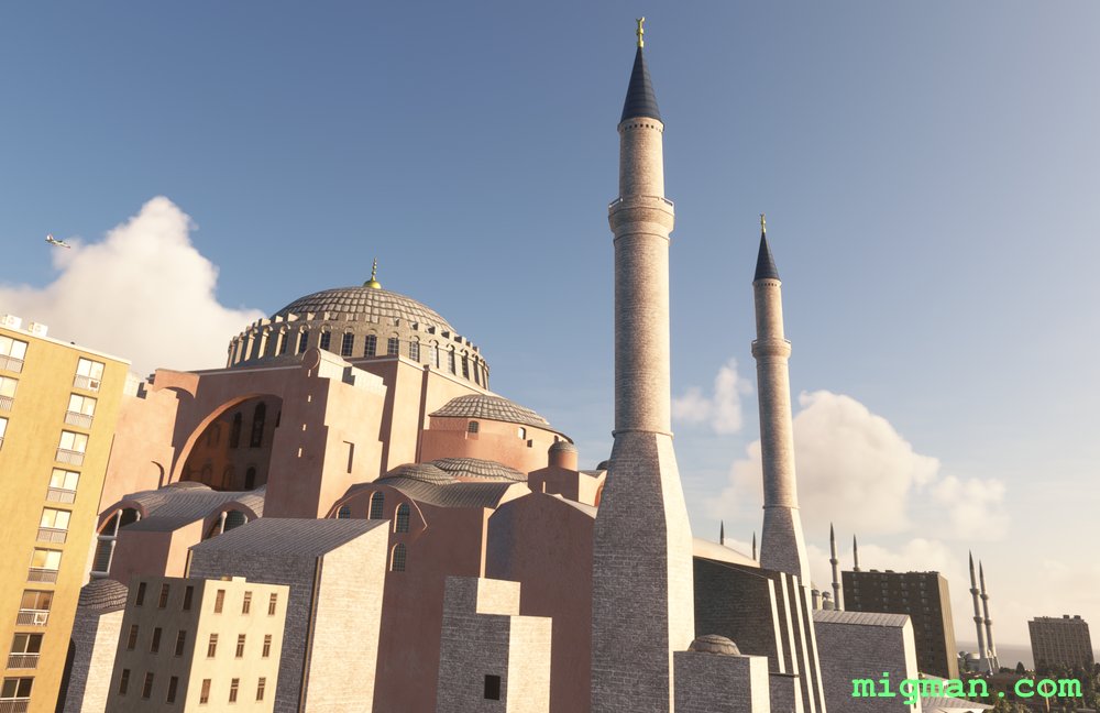
Istanbul, Back to the Bosphorus.
AboutYour first waypoint is the Hagia Sophia which was built in 537 A.D. by the Roman emperor Justinian I.
Fly along the mighty Bosphorus River from the Sea of Marmara to the Black Sea in the north. Pass the three main bridges on the Bosphorus river: Bosphorus Bridge, Fatih Sultan Mehmet Bridge and the Yavuz Sultan Selim Bridge.
Explore the Black Sea coast to Sile, fly south past the Darlik Dam and to the Osmangazi Bridge on the Gulf of İzmit.
Fly past Gebze, Darica, Tuzla, Pendik and Kartal as you return along the coast of the Sea of Marmara, back to the Bosphorus River.
16 nm: WP 1 - Mouth of the Bosphorus / Mosque: Hagia Sophia
42 nm: WP1,2,3 and return
44 nm: Along the coast of the Gulf of Izmit to WP 6 and return
104 nm: Entire route
Turkey
location_cityIstanbul
flight_takeoffLTBA Ataturk
airline_seat_recline_extraMiddle East 2
tagBridges
tagCoastal flight
tagDam spotting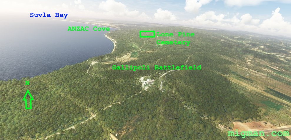
ANZAC
AboutFly the length of the strategically important Dardanelles Strait which connects the Agean Sea to the Sea of Marmara.
During World War I, on April 25th 1915 the Australia New Zealand Army Corp (ANZAC) landed south of Suvla bay as part of an offensive to open the Dardenelles Straits to Allied warships. The campaign lasted 11 months, ended in stalemate, and the forces were withdrawn in January 1916. The ANZAC Corp were assisted by British, Indian, Irish, French, and Newfoundland troops. The Gallipoli Campaign is commemorated annually in Australia and New Zealand and is the most significant day on their calendar remembering military casualties.
Helles - British landings on April 25th, 1915. Anzac Cove - Beach where ANZAC forces landed. Suvla Bay - Site where the British IX Corps landed on August 6th 1915.
Round trip distances:
7 nm: Cannakale and Canakkale Port Services Command, 1nm before WP 7
14 nm: WP 2 - Gallipoli Battlefield
40 nm: WP 6 - Town of Geliboli
81 nm: Entire route
Turkey
location_cityGallipoli
flight_takeoffLTBH Canakkale
airline_seat_recline_extraMiddle East 2
tagCoastal flight
Hatay Province North
AboutHatay Province lays between the eastern end of the Mediterranean and the border with Syria. Take off from Haty ap LTDA near the town of Aktas. Have a trip along the Med shore, over the mountain range and return along the Turkey / Syria border.
29 nm: Fly to the coast at WP 1 and return | 103 nm: Entire route
29 nm: Fly to the coast at WP 1 and return | 103 nm: Entire route
Turkey
location_cityHatay
flight_takeoffLTDA Hatay
airline_seat_recline_extraMiddle East 2
tagBorder Patrol
tagBridges
tagCoastal flight
Antioch and Hatay Province South
AboutThe ancient Greek city of Antioch (Antakya) is in Hatay province, near the Syrian border and on the east end of the Mediterranean.
Fly south through Antioch and return along the Med shore to the west. The compound at WP 3 is only about 100 yds from the border.
25 nm: Fly to Antioch at WP 1 and return | 107 nm: Entire route
Fly south through Antioch and return along the Med shore to the west. The compound at WP 3 is only about 100 yds from the border.
25 nm: Fly to Antioch at WP 1 and return | 107 nm: Entire route
Turkey
location_cityHatay
flight_takeoffLTDA Hatay
airline_seat_recline_extraMiddle East 2
tagBorder Patrol
tagBridges
tagCoastal flight
Gulf of Aden
AboutFly out of Yemen's Aden, on the Gulf of Aden and follow the rugged coastline to the SW.
NOTAM: 10 nm: WP 5, over Aden city | 33 nm: Entire route
NOTAM: 10 nm: WP 5, over Aden city | 33 nm: Entire route
 Yemen
location_cityAden
flight_takeoffOYAA Aden
airline_seat_recline_extraMiddle East 2
tagCoastal flight
Yemen
location_cityAden
flight_takeoffOYAA Aden
airline_seat_recline_extraMiddle East 2
tagCoastal flight
Rijeka, Croatia
AboutFly south into Croatia and explore the Adriatic coast at Rijeka.
 Slovenia
location_cityPostojna
flight_takeoffLJDI Divaca
airline_seat_recline_extraSlovenia 1
tagCoastal flight
tagCanyon runs & Mach Loops
tagAiports
Slovenia
location_cityPostojna
flight_takeoffLJDI Divaca
airline_seat_recline_extraSlovenia 1
tagCoastal flight
tagCanyon runs & Mach Loops
tagAiports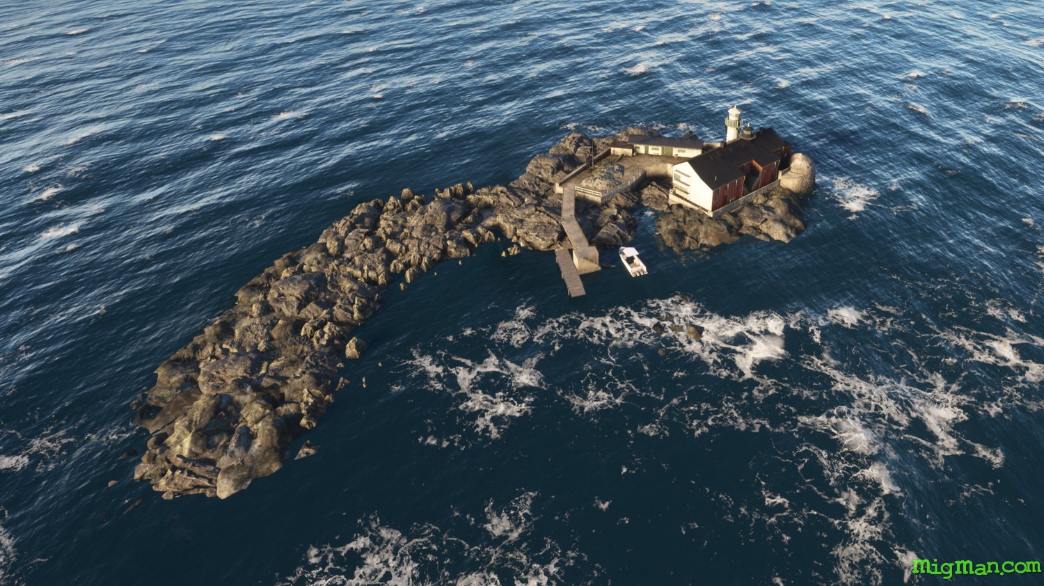
Ullevi Stadium, Botto Lighthouse and 3 important ports.
AboutUllevi, or Nya Ullevi (New Ullevi) Stadium, is one of the largest in all the Nordic countries. Botto Lighthouse is on a very small rocky outcrop off the large river port of Goteborg. Varberg was established around 1280 as a fortress town by the Danish and called Wardbergh (’watch hill’) the town was transferred to Sweden in the Treaty of Roskilde (1658). Established by the Danish at the mouth of the Atran River, Falkenberg was named after the Swedish words for falcon and mountain (berg). It was also transferred to Sweden in the Treaty of Roskilde (1658), after much conflict. Halmstad was established in the 1300s and is now one of the 10 largest seaports in Sweden. Like many cities on the west coast it has a long history with Denmark. Halmstad Airport ESMT was an airforce base between 1944 and 1961 and today supports both civil and military traffic.
Sweden
location_cityVastra Gotaland
flight_takeoffESGG Landvetter
airline_seat_recline_extra
tagCoastal flight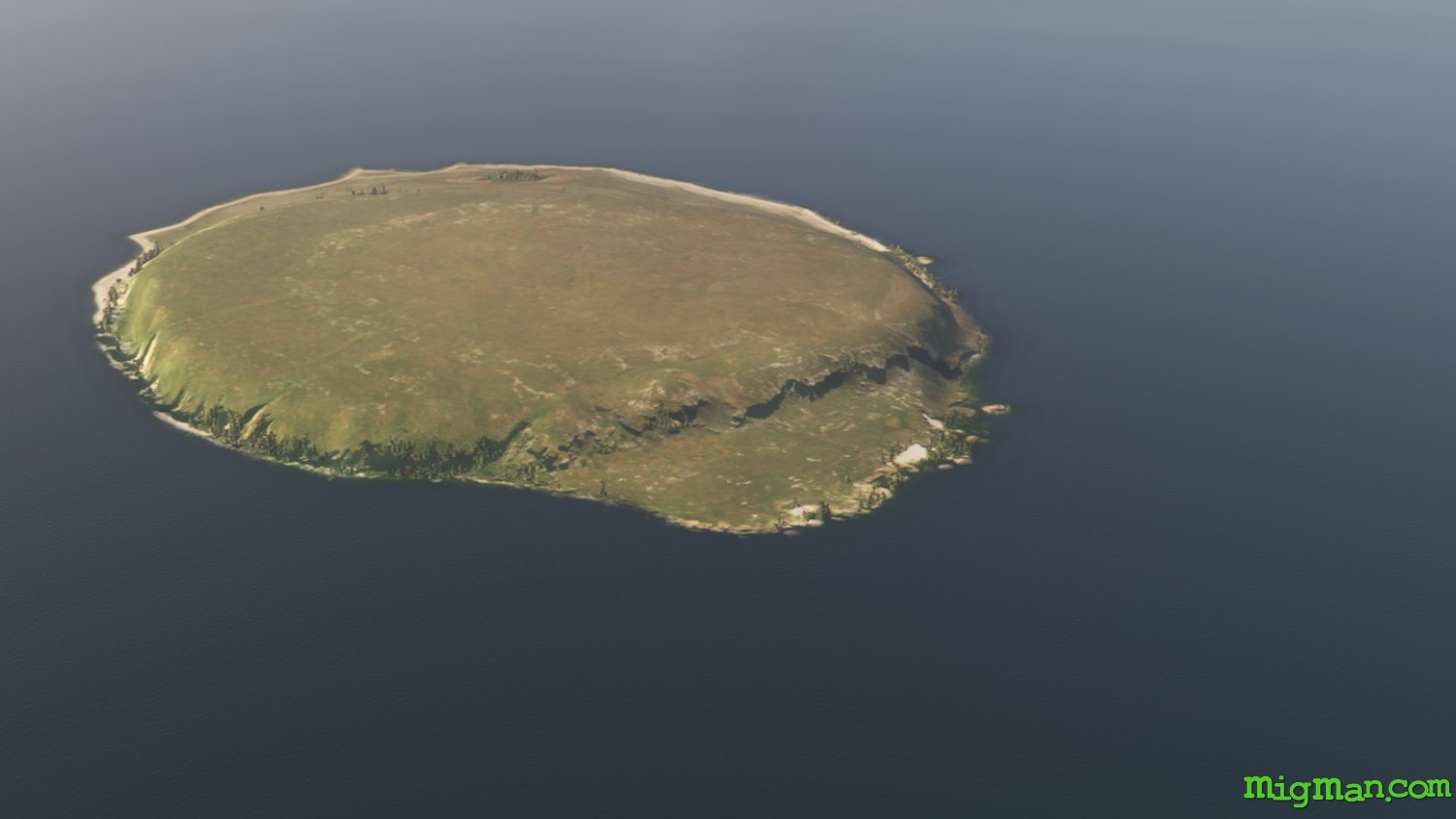
Circumnavigate Gotland
AboutThis flight is long. Take it when you're in the mood for a relaxing coastal flight. The landscape is subtle rather than spectacular, but ultimately enchanting. Bask in the blue waters of the Baltic and remember to keep the green to your left!
Sweden
location_cityGotland
flight_takeoffESSV Visby
airline_seat_recline_extra
tagCoastal flight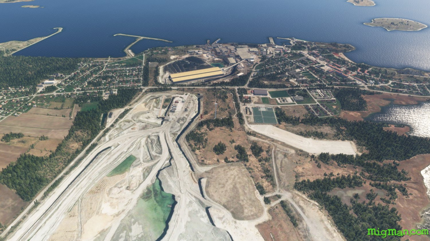
Gotland North
AboutThis flight showcases the main visual points of interest on Gotland, outside of Visby.
Sweden
location_cityGotland
flight_takeoffESSV Visby
airline_seat_recline_extra
tagCoastal flight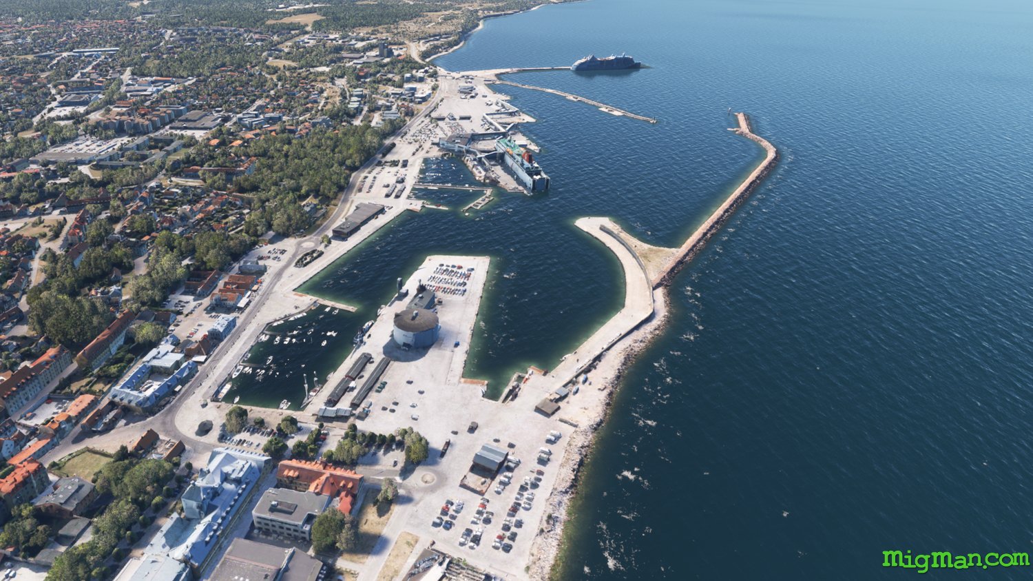
Visby local
AboutThis very short orientation flight will take you around the medieval town of Visby. Once you get the lay of the land I suggest spending free flight time in Visby with your helicopter.
Sweden
location_cityGotland
flight_takeoffESSV Visby
airline_seat_recline_extra
tagCoastal flight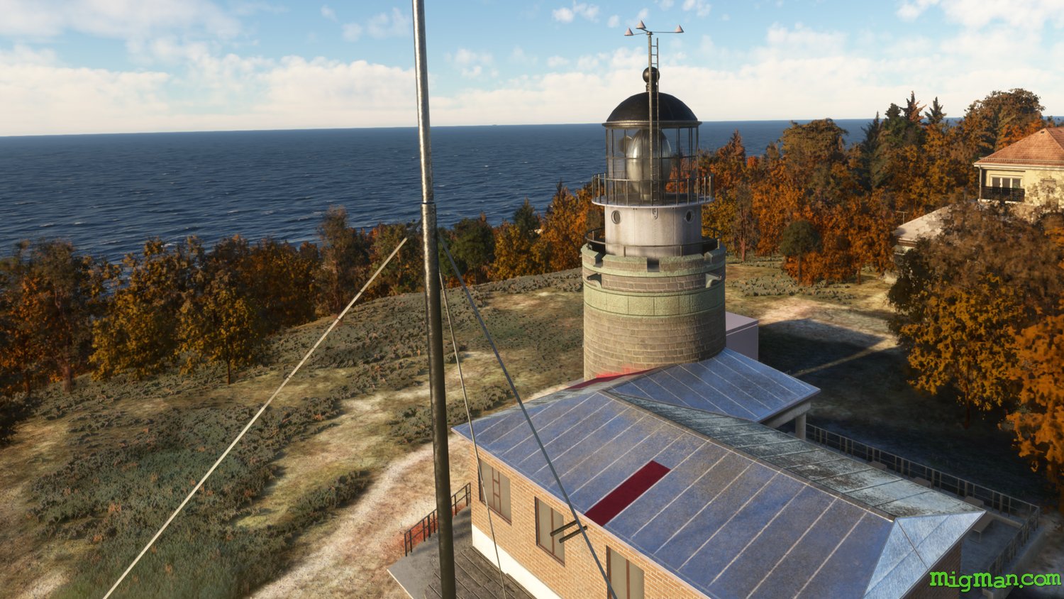
Halmstad to Kullen Lighthouse
AboutTake off from Halmstad, visit the popular Tylosand beach and stop at a few local airports. Fly by Kullen lighthouse on the return leg. Adjust your flight time to dusk and see the lighthouse spring into action!
Sweden
location_cityHallan
flight_takeoffESMT Halmstad City
airline_seat_recline_extra
tagCoastal flight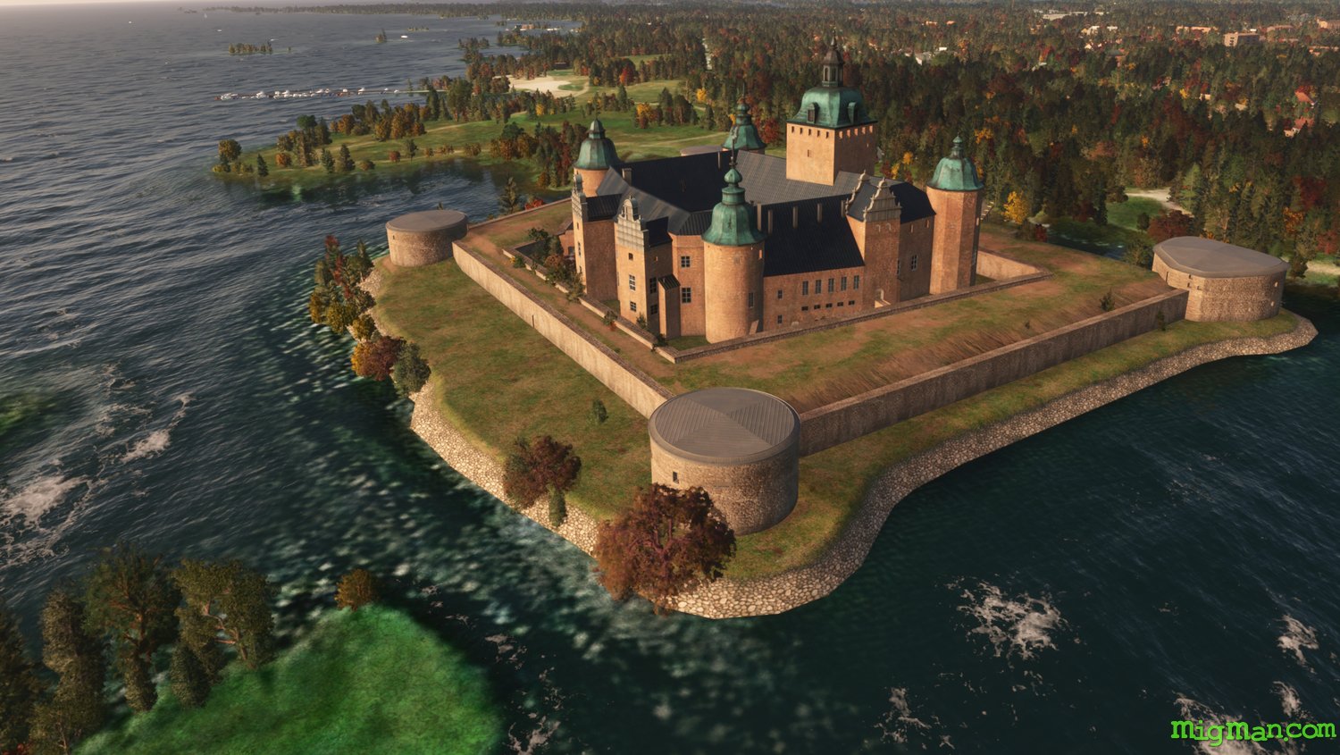
Kalmar Castle & Oland Bridge
AboutTake a helicopter or light aircraft on this short tour of local landmarks in the coastal port of Kalmar.
Sweden
location_cityKalmar
flight_takeoffESMQ Kalmar Oland
airline_seat_recline_extra
tagCoastal flight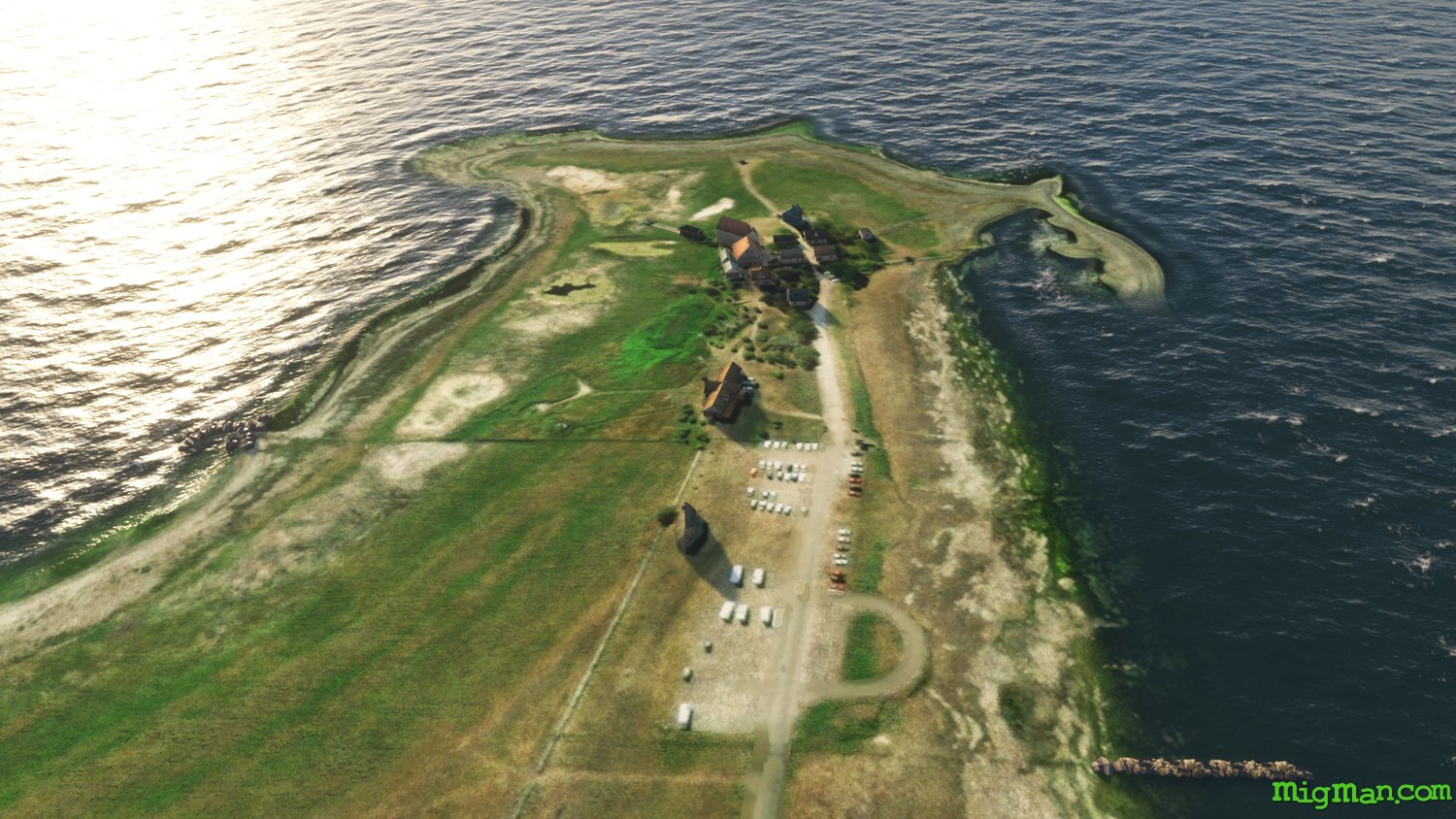
Kalmar Strait
AboutPerform touch'n'gos at airports near Kalmar. This is also a great coastal flight, and depending on your sim setup, there may be quite a few ships in the area too.
Sweden
location_cityKalmar
flight_takeoffESMQ Kalmar Oland
airline_seat_recline_extra
tagCoastal flight
tagAiports
tagBridges
Kullen Lighthouse at Angelholm
AboutFly out of Angelholm on Sweden’s west coast, past Kullen Lighthouse which guards the entrance to Oresund, the body of water between Sweden and Denmark.
Sweden
location_citySkane
flight_takeoffESTA Angelholm / Helsingborg
airline_seat_recline_extra
tagCoastal flight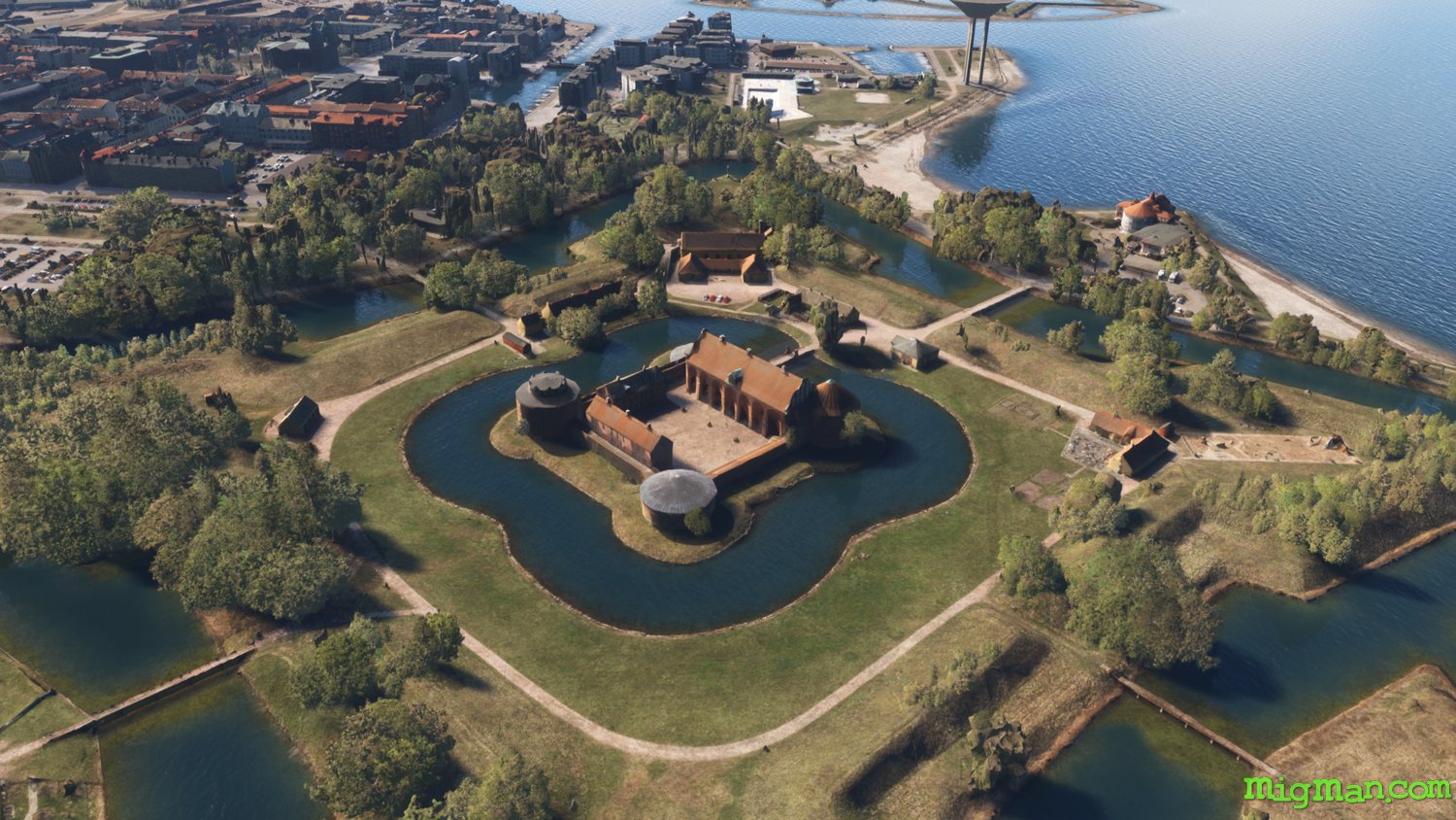
Landskrona Slott
AboutThis 16c castle fortress is largely intact, which is quite rare for this type of structure. It sits adjacent to the harbour and is surrounded by a moat.
Sweden
location_citySkane
flight_takeoffESML Landskrona
airline_seat_recline_extra
tagCoastal flight
tagArchitectural Wonders