MiGMan: The Missions
 airline_seat_recline_extraAfrica 1airline_seat_recline_extraMiGMan’s World Tour
tagMission
airline_seat_recline_extraAfrica 1airline_seat_recline_extraMiGMan’s World Tour
tagMissionPublished:2021Last edit:Dec 8, 2023
 airline_seat_recline_extraAfrica 2airline_seat_recline_extraMiGMan’s World Tour
tagMission
airline_seat_recline_extraAfrica 2airline_seat_recline_extraMiGMan’s World Tour
tagMissionPublished:2021Last edit:Dec 8, 2023
 airline_seat_recline_extraAfrica 3airline_seat_recline_extraMiGMan’s World Tour
tagMission
airline_seat_recline_extraAfrica 3airline_seat_recline_extraMiGMan’s World Tour
tagMissionPublished:2021Last edit:Dec 8, 2023
 airline_seat_recline_extraAfrica 4airline_seat_recline_extraMiGMan’s World Tour
tagMission
airline_seat_recline_extraAfrica 4airline_seat_recline_extraMiGMan’s World Tour
tagMissionPublished:2021Last edit:Dec 8, 2023
 airline_seat_recline_extraAsia 1airline_seat_recline_extraMiGMan’s World Tour
tagMission
airline_seat_recline_extraAsia 1airline_seat_recline_extraMiGMan’s World Tour
tagMissionPublished:2021Last edit:Dec 8, 2023
 airline_seat_recline_extraAsia 2airline_seat_recline_extraMiGMan’s World Tour
tagMission
airline_seat_recline_extraAsia 2airline_seat_recline_extraMiGMan’s World Tour
tagMissionPublished:2021Last edit:Dec 8, 2023
 airline_seat_recline_extraAustralia 1airline_seat_recline_extraMiGMan’s World Tour
tagMission
airline_seat_recline_extraAustralia 1airline_seat_recline_extraMiGMan’s World Tour
tagMissionPublished:2021Last edit:Dec 8, 2023
 airline_seat_recline_extraAustralia 2airline_seat_recline_extraMiGMan’s World Tour
tagMission
airline_seat_recline_extraAustralia 2airline_seat_recline_extraMiGMan’s World Tour
tagMissionPublished:2021Last edit:Dec 8, 2023
 airline_seat_recline_extraAustralia 3airline_seat_recline_extraMiGMan’s World Tour
tagMission
airline_seat_recline_extraAustralia 3airline_seat_recline_extraMiGMan’s World Tour
tagMissionPublished:2021Last edit:Dec 8, 2023
 airline_seat_recline_extraAustralia 4airline_seat_recline_extraMiGMan’s World Tour
tagMission
airline_seat_recline_extraAustralia 4airline_seat_recline_extraMiGMan’s World Tour
tagMissionPublished:2021Last edit:Dec 8, 2023
 airline_seat_recline_extraCaribbean 1airline_seat_recline_extraMiGMan’s World Tour
tagMission
airline_seat_recline_extraCaribbean 1airline_seat_recline_extraMiGMan’s World Tour
tagMissionPublished:2021Last edit:Dec 8, 2023
 airline_seat_recline_extraCaribbean 2airline_seat_recline_extraMiGMan’s World Tour
tagMission
airline_seat_recline_extraCaribbean 2airline_seat_recline_extraMiGMan’s World Tour
tagMissionPublished:2021Last edit:Dec 8, 2023
 airline_seat_recline_extraCaribbean 3airline_seat_recline_extraMiGMan’s World Tour
tagMission
airline_seat_recline_extraCaribbean 3airline_seat_recline_extraMiGMan’s World Tour
tagMissionPublished:2021Last edit:Dec 8, 2023
 airline_seat_recline_extraCaribbean 4airline_seat_recline_extraMiGMan’s World Tour
tagMission
airline_seat_recline_extraCaribbean 4airline_seat_recline_extraMiGMan’s World Tour
tagMissionPublished:2021Last edit:Dec 8, 2023
 airline_seat_recline_extraEurope 1airline_seat_recline_extraMiGMan’s World Tour
tagMission
airline_seat_recline_extraEurope 1airline_seat_recline_extraMiGMan’s World Tour
tagMissionPublished:2021Last edit:Dec 8, 2023
 airline_seat_recline_extraEurope 2airline_seat_recline_extraMiGMan’s World Tour
tagMission
airline_seat_recline_extraEurope 2airline_seat_recline_extraMiGMan’s World Tour
tagMissionPublished:2021Last edit:Dec 8, 2023
 airline_seat_recline_extraEurope 3airline_seat_recline_extraMiGMan’s World Tour
tagMission
airline_seat_recline_extraEurope 3airline_seat_recline_extraMiGMan’s World Tour
tagMissionPublished:2021Last edit:Dec 8, 2023
 airline_seat_recline_extraEurope 4airline_seat_recline_extraMiGMan’s World Tour
tagMission
airline_seat_recline_extraEurope 4airline_seat_recline_extraMiGMan’s World Tour
tagMissionPublished:2021Last edit:Dec 8, 2023
 airline_seat_recline_extraMiddle East 1airline_seat_recline_extraMiGMan’s World Tour
tagMission
airline_seat_recline_extraMiddle East 1airline_seat_recline_extraMiGMan’s World Tour
tagMissionPublished:2021Last edit:Dec 8, 2023
 airline_seat_recline_extraMiddle East 2airline_seat_recline_extraMiGMan’s World Tour
tagMission
airline_seat_recline_extraMiddle East 2airline_seat_recline_extraMiGMan’s World Tour
tagMissionPublished:2021Last edit:Dec 8, 2023
 airline_seat_recline_extraSlovenia 1airline_seat_recline_extraMiGMan’s World Tour
tagMission
airline_seat_recline_extraSlovenia 1airline_seat_recline_extraMiGMan’s World Tour
tagMissionPublished:2021Last edit:Dec 8, 2023
 airline_seat_recline_extraSlovenia 2airline_seat_recline_extraMiGMan’s World Tour
tagMission
airline_seat_recline_extraSlovenia 2airline_seat_recline_extraMiGMan’s World Tour
tagMissionPublished:2021Last edit:Dec 8, 2023
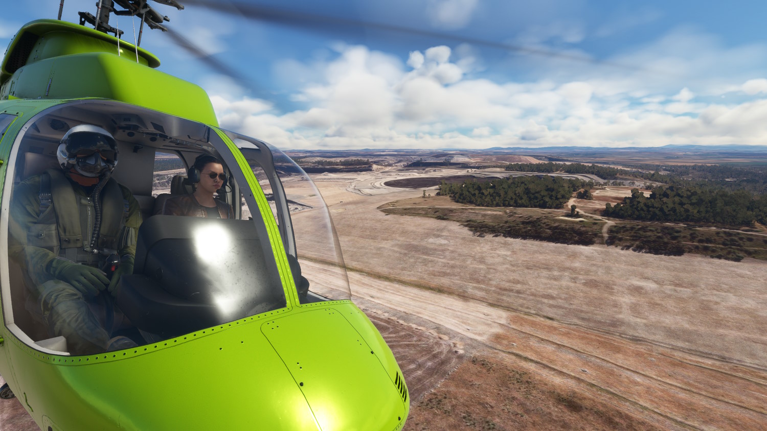
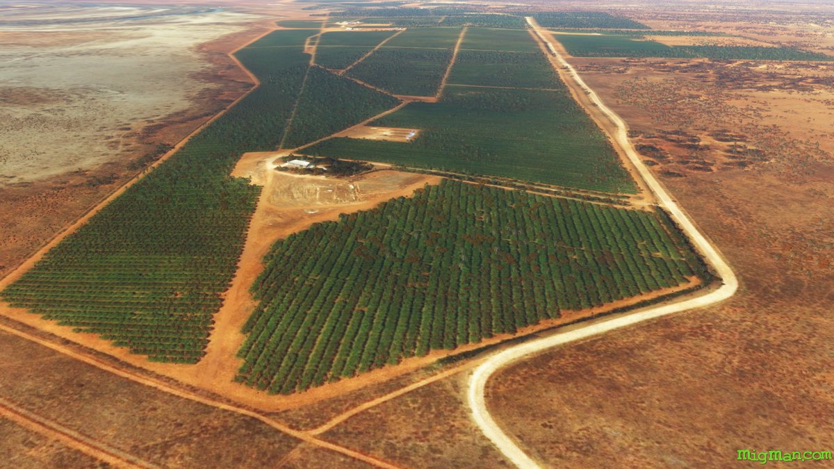
AboutExplore the enormous open cut coal mine, Mount Thorley Warkworth Mine, near Singleton in the Newcastle & Hunter region of N.S.W..
airline_seat_recline_extraAustralia 1airline_seat_recline_extraMiGMan’s World Tour
 Australia
location_cityN.S.W. | Newcastle & Hunter
flight_takeoffYCNK Cessnock
local_airportBell 407
tagMission
tagGallery
Australia
location_cityN.S.W. | Newcastle & Hunter
flight_takeoffYCNK Cessnock
local_airportBell 407
tagMission
tagGalleryPublished:2022Last edit:Nov 15, 2023