Navigation
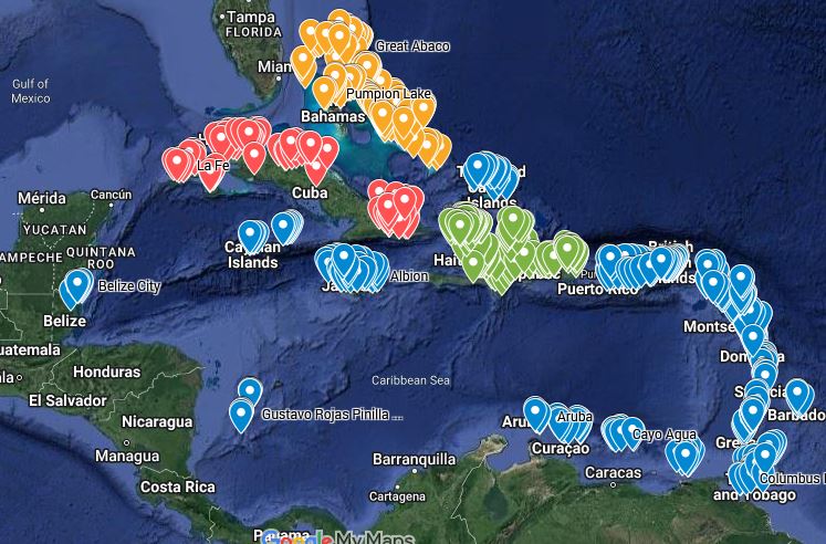
AboutMaps of all the locations and Points of Interest in the MiGMan’s World Tour products.
airline_seat_recline_extraMiGMan’s World Tour
tagIndex
tagNavigation
AboutAll the flights in the MiGMan’s World Tour products.
airline_seat_recline_extraMiGMan’s World Tour
tagIndex
tagHomepage
tagNavigation
 airline_seat_recline_extraMiGMan’s World Tour
tagNavigation
tagTutorial
airline_seat_recline_extraMiGMan’s World Tour
tagNavigation
tagTutorialPublished:2021Last edit:Apr 3, 2024
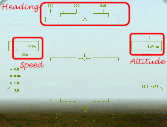
Navigation | Looking left and right
airline_seat_recline_extraMiGMan’s World Tour
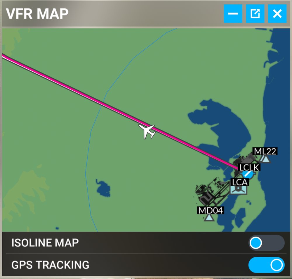
 Djibouti
location_cityDjibouti City
flight_takeoffHDAM Ambouli
tagTutorial
tagNavigation
Djibouti
location_cityDjibouti City
flight_takeoffHDAM Ambouli
tagTutorial
tagNavigationPublished:2021Last edit:Aug 25, 2021
About> > >No autopilot required! < < <
Just look out the window.
airline_seat_recline_extraMiGMan’s World Tour
tagTutorial
tagView
tagNavigationJust look out the window.

 airline_seat_recline_extraF/A-18 Korea
local_airportMcDonnell Douglas F/A-18 Hornet
tagChecklist
tagNavigation
airline_seat_recline_extraF/A-18 Korea
local_airportMcDonnell Douglas F/A-18 Hornet
tagChecklist
tagNavigationPublished:1998Last edit:Aug 24, 2022
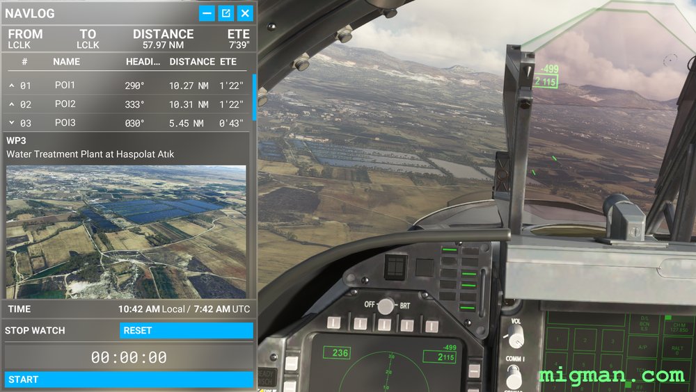
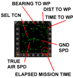
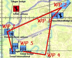
airline_seat_recline_extraF/A-18 Korea
 South Korea
local_airportMcDonnell Douglas F/A-18 Hornet
tagChecklist
tagTACAN
tagNavigation
South Korea
local_airportMcDonnell Douglas F/A-18 Hornet
tagChecklist
tagTACAN
tagNavigation
South Korea
local_airportMcDonnell Douglas F/A-18 Hornet
tagChecklist
tagTACAN
tagNavigationPublished:1998
 airline_seat_recline_extraF/A-18E Super Hornet
local_airportBoeing F/A-18E Super Hornet
tagNavigation
airline_seat_recline_extraF/A-18E Super Hornet
local_airportBoeing F/A-18E Super Hornet
tagNavigation
About" The following comments are added to give some idea of the depth of thought that was put into producing this amazing simulation and as a salute to the people who brought it to life. This is a simulation for those who are prepared to work, who enjoy success and the feeling of pride in achievement." - Don "Splash One" Beckley.
airline_seat_recline_extraJet-Pilot
local_airportEnglish Electric Lightning
precision_manufacturingVulcan Software
personDon "Splash One" Beckley
tagGuide
tagAA: Intercept
tagAA: Radar Guided
tagNavigationPublished:2001
Little Navmap
airline_seat_recline_extraLittle Navmapairline_seat_recline_extraMSFS 2020
personAlexander Barthel
tagNavigation
tagUtilityPublished:2021Last edit:Apr 2, 2021
AboutClick the title to see all articles on this topic in the Flight Sim Museum.
tagAirmanship
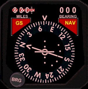
tagNavigationGarmin --/o\-- Navigation Equipment
precision_manufacturingGarmin
tagNavigation
tagDisplay
tagCockpitPublished:2021Last edit:Mar 11, 2021
compare_arrowshttp://airnav.com/ (external link)
AboutUS approach charts, frequencies and more. Great flight sim aid.
 USA
tagNavigation
tagATC
tagEditorial
USA
tagNavigation
tagATC
tagEditorialLast edit:Sep 25, 2020
Navigation IRL (In Real Life) and Flight Simulation
tagNavigationPublished:2021Last edit:Mar 11, 2021